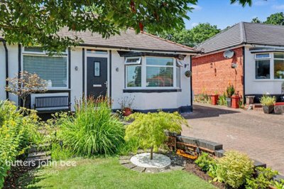
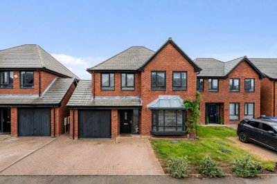
£240,000
Semi-Detached Bungalow, 3 bed
Grange Lane, CW7 2BP
£240,000
Semi-Detached Bungalow, 3 bed
Grange Lane, CW7 2BP

Compare local agents for a Winsford home using sold-price evidence from 347 recent sales


Winsford's average property price sits at £237,572, with 347 residential sales recorded over the last 12 months. That is 26.22% fewer transactions than the year before, so pricing skill and marketing discipline matter more than ever. A good estate agent can protect your sale price, reduce wasted time and keep buyers engaged when stock is moving unevenly. In a market like this, the first asking price sets the tone.
The local spread is wide. Detached homes average £323,400, flats sit at £107,000, 2-bed homes average £146,854 and 3-bed homes average £230,713. Many Winsford wards are dominated by 3-bedroom properties, while fewer than 7% of homes are flats, so presentation needs to fit a family-led market rather than a one-size-fits-all approach. The right agent should understand that mix street by street, from Roehurst Lane to the older town-centre roads near St Chad's Church.

£237,572
Average House Price
347
Sales in Last 12 Months
+3.01%
12-Month Price Change
£323,400
Detached Average
£230,713
Semi-Detached Average
£146,854
Terraced Average
£107,000
Flat Average
Using listing data from home.co.uk and property data from homedata.co.uk
Pricing in Winsford has climbed modestly over the last year, with average property values up 3.01% and the five-year rise reaching 17.09%. Current listings sit at £274,727, which gives a sense of the gap between what sellers hope for and what the market is currently prepared to support. That gap is where a good estate agent earns their fee. If a home is launched too high, the first burst of buyer interest can disappear before viewings begin.
Most of the activity sits in the middle of the market. The largest sales cluster was 76 homes in the £156,000-£202,000 band, which lines up with the town's strong supply of 2-bed and 3-bed houses. Those homes average £146,854 and £230,713 respectively, so an agent needs to decide quickly whether the property should be priced to attract first-time buyers, upsizers or landlords. A detached home at £323,400 needs a different story again, especially where gardens, parking and layout make a clear difference.
Detached stock still anchors the top end, while flats remain a small part of the market at £107,000 on average. That split matters because Winsford is not a town where a generic valuation will do the job well. Homes with 4 bedrooms average £405,199 and 5-bed homes reach £510,357, so the larger end of the market can pull the average upward without changing the day-to-day reality on most streets. For sellers, the lesson is simple: compare the agent's figure against recent comparable sales, not against a hopeful headline number.
Based on 152 live listings with an average asking price of £250,038.
Source: home.co.uk
See which agents are selling fastest and at the best prices in Winsford.
Compare Estate Agents FreeNew-build activity matters here because it gives a clear read on what the local market can support. Lumina by Seddon Homes is planned in Winsford, while The Woodlands on Roehurst Lane brings 268 low-carbon homes, including 161 affordable homes and a mix of 1, 2, 3 and 4-bedroom properties. That scheme also includes self-finish options on some plots, which changes how buyers think about price and specification. In a town where many homes were built in the 1960s and 1970s, modern energy-efficient layouts can stand out quickly.
The strongest example of pricing discipline is at Fox Wood Garden Village, where 2 and 3-bedroom homes include The Beaford from £215,995 and The Eynsford from £239,995. Stonecross Vale on Wharton Road adds shared ownership stock, including 3-bedroom semi-detached homes with a 75% share around £165,750. On top of that, Torus is delivering 99 highly sustainable homes off Clough Road and Weaver Street, designed for net-zero carbon in use, while Richborough's proposals would add more homes off Darnall School Lane and west of Swanlow Lane. Estate agents who understand these schemes can price older stock against nearby new-build competition without overreaching.
Sales patterns suggest that smaller family homes remain the engine room of the market. The majority of homes sold last year sat in the middle price bracket, and the newest homes give buyers a clear alternative to older post-war properties. That makes presentation more important, not less. Buyers comparing a renovated terrace near the town centre with a new 3-bed on Fox Wood Garden Village will notice the difference in finish, running costs and long-term maintenance.
Population patterns in Winsford shape how homes sell. The built-up area had 32,530 people at the 2021 census, the parish had 33,547, and the five wards totalled 31,041. The town is younger than the borough average, with more residents under 15 in every ward, while 1 and 2-person households make up most of the household mix. That combination keeps demand broad, from smaller homes for downsizers to 3-bed houses for households that need an extra room.
Ground conditions matter here too. Winsford has a history of salt mining, which brings a subsidence risk that should be handled carefully during valuation and conveyancing. Most homes were built between 1960 and 1980, so post-war construction methods dominate much of the stock, and some estates used timber-framed houses with flat roofing. Older Victorian and Edwardian properties still appear closer to the town centre, including around St Chad's Church, where the Saxon Cross is preserved. A local agent should be able to explain how those building eras affect demand, survey risk and likely buyer expectations.
Movement around the town is shaped by the River Weaver, the Marina, New Road, Bradford Road and the estates around Wharton Road and Roehurst Lane. Flood risk is usually in Zones 1 or 2, but localised surface water pockets still matter, and the Weaver Navigation flood warning area affects places such as New Road, the Red Lion Pub, the Marina and Lakeside Caravan Park. Lakeside Caravan Park also sits within Flood Zones 3 and 2, and flooding has happened there when the River Weaver and Bottom Flash run high. Agents who know these pockets can help sellers avoid surprises during viewings and survey enquiries.
Fee models change the shape of a sale. High-street agents usually charge 1-1.8% + VAT on a sole agency basis, while online agents often use a fixed fee from £999-£1,999. On a Winsford average price of £237,572, even a small percentage shift can make a noticeable difference to your net proceeds. A 0.5% change is about £1,188 before VAT, so the headline fee deserves proper attention.
A simpler route is not always the cheapest route. Sole agency contracts usually run for 8-16 weeks, while multi-agency agreements can cost more because several agents may compete for the same instruction. High-street firms often suit homes that need more careful pricing, such as older post-war properties, homes with subsidence questions or houses close to the Weaver flood warning area. Online or hybrid models can still work well for sellers who know the local market and want a lower upfront commitment.
Marketing style also matters. Some agents rely on strong photography and polished brochures, while others lean on local appointments, accompanied viewings and quick feedback after each visit. In Winsford, where many homes sit in the £156,000-£202,000 band, a careful launch can make the difference between an early offer and a stale listing. Ask each agent how they would position the home, which buyers they would target and how quickly they would report on demand.

Book free valuations with 2-3 agents and compare the numbers side by side. A good estimate should reference recent sales on streets such as Roehurst Lane, Wharton Road or the older roads near the town centre.
Ask each agent which Winsford homes they have sold recently, then press for comparable examples in the same price band. The best answer will explain why a 3-bed house at £230,713 behaves differently from a detached home at £323,400.
Look at percentage fee, VAT, contract length and any withdrawal or marketing charges. A low headline fee can be less appealing if the tie-in runs long or the extras push the total cost higher.
Ask how they will photograph the home, where it will be listed and how quickly viewings will be handled. Strong marketing should be tailored to the property type, not copied from a standard template.
Notice how quickly each agent replies, how clearly they explain the valuation and how much local detail they give. Good communication during instruction usually carries through to negotiations and buyer updates later on.
Pick the agent who gives the clearest case for the price, the strongest local insight and the most realistic route to completion. The cheapest fee is rarely the only factor that matters.
Never choose an agent on the highest valuation alone. Ask how they arrived at the figure, which recent Winsford sales they used and how they would handle the £156,000-£202,000 price band that shapes so much of the market. The best answer should be clear, local and specific.
Fee levels need to be judged against the final net result, not just the headline percentage. On a Winsford average of £237,572, a 1.5% fee plus VAT comes to about £4,276, so there is real money at stake when you compare agents. That is why getting 2-3 valuations is useful. It gives you a clearer picture of which agent is pricing the home realistically and which one is simply chasing the instruction.
Contract terms matter just as much. Sole agency agreements often sit within the 8-16 week range, and that tie-in should be checked before you sign anything. Ask whether photography, floorplans, accompanied viewings and portal exposure are included, because those extras can change the real cost of selling. A cheap fee with weak marketing is rarely a win in a town where buyer interest is split across post-war homes, newer developments and older centre properties.
Negotiation is usually easier when you can show competing quotes. If one agent offers stronger local evidence and another has a lower fee, you can ask the stronger one to sharpen its terms or improve the package. Sellers in Winsford should also ask how the agent will handle a detached home at £323,400 versus a 2-bed at £146,854, because the right strategy changes with the price point. Good agents explain the plan before they ask for your signature.

152 properties currently listed across Winsford. Here are the most recently added.
£240,000
Semi-Detached Bungalow, 3 bed
Grange Lane, CW7 2BP
£240,000
Semi-Detached Bungalow, 3 bed
Grange Lane, CW7 2BP
£385,000
Detached, 4 bed
CW7 2RW
£385,000
Detached, 4 bed
CW7 2RW
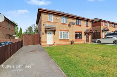
£180,000
Semi-Detached, 2 bed
Chillingham Road, CW7 1FY
£180,000
Semi-Detached, 2 bed
Chillingham Road, CW7 1FY
£220,000
Link Detached House, 2 bed
Chirk Place, CW7 2LW
£220,000
Link Detached House, 2 bed
Chirk Place, CW7 2LW
£350,000
Detached, 4 bed
Lapwing Close, CW7 1SN
£350,000
Detached, 4 bed
Lapwing Close, CW7 1SN
£122,500
Semi-Detached Bungalow, 1 bed
Victoria Square, CW7 2YL
£122,500
Semi-Detached Bungalow, 1 bed
Victoria Square, CW7 2YL
£165,000
Semi-Detached, 3 bed
CW7 1RP
£165,000
Semi-Detached, 3 bed
CW7 1RP
 New Build
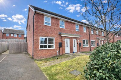
£220,000
Terraced, 3 bed
Swanlow Lane, CW7 1JD
New Build
£220,000
Terraced, 3 bed
Swanlow Lane, CW7 1JD
£350,000
Detached, 4 bed
Hatton Lane, CW7 3GT
£350,000
Detached, 4 bed
Hatton Lane, CW7 3GT
£152,000
Mews, 3 bed
Dunnock Close, CW7 4FN
£152,000
Mews, 3 bed
Dunnock Close, CW7 4FN
£195,000
Semi-Detached, 3 bed
Mendip Close, CW7 1RP
£195,000
Semi-Detached, 3 bed
Mendip Close, CW7 1RP
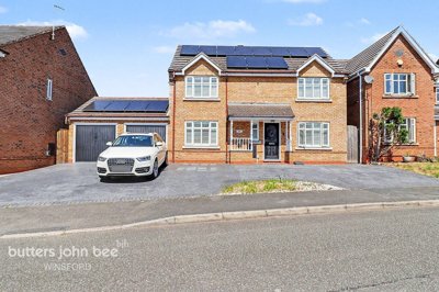
£375,000
Detached, 4 bed
Hartwell Grove, CW7 3UR
£375,000
Detached, 4 bed
Hartwell Grove, CW7 3UR
Get free, no-obligation valuations from the top-performing local agents. Compare fees, services, and track records before you decide.
Compare Agents FreeStart with 2-3 free valuations and compare the numbers against recent local sales. The strongest agent should explain why your home fits a particular price band, how they would market it and what kind of buyer they expect to attract. Look closely at fee structure, contract length and how quickly they respond to your questions. Local knowledge matters, especially for homes near the Weaver flood warning area or properties with possible subsidence concerns.
Most high-street agents charge 1-3% + VAT, with many sole agency fees sitting around 1-1.8% + VAT. Online agents usually offer fixed fees, often in the £999-£1,999 range. On a Winsford average price of £237,572, even a small change in fee can affect your net proceeds by a meaningful amount. Always ask what is included before you compare the headline price.
Yes, the average property price has risen by 3.01% over the last 12 months. The five-year increase is 17.09%, which shows the market has moved up over time even if short-term activity has been uneven. Sales volumes have fallen, with 347 transactions in the last year, down 26.22% on the year before. That makes realistic pricing and strong presentation more important.
Winsford has a younger profile than the borough average, with more residents under 15 across the wards. Many homes were built between 1960 and 1980, while older Victorian and Edwardian properties sit nearer the town centre around St Chad's Church. The town also has a stronger industrial and distribution base than many nearby places, and 24% of homes are social rented. Flood and subsidence checks matter in certain streets, so local advice is useful.
Sole agency usually suits sellers who want a clearer relationship and a lower fee, with contracts often lasting 8-16 weeks. Multi-agency can drive more competition between agents, but the cost is usually higher. In Winsford, the right choice often depends on property type and price point, because a detached home or a home with structural questions may benefit from a more hands-on approach. Ask how each option would work for your specific address.
That depends on pricing, condition and the amount of competition in your part of town. The best-supported price band last year was £156,000-£202,000, so homes placed well in that range may generate quicker interest. Larger detached houses and homes with survey issues usually need more patience. A good agent will tell you what level of activity to expect before the listing goes live.
A Level 2 survey is a sensible choice for many conventional homes in reasonable condition, and local prices start from £475. It can be especially useful where properties date from the 1960s and 1970s, since common issues include cavity wall tie corrosion, roof covering wear, outdated services and damp-related defects. If a home is heavily altered, older or built with non-standard materials, a Level 3 survey is usually the better fit. Salt mining history also means subsidence checks can be important.
Older post-war homes can be tricky if the construction type is non-traditional or if the property has had limited updating. Homes near flood warning areas, such as around New Road, the Marina or Lakeside Caravan Park, also need careful handling because buyers will ask about risk and insurability. Detached homes at the upper end of the market need strong presentation, while flats make up a very small share of the stock. An agent with local experience should be able to explain the difference clearly.
Yes, new schemes are giving buyers more choice and putting pressure on older homes to justify their asking price. The Woodlands on Roehurst Lane, Torus off Clough Road and Weaver Street, and Fox Wood Garden Village all offer modern layouts or lower running costs that buyers can compare with existing stock. That does not weaken the market for older homes, but it does raise the standard sellers need to meet. Good agents understand how to pitch an older property against nearby new-build competition.
From £475
A practical survey for many conventional Winsford homes in reasonable condition
From £650
Best for older, altered or non-standard homes where deeper inspection is sensible
From £66
Get the energy rating buyers will see before they book a viewing
From £250
Useful if you need an independent valuation before a sale or equity move
Estate Agents In London

Estate Agents In Plymouth

Estate Agents In Liverpool

Estate Agents In Glasgow

Estate Agents In Sheffield

Estate Agents In Edinburgh

Estate Agents In Coventry

Estate Agents In Bradford

Estate Agents In Manchester

Estate Agents In Birmingham

Estate Agents In Bristol

Estate Agents In Oxford

Estate Agents In Leicester

Estate Agents In Newcastle

Estate Agents In Leeds

Estate Agents In Southampton

Estate Agents In Cardiff

Estate Agents In Nottingham

Estate Agents In Norwich

Estate Agents In Brighton

Estate Agents In Derby

Estate Agents In Portsmouth

Estate Agents In Northampton

Estate Agents In Milton Keynes

Estate Agents In Bournemouth

Estate Agents In Bolton

Estate Agents In Swansea

Estate Agents In Swindon

Estate Agents In Peterborough

Estate Agents In Wolverhampton

Compare local agents for a Winsford home using sold-price evidence from 347 recent sales
Find AgentsHomemove is a trading name of HM Haus Group Ltd (Company No. 13873779, registered in England & Wales). Homemove Mortgages Ltd (Company No. 15947693) is an Appointed Representative of TMG Direct Limited, trading as TMG Mortgage Network, which is authorised and regulated by the Financial Conduct Authority (FRN 786245). Homemove Mortgages Ltd is entered on the FCA Register as an Appointed Representative (FRN 1022429). You can check registrations at NewRegister or by calling 0800 111 6768.
We use cookies to show you personalised content and improve your experience of our website. Find out more in our Privacy policy and Cookie policy.