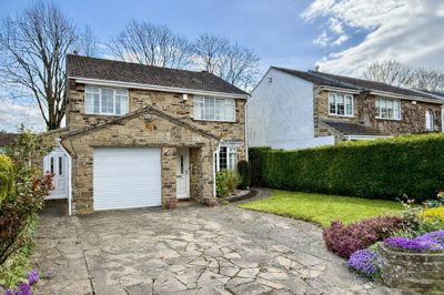
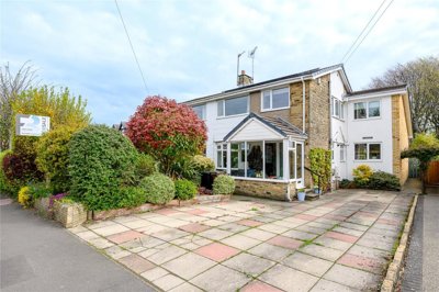
£595,000
Detached, 4 bed
Grasmere Avenue, LS22 6YT
£595,000
Detached, 4 bed
Grasmere Avenue, LS22 6YT

Compare 28 local agents, data from 268 active listings


We track 28 estate agents actively marketing properties in Wetherby, and we have ranked them all based on live listing data, market share, and average asking prices. Whether you are selling a Victorian terrace on Westgate or a modern detached home near the River Wharfe, finding the right agent can make a significant difference to your final sale price and how quickly your property moves.
The Wetherby property market has shown resilience despite broader national fluctuations. With an average asking price of £409,195 across 268 active listings, the town offers everything from affordable flats to premium detached family homes. Our analysis shows that the top-performing agents control a substantial share of the market, meaning their expertise could be the key to achieving the best result for your property.

28
Active Estate Agents
£409,195
Average Asking Price
268
Properties For Sale
The Wetherby housing market presents a nuanced picture when we examine recent sold price data from Land Registry and major property portals. According to home.co.uk, sold prices in Wetherby were 15% up on the previous year and 6% above the 2021 peak, indicating strong underlying demand in this commuter town between Leeds and York. However, home.co.uk reported a 3.4% fall in sold prices over the last 12 months, suggesting some moderation after the post-pandemic surge.
Sector-level analysis reveals significant variation across the LS22 postcode area. The LS22 6 sector around Wetherby town centre saw house prices grow 8.2% in the last year, representing a 4.1% real increase after inflation. In contrast, the LS22 7 sector experienced a 2.0% decline, falling 5.7% after inflation adjustment. This divergence underscores the importance of local knowledge when pricing your property.
Our current listings data shows asking prices ranging from under £200,000 for some flats through to properties exceeding £1 million for premium detached homes. The most active price band is the £300,000 to £500,000 range, which accounts for approximately 95 of the 204 properties currently for sale. This mid-market segment is where competition among buyers remains most intense, making expert agent representation particularly valuable.
Looking at transaction volumes, the LS22 6 postcode sector saw 183 property transactions in the most recent period tracked, while LS22 7 recorded 150 transactions over 24 months. October 2025 saw 19 properties sold in Wetherby, according to Home.co.uk data, indicating healthy market activity despite broader economic uncertainty.
Based on 113 live listings with an average asking price of £402,490.
Source: home.co.uk
See which agents are selling fastest and at the best prices in Wetherby.
Compare Estate Agents FreeTransaction volumes in Wetherby remain healthy despite broader market uncertainty. The LS22 6 postcode sector saw 183 property transactions in the most recent period tracked, while LS22 7 recorded 150 transactions over 24 months. October 2025 saw 19 properties sold in Wetherby, according to Home.co.uk data.
New build activity is shaping the local market significantly. Taylor Wimpey's Swinnow Park development is delivering approximately 726 new homes at Racecourse Approach, with prices ranging from £394,995 to £794,995. This development features energy-efficient homes with triple glazing, EV charging points, and a community heat hub. Persimmon has submitted proposals for 130 new homes at Sandbeck Lane, which would include 46 homes transferred to a local housing association.
Property type distribution in our current listings shows detached properties dominate with 82 homes available, followed by 50 flats, 44 semi-detached houses, and 23 terraced properties. The strong presence of detached homes reflects Wetherby's character as a prosperous market town with significant family housing demand.
Wetherby is a prosperous market town situated in the City of Leeds metropolitan district, approximately 13 miles east of Leeds city centre and 10 miles west of York. The 2021 Census recorded a population of 11,712 for the Wetherby built-up area, with the broader Wetherby Ward home to 21,616 residents across 9,319 households. The town serves as a commuter hub, with many residents traveling to Leeds for work or to the nearby Thorp Arch Estate for manufacturing and retail positions.
The underlying geology of Wetherby consists of Upper Permian Cadeby Formation dolostone, commonly known as Magnesian Limestone. This creamy-yellow oolitic limestone has been used in significant national structures including York Minster and the Houses of Parliament. Local quarrying has historically supplied building materials for the town's distinctive architecture, particularly within the conservation area. However, the clay-rich soils south of Wetherby present a shrink-swell risk, where ground movement can affect foundations, particularly during periods of drought or excessive rainfall.
Flood risk is a consideration for certain properties in Wetherby. The River Wharfe flows through the town, with low-lying areas near Bridge Foot, Scott Lane, and the Wilderness car park susceptible to flooding. Storm Eunice in February 2022 saw vehicles stranded in car parks due to river flooding. If you are considering a property in these areas, a RICS Level 2 Survey can identify any flood-related damage or necessary damp-proofing works.
The Wetherby Conservation Area covers the historic core from Boston Road in the south to St James' Church in the north. The town contains 33 Grade II listed buildings, including Wetherby Bridge (a Scheduled Ancient Monument), the Church of St James, several public houses dating from the 18th and 19th centuries, and the former Town Hall. This historic character contributes significantly to Wetherby's appeal, though buyers should be aware that listed buildings may require specialist surveys.
Sellers in Wetherby can choose between traditional high-street agents who charge percentage-based fees and online agents offering fixed-price packages. The traditional model, exemplified by agents such as Renton & Parr who average £465,027 across their 42 active listings, provides hands-on marketing, regular property viewings, and dedicated sales progression. Manning Stainton, with 33 listings at an average price of £313,333, represents another established high-street presence offering comprehensive service throughout the selling process.
Online agents such as Yopa and Keller Williams Plus operate across Wetherby with lower fixed fees, typically ranging from £999 to £1,999 including VAT. These agents can be suitable for straightforward sales where the vendor is comfortable managing aspects of the process themselves. However, our data shows that traditional agents with physical offices in Wetherby dominate the local market, collectively handling the vast majority of transactions.
The choice between sole agency and multi-agency agreements is another consideration. Sole agency agreements typically run for 8-16 weeks and charge lower fees (usually 1-2% + VAT), while multi-agency agreements can reach 2.5-3% + VAT but provide exposure across multiple agencies. For premium properties averaging above £500,000, where the difference in fees is proportionally smaller, many vendors opt for multi-agency to maximise buyer reach.

Look at each agent's active listings, average asking prices, and market share in Wetherby. Agents like Furnell Residential with an average price of £528,739 may be better suited to premium properties, while others focus on different price segments. Our live data shows which agents are most active in your neighbourhood.
Request free valuations from at least three agents. Be wary of agents who overvalue your property to win your instruction, as an overpriced home will simply sit on the market while correct pricing attracts serious buyers. Our comparison tool makes this process straightforward.
Ask about photography, floor plans, virtual tours, and listing portals. Agents who invest in quality marketing typically achieve faster sales and better prices. In Wetherby's competitive market, premium listings on home.co.uk can make a significant difference.
Ensure you receive a written terms of business detailing all fees, including any marketing costs, negotiation fees, or charges if you change agents. Remember that the lowest fee is not always the best value, especially for properties in the premium segment.
Understand the contract length, notice period, and what happens if your property is not sold. Many agents require a minimum term of 12-16 weeks. We recommend negotiating terms that protect your interests if circumstances change.
Choose an agent who understands the local market, communicates clearly, and makes you feel confident about the selling process. Local knowledge matters significantly in Wetherby's varied market sectors.
Do not accept the first fee quoted. Most agents have flexibility in their charges, particularly for multi-agency agreements or properties in the popular £300,000-£500,000 price band. Getting quotes from multiple agents puts you in a stronger negotiating position.
Understanding price distribution by bedroom count helps vendors price competitively and buyers understand their options. Our data shows that three-bedroom properties are the most common in Wetherby, with 83 listings averaging £356,009. This makes 3-bed homes the engine of the local market, typically attracting families and first-time buyers looking for space without premium pricing.
Four-bedroom properties represent strong demand with 72 listings averaging £566,695, showing the premium that Wetherby's excellent schools command. Two-bedroom properties offer the best entry point at 71 listings averaging £270,194, popular with first-time buyers and downsizers. At the upper end, five-bedroom homes average £813,993, with only 15 currently available, reflecting limited supply at this premium level.
One-bedroom flats average £176,698 across 20 listings, providing affordable options for first-time buyers or investors. The data reveals that prices per bedroom increase substantially beyond three beds, with five-bedroom properties costing more than double a three-bedroom average. For sellers, this means correctly positioning your property against comparable bedroom counts is essential for attracting serious buyers.
Pricing strategy is critical in the Wetherby market, where sector-level price trends vary significantly. Properties in the LS22 6 sector have seen 8.2% annual growth, while LS22 7 has experienced a 2% decline. Your agent should understand these micro-market dynamics and price accordingly. An overpriced property in a declining sector will linger on the market, often requiring price reductions that damage buyer confidence.
First impressions matter enormously. Properties with professional photography, detailed floor plans, and accurate descriptions attract more viewings and better offers. Agents who invest in marketing your property typically recover their costs through higher final sale prices. Consider whether your agent offers virtual tours, social media promotion, and home.co.uk Premium listings.
A RICS Level 2 Survey can add value by identifying issues that might otherwise derail a sale. For Wetherby's older properties, particularly those in the conservation area or with listed building status, a detailed survey can uncover hidden defects, from damp issues common in period properties to structural concerns related to the local clay soils. Addressing these issues before marketing, or pricing to reflect them, leads to smoother transactions. In Wetherby, RICS Level 2 Surveys typically cost between £350 and £600 depending on property size and value, with premium properties requiring more detailed assessments.
113 properties currently listed across Wetherby. Here are the most recently added.
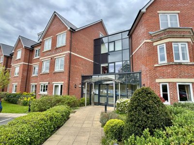
£595,000
Detached, 4 bed
Grasmere Avenue, LS22 6YT
£595,000
Detached, 4 bed
Grasmere Avenue, LS22 6YT
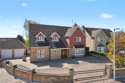
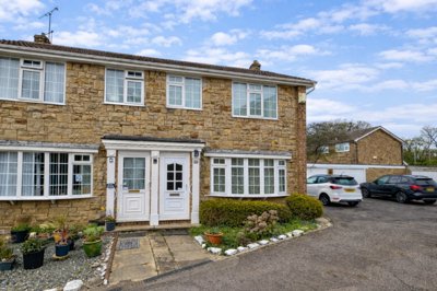
£425,000
Detached, 3 bed
North Grove Avenue, LS22 7PZ
£425,000
Detached, 3 bed
North Grove Avenue, LS22 7PZ
£375,000
Detached, 3 bed
Barleyfields Close, LS22 7FP
£375,000
Detached, 3 bed
Barleyfields Close, LS22 7FP
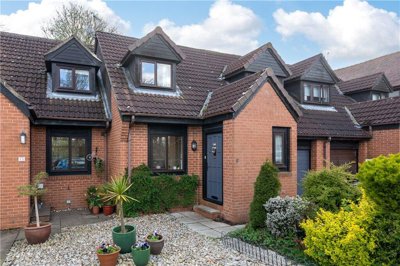
£170,000
Terraced, 1 bed
Kings Meadow View, LS22 7FX
£170,000
Terraced, 1 bed
Kings Meadow View, LS22 7FX
£210,000
Apartment, 1 bed
York Road, LS22 7AA
£210,000
Apartment, 1 bed
York Road, LS22 7AA
£1,250,000
Detached, 5 bed
Avon Garth, LS22 6HH
£1,250,000
Detached, 5 bed
Avon Garth, LS22 6HH
£545,000
Apartment, 2 bed
Westgate, LS22 6NH
£545,000
Apartment, 2 bed
Westgate, LS22 6NH
£325,000
Terraced, 3 bed
Barleyfields Court, LS22 6FZ
£325,000
Terraced, 3 bed
Barleyfields Court, LS22 6FZ
£450,000
Semi-Detached, 5 bed
Deighton Road, LS22 7QF
£450,000
Semi-Detached, 5 bed
Deighton Road, LS22 7QF
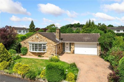
£625,000
Bungalow, 3 bed
Manley Drive, LS22 6XQ
£625,000
Bungalow, 3 bed
Manley Drive, LS22 6XQ
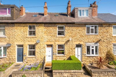
£290,000
House, 2 bed
St James Street, LS22 6RS
£290,000
House, 2 bed
St James Street, LS22 6RS
£250,000
Terraced, 2 bed
The Chase, LS22 6YU
£250,000
Terraced, 2 bed
The Chase, LS22 6YU
Get free, no-obligation valuations from the top-performing local agents. Compare fees, services, and track records before you decide.
Compare Agents FreeBased on our live market data, Renton & Parr leads with 42 active listings and 15.7% market share, followed by Manning Stainton with 33 listings (12.3% share) and Furnell Residential with 22 listings (8.2% share). These three agents collectively control over 36% of the Wetherby market. The best agent for your property depends on your price point and specific circumstances, with Furnell Residential particularly strong in the premium sector averaging over £528,000.
Traditional high-street agents in Wetherby typically charge between 1% and 3% + VAT (1.2% to 3.6% including VAT) of the sale price. Online agents offer fixed-fee packages ranging from £999 to £1,999 including VAT. For a property at the Wetherby average of £409,195, this means fees ranging from approximately £4,900 to £14,700 with a traditional agent, or around £1,000-£2,000 with an online service. Many agents are open to negotiation, particularly for properties in the popular £300,000-£500,000 range.
The picture is mixed. Overall sold prices were 15% up on the previous year according to home.co.uk listings data, but home.co.uk reported a 3.4% decline over the last 12 months. Sector-level data shows LS22 6 grew 8.2% while LS22 7 fell 2.0%. Asking prices have decreased 2.2% over the past six months, suggesting a period of price stabilisation after previous growth. The market remains active with 19 properties sold in October 2025 alone.
Wetherby is a prosperous market town with excellent transport links to Leeds and York via the A1(M). The town offers good local schooling, independent shops, and restaurants along its historic high street. The River Wharfe provides attractive riverside walks, while the conservation area features distinctive limestone buildings. Commuters appreciate the direct road connections, while families value the local amenities and community feel. The 2021 Census recorded 11,712 residents in the built-up area.
Wetherby offers diverse housing including Victorian and Edwardian terraced houses in the town centre, substantial detached homes in areas like Spofforth Hill, 1960s and 1970s housing in Sandbeck and Linton Park View, and new developments such as Taylor Wimpey's Swinnow Park. Detached properties dominate the current market with 82 listings, followed by 50 flats and 44 semi-detached homes. The characteristic building material is locally-quarried Magnesian Limestone.
Our data shows that local agents with physical offices in Wetherby dominate the market, handling the vast majority of transactions. Local agents bring established relationships with other local agencies, valuers, and conveyancers, plus intimate knowledge of micro-market conditions across different Wetherby sectors. Online agents may suit straightforward sales but risk lacking this local expertise. The top three agents by market share all have dedicated Wetherby offices.
The major new development is Taylor Wimpey's Swinnow Park at Racecourse Approach, delivering approximately 726 homes with prices from £394,995 to £794,995. This development features energy-efficient homes with triple glazing, EV charging points, and a community heat hub. Persimmon has proposed 130 new homes at Sandbeck Lane, subject to planning approval. Nearby developments in Collingham and Tockwith also serve the Wetherby area. New builds offer modern energy efficiency but often come at a premium over comparable existing properties.
Look for agents with strong local market knowledge, relevant experience with your property type, competitive but realistic fee structures, and quality marketing services. Check their current listings to see if they handle properties similar to yours, and ask about their average time to sell locally. Agents who can demonstrate recent sales in your street or neighbourhood are often the best choice. Given Wetherby's varied market sectors, choose someone who understands whether your property sits in the growing LS22 6 area or the softer LS22 7 sector.
From £350
From structural inspections to damp assessments, our RICS Level 2 surveys identify issues before they derail your sale. Wetherby's older properties often reveal hidden defects.
From £600
Comprehensive building surveys for older properties, listed buildings, and period homes in Wetherby's conservation area.
From £80
Required by law before marketing your property. Our accredited assessors provide fast turnaround across Wetherby.
From £200
Accurate valuations backed by local market data. Essential for setting the right asking price in Wetherby's nuanced market.
Estate Agents In London

Estate Agents In Plymouth

Estate Agents In Liverpool

Estate Agents In Glasgow

Estate Agents In Sheffield

Estate Agents In Edinburgh

Estate Agents In Coventry

Estate Agents In Bradford

Estate Agents In Manchester

Estate Agents In Birmingham

Estate Agents In Bristol

Estate Agents In Oxford

Estate Agents In Leicester

Estate Agents In Newcastle

Estate Agents In Leeds

Estate Agents In Southampton

Estate Agents In Cardiff

Estate Agents In Nottingham

Estate Agents In Norwich

Estate Agents In Brighton

Estate Agents In Derby

Estate Agents In Portsmouth

Estate Agents In Northampton

Estate Agents In Milton Keynes

Estate Agents In Bournemouth

Estate Agents In Bolton

Estate Agents In Swansea

Estate Agents In Swindon

Estate Agents In Peterborough

Estate Agents In Wolverhampton

Compare 28 local agents, data from 268 active listings
Find AgentsHomemove is a trading name of HM Haus Group Ltd (Company No. 13873779, registered in England & Wales). Homemove Mortgages Ltd (Company No. 15947693) is an Appointed Representative of TMG Direct Limited, trading as TMG Mortgage Network, which is authorised and regulated by the Financial Conduct Authority (FRN 786245). Homemove Mortgages Ltd is entered on the FCA Register as an Appointed Representative (FRN 1022429). You can check registrations at NewRegister or by calling 0800 111 6768.
We use cookies to show you personalised content and improve your experience of our website. Find out more in our Privacy policy and Cookie policy.