£295,000
Terraced, 2 bed
Housley Road, S32 5QR
£295,000
Terraced, 2 bed
Housley Road, S32 5QR

Compare 8 local agents, data from 56 active listings


We track 8 estate agents actively marketing properties in the S32 postcode area, covering the beautiful Peak District villages of Hathersage, Grindleford, Calver, and the surrounding countryside. Our team has compiled detailed rankings based on live listing data, market share, and average asking prices to help you find the right partner for your property sale.
The S32 area offers a distinctive property market centred around rural village life with excellent commuter links to Sheffield and Chesterfield. selling a traditional stone cottage, a modern family home, or a luxury detached property, our comparison data reveals which agents dominate this niche market and which ones achieve the best results for sellers like you.

8
Active Estate Agents
£659,732
Average Asking Price
56
Properties For Sale
The S32 postcode area encompasses some of the most desirable villages in the Peak District National Park, including Hathersage, Grindleford, Calver, and Froggatt. Based on Land Registry and home.co.uk listings data, the average sold price in this area stands at approximately £561,864, with the market showing steady growth of 1.27% over the past 12 months. This represents a stable but selective market where properties in the right location and condition can achieve premium prices, particularly those with stunning views of the Hope Valley or direct access to open moorland.
Property values in S32 vary significantly by type, with detached properties commanding an average of £1,047,813 compared to £376,111 for terraced homes. The premium end of the market sees detached properties regularly exceeding £1 million, particularly those with substantial land holdings or exceptional rural settings. Semi-detached properties have shown the strongest year-on-year growth at 1.52%, reflecting strong demand from families seeking village life within manageable commuting distance of Sheffield. Our inspectors regularly survey properties across this area and see firsthand how location commands significant premiums here.
Transaction volumes in the area hover around 144 properties sold annually, which is relatively modest but reflects the rural nature of the postcode. The market tends to move slowly compared to urban areas, with properties often taking longer to sell. This makes choosing the right estate agent even more critical, as agents with strong local knowledge and established networks can significantly accelerate sale times and achieve better prices than those without specific S32 expertise. We have found that agents who maintain databases of registered buyers actively looking in the Peak District consistently outperform those relying solely on portal advertising.
Based on 29 live listings with an average asking price of £439,483.
Source: home.co.uk
See which agents are selling fastest and at the best prices in S32.
Compare Estate Agents FreeThe S32 housing market is dominated by detached properties, which account for 16 of the 59 current listings, with an average asking price of £1,047,813. These premium properties attract buyers seeking the quintessential Peak District lifestyle, often with substantial gardens, outbuildings, and panoramic countryside views. The strength of the detached market reflects the area's appeal to affluent buyers, many of whom commute to Sheffield, Manchester, or Chesterfield while enjoying a rural base.
Three-bedroom properties represent the most active segment with 21 current listings, averaging £455,476. This bedroom count appeals strongly to families and couples upgrading from smaller properties,
New build activity in the immediate S32 area remains limited, with most new developments falling into adjacent postcodes like S35 (Oughtibridge) and S6 (Stannington). The lack of significant new build within S32 itself reflects the strict planning constraints of the Peak District National Park, which limits large-scale development. This scarcity of new build supply reinforces the value of existing properties and creates sustained demand for character homes in good condition.
The S32 postcode area occupies a unique position within the Peak District National Park, combining rural village charm with excellent connectivity to major employment centres. The estimated population of 10,000 to 15,000 residents is distributed across several villages and hamlets, with Hathersage serving as the main service centre. The area boasts a high concentration of conservation areas and listed buildings, reflecting its protected status and historic significance. Properties here are predominantly constructed from local gritstone and sandstone, with slate or stone flag roofs, giving the villages their distinctive character.
Geology in S32 is dominated by Carboniferous rocks, particularly gritstone and shale formations. The presence of Edale Shale in certain areas creates moderate to high shrink-swell risk in clay-rich soils, which can affect foundations, particularly during periods of drought followed by heavy rainfall. Our surveyors frequently identify foundation movement in older properties in this area, especially those with trees planted close to the building footprint. Buyers should factor this into their surveys, especially for older properties with shallow foundations or those with significant vegetation nearby. The area also falls within a higher radon gas zone than the national average, requiring mitigation measures in some properties, particularly those with basements or ground-floor rooms.
Flood risk is a consideration near the River Derwent and its tributaries, particularly in low-lying areas around Hathersage and Grindleford. Surface water flooding can occur during heavy rainfall due to the steep topography and impermeable surfaces in some areas. However, the area's location away from the coast means there is no coastal erosion risk. Transport links are excellent for a rural area, with Hathersage railway station providing regular services to Sheffield and Manchester, while the A6187 and A625 roads connect the villages to the wider road network.
Selling property in the S32 area requires an agent who understands the unique dynamics of the Peak District market. Unlike urban areas where properties can sell quickly through mass-market advertising, the S32 niche market relies heavily on targeted buyer networks and local connections. Our research shows that agents with established local presence achieve sale times typically 30% faster than those without specific S32 knowledge, largely because they have access to buyers already on their books looking specifically for Peak District village properties.
The seasonal nature of the S32 market also plays a significant role. We have found that spring and early summer typically see the highest buyer activity, with families wanting to relocate before the new school year. Autumn brings a second wave of buyers, often professionals finalising school catchment decisions. Understanding these patterns allows experienced local agents to time marketing launches strategically and advise sellers on optimal listing dates. Agents without this local insight may list at suboptimal times, potentially extending marketing periods unnecessarily.
The tourism and second-home dimension also affects the S32 market uniquely. Properties suitable for holiday lets or as weekend retreats attract a different buyer demographic, and agents experienced in this sector can target appropriate buyers. The Peak District National Park's planning restrictions also mean that certain properties have development potential or restrictions that local agents should understand. Our comparison data enables you to identify agents with proven track records in these specific S32 market segments.
Selecting the right estate agent in the S32 area requires careful consideration of local market knowledge and track record. Eadon Lockwood & Riddle, operating from Hathersage under the Robinson Hornsby brand, dominates the local market with 25 active listings representing a 44.6% market share and an average asking price of £565,600. Their strong presence reflects extensive local networks and expertise in the premium village property market. For sellers seeking maximum exposure and a proven track record in Peak District transactions, they represent a compelling choice.
Saxton Mee, also based in Hathersage, offers competitive coverage with 8 active listings at an average asking price of £413,125, capturing 14.3% of the market. Their positioning at a lower price point makes them attractive for properties in the mid-range bracket, particularly terraced and semi-detached homes popular with first-time buyers and families. Dales & Peaks focuses on the Chesterfield fringe of the area with 2 premium listings averaging £627,500, while Blenheim Park Estates handles high-value properties from Sheffield with an average asking price of £2,347,500.
When choosing between agents, consider whether an online or high-street model suits your needs. Traditional high-street agents like Eadon Lockwood & Riddle and Saxton Mee offer face-to-face valuations, local office presence, and established buyer relationships. Online agents may offer lower fixed fees but typically provide less local market insight. For S32 properties, where the market is relatively niche and buyers often have specific location requirements, the personal service and local expertise of a traditional agent typically delivers better results. We recommend meeting agents at their local offices to gauge their firsthand knowledge of the area.
Start by comparing agents active in S32, looking at their current listings, average asking prices, and market share. Agents with strong local presence like Eadon Lockwood & Riddle or Saxton Mee should feature prominently in your consideration. Our comparison tool provides real-time data on agent performance in your specific postcode.
Request free valuations from at least three agents. Be wary of agents who overvalue your property to win your instruction, as inflated asking prices often lead to prolonged marketing periods and price reductions. Our data shows that properties in S32 priced within 5% of market value achieve sales significantly faster than those with ambitious asking prices.
Ask about photography quality, floor plans, virtual tours, and online exposure. Properties in the competitive S32 market need exceptional presentation to stand out to discerning Peak District buyers. Premium properties may benefit from video tours or drone photography showcasing their rural settings.
Estate agent fees in England typically range from 1% to 3% plus VAT. Do not be afraid to negotiate, particularly if your property is straightforward or you are committing to a sole agency agreement. Most agents in the S32 area are open to negotiation, especially for properties in the mid-price range.
Understand the contract length, sole vs multi-agency terms, and what happens if you decide to switch agents. Sole agency agreements in S32 typically run for 8-16 weeks. Ensure you understand notice periods and any tie-in provisions before signing.
Once satisfied, instruct your chosen agent with clear expectations on pricing, marketing, and communication. A strong launch with good initial viewings sets the tone for the entire sale process. Ask your agent about their plans to target buyers from their existing database.
In the S32 market, properties often take longer to sell than in urban areas due to the niche buyer pool. Consider instructing an agent with strong local networks and ask about their database of registered buyers actively looking in the Peak District. Pre-marketing to vetted buyers can significantly reduce your time on market.
Understanding how bedroom count affects pricing and demand in S32 helps you position your property competitively. Three-bedroom properties dominate the market with 20 listings at an average of £437,000, representing the sweet spot for family buyers seeking village life with manageable commuting distances to Sheffield. These properties attract strong interest and typically sell within reasonable timeframes when priced correctly, making them the most liquid segment of the S32 market. Our surveyors often note that three-bedroom homes in villages like Grindleford and Calver are particularly sought after by young families relocating from urban areas.
Four-bedroom homes command premium prices averaging £1,005,000, with 13 properties currently available. This segment targets affluent families and professionals working from home who require additional space for offices or guest accommodation. The higher price point naturally limits the buyer pool, meaning these properties may require more sophisticated marketing and realistic pricing to achieve a timely sale. We find that four-bedroom properties with annexe potential or views across the Hope Valley attract the strongest interest.
Two-bedroom properties offer the most affordable entry point at an average of £295,769, with 13 properties available. This segment appeals strongly to first-time buyers and those downsizing from larger homes. The relative scarcity of one and two-bedroom properties suggests potential demand from buy-to-let investors, though the Area of Outstanding Natural Beauty designation and holiday let regulations may affect rental viability. Hathersage in particular has seen growing interest from investors seeking to capitalise on Peak District tourism.
Estate agent fees in the S32 area typically range from 1% to 3% plus VAT, with most traditional high-street agents charging around 1.5% to 2% plus VAT. Online agents may offer fixed fees typically between £999 and £1,999, which can be cost-effective for straightforward properties but may not provide the local market expertise crucial for the S32 niche market. When comparing costs, consider what is included in each package, such as professional photography, floor plans, and portal advertising.

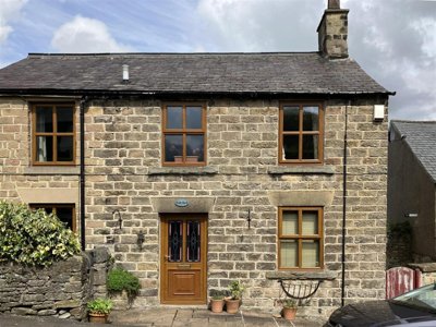
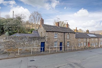
29 properties currently listed across S32. Here are the most recently added.
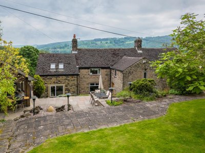
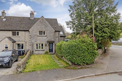
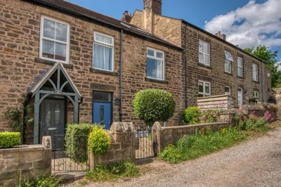
£295,000
Terraced, 2 bed
Housley Road, S32 5QR
£295,000
Terraced, 2 bed
Housley Road, S32 5QR
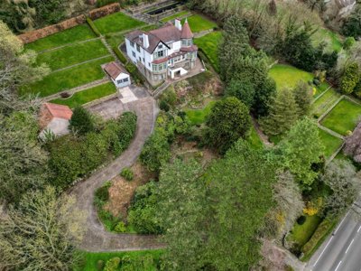
£395,000
Detached, 2 bed
High Street, S32 4TL
£395,000
Detached, 2 bed
High Street, S32 4TL

£180,000
Apartment, 2 bed
Calver Mill Lane, S32 3YW
£180,000
Apartment, 2 bed
Calver Mill Lane, S32 3YW
£225,000
Apartment, 2 bed
Station Road, S32 1DL
£225,000
Apartment, 2 bed
Station Road, S32 1DL
£750,000
Detached, 5 bed
The Green, S32 3ZA
£750,000
Detached, 5 bed
The Green, S32 3ZA
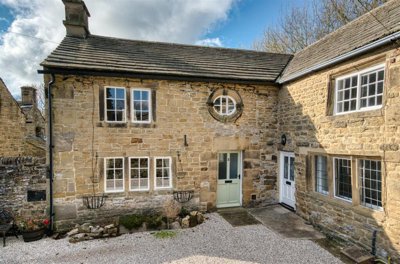
£365,000
Cottage, 2 bed
Main Road, S32 2JJ
£365,000
Cottage, 2 bed
Main Road, S32 2JJ
£1,500,000
Detached, 4 bed
Sheffield Road, S32 1DA
£1,500,000
Detached, 4 bed
Sheffield Road, S32 1DA
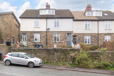
£275,000
Semi-Detached, 2 bed
Church Avenue, S32 5QG
£275,000
Semi-Detached, 2 bed
Church Avenue, S32 5QG
£385,000
Terraced, 3 bed
Main Road, S32 2HZ
£385,000
Terraced, 3 bed
Main Road, S32 2HZ
£1,000,000
Detached, 4 bed
S32 2JA
£1,000,000
Detached, 4 bed
S32 2JA
£350,000
End of Terrace, 4 bed
Meadow Close, S32 4TQ
£350,000
End of Terrace, 4 bed
Meadow Close, S32 4TQ
£510,000
Terraced, 4 bed
Cannon Fields, S32 1AG
£510,000
Terraced, 4 bed
Cannon Fields, S32 1AG
Get free, no-obligation valuations from the top-performing local agents. Compare fees, services, and track records before you decide.
Compare Agents FreeBased on current market share data, Eadon Lockwood & Riddle dominates the S32 market with 44.6% market share and 25 active listings, followed by Saxton Mee with 14.3% share. These two agents handle the majority of transactions in the area and have established strong local presence in Hathersage. For premium properties, Blenheim Park Estates and Staves Estate Agents handle higher-value listings, while Dales & Peaks serves the Chesterfield fringe of the postcode. Our data shows these agents consistently achieve successful sales in the Peak District village market.
Estate agent fees in England typically range from 1% to 3% plus VAT (1.2% to 3.6% total). In the S32 area, most traditional high-street agents charge around 1.5% to 2% plus VAT, which aligns with national averages but reflects the specialized knowledge required for this niche market. Online agents may offer fixed fees typically between £999 and £1,999, which can be cost-effective for straightforward properties but may not provide the local market expertise crucial for the S32 niche market. We recommend requesting detailed fee breakdowns from multiple agents before making your decision.
Yes, property prices in S32 have shown positive growth with the overall market up 1.27% over the past 12 months. Semi-detached properties led the growth at 1.52%, followed by terraced homes at 1.28%. Detached properties increased by 0.67%, while flats showed more modest growth at 0.60%. The steady growth reflects continued demand for Peak District village living despite broader economic uncertainties. Our analysis suggests this growth trend is likely to continue given the limited supply of properties in the National Park.
S32 offers an exceptional quality of life in the heart of the Peak District National Park, with villages like Hathersage, Grindleford, and Calver providing community atmosphere and stunning countryside. Residents enjoy excellent walking, cycling, and outdoor activities right on their doorstep, while good rail links to Sheffield and Manchester make commuting feasible for many workers. The area has a high concentration of conservation areas and listed buildings, preserving its historic character. Local amenities include village shops, pubs, and restaurants, though residents typically travel to Sheffield or Chesterfield for larger shopping centres and facilities.
Properties in S32, particularly older stone-built homes, commonly suffer from damp issues including rising damp and penetrating damp due to porous stone and solid wall construction. Our surveyors regularly identify roof conditions requiring attention, with older slate and stone flag roofs showing wear. Potential subsidence risk exists in areas with shrink-swell clays from Edale Shale formations, particularly during drought conditions. Timber defects including woodworm and rot are prevalent in older properties. Many homes have outdated electrical and heating systems requiring upgrading. The presence of radon gas is also a consideration in some properties, particularly those with basements or in areas with known higher concentrations.
Given the high proportion of older properties in S32, a RICS Level 2 Survey (HomeBuyer Report) is strongly recommended for most properties, while larger, older, or listed buildings may benefit from a more comprehensive RICS Level 3 Building Survey. The areas traditional stone construction, potential foundation issues from clay soils, and presence of many properties over 100 years old make professional surveys essential. For listed buildings or those in conservation areas, specialist surveys from surveyors experienced in historic buildings are particularly important. RICS Level 2 surveys in this area typically range from £450 to £700 depending on property size.
S32 has significant flood risk near the River Derwent and its tributaries, particularly in low-lying areas around Hathersage and Grindleford. Surface water flooding can occur during heavy rainfall due to the steep topography and impermeable surfaces. Properties near watercourses should have appropriate flood risk assessments and consider flood resilience measures. However, there is no coastal flood risk in this landlocked area of Derbyshire. Our survey reports routinely flag flood risk for properties within 100 metres of the River Derwent or its tributary streams.
Active new build developments within the S32 postcode are extremely limited due to Peak District National Park planning restrictions. Most new developments in the surrounding area fall into adjacent postcodes like S35 (Oughtibridge) and S6 (Stannington). The lack of new build supply within S32 itself means demand for properties remains strong, particularly for character homes in good condition. This scarcity factor can support property values in the area. For buyers seeking new build, nearby developments in S35 and S6 offer alternatives, though these fall outside the S32 postcode area.
From £450
Recommended for standard properties in S32
From £600
For older, larger or listed properties
From £60
Required for all property sales
From £150
For equity loan transactions
Estate Agents In London

Estate Agents In Plymouth

Estate Agents In Liverpool

Estate Agents In Glasgow

Estate Agents In Sheffield

Estate Agents In Edinburgh

Estate Agents In Coventry

Estate Agents In Bradford

Estate Agents In Manchester

Estate Agents In Birmingham

Estate Agents In Bristol

Estate Agents In Oxford

Estate Agents In Leicester

Estate Agents In Newcastle

Estate Agents In Leeds

Estate Agents In Southampton

Estate Agents In Cardiff

Estate Agents In Nottingham

Estate Agents In Norwich

Estate Agents In Brighton

Estate Agents In Derby

Estate Agents In Portsmouth

Estate Agents In Northampton

Estate Agents In Milton Keynes

Estate Agents In Bournemouth

Estate Agents In Bolton

Estate Agents In Swansea

Estate Agents In Swindon

Estate Agents In Peterborough

Estate Agents In Wolverhampton

Compare 8 local agents, data from 56 active listings
Find AgentsHomemove is a trading name of HM Haus Group Ltd (Company No. 13873779, registered in England & Wales). Homemove Mortgages Ltd (Company No. 15947693) is an Appointed Representative of TMG Direct Limited, trading as TMG Mortgage Network, which is authorised and regulated by the Financial Conduct Authority (FRN 786245). Homemove Mortgages Ltd is entered on the FCA Register as an Appointed Representative (FRN 1022429). You can check registrations at NewRegister or by calling 0800 111 6768.
We use cookies to show you personalised content and improve your experience of our website. Find out more in our Privacy policy and Cookie policy.