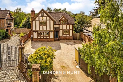
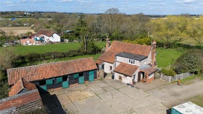
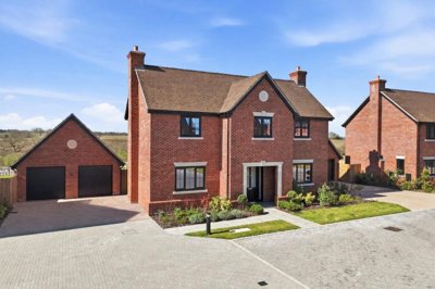
£1,000,000
Detached, 4 bed
Oak Hill Road, RM4 1EH
£1,000,000
Detached, 4 bed
Oak Hill Road, RM4 1EH

Compare 40 local agents, data from 116 active listings


We track 40 estate agents actively marketing properties in RM4, and we have ranked them all based on live listing data. Whether you are selling a family home in Abridge, a period property in Theydon Bois, or a modern detached house in Stapleford Abbotts, finding the right agent makes all the difference to your final sale price and the smoothness of your transaction.
The RM4 postcode covers some of east London's most desirable suburban and semi-rural villages, including Theydon Bois, Ongar, Abridge, and Stapleford Abbotts. With an average asking price of £975,125 across 116 active listings, this is a premium market where expert guidance can significantly impact your final sale price. Our comprehensive data helps you compare agents based on their actual performance in your specific area.

40
Active Estate Agents
£975,125
Average Asking Price
116
Properties For Sale
The RM4 property market has seen subtle shifts over the past year, with both opportunities and challenges for sellers. According to homedata.co.uk, the average sold house price in RM4 stands at £681,548 over the last 12 months, while home.co.uk reports a slightly lower overall average of £637,830. Our live listing data shows sellers are currently asking for £975,125 on average, indicating a gap between asking and achieved prices that successful negotiation can bridge.
Year-on-year price trends reveal a market adjusting to economic conditions. Overall house prices in RM4 have decreased by -1.12% over the last 12 months, with home.co.uk reporting that sold prices were 13% down on the previous year and 8% down on the 2021 peak of £693,772. However, certain sub-postcode sectors show remarkable resilience, with RM4 1DF seeing prices up 56% on the previous year, suggesting micro-market variations that local expertise can navigate.
Transaction volumes tell an important story for anyone considering a sale. There were 45 residential property sales in RM4 over the last year, representing a decrease of 6 transactions compared to the previous year. This 13.33% reduction in sales volume reflects broader national trends, but the continued presence of active buyers seeking quality properties means well-priced homes are still achieving successful sales. The key differentiator in the current market is accurate pricing and effective marketing, both of which depend heavily on choosing the right estate agent.
Based on 67 live listings with an average asking price of £1,073,097.
Source: home.co.uk
See which agents are selling fastest and at the best prices in RM4.
Compare Estate Agents FreeThe RM4 market is dominated by detached properties, which represent the largest segment of available stock with 41 listings averaging £1,481,098. This reflects the semi-rural character of villages like Theydon Bois, Stapleford Abbotts, and Abridge, where buyers seek spacious family homes with gardens away from urban density. Four-bedroom properties are the most common listing type at 41 properties, with an average asking price of £1,039,866.
New build activity in RM4 focuses on exclusive small-scale developments rather than large housing estates. Woodlands Grove in Stapleford Abbotts offers four-bedroom detached houses at £835,000 within a private gated development. High House Farm, also in Stapleford Abbotts, presents 14 luxury homes priced between £1,150,000 and £1,600,000. Meadow View in Stapleford Tawney features four individually designed homes at £1,395,000-£1,680,000 behind private security gates. These developments attract buyers seeking modern construction with traditional village settings.
Three-bedroom properties remain popular with families, with 28 listings averaging £560,714, while two-bedroom properties at an average of £405,208 provide more accessible entry points to the RM4 market. The premium end of the market sees five-bedroom homes averaging £1,796,333 and six-bedroom properties reaching £2,312,500, demonstrating strong demand for large family homes in this area.
RM4 encompasses villages that blend excellent transport links with outstanding natural environment, making it particularly attractive to families and professionals seeking quality of life. The postcode falls within the London Borough of Havering, which boasts the highest home ownership rate across all London boroughs at 70.5%, reflecting the area's popularity among buyers seeking stability and space. The predominant housing stock consists of houses and bungalows at 76.7%, far exceeding the London average of 45.9%.
Transport connections significantly influence property values in RM4. The area is well-served by the Central Line at Theydon Bois and Ongar stations, providing direct links into central London. For drivers, the M25 junction 26 and M11 motorway give straightforward access to the wider region. This combination of rural charm and urban connectivity makes RM4 particularly appealing to commuters who want village living without sacrificing city access.
The geological characteristics of RM4 warrant attention for property owners. The area sits on clay-rich soils typical of South-East England, creating potential for shrink-swell ground movement that can cause subsidence, particularly during dry spells when clay contracts. The British Geological Survey GeoSure data confirms higher risk in areas with high plasticity clay soils. Property owners, especially those with older properties or trees near foundations, should factor this into maintenance considerations and survey requirements.
Flood awareness is essential when considering properties in RM4. While general flood risk from rivers, sea, and groundwater remains low for most of the area, the River Rom at Romford, including Rush Green, is designated as a Flood Warning Area. Historical flooding events in the borough include significant incidents in August 2021 and 2016 along the River Rom. Surface water flooding can also occur during intense rainfall, so prospective buyers should inquire about specific location flood history.
Conservation considerations add character to the RM4 area. Havering-atte-Bower Conservation Area encompasses parts of RM4, preserving the linear village character that grew up on Havering Ridge. The nearby Epping Forest, a Special Area of Conservation and Site of Special Scientific Interest, borders the postcode and offers ancient woodland, old grassland plains, and important habitats. New residential developments within 6.2km of Epping Forest SAC may require mitigation payments due to recreational pressure.
The RM4 market features a diverse mix of estate agents, from boutique specialists operating in the village centres to larger regional and national brands. Butler & Stag leads the market with 16.4% market share and 19 active listings at an average price of £866,053, establishing themselves as a dominant force in the Theydon Bois and surrounding villages. Their strong local presence and focus on the premium village market make them a go-to choice for period properties and family homes.
For sellers with higher-value properties, Durden & Hunt operates from Ongar with an average asking price of £1,715,000 across their 12 listings, representing 10.3% of the market. Their positioning at the premium end of the RM4 market suits larger detached homes and village properties. Meanwhile, The Agency UK (Tauk) covers the more affordable segment with an average price of £543,333 across 9 listings, appealing to first-time buyers and those seeking smaller properties.
Millers Estate Agents, based in Epping with 6 listings averaging £925,832, offers another strong local option, while Madison Fox in Loughton focuses on properties averaging £1,106,250. When selecting an agent, consider their specific area expertise, the properties they typically sell, and their track record in your price bracket. Fee structures in RM4 typically range from 1-3% plus VAT, with sole agency agreements lasting 8-16 weeks. Always request free valuations from multiple agents before instructing.
The right estate agent for your property depends significantly on your location within RM4 and property type. Agents like Butler & Stag excel in the Theydon Bois and Abridge areas with their village community connections, while Durden & Hunt has established expertise in the Ongar market. National online agents like Tauk and Yopa offer lower fees but may lack the local knowledge needed to navigate RM4's micro-market variations, particularly in sub-postcodes like RM4 1DF where prices have shown significant growth.
Look at which agents have the most active listings in RM4 and what properties they are selling. Our data shows Butler & Stag, Durden & Hunt, and Millers Estate Agents have significant market presence. Pay attention to whether they regularly sell properties similar to yours in your specific village.
Request free valuations from at least three agents. This gives you market insight and allows you to compare their recommended asking price and marketing strategy. Use our comparison tool to see how different agents value properties in your area.
Ask about photographs, floor plans, virtual tours, and portal advertising. Premium agents like those in RM4 often offer enhanced marketing packages including professional photography, drone footage, and targeted social media campaigns that can make a significant difference in buyer interest.
Estate agent fees in RM4 typically range from 1-3% plus VAT. Negotiate fees based on your property type and whether you want sole or multi-agency. Remember that the lowest fee is not always the best value if the agent lacks local expertise.
Understand the contract length, notice period, and what happens if your property does not sell. Most sole agency agreements run for 8-16 weeks. Ensure you understand exit clauses and any tie-in periods before signing.
Choose an agent who understands the local RM4 market, communicates clearly, and makes you feel confident in their ability to sell your property. The right agent should be able to explain local market conditions and provide evidence of recent sales in your area.
Before instructing any estate agent in RM4, get at least three free valuations. Average asking prices vary significantly between agents, with our data showing a range from £543,333 to £1,715,000. This comparison ensures you price competitively and choose an agent with genuine local expertise.
Understanding how bedroom count affects pricing helps sellers position their property correctly and buyers understand value. Four-bedroom properties dominate the RM4 market with 41 listings averaging £1,039,866, reflecting strong demand from families seeking spacious accommodation in the area's villages. These properties typically offer flexible living space and appeal to buyers willing to pay a premium for room flexibility.
Five-bedroom properties represent the premium segment with 15 listings averaging £1,796,333, appealing to larger families and those seeking annexe potential or home office space. Six-bedroom properties, though rare with only 4 listings, reach an average of £2,312,500, demonstrating the market's capacity for ultra-premium family homes in select locations. Many of these larger homes are found in prestigious spots near Epping Forest or within gated developments like those in Stapleford Abbotts.
For buyers entering the RM4 market at lower price points, two-bedroom properties offer the best value with 24 listings averaging £405,208. These properties provide an accessible entry point to the area's excellent schools and transport links. One-bedroom properties average just £182,500 across 2 listings, representing the most affordable option, though stock is limited. Three-bedroom properties at an average of £560,714 across 28 listings remain popular with growing families seeking a balance between space and budget.
Price segmentation in RM4 is notably polarized, with 43 listings exceeding £1 million while 21 properties fall in the £300,000-£500,000 range. This distribution reflects the area's dual market: premium village homes attracting wealthy buyers seeking space and rural character, alongside more affordable options for first-time buyers and those seeking value in surrounding areas.
While the sales market dominates RM4, the rental sector offers opportunities for investors and landlords. Our data shows 14 rental listings across 11 active agents, with rental prices ranging from £995 to £3,850 per month. The limited rental stock suggests potential demand from tenants unable to purchase in this premium market.
Iglu Property Management leads the rental market with 2 listings averaging £998 per month, targeting budget-conscious tenants. At the premium end, Butler & Stag offers one rental property at £3,850 per month, reflecting the high-end nature of their client base. For investors considering buy-to-let in RM4, the strong owner-occupier market and high home ownership rates of 70.5% suggest rental demand may be constrained but potentially profitable for well-presented properties.
67 properties currently listed across RM4. Here are the most recently added.
£1,000,000
Detached, 4 bed
Oak Hill Road, RM4 1EH
£1,000,000
Detached, 4 bed
Oak Hill Road, RM4 1EH

£9,000,000
Detached, 10 bed
Albyns Lane, RM4 1RS
£9,000,000
Detached, 10 bed
Albyns Lane, RM4 1RS
£1,450,000
Detached, 6 bed
North Road, RM4 1QA
£1,450,000
Detached, 6 bed
North Road, RM4 1QA
£500,000
Semi-Detached, 2 bed
North Road, RM4 1PS
£500,000
Semi-Detached, 2 bed
North Road, RM4 1PS
 Haart
-16d ago
Haart
-16d ago
£100,000
Detached, 1 bed
Sunset Drive, RM4 1QL
£100,000
Detached, 1 bed
Sunset Drive, RM4 1QL
£1,200,000
Detached, 2 bed
Albyns Lane, RM4 1RT
£1,200,000
Detached, 2 bed
Albyns Lane, RM4 1RT
£485,000
Terraced, 3 bed
Tysea Hill, RM4 1JS
£485,000
Terraced, 3 bed
Tysea Hill, RM4 1JS
£230,000
Flat, 1 bed
Orchid Close, RM4 1DF
£230,000
Flat, 1 bed
Orchid Close, RM4 1DF
£650,000
End of Terrace, 3 bed
Pancroft, RM4 1DA
£650,000
End of Terrace, 3 bed
Pancroft, RM4 1DA
 Tauk
-27d ago
Tauk
-27d ago
 New Build
£1,500,000
Detached, 4 bed
RM4 1EW
New Build
£1,500,000
Detached, 4 bed
RM4 1EW
£665,000
Semi-Detached, 3 bed
Willow Tree Close, RM4 1BL
£665,000
Semi-Detached, 3 bed
Willow Tree Close, RM4 1BL
£1,595,000
Detached, 4 bed
Hoe Lane, RM4 1AU
£1,595,000
Detached, 4 bed
Hoe Lane, RM4 1AU
Get free, no-obligation valuations from the top-performing local agents. Compare fees, services, and track records before you decide.
Compare Agents FreeBased on our live market data, Butler & Stag leads RM4 with 16.4% market share and 19 active listings, making them the most active agent in the area. Durden & Hunt follows with 10.3% market share focusing on premium properties averaging £1,715,000. The Agency UK (Tauk), Millers Estate Agents, and Madison Fox also have significant presences. The best agent for your property depends on your price point, property type, and location within RM4. For example, if you are selling in Theydon Bois, Butler & Stag's local expertise would be particularly valuable, while Durden & Hunt would be suited for premium Ongar properties.
Estate agent fees in RM4 typically range from 1% to 3% plus VAT, which aligns with national averages. The average fee is approximately 1.5% plus VAT. Premium agents handling higher-value properties may charge at the higher end, while some online agents offer fixed-fee packages ranging from £500-£1,500. Always negotiate and compare what services are included. In RM4's premium market, higher fees are often justified by enhanced marketing packages and proven local expertise that can achieve a better sale price.
House prices in RM4 have decreased by -1.12% over the last 12 months according to our research. home.co.uk data shows prices were 13% down on the previous year and 8% down on the 2021 peak of £693,772. However, certain sub-postcode areas like RM4 1DF have shown strong growth of 56% year-on-year, demonstrating that local market conditions vary significantly within the postcode. The key is understanding your specific micro-market within RM4, which a knowledgeable local agent can help you navigate.
RM4 encompasses desirable villages including Theydon Bois, Ongar, Abridge, and Stapleford Abbotts within the London Borough of Havering. The area offers excellent transport links into London via the Central Line, outstanding natural surroundings including Epping Forest, and a strong community feel. With 70.5% home ownership, it has the highest rate in London, reflecting its appeal to families seeking stability, space, and quality of life. The area boasts excellent schools, traditional village pubs, and easy access to countryside while remaining connected to central London.
Detached properties are most common in RM4 with 41 listings averaging £1,481,098, reflecting the semi-rural village character. Terraced properties average £470,000 across 12 listings, while semi-detached homes average £659,500. Flats represent the smallest segment at 8 listings averaging £255,000. The market clearly favors family homes with gardens, with the majority of housing stock consisting of detached and semi-detached properties typical of the area's village character.
There are currently 116 properties for sale in RM4 according to our live listing data. This includes 41 detached homes, 45 other properties, 12 terraced houses, 10 semi-detached properties, and 8 flats. The market offers diverse options across price ranges from around £180,000 to over £2 million, with 43 properties priced above £1 million reflecting the premium nature of this market.
New build options in RM4 include exclusive small-scale developments such as Woodlands Grove in Stapleford Abbotts (four-bedroom detached houses from £835,000), High House Farm with 14 luxury homes (£1,150,000-£1,600,000), Meadow View in Stapleford Tawney (£1,395,000-£1,680,000), and Ongar Road in Abridge (five-bedroom detached houses from £1,500,000). These developments typically offer modern specifications in village settings, often featuring gated access, high-end fixtures, and energy-efficient construction.
Local estate agents like Butler & Stag and Millers Estate Agents have established relationships within RM4's village communities and understand micro-market variations. They can provide valuable insights into specific areas like conservation requirements in Havering-atte-Bower, flood history along the River Rom, and local school catchment details. Online agents like Tauk and Yopa offer lower fees but may provide less personalized service. For premium properties or complex sales, local expertise often proves valuable. Consider your priorities between cost savings and hands-on support when making your decision.
Current market conditions in RM4 reflect national trends with varying sale times depending on pricing and property type. Well-priced properties in desirable locations like Theydon Bois with good transport links tend to sell more quickly, while premium properties may take longer due to narrower buyer pools. Working with an agent who understands the local market dynamics and can advise on realistic pricing is essential for achieving a timely sale in the current climate.
Effective marketing in RM4 should include professional photography that showcases the village setting and period features common in the area. Look for agents who advertise on major portals, use virtual tours for remote buyer viewing, and have strong local knowledge to highlight advantages like proximity to Epping Forest, Central Line access, and good school catchment areas. Premium agents often provide floor plans, brochure design, and targeted social media marketing that can significantly increase buyer interest in your property.
Estate Agents In London

Estate Agents In Plymouth

Estate Agents In Liverpool

Estate Agents In Glasgow

Estate Agents In Sheffield

Estate Agents In Edinburgh

Estate Agents In Coventry

Estate Agents In Bradford

Estate Agents In Manchester

Estate Agents In Birmingham

Estate Agents In Bristol

Estate Agents In Oxford

Estate Agents In Leicester

Estate Agents In Newcastle

Estate Agents In Leeds

Estate Agents In Southampton

Estate Agents In Cardiff

Estate Agents In Nottingham

Estate Agents In Norwich

Estate Agents In Brighton

Estate Agents In Derby

Estate Agents In Portsmouth

Estate Agents In Northampton

Estate Agents In Milton Keynes

Estate Agents In Bournemouth

Estate Agents In Bolton

Estate Agents In Swansea

Estate Agents In Swindon

Estate Agents In Peterborough

Estate Agents In Wolverhampton

Compare 40 local agents, data from 116 active listings
Find AgentsHomemove is a trading name of HM Haus Group Ltd (Company No. 13873779, registered in England & Wales). Homemove Mortgages Ltd (Company No. 15947693) is an Appointed Representative of TMG Direct Limited, trading as TMG Mortgage Network, which is authorised and regulated by the Financial Conduct Authority (FRN 786245). Homemove Mortgages Ltd is entered on the FCA Register as an Appointed Representative (FRN 1022429). You can check registrations at NewRegister or by calling 0800 111 6768.
We use cookies to show you personalised content and improve your experience of our website. Find out more in our Privacy policy and Cookie policy.