£110,000
End of Terrace, 2 bed
Sunny Bank Road, WF14 0NL
£110,000
End of Terrace, 2 bed
Sunny Bank Road, WF14 0NL

Compare 32 local agents, data from 283 active listings


We track 32 estate agents actively marketing properties in Mirfield, and we've ranked them all based on live listing data, market share, and average asking prices. selling a Victorian terrace on Old Bank Road or a modern detached home near the River Calder, our analysis helps you find the right agent for your property.
The Mirfield property market has shown remarkable resilience, with sold prices rising 12.5% over the past year according to home.co.uk listings data. With an average asking price of £318,624 across 283 current listings, the market offers opportunities across every price point, from affordable terraced homes to premium detached properties. Our team has compiled comprehensive data to help you compare agents free and get the best outcome for your sale.
The Mirfield housing market sits in the WF14 postcode district, which saw overall growth of 4.18% in the past year, with specific sectors performing differently. The WF14 8 sector showed the strongest performance at 9.7% year-on-year growth, while WF14 0 posted a more modest 4.5% increase. Understanding these local variations helps you price your property competitively and choose an agent with proven results in your specific area of Mirfield.

32
Active Estate Agents
£318,624
Average Asking Price
283
Properties For Sale
The Mirfield housing market has demonstrated strong growth, with the average sold price reaching £280,000 as of early 2026, representing a 12.5% increase over the previous twelve months according to home.co.uk listings data. This places Mirfield among the better-performing markets in West Yorkshire, driven by sustained demand from families seeking the town's blend of rural character and good transport links to Leeds and Huddersfield. Our data shows the current average asking price sits at £325,139, with properties typically achieving between 85-95% of their asking price in current market conditions.
Looking at specific postcode sectors reveals nuanced performance within the WF14 district. The WF14 8 sector has shown the strongest growth at 9.7% year-on-year, while WF14 0 posted a more modest 4.5% increase. The WF14 9 area recorded 6.5% growth, with all sectors showing positive real returns after accounting for inflation. These sector-level differences matter significantly when pricing your property, as the same property type can command notably different values depending on exact location within Mirfield.
Transaction volumes in the WF14 area reached 263 sales over the past year, though this represents a decrease of 47 transactions compared to the previous year, down 17.87%. This reduction in supply, combined with steady demand, has helped support the price growth seen across the market. Properties in Mirfield are spending an average of 6-10 weeks on the market before achieving a sale, with well-presented homes in popular areas achieving faster results.
The price gap between asking and selling prices remains healthy, with most properties achieving 85-95% of their initial asking price. This reflects a market where realistic pricing and quality marketing combine to deliver successful outcomes. Our inspectors regularly survey properties across Mirfield, and we see well-maintained homes in good school catchment areas achieving prices at the upper end of these ranges.
Based on 133 live listings with an average asking price of £326,421.
Source: home.co.uk
See which agents are selling fastest and at the best prices in Mirfield.
Compare Estate Agents FreeMirfield's property market benefits from diverse housing stock, with semi-detached properties dominating the current listings at 63 homes, followed closely by detached properties at 64 listings. Three-bedroom homes represent the largest segment of buyer demand, with 78 properties currently available at an average price of £278,610. This reflects the strong family market in Mirfield, where good schools and family-friendly neighbourhoods drive purchasing decisions.
New build activity is contributing to the market mix with two significant developments currently underway. Applewood by Miller Homes on Granny Lane offers 67 energy-efficient three, four, and five-bedroom homes priced from £250,000 for a three-bedroom property to £410,000 for the four-bedroom Mitford style. The development opened in February 2023 and sits between open countryside and the River Calder, appealing to buyers seeking modern efficiency with semi-rural surroundings.
Crowther House by Darren Smith Homes represents a different market segment, offering luxury apartments designed for the over-55s market on the canal-side at East-Thorpe Court. Prices range from £340,000 to £499,000 for two-bedroom apartments, with phase two currently in development and 25% of homes already sold. The site manager received an NHBC Pride in the Job Supreme Award in 2025, reflecting the quality of construction. This development addresses a specific gap in the Mirfield market for downsizers seeking modern, low-maintenance accommodation.
A proposed development by Bellway for 75 homes at Woodward Court has faced significant local opposition. The "Save Mirfield" campaign has criticised the plans as "unsuitable and unsafe" due to proximity to Crossley Fields Junior and Infant School and narrow roads. The site was safeguarded in Kirklees Council's Local Plan with development not anticipated until at least 2031, but is being considered due to the council's lack of a five-year housing land supply.
Mirfield sits within the Metropolitan Borough of Kirklees in West Yorkshire, with a population of approximately 20,171 residents as of 2024 estimates. The town sits in the Calder Valley, traversed by the River Calder and the Calder and Hebble Navigation, giving the area its distinctive waterways character. The 2021 Census recorded 8,766 households in Mirfield, with a median age of 44, reflecting a community with a good balance of families, working-age adults, and retirees.
The geological context is important for property owners to understand. Mirfield sits on the Pennine Lower Coal Measures Formation, consisting of interbedded grey mudstone, siltstone, and pale grey sandstone. This geology brings specific considerations, as the clay-rich soils can exhibit shrink-swell behaviour with changing moisture levels, potentially affecting foundations. Additionally, Mirfield has a historical coal mining legacy, with workings recorded at depths from 40m to 1140m. While movement from deeper, older workings should have ceased, some shallow coal at or close to the surface may still pose risks that a surveyor would identify during a property inspection.
Flood risk is a genuine consideration in certain parts of Mirfield due to its riverside location. The Environment Agency has designated flood warning zones for the River Calder at Central Mirfield, affecting areas including Lower Hopton industrial units, Low Mill Lane industrial estate, Parkfield Crescent, Calder View, Granny Lane, Steanard Lane, and Back Station Road. Properties in these areas should have flood risk assessed as part of any purchase decision, and appropriate insurance cover considered.
Transport connectivity strengthens Mirfield's appeal for commuters. The town has direct rail connections to Leeds and Manchester, making it practical for workers in both cities. The M62 motorway is accessible via the A62, connecting to Leeds to the east and Manchester to the west. Local bus services provide good coverage across the Mirfield and Batley areas. The predominant housing stock reflects Mirfield's historical development, with Victorian terraced properties in the town centre, stone-built homes along the canal, and more modern developments on the town periphery.
Mirfield contains 47 listed buildings on the National Heritage List for England, including two Grade II* listed structures. The majority are residential properties, though notable examples include the 13th-century Tower of the Old Church of St Mary and Balderstone Hall. Upper Hopton is designated as a Conservation Area, and the broader Dewsbury & Mirfield Conservation Area covers significant parts of the town centre. Properties in these designated areas may require specialist surveys and face restrictions on alterations.
Selecting the right estate agent in Mirfield requires understanding how different agents perform across the market segments. Our data shows clear leaders in the local market, with Wilcock dominating the premium segment with an average asking price of £331,983 across 9 active listings, representing 3.9% of the market. This Mirfield-based agent clearly focuses on higher-value properties and has the largest market presence of any agent in the area.
Bramleys, also headquartered in Mirfield, presents a strong alternative with 43 active listings at an average price of £302,710, capturing 18.5% market share. This agent demonstrates particular strength across the mid-market segment, where the majority of Mirfield's three-bedroom family homes are positioned. Snowgate Estate Agency operates at a slightly higher average price point of £252,333 across 6 listings, appealing to sellers seeking a more boutique approach while maintaining strong local presence.
For sellers with properties at the more affordable end of the market, Whitegates offers an interesting option with 29 listings averaging £161,048. This franchise operates nationally but maintains good local knowledge through their Mirfield office. The contrast between agents like Mr & Mr Child, who average £650,622 across just 16 listings, versus agents like Adams Estates averaging £97,773, demonstrates the wide spectrum of market activity in Mirfield.
When choosing an agent, consider their track record in your specific price bracket and property type. High-street agents like Wilcock and Bramleys offer the advantage of physical offices where potential buyers can visit, while online agents like Purplebricks provide fixed-fee options that can reduce upfront costs. Multi-agency agreements, typically charging 0.5-1% extra, may be worth considering for premium properties where maximum exposure matters. Our team recommends getting valuations from at least three agents before making your decision.
Look at how many listings each agent has in Mirfield and their average asking prices. Agents with strong market share in your price bracket typically have more relevant buyers on their books. Focus on agents who regularly sell properties similar to yours in value and type.
Request free valuations from at least three agents. Compare their suggested asking prices and their proposed marketing strategies. Don't automatically go with the highest valuation, as unrealistic pricing can lead to your property sitting unsold while buyers overlook it.
Ask about photography quality, floor plans, virtual tours, and how extensively your property will be advertised across home.co.uk, homedata.co.uk, and social media. The best agents invest in professional marketing that makes your property stand out from the competition.
Estate agent fees in Mirfield typically range from 1% to 3% plus VAT (1.2% to 3.6% total). Some agents offer fixed fees, while others charge percentage-based commissions. Make sure you understand exactly what's included and whether there are any additional costs.
Standard sole agency agreements run for 8-16 weeks. Understand notice periods and what happens if you want to switch agents during the term. Some contracts may require you to pay fees even if you terminate early, so read the small print carefully.
Fees are often negotiable, especially if your property is in a desirable price range. Don't be afraid to ask for reductions or enhanced marketing packages. Our data shows Mirfield agents compete heavily for listings, so you have leverage.
Don't accept the first fee you're quoted. Our data shows Mirfield agents compete heavily for listings, especially in the popular £221,413-£410,981 bracket. Getting quotes from multiple agents and mentioning competing offers can help you negotiate a better rate while securing a strong marketing partner.
Understanding how bedroom count affects pricing in Mirfield helps you position your property competitively. Three-bedroom homes dominate the market with 78 listings available at an average price of £278,610, representing strong demand from families. This is the heart of the Mirfield market, where well-presented three-bed semis in popular school catchment areas command premium prices.
Four-bedroom properties form the second-largest segment with 59 listings averaging £410,981. These family homes with their additional space attract buyers willing to pay more for larger accommodation, particularly in sought-after developments near good schools. Two-bedroom properties offer the entry point to the Mirfield market with 62 listings averaging £221,413, popular with first-time buyers and those downsizing.
At the premium end, five-bedroom properties average £650,622 across 16 listings, with just four six-bedroom homes currently available at an average of £932,500. The top end of the market, including premium detached homes in select developments, sees less transaction volume but can achieve excellent prices when properly marketed. One-bedroom properties average £97,773 across 11 listings, representing the most affordable entry to Mirfield ownership, typically flats or converted apartments.
The most active price bracket is £200,000-£300,000 with 78 listings, followed by £300,000-£500,000 with 59 listings. If your property falls into these competitive brackets, choosing an agent with strong local presence and marketing capabilities becomes particularly important to stand out from similar properties.
Selling a property in Mirfield benefits significantly from working with an agent who understands the local market nuances. Our inspectors regularly survey properties across the area, and we see how different neighbourhoods and street locations can significantly affect property values and saleability within just a few streets of each other.
Properties near the Calder Valley primary schools in WF14 8 tend to command premium prices due to strong catchment area demand. The canal-side properties in East-Thorpe appeal to a specific buyer demographic seeking character and waterways views, while properties near the town centre offer convenience for those wanting easy access to Mirfield's shops and rail station.
Geological and environmental factors also play a role in the local market. Our surveyors note that properties in areas with historical coal mining activity or within designated flood zones may require additional disclosures and may face challenges during the conveyancing process. An experienced local agent will understand these factors and market your property appropriately to the right buyers.
The Mirfield rental market shows steady activity with 33 current listings and average rents around £900-£1,000 per month. If you're considering letting your property rather than selling, agents like Whitegates and Wilcock have strong rental departments with good tenant demand in the area.
133 properties currently listed across Mirfield. Here are the most recently added.
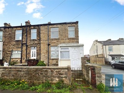
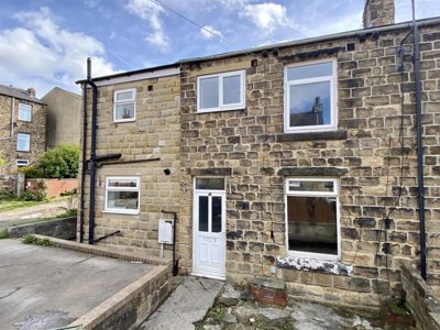
£110,000
End of Terrace, 2 bed
Sunny Bank Road, WF14 0NL
£110,000
End of Terrace, 2 bed
Sunny Bank Road, WF14 0NL
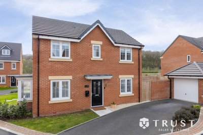
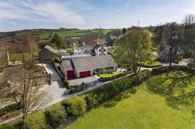
£325,000
Detached, 3 bed
Riverside Close, WF14 8BU
£325,000
Detached, 3 bed
Riverside Close, WF14 8BU
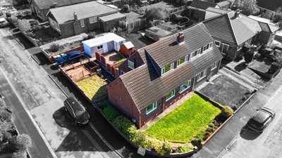
£300,000
Semi-Detached Bungalow, 4 bed
Manor Park, WF14 0EW
£300,000
Semi-Detached Bungalow, 4 bed
Manor Park, WF14 0EW
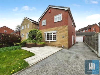
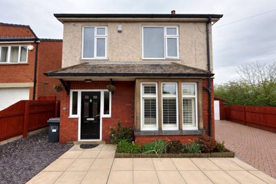
£360,000
Detached, 3 bed
Shillbank View, WF14 0QG
£360,000
Detached, 3 bed
Shillbank View, WF14 0QG
£150,000
End of Terrace, 3 bed
Brickyard, WF14 9BS
£150,000
End of Terrace, 3 bed
Brickyard, WF14 9BS
£190,000
Terraced, 3 bed
Old Engine Close, WF14 0JF
£190,000
Terraced, 3 bed
Old Engine Close, WF14 0JF
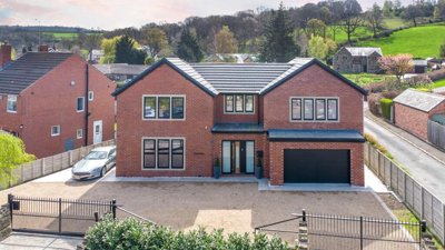
£850,000
Detached, 4 bed
Granny Lane, WF14 8LA
£850,000
Detached, 4 bed
Granny Lane, WF14 8LA
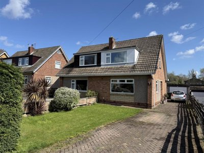
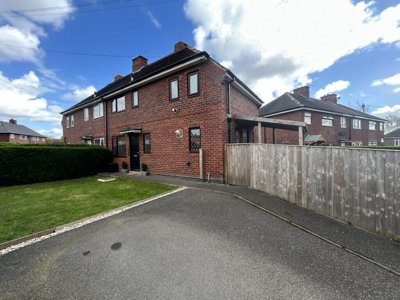
£280,000
Semi-Detached, 3 bed
Over Hall Road, WF14 9LH
£280,000
Semi-Detached, 3 bed
Over Hall Road, WF14 9LH
£500,000
Detached, 2 bed
Chapel Hill, WF14 8EW
£500,000
Detached, 2 bed
Chapel Hill, WF14 8EW
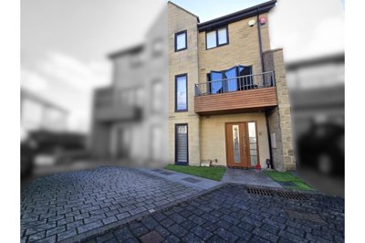
£380,000
Detached, 4 bed
Taylor Hall Lane, WF14 0HW
£380,000
Detached, 4 bed
Taylor Hall Lane, WF14 0HW
£225,000
Semi-Detached, 3 bed
Greenside Estate, WF14 0BA
£225,000
Semi-Detached, 3 bed
Greenside Estate, WF14 0BA
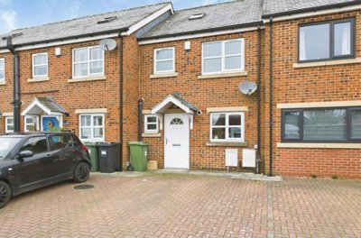
£229,000
End of Terrace, 2 bed
Radley Court, WF14 9FD
£229,000
End of Terrace, 2 bed
Radley Court, WF14 9FD
Get free, no-obligation valuations from the top-performing local agents. Compare fees, services, and track records before you decide.
Compare Agents FreeBased on our live market data, Wilcock leads Mirfield with 3.9% market share and 9 active listings at an average price of £331,983. Bramleys follows closely with 18.5% market share and 43 listings averaging £302,710, while Snowgate Estate Agency holds 2.6% of the market with 6 listings. These three agents collectively represent nearly 25% of all active listings in Mirfield, making them the dominant forces in the local market. Our team recommends getting valuations from each of these leading agents to compare their specific strengths for your property type.
Estate agent fees in Mirfield typically range from 1% to 3% plus VAT (1.2% to 3.6% total), which aligns with national averages. The average fee sits around 1.5% plus VAT for standard high-street agents. Online agents like Purplebricks offer fixed-fee alternatives typically ranging from £999 to £1,999, which can be more cost-effective for properties under £300,000. Always negotiate, as agents are often willing to reduce their fees to secure quality listings in this competitive market.
Yes, house prices in Mirfield have risen significantly, with sold prices increasing 12.5% over the past twelve months according to home.co.uk listings data. The WF14 postcode district saw overall growth of 4.18%, with sector-specific performance varying: WF14 8 performed strongest at 9.7%, WF14 9 grew 6.5%, and WF14 0 increased 4.5%. This sustained growth reflects strong demand and relatively limited supply in the Mirfield market, with transaction volumes down 17.87% year-on-year helping to support continued price appreciation.
Mirfield offers an attractive mix of Yorkshire character and practical connectivity for commuters. The town has a population of around 20,000 with good local amenities, schools, and transport links to Leeds and Manchester via direct train services. The Calder Valley location provides pleasant waterways and walks along the Calder and Hebble Navigation, while the town centre maintains its Victorian heritage with period properties along Old Bank Road and Northgate. The main drawbacks include some flood risk in riverside areas like Calder View and Granny Lane, plus the geological considerations from the historical coal mining background that buyers should be aware of before purchasing.
The current average asking price in Mirfield is £325,139 based on 233 active listings across the WF14 postcode area. This breaks down across property types: detached homes average £531,702, semi-detached properties average £269,826, terraced homes average £161,048, and flats average £101,742. The most common price bracket is £200,000-£300,000 with 78 listings in this range, followed by £300,000-£500,000 with 59 listings available.
Properties in Mirfield typically take 6-10 weeks to secure a buyer from listing to sale agreed, though well-presented homes in popular areas can achieve faster results. The market has seen some slowdown in transaction volumes, with 263 sales in the past year representing a 17.87% decrease from the previous year. This reduced supply has helped support prices, creating conditions where properly priced and marketed properties can achieve successful sales within typical timeframes. Properties priced realistically from the start tend to attract more viewings and sell faster than those requiring subsequent price reductions.
Two significant new build developments are active in Mirfield currently. Applewood by Miller Homes on Granny Lane offers 67 three to five-bedroom homes from £250,000 to over £410,000, opened in February 2023 and situated between open countryside and the River Calder. Crowther House by Darren Smith Homes provides luxury over-55s apartments from £340,000 to £499,000 on the canal-side at East-Thorpe Court, with phase two currently under construction and the site manager having won an NHBC Pride in the Job Supreme Award in 2025. A proposed Bellway development for 75 homes at Woodward Court has faced local opposition and remains under consultation.
Local agents with a physical presence in Mirfield like Wilcock, Bramleys, and Snowgate Estate Agency typically have stronger market knowledge and better buyer connections in the immediate area. They understand local school catchments in WF14 8, flood risk zones along the River Calder, and neighbourhood preferences that national online agents may miss. However, for premium properties or unique situations, larger regional or national firms may offer broader marketing reach. The key is matching your agent's strengths to your specific property and target buyer demographic.
Quality marketing can significantly impact how quickly your Mirfield property sells and the price you achieve. Look for agents who invest in professional photography, detailed floor plans, and virtual tours where appropriate. They should advertise extensively on home.co.uk and homedata.co.uk, which generate the majority of property searches in the UK. Social media marketing and email campaigns to their existing database of buyers add additional reach. Ask to see examples of their current listings and marketing materials to assess the quality before committing.
First impressions matter significantly in the Mirfield market. Our surveyors often see properties that would benefit from basic improvements before listing: decluttering, fresh neutral paintwork, kerb appeal enhancements, and addressing any obvious maintenance issues. Properties in flood risk areas should have flood resilience measures in place and documentation readily available. For Victorian terraced properties common in the town centre, highlighting period features while ensuring modern convenience can attract buyers seeking character. Consider obtaining a RICS Level 2 survey before marketing to identify and address any issues that might arise during the conveyancing process.
Estate Agents In London

Estate Agents In Plymouth

Estate Agents In Liverpool

Estate Agents In Glasgow

Estate Agents In Sheffield

Estate Agents In Edinburgh

Estate Agents In Coventry

Estate Agents In Bradford

Estate Agents In Manchester

Estate Agents In Birmingham

Estate Agents In Bristol

Estate Agents In Oxford

Estate Agents In Leicester

Estate Agents In Newcastle

Estate Agents In Leeds

Estate Agents In Southampton

Estate Agents In Cardiff

Estate Agents In Nottingham

Estate Agents In Norwich

Estate Agents In Brighton

Estate Agents In Derby

Estate Agents In Portsmouth

Estate Agents In Northampton

Estate Agents In Milton Keynes

Estate Agents In Bournemouth

Estate Agents In Bolton

Estate Agents In Swansea

Estate Agents In Swindon

Estate Agents In Peterborough

Estate Agents In Wolverhampton

Compare 32 local agents, data from 283 active listings
Find AgentsHomemove is a trading name of HM Haus Group Ltd (Company No. 13873779, registered in England & Wales). Homemove Mortgages Ltd (Company No. 15947693) is an Appointed Representative of TMG Direct Limited, trading as TMG Mortgage Network, which is authorised and regulated by the Financial Conduct Authority (FRN 786245). Homemove Mortgages Ltd is entered on the FCA Register as an Appointed Representative (FRN 1022429). You can check registrations at NewRegister or by calling 0800 111 6768.
We use cookies to show you personalised content and improve your experience of our website. Find out more in our Privacy policy and Cookie policy.