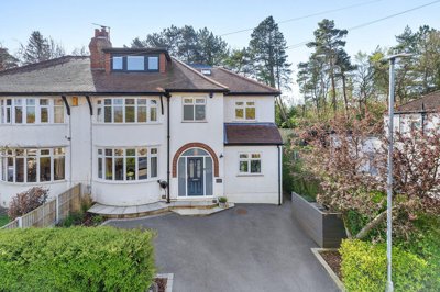
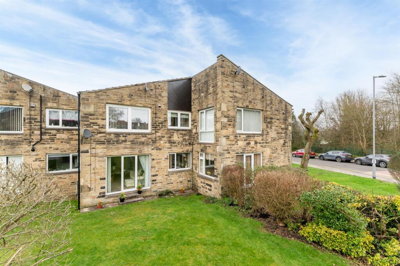
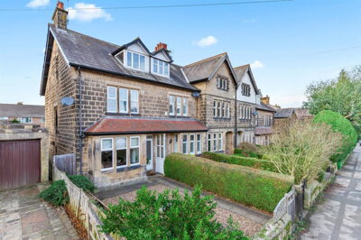
£750,000
Semi-Detached, 5 bed
Windermere Avenue, LS29 6NR
£750,000
Semi-Detached, 5 bed
Windermere Avenue, LS29 6NR

Compare 17 local agents, data from 105 active listings


We track 17 estate agents actively marketing properties in Menston, and we have ranked them all based on live listing data, market share, and average asking prices. Whether you are selling a Victorian terrace near the station or a modern detached home in one of the new developments, finding the right agent can make a significant difference to your final sale price and how quickly your property sells.
Menston's property market has shown steady growth, with the average asking price currently sitting at £506,905. This attractive West Yorkshire village, with its excellent transport links to Leeds and Bradford, appeals to commuters and families alike. Our comprehensive comparison helps you identify which agents have the strongest presence in this market and which specialize in properties similar to yours.

17
Active Estate Agents
£506,905
Average Asking Price
105
Properties For Sale
Menston's housing market has demonstrated resilient growth over the past year, with house prices increasing by approximately 4% according to home.co.uk listings data, though some sources report rises of up to 9.3% in sold prices. The current average asking price of £506,905 reflects a premium market compared to surrounding areas, driven by Menston's desirable position as a commuter village with excellent rail connections to Leeds. Land Registry data shows properties in the LS29 6 postcode sector experienced 8.3% growth in the last year, making it one of the stronger performing areas in the Bradford district.
Transaction volumes have seen some moderation, with approximately 75-88 residential property sales recorded over the past year, representing a decrease of around 30% compared to the previous year according to Property Solvers data. This reduction in sales volume is consistent with broader national trends, but the underlying demand remains solid given the limited supply of quality properties in this sought-after village. The average sold price stands at approximately £417,133 according to home.co.uk listings data, though this varies significantly by property type and location within Menston.
Detached properties command the highest prices in Menston, with current Atlas data showing an average of £735,853 for the 26 detached homes currently listed. Semi-detached properties average £479,339, while terraced homes average around £311,354. Flats represent the most accessible entry point at an average of £210,333. The strong representation of larger family homes in the current market reflects both the demographic profile of Menston and the nature of new development activity in the area, with several new build developments targeting the premium end of the market.
Based on 47 live listings with an average asking price of £444,690.
Source: home.co.uk
See which agents are selling fastest and at the best prices in Menston.
Compare Estate Agents FreeThe new build sector has been particularly active in Menston, with several significant developments bringing fresh stock to the market. Moordale Gardens on Derry Hill offers a selection of 2, 3, and 4 bedroom homes from an unverified developer, while The Spindles by Adlington Estates on Bradford Road provides retirement properties including 3-bedroom en-suite apartments with balconies. These developments sit alongside larger scale projects including the Moor Lane site by Termrim Construction, which features 2, 3, and 4 bedroom semi-detached and detached homes including shared ownership options.
Planning activity continues to shape the future housing supply, with approval granted for 47 houses at Derry Hill through Stonebridge Homes and Greenlight Developments, including 14 affordable homes. Yorkshire Housing received permission for 114 affordable homes on Moor Lane, addressing local housing needs. The proposed Otley Road development by Avant Homes would bring an additional 75 houses on Green Belt land between Menston and Otley, though this remains at outline application stage. The transaction mix shows detached properties dominate recent sales, followed by semi-detached homes, with terraced properties and flats forming a smaller portion of the market according to Plumplot data.
Property characteristics in Menston reflect its evolution from a railway village to a commuter hub. The historic core features gritstone buildings, some dating back to the 17th century including the Grade II* listed Fairfax Hall, with many retaining stone roofs. Post-war development added substantial brick-built housing, while recent years have seen reconstituted stone used in newer developments. The village maintains a mix of bungalows, two-storey houses, and properties with loft conversions, catering to buyers across different life stages from first-time purchasers to those seeking larger family homes.

Menston sits in the Wharfedale Ward, recognized as one of the least deprived areas in the Bradford District, with an average household income of £54,600 significantly exceeding the West Yorkshire average of £38,499. The population stands at approximately 5,905 according to the 2021 Census, with the village serving as a residential base for professionals working in Leeds, Bradford, and surrounding areas. The railway station provides regular services to Leeds and Bradford, making the village particularly attractive to commuters who want village character without sacrificing city accessibility.
The local geology presents some considerations for property owners and buyers. Menston sits on a hillside underlain by Millstone Grit aquifer, creating hummocky terrain with responsive groundwater levels. This geology can lead to shrink-swell movement in soils, potentially affecting foundations, particularly in properties with older drainage systems. Flood risk exists along Mire Beck to the east of the A65, with some areas in Flood Zone 3, and the area has experienced significant flooding in recent years on fields off Derry Hill and Moor Lane, requiring flood attenuation measures on new developments.
Local amenities in Menston include shops, pubs, and services serving daily needs, with the nearby towns of Ilkley and Otley providing additional retail and leisure options. The village hosts a conservation area covering a relatively small part of the community with approximately 200 residents, protecting the historic character of properties around Fairfax Hall and the old village core. Schools in the area serve families considering relocation, and the community benefits from various clubs and organizations reflecting the active village character.
Choosing between online and traditional high-street agents is an important decision for Menston sellers, and the local market offers examples of both approaches. Dacre Son & Hartley maintains a strong presence from their Burley in Wharfedale office with 17 active listings representing 16.2% of the market, positioning them as the leading agent in Menston by volume. Their average asking price of £504,353 reflects a focus on properties across the price spectrum. Enfields Luxe operates as a premium agent covering Wharfedale with 10 listings at an average price of £688,500, targeting the higher end of the market.
Traditional high-street agents like Tranmer White based in Ilkley offer personal service with local market knowledge, holding 9 listings at £546,100 average. Shankland Barraclough from Otley brings 9 listings at £422,222 average, appealing to buyers seeking more affordable properties. Hunters and Hardisty both operate in the Otley and Ilkley area, with Hunters holding 5 listings at £285,000 and Hardisty maintaining 5 listings at £231,000. For sellers considering online alternatives, these traditional agents typically charge percentage-based fees of 1-3% plus VAT, while online fixed-fee agents may offer savings for straightforward sales.
The choice often depends on your property type and selling circumstances. Premium properties may benefit from the personal service and marketing reach of established high-street brands like Harrison Robinson in Ilkley, whose 3 listings average £629,833, or Manning Stainton with listings averaging £599,983. Properties at lower price points might suit agents with strong volume presence like Yorkshire Housing handling resale properties at £125,436 average. Getting valuations from multiple agents before instructing is essential, as is understanding whether you want sole agency or the broader exposure that multi-agency agreements provide.

Request free valuations from at least three different agents operating in Menston. Compare their asking price suggestions and their reasoning for the valuation. Be wary of agents who overpromise on price to win your business, as inflated valuations often lead to properties sitting unsold and eventual price reductions.
Ask about recent sales in Menston and surrounding areas. How quickly did properties sell? Did they achieve the asking price? Our comparison data shows market share and listing volumes, giving you insight into which agents are most active locally. Agents with strong local presence typically have established buyer relationships and know what sells in your specific area.
Traditional agents in this area typically charge 1-3% plus VAT (1.2-3.6% total). Online agents offer fixed fees typically between £999-£1,999. Consider what services are included and whether you will need to pay extra for photography, floorplans, or marketing materials. Remember that the cheapest option is not always the best value.
Quality photography, floorplans, and virtual tours can significantly impact buyer interest. Ask which platforms they advertise on and how they plan to market your specific property. The best agents tailor their approach to your property type, using professional staging advice and targeted online advertising to reach the right buyers.
Understand the agreement length, typically 8-16 weeks for sole agency. Know what happens if you want to leave early or if they find a buyer but you decide not to sell. Multi-agency agreements offer broader coverage but typically cost 0.5-1% more in fees, and may be worth considering for premium properties or slower market conditions.
The top three agents in Menston hold over 34% of the market. However, smaller specialists like Hardisty Prestige, focusing on premium properties averaging £755,000, may better suit higher-value homes. Always compare agents against those with similar property types in your price range.
Understanding how bedroom count affects pricing helps you position your property competitively in the Menston market. Four-bedroom homes represent the largest segment of current listings at 29 properties, with an average price of £665,993, reflecting strong demand from families upgrading within the village or relocating from nearby cities. Five-bedroom properties average £808,450 across 10 listings, appealing to buyers seeking substantial family homes with multiple reception rooms and generous gardens.
Three-bedroom properties form the second-largest segment at 35 listings, averaging £478,435, representing the heart of the family housing market in Menston. These properties attract first-time buyers moving up from two-bedroom homes and families seeking a property that offers space without premium pricing. Two-bedroom properties number 25 listings at an average of £250,057, popular with first-time buyers, young couples, and buy-to-let investors given the strong rental demand from commuting professionals.
One-bedroom properties average £276,667 across just 3 listings, reflecting limited supply rather than lack of demand, as these smaller properties suit single professionals or couples starting their property journey. Six-bedroom properties represent a small niche at 2 listings averaging £912,500, typically period homes or substantial modern houses in premium positions. The bedroom distribution shows Menston predominantly serves the family market, with excellent options at every level from compact starter homes through to substantial executive properties.

Pricing your property correctly from the outset is crucial in the Menston market, where informed buyers compare options carefully. Our data shows the average asking price sits at £506,905, but properties priced within the £300k-£500k range (30 current listings) attract the most buyer interest. Properties in the £500k-£750k bracket number 25 listings, while the premium segment above £750k holds 20 listings, indicating solid demand at higher price points.
Agent fees are typically negotiable in this market, with standard charges ranging from 1% to 3% plus VAT depending on the agent and services provided. Getting quotes from multiple agents allows you to negotiate, particularly if you can demonstrate you have received competitive offers. Consider whether you want sole agency (typically 8-16 weeks) giving one agent exclusive rights, or multi-agency allowing multiple firms to market your property for a higher fee but potentially reaching more buyers.
The quality of your agent's marketing and their ability to present your property effectively can justify higher fees through better final sale prices. Properties with professional photography, accurate floorplans, and virtual tours typically generate more viewings and stronger buyer interest. Given the competitive nature of the Menston market, where similar properties may be available from multiple agents, your choice of agent and their marketing approach can significantly influence both the speed of sale and the price achieved.

47 properties currently listed across Menston. Here are the most recently added.
£750,000
Semi-Detached, 5 bed
Windermere Avenue, LS29 6NR
£750,000
Semi-Detached, 5 bed
Windermere Avenue, LS29 6NR
£250,000
End of Terrace, 2 bed
South View, LS29 6JX
£250,000
End of Terrace, 2 bed
South View, LS29 6JX
£995,000
Detached, 5 bed
Halstead Drive, LS29 6NT
£995,000
Detached, 5 bed
Halstead Drive, LS29 6NT
£385,000
House, 2 bed
Station Road, LS29 6JH
£385,000
House, 2 bed
Station Road, LS29 6JH
£175,000
Apartment, 2 bed
St Peters Way, LS29 6NY
£175,000
Apartment, 2 bed
St Peters Way, LS29 6NY
£289,950
Apartment, 1 bed
Bradford Road, LS29 6GY
£289,950
Apartment, 1 bed
Bradford Road, LS29 6GY
£599,950
Apartment, 3 bed
Bradford Road, LS29 6GY
£599,950
Apartment, 3 bed
Bradford Road, LS29 6GY
£300,000
Terraced, 3 bed
Farnley Road, LS29 6JN
£300,000
Terraced, 3 bed
Farnley Road, LS29 6JN

£875,000
Detached, 3 bed
Cleasby Road, LS29 6HW
£875,000
Detached, 3 bed
Cleasby Road, LS29 6HW

£175,000
Apartment, 2 bed
Farnley Road, LS29 6GA
£175,000
Apartment, 2 bed
Farnley Road, LS29 6GA
£515,000
End of Terrace, 4 bed
Cleasby Road, LS29 6HN
£515,000
End of Terrace, 4 bed
Cleasby Road, LS29 6HN
£495,000
Bungalow, 2 bed
Farnley Road, LS29 6JW
£495,000
Bungalow, 2 bed
Farnley Road, LS29 6JW
Get free, no-obligation valuations from the top-performing local agents. Compare fees, services, and track records before you decide.
Compare Agents FreeBased on current market data, Dacre Son & Hartley leads with 17 active listings and 16.2% market share, followed by Enfields Luxe with 10 listings focusing on premium properties averaging £688,500. Shankland Barraclough and Tranmer White each hold 9 listings. The best agent depends on your property type, with Dacre Son & Hartley handling volume across price points, Enfields Luxe targeting the premium sector, and agents like Hardisty Prestige focusing on properties averaging £755,000.
Estate agent fees in Menston follow the national average of 1-3% plus VAT (1.2-3.6% total), with the typical rate around 1.5% plus VAT. High-street agents like Tranmer White and Harrison Robinson generally charge percentage-based fees, while online alternatives offer fixed fees typically between £999-£1,999. Multi-agency agreements usually cost 0.5-1% more than sole agency agreements. Always negotiate and compare what is included in the fee.
Yes, house prices in Menston have been rising. home.co.uk reports a 4% increase on the previous year, while home.co.uk shows 9.3% growth in sold prices. The LS29 6 postcode sector specifically saw 8.3% growth according to Housemetric. However, transaction volumes have decreased by around 30% compared to the previous year, suggesting a competitive market with limited supply rather than high transaction activity.
Menston is a prosperous West Yorkshire village in the Wharfedale Ward, one of the least deprived areas in Bradford. With an average household income of £54,600 significantly above the regional average, it attracts professionals commuting to Leeds and Bradford via the railway station. The village offers local shops, pubs, and a conservation area protecting historic properties including the Grade II* listed Fairfax Hall. The community has an active character with various clubs and organizations.
Menston's housing stock is predominantly detached and semi-detached properties, with detached homes making up approximately 29.41% of sales. Current Atlas data shows 26 detached listings averaging £735,853, 23 semi-detached at £479,339, 15 flats averaging £210,333, and 6 terraced homes at £311,354. The village features Victorian and Edwardian properties from the railway era, post-war brick homes, and new developments including apartments and family houses.
Yes, several new build developments are active in Menston. Moordale Gardens on Derry Hill offers 2, 3, and 4 bedroom homes. The Spindles provides retirement apartments. Termrim Construction is building homes on Moor Lane including shared ownership options. The Moorlands by Park Lane Homes was completed in 2021 with luxury detached properties. Planning permission exists for 47 houses at Derry Hill and 114 affordable homes on Moor Lane, with further proposed development on Otley Road.
Look for agents with strong local presence and market share in Menston, relevant experience with your property type, and a realistic rather than optimistic valuation. Research their recent sales in the area and ask about time-on-market averages. Understand their fee structure and what is included. Ensure they offer quality marketing including photography and floorplans. Get at least three valuations to compare approaches and negotiate on fees.
Menston has identified flood risks including fluvial flooding along Mire Beck to the east of the A65, with some areas in Flood Zone 3. Surface water flooding occurs in vulnerable locations, and groundwater flooding is a concern given the underlying Millstone Grit aquifer. Recent years have seen significant flooding on fields off Derry Hill and Moor Lane, requiring flood attenuation measures on new developments. Consider this when purchasing and check specific site surveys.
Estate Agents In London

Estate Agents In Plymouth

Estate Agents In Liverpool

Estate Agents In Glasgow

Estate Agents In Sheffield

Estate Agents In Edinburgh

Estate Agents In Coventry

Estate Agents In Bradford

Estate Agents In Manchester

Estate Agents In Birmingham

Estate Agents In Bristol

Estate Agents In Oxford

Estate Agents In Leicester

Estate Agents In Newcastle

Estate Agents In Leeds

Estate Agents In Southampton

Estate Agents In Cardiff

Estate Agents In Nottingham

Estate Agents In Norwich

Estate Agents In Brighton

Estate Agents In Derby

Estate Agents In Portsmouth

Estate Agents In Northampton

Estate Agents In Milton Keynes

Estate Agents In Bournemouth

Estate Agents In Bolton

Estate Agents In Swansea

Estate Agents In Swindon

Estate Agents In Peterborough

Estate Agents In Wolverhampton

Compare 17 local agents, data from 105 active listings
Find AgentsHomemove is a trading name of HM Haus Group Ltd (Company No. 13873779, registered in England & Wales). Homemove Mortgages Ltd (Company No. 15947693) is an Appointed Representative of TMG Direct Limited, trading as TMG Mortgage Network, which is authorised and regulated by the Financial Conduct Authority (FRN 786245). Homemove Mortgages Ltd is entered on the FCA Register as an Appointed Representative (FRN 1022429). You can check registrations at NewRegister or by calling 0800 111 6768.
We use cookies to show you personalised content and improve your experience of our website. Find out more in our Privacy policy and Cookie policy.