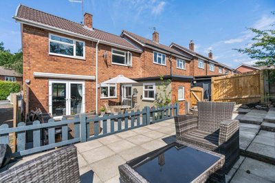
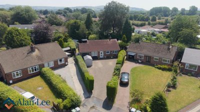
£280,000
Semi-Detached, 3 bed
Delamere Drive, SK10 2PU
£280,000
Semi-Detached, 3 bed
Delamere Drive, SK10 2PU

Compare local agents for a Macclesfield home, using sold-price evidence from 812 recent sales


Macclesfield sold prices average £292,043, which gives sellers a clear starting point before inviting valuations. The town recorded 812 residential sales in the last 12 months, down by 44 transactions against the previous year. That 5.42% fall in volume makes pricing discipline more important, especially around SK10 and SK11 where buyer budgets can vary sharply. We help you compare estate agents by looking at how they value homes, how they market them, and how their fee terms affect your final proceeds.
Our sold-price analysis shows a market with several layers. Detached homes average £475,000, semi-detached homes average £320,639, terraced homes average £214,701, and flats average £315,333 on the latest sale figures available for that property type. Prices rose by 2.89% over 12 months, while asking prices moved by -1.5% over the past 6 months. A good Macclesfield agent should understand that gap, particularly near Fence Avenue, Chelford Road, Moss Lane, and the older town-centre streets around Chestergate and Jordangate.

£292,043
Average Sold Price
812
Sales in Last 12 Months
+2.89%
12-Month Price Change
£475,000
Detached Average
£320,639
Semi-Detached Average
£214,701
Terraced Average
£315,333
Flat Average
Using listing data from home.co.uk and property data from homedata.co.uk
Macclesfield is not one single price market. A detached house at £475,000 sits in a different buyer pool from a terraced home at £214,701, and that affects the right launch price. The gap between the average sold price of £292,043 and the average asking price of £478,768 also matters. Around Macclesfield town centre, older terraces and flats compete with newer homes at Kings Park on Fence Avenue and Silk Waters Green on Moss Lane.
Price movement has been modest but positive. The 12-month rise of 2.89% suggests Macclesfield has not seen a runaway surge, yet it has avoided the sharper falls seen in some slower markets. SK11 6 performed more strongly, with 5.0% annual growth and 1.8% growth after inflation. Sellers in streets close to Park Green, Sunderland Street, and Brook Street need a valuation that reflects both the street-level micro-market and the broader town trend.
Transaction volume gives another signal. There were 812 residential sales in the last 12 months, down by 44 sales from the previous year. Fewer completions can mean buyers take longer to commit, especially where the property needs survey work or sits close to known surface-water routes. A careful agent should explain the likely buyer profile before launch, not just suggest the highest valuation.
Based on 405 live listings with an average asking price of £342,998.
Source: home.co.uk
See which agents are selling fastest and at the best prices in Macclesfield.
Compare Estate Agents FreeMacclesfield sales activity is broad, but it is not even across property types. Terraces remain a key part of the town’s stock, particularly around older streets near the centre and former industrial areas linked to the silk trade. Semi-detached homes at an average of £320,639 sit close to the overall town average, so they often set the tone for mainstream family-house pricing. Detached homes, especially in Tytherington and towards Prestbury and Adlington, move in a higher bracket.
New-build supply is also shaping buyer expectations. Kings Park by David Wilson Homes on Fence Avenue has 2, 3, 4 and 5 bedroom homes priced from £252,000 to £655,000. Weaver Green by Bellway Homes on Chelford Road lists 2, 3 and 4 bedroom homes from £399,995 to £609,995. Silk Waters Green by Barratt Homes on Moss Lane ranges from £244,995 to £570,645, so nearby resale homes need sharper presentation if they compete with new kitchens, warranties, and energy efficiency.
Affordable and shared ownership schemes add another layer. Ivy Road and Countess Road by Peaks & Plains Housing Trust includes 29 new homes, with 16 for social rent and 13 for Shared Ownership. Bollin Grange on Gaw End Lane includes 2, 3, 4 and 5 bedroom homes, with shared ownership options through Onward Living. A Macclesfield agent valuing a resale home near London Road or Moss Lane should know how these schemes influence local buyer choices.

Macclesfield’s housing stock reflects its long industrial and market-town history. The Town Centre Conservation Area includes Chestergate, Market Place, Church Street, and Jordangate, where Georgian and Victorian buildings sit close to older timber-framed structures with later brick or rendered fronts. St Michael’s Church and the early 19th-century Town Hall help define the core of the town. Buyers often respond well to these buildings, but survey findings can affect negotiation after an offer is agreed.
The wider borough has 46 conservation areas and almost 1,900 listed buildings, with 218 designated listed buildings recorded in Macclesfield itself. Of those, 18 are Grade II* and the rest are Grade II. The Macclesfield Canal Conservation Area was designated in June 1975 and covers the canal length within the borough. Homes near canalside structures or older stone and brick buildings need marketing that explains character without ignoring maintenance cost.
Macclesfield’s median construction year is 1972, which means much of the stock comes from post-war expansion rather than the town-centre core. Around 8.6% of homes were built before the 1940s, with a further 2.7% built by 1949. In Macclesfield Tytherington, 50.5% of homes have four or more bedrooms, while Prestbury and Adlington reaches 58.3%. This split creates a clear difference between central terraces, suburban family houses, and larger homes on the northern edge of town.
The town-wide 2.89% annual price rise hides local variation. SK11 6 grew by 5.0% over the last year, with 1.8% growth after inflation. That sector covers part of the Macclesfield market where pricing can be sensitive to condition, parking, and street setting. An agent should not apply one town-wide percentage to every house from Mill Lane to Buxton Road.
Asking prices tell a different story from completed sales. The average asking price is £478,768, but asking prices have changed by -1.5% over 6 months. That can happen when ambitious launch prices are reduced to meet buyer budgets. Sellers near Chelford Road, Gaw End Lane, and London Road should ask agents how they track price reductions, not only how they win instructions.
Property type has the biggest effect. Terraced homes averaged £214,701 over the last year, while semi-detached homes averaged £320,639. Detached houses at £475,000 need a different marketing plan, with higher-quality photography, stronger floorplans, and careful handling of chain risk. Flats are more mixed, with recent flat sale averages at £315,333 and a separate March 2025 measure showing flats made up 12% of sales at an average £156,480.
Macclesfield railway station is a major factor in buyer search patterns. Kings Park on Fence Avenue is described as around 10 minutes’ walk from both the town centre and railway station, which is a clear selling point for buyers who need rail access. Streets near the station can also sit close to surface-water risk routes, so presentation and disclosure both matter. A strong agent should be able to sell the location while preparing buyers for sensible due diligence.
AstraZeneca is one of the town’s most important employers, with approximately 1,800 people working at its second-largest manufacturing site in Macclesfield. The constituency’s median weekly wage for full-time employees is £683.50, higher than the North West figure of £602.30 and the UK average of £640.00. That supports demand for well-presented homes, particularly where school access and parking are part of the brief. It also means buyers may compare resale homes against new-build options at Moss Lane and Chelford Road.
The 2021 Census recorded 54,340 people in Macclesfield, with an estimated 56,351 in 2024. Macclesfield Civil Parishes had 24,191 households in 2021, while the wider constituency had 44,700 households. Cheshire East has 30.4% one-person households and 37.1% two-person households, which supports demand for smaller homes as well as larger properties. Macclesfield Central stands out, with 43.1% single-resident addresses.
Macclesfield has variable geology, and that matters during a sale. The area has a subsidence claims frequency rated at 1.277 times the UK average. Clay-rich soils can shrink and swell, with seasonal moisture fluctuation usually in the upper 1.5-2 m and sometimes up to 5 m where tree roots or surface cracking are involved. Buyers may ask more questions if a house shows cracking, uneven floors, or historic movement.
Flood risk is also part of the local picture. Macclesfield has been re-classed as a Local Flood Risk Area, with surface-water and ordinary watercourse flooding linked partly to older culverted watercourses. The River Bollin flood warning area includes land and property near Mill Lane, River Street, Stubbs Terrace, Waterside, Park Green, Allen Street, Brook Street, Charlotte Street, Sunderland Street, George Street, Royal Court, Garden Street, Black Lane, and Steeple Street. Macclesfield recorded 47 flooding incidents between 2011 and 2021, the highest figure in Cheshire East.
Surveys can shift negotiations after offer, especially on older stock near Chestergate, Church Street, and the canal. Common defects include damp, slipped roof tiles, defective chimney flashings, rotten windows, lintel movement, and inadequate sub-floor ventilation. Some eastern areas, including streets such as Buxton Road and Lark Hall Road, have a raised radon probability of 1-3% above the action level. A good agent should prepare the buyer journey early, so survey findings do not turn into late-stage renegotiation.
Macclesfield sellers usually choose between high-street, online, and hybrid estate agency models. A high-street agent may be useful for a Victorian terrace near Jordangate or a larger house in Tytherington where local viewing feedback can change strategy quickly. Online agents can work for confident sellers with straightforward homes, particularly when the property has clear comparables. Hybrid agents sit between the two, often using fixed fees with some local support.
Fees should be viewed against the sale price, not as a standalone number. A 1.5% plus VAT fee on a £292,043 sale is very different from a fixed online fee of £999-£1,999, but the final outcome depends on price achieved and fall-through risk. Sole agency contracts commonly run for 8-16 weeks. Multi-agency can raise exposure, yet it usually costs more and needs careful control of messaging.
Macclesfield’s varied stock makes contract detail important. A new home near Moss Lane does not need the same sales pitch as a listed or conservation-area home near Market Place. Houses close to flood-warning streets may need more careful buyer qualification before a sale is agreed. Ask each agent how they handle survey concerns, mortgage valuation queries, and price reductions in SK10 and SK11.

Invite 2-3 agents to value the property and ask each one to justify the figure using Macclesfield sold evidence. A terrace near Sunderland Street should not be valued like a detached house in Tytherington, and the £292,043 town average is only a starting point.
Ask about SK10, SK11, the station area, the Town Centre Conservation Area, and streets affected by the River Bollin warning zone. Strong agents should explain how location, flood risk, parking, schools, and property condition affect buyer interest.
Check the percentage fee, VAT, withdrawal charges, photography cost, premium listing cost, and contract length. In Macclesfield, sole agency terms of 8-16 weeks are common, while online fixed-fee models often sit around £999-£1,999.
Ask for examples of recent sales by property type, such as terraced homes around the £214,701 average or semi-detached homes around £320,639. Focus on completed prices rather than marketing claims, because buyers and lenders care about evidence.
Confirm photography, floorplans, portal launch timing, viewing arrangements, and how the agent will describe conservation-area features or new-build competition. A house near Kings Park, Weaver Green, or Bollin Grange needs a different pitch from an older central home.
The first 2-3 weeks tell you a lot. If viewings are low, ask whether price, photos, floorplan, or buyer targeting need adjustment. Macclesfield asking prices have moved -1.5% over 6 months, so slow reaction can cost time.
Do not choose the highest valuation unless the agent can support it with Macclesfield sold prices. Ask how they have adjusted for property type, condition, flood-risk streets near the River Bollin, and new-build competition at Fence Avenue, Chelford Road, Gaw End Lane, and Moss Lane.
The best sale price usually comes from the right launch strategy, not from testing the market at any number. Macclesfield has 812 recent sales, but the 5.42% fall in transaction count means buyers can be selective. A house with survey concerns near the canal or town centre may need preparation before photography. Small repairs to gutters, slipped tiles, ventilation, and damp staining can make a real difference to confidence.
Bedroom count and local stock should shape the valuation. Cheshire East is above the national average for homes with four or more bedrooms at 29%, while Macclesfield Tytherington reaches 50.5% and Prestbury and Adlington reaches 58.3%. That higher-bedroom stock competes directly with new-build 4 and 5 bedroom homes at Kings Park and Bollin Grange. Smaller flats and terraces need a different campaign, often focused on affordability, running costs, and access to the town centre.
Agent fee negotiation is easier when you know the numbers. On a £292,043 sale, a 1.5% plus VAT commission is a meaningful cost, but a weak marketing plan can cost more if the property sells below its fair level. Ask what happens if you need to reduce the price after 4 weeks. Also ask whether the same negotiator handles the sale from valuation through to completion.

New-build schemes have changed the Macclesfield market, especially on the edges of the town. Kings Park on Fence Avenue, Weaver Green on Chelford Road, Bollin Grange on Gaw End Lane, and Silk Waters Green on Moss Lane all give buyers modern alternatives. These homes often come with fresh warranties, chain-free purchase routes, and clear bedroom options. Resale homes nearby need a stronger reason to choose them.
Price ranges create direct pressure on second-hand stock. Kings Park runs from £252,000 to £655,000, while Weaver Green runs from £399,995 to £609,995. Silk Waters Green ranges from £244,995 to £570,645. If a resale home is priced close to a new-build option, the agent must show the advantages clearly, such as larger plots, a more central street, or lower service charges.
Smaller schemes matter too. The Old School House by Victoria Park includes 27 open-market one and two bedroom apartments, plus two and three bedroom shared ownership homes. Thistledowns just north of the town centre has 12 four-bedroom townhouses. The proposed Prestbury Road development could add around 200 homes, with 45% affordable housing provision, so sellers on the northern edge should keep an eye on future supply.
Estate agent fees in England often fall between 1% and 3% plus VAT, with many sole agency agreements around 1.5% plus VAT. On Macclesfield’s £292,043 average sold price, that fee level should be weighed against marketing quality and negotiation skill. A cheaper fee is not always cheaper if weak pricing leads to a low offer. A higher fee needs a clear plan and evidence that the agent can protect the sale price.
Contract length deserves careful reading. A sole agency period of 8-16 weeks can be reasonable, but long tie-ins are risky if the launch is poor. Check notice periods, withdrawal fees, ready-willing-and-able clauses, and whether VAT is included in every quoted cost. Sellers around Macclesfield Central, where 43.1% of addresses are single-resident households, may also want clear viewing support if daytime access is limited.
Marketing extras can add up. Ask whether professional photography, floorplans, accompanied viewings, premium portal placement, and sales progression are included. Older homes near Chestergate or Church Street may need more detailed descriptions to explain listed status, conservation-area setting, or repairs. Homes near new-build schemes on Chelford Road or Moss Lane need sharp presentation from day one.

405 properties currently listed across Macclesfield. Here are the most recently added.
£280,000
Semi-Detached, 3 bed
Delamere Drive, SK10 2PU
£280,000
Semi-Detached, 3 bed
Delamere Drive, SK10 2PU
£79,950
Retirement Property, 1 bed
Hope Street West, SK10 1BR
£79,950
Retirement Property, 1 bed
Hope Street West, SK10 1BR
£235,000
End of Terrace, 2 bed
Balmoral Crescent, SK10 2NP
£235,000
End of Terrace, 2 bed
Balmoral Crescent, SK10 2NP
£525,000
Retirement Property, 3 bed
SK10 1FW
£525,000
Retirement Property, 3 bed
SK10 1FW
£167,500
End of Terrace, 2 bed
SK10 1AX
£167,500
End of Terrace, 2 bed
SK10 1AX
£235,000
Mews, 2 bed
Pickenham Close, SK11 8XF
£235,000
Mews, 2 bed
Pickenham Close, SK11 8XF

£250,000
House, 3 bed
Lowerfield Road, SK10 2BJ
£250,000
House, 3 bed
Lowerfield Road, SK10 2BJ
£445,000
Bungalow, 2 bed
Oak Avenue, SK11 7UN
£445,000
Bungalow, 2 bed
Oak Avenue, SK11 7UN
£650,000
Terraced, 4 bed
Great King Street, SK11 6PR
£650,000
Terraced, 4 bed
Great King Street, SK11 6PR

£159,950
Terraced, 2 bed
St Georges Street, SK11 6TD
£159,950
Terraced, 2 bed
St Georges Street, SK11 6TD
£500,000
Detached, 4 bed
Vine Close, SK11 8PA
£500,000
Detached, 4 bed
Vine Close, SK11 8PA
£190,000
Block of Apartments, 1 bed
Sunderland Street, SK11 6JL
£190,000
Block of Apartments, 1 bed
Sunderland Street, SK11 6JL
Get free, no-obligation valuations from the top-performing local agents. Compare fees, services, and track records before you decide.
Compare Agents FreeStart with 2-3 valuations and ask each agent to support the price with Macclesfield sold evidence. Compare how they treat SK10 and SK11, as a terrace near Park Green will not behave like a detached house in Tytherington. Check fees, VAT, contract length, viewing arrangements, and sales progression before signing.
Macclesfield prices rose by 2.89% over the last 12 months. SK11 6 was stronger, with 5.0% annual growth and 1.8% growth after inflation. Asking prices moved by -1.5% over 6 months, so sellers need realistic launch pricing.
Macclesfield is a Cheshire East market town with a strong historic core around Chestergate, Market Place, Church Street, and Jordangate. The town has 24,191 households across the Civil Parishes and a 2024 estimated population of 56,351. It also has major employment through AstraZeneca, with around 1,800 people working at its local manufacturing site.
High-street estate agents commonly charge 1-3% plus VAT, with many sole agency fees near 1.5% plus VAT. Online agents often charge a fixed fee of around £999-£1,999. Always check whether photography, floorplans, premium marketing, and sales progression are included.
Online agents can work well for straightforward homes with clear comparables, such as some modern houses near newer developments. A high-street agent may be more useful for older properties near the Town Centre Conservation Area, where survey issues and buyer questions are more likely. Hybrid agents can suit sellers who want a fixed-fee approach with some local support.
Sole agency contracts often run for 8-16 weeks. That can be fair if the agent has a strong launch plan, but long tie-ins can be a problem if viewings are weak. Check the notice period and any withdrawal charges before signing, especially if your home is near new-build competition on Moss Lane or Chelford Road.
Macclesfield has a varied market, with detached homes averaging £475,000, semi-detached homes averaging £320,639, terraced homes averaging £214,701, and flats averaging £315,333 on recent figures. Terraces are common around older central streets, while larger homes are more visible in Tytherington, Prestbury, and Adlington. New-build schemes add 2, 3, 4 and 5 bedroom options at sites such as Kings Park and Bollin Grange.
Ask how they arrived at the valuation, which comparable sales they used, and how they would handle survey issues. In Macclesfield, that can include subsidence risk, River Bollin flood-warning streets, conservation-area constraints, or radon probability east of the town. Also ask who will conduct viewings and who will progress the sale after an offer.
They can affect buyer confidence and survey outcomes. Macclesfield has been re-classed as a Local Flood Risk Area, and the River Bollin flood warning area includes streets such as Mill Lane, River Street, Waterside, and Brook Street. Subsidence claims frequency is rated at 1.277 times the UK average, so clear paperwork and honest presentation help reduce late renegotiation.
New-build schemes give buyers more choice, especially at Kings Park, Weaver Green, Bollin Grange, and Silk Waters Green. Resale homes near those sites need strong pricing and presentation because buyers may compare them with warranties, new fittings, and chain-free options. A good agent should explain the specific competition before launch.
Prepare title documents, planning papers, building regulation certificates, guarantees, service records, and any flood or insurance history. Older homes around Chestergate, Church Street, and the canal may also need paperwork for listed status or conservation-area works. Having documents ready helps your agent answer buyer questions quickly.
Price the home against completed sales, not just nearby asking prices. Prepare the property for photography, fix obvious defects, and choose an agent who understands your part of Macclesfield. Review feedback after 2-3 weeks, because the local fall in transaction volume means slow campaigns can lose momentum.
From £400
A mid-level survey for conventional Macclesfield homes in reasonable condition, often used by buyers of modern houses and flats.
From £499
A detailed survey for older, larger, listed, altered, or higher-risk homes, including Victorian and Georgian properties around central Macclesfield.
From £69
An Energy Performance Certificate is needed before marketing a property for sale in Macclesfield.
From £199
A valuation service for eligible shared ownership or Help to Buy related transactions, including suitable Macclesfield resale cases.
Estate Agents In London

Estate Agents In Plymouth

Estate Agents In Liverpool

Estate Agents In Glasgow

Estate Agents In Sheffield

Estate Agents In Edinburgh

Estate Agents In Coventry

Estate Agents In Bradford

Estate Agents In Manchester

Estate Agents In Birmingham

Estate Agents In Bristol

Estate Agents In Oxford

Estate Agents In Leicester

Estate Agents In Newcastle

Estate Agents In Leeds

Estate Agents In Southampton

Estate Agents In Cardiff

Estate Agents In Nottingham

Estate Agents In Norwich

Estate Agents In Brighton

Estate Agents In Derby

Estate Agents In Portsmouth

Estate Agents In Northampton

Estate Agents In Milton Keynes

Estate Agents In Bournemouth

Estate Agents In Bolton

Estate Agents In Swansea

Estate Agents In Swindon

Estate Agents In Peterborough

Estate Agents In Wolverhampton

Compare local agents for a Macclesfield home, using sold-price evidence from 812 recent sales
Find AgentsHomemove is a trading name of HM Haus Group Ltd (Company No. 13873779, registered in England & Wales). Homemove Mortgages Ltd (Company No. 15947693) is an Appointed Representative of TMG Direct Limited, trading as TMG Mortgage Network, which is authorised and regulated by the Financial Conduct Authority (FRN 786245). Homemove Mortgages Ltd is entered on the FCA Register as an Appointed Representative (FRN 1022429). You can check registrations at NewRegister or by calling 0800 111 6768.
We use cookies to show you personalised content and improve your experience of our website. Find out more in our Privacy policy and Cookie policy.