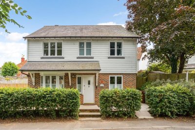
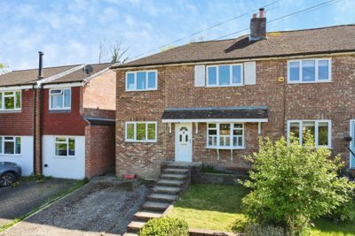
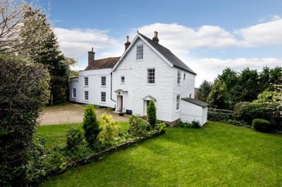
£550,000
Detached, 4 bed
Talbot Road, TN18 4LU
£550,000
Detached, 4 bed
Talbot Road, TN18 4LU

Compare 20 local agents, data from 100 active listings


We track 20 estate agents actively marketing properties in Hawkhurst, and we've ranked them all based on live listing data, market share, and average asking prices. selling a family home in the village centre or a period property in one of Hawkhurst's four conservation areas, finding the right agent is the first step to a successful sale.
The Hawkhurst property market sits within the beautiful High Weald Area of Outstanding Natural Beauty, with an average asking price of £635,030 across 100 current listings. Our comparison tool puts you in touch with the agents who know this local market best, from those handling premium properties to specialists in the more affordable price brackets.

20
Active Estate Agents
£635,030
Average Asking Price
100
Properties For Sale
The Hawkhurst housing market has experienced notable adjustments over the past year, with home.co.uk data showing sold prices 14% down on the previous year and 20% below the 2022 peak of £545,553. home.co.uk reports an 8.4% decline in sold prices as of February 2026, reflecting broader trends across southern England where house price inflation remains subdued at 1.3% nationally. Despite these corrections, Hawkhurst's average price of £434,397 over the last year remains slightly above the Kent average of £427,430, indicating underlying demand for this desirable village location.
The Hawkhurst housing market has experienced notable adjustments over the past year, with home.co.uk data showing sold prices 14% down on the previous year and 20% below the 2022 peak of £545,553. home.co.uk reports an 8.4% decline in sold prices as of February 2026, reflecting broader trends across southern England where house price inflation remains subdued at 1.3% nationally. Despite these corrections, Hawkhurst's average price of £646,793 over the last year remains slightly above the Kent average of £427,430, indicating underlying demand for this desirable village location.
Transaction volumes in the TN18 postcode area remain healthy, with home.co.uk recording over 1,300 property sales in the surrounding area over the past year. The village's proximity to Tunbridge Wells, excellent transport links, and position within the High Weald AONB continue to attract buyers seeking a balance between rural character and commuter accessibility. Land Registry data confirms that the broader Tunbridge Wells borough maintains its reputation as a premium residential location, with market fundamentals supported by strong employment sectors in professional occupations and management roles.
Based on 76 live listings with an average asking price of £734,754.
Source: home.co.uk
See which agents are selling fastest and at the best prices in Hawkhurst.
Compare Estate Agents FreeOur current listings data shows strong representation across property types, with detached properties dominating at 42 listings with an average asking price of £1,039,893. Semi-detached homes account for 26 listings averaging £466,460, while terraced properties and flats each represent 7 and 3 listings at £355,571 and £388,333 respectively. The market demonstrates particular strength in the £300,000 to £500,000 bracket, which contains 34 listings, showing active demand from buyers seeking family homes in this sought-after village.
Gills Green Courtyard by Simon Patience New Homes offers a different character at Gills Green, providing 2, 3, and 4 bedroom cottages and detached houses. The Grove by Riverdale Developments adds 17 new family homes with 3, 4, or 5 bedrooms within walking distance of the village centre. These developments reflect ongoing demand for modern homes in Hawkhurst, though the market also benefits from significant stock in period properties across four designated conservation areas containing over 200 listed buildings, including one Grade I building, six Grade II* properties, and 132 Grade II listed structures.
Hawkhurst sits within the High Weald National Landscape, characterised by distinctive sandstone ridges and steep-sided valleys formed by the underlying geology of Tunbridge Wells Sand overlying Wadhurst Clay. This geological composition creates both the area's attractive rolling countryside and practical considerations for property owners, as the Wadhurst Clay presents potential shrink-swell behaviour that can affect foundations. The village's streams drain north to the Hexden Channel and south to the Kent Ditch Water Body, both feeding the River Rother, whose floodplains create an abrupt landscape change to the south of the village.
The population of Hawkhurst parish stands at approximately 4,990 residents according to the 2021 Census, with estimates suggesting around 5,200 by 2024. The built-up area itself houses roughly 3,800 residents across around 2,700 households, with an average household size of 2.3 persons. Home ownership rates in Hawkhurst reach 69.67%, notably above the national average, reflecting the area's prosperity and appeal to established families and retirees alike. The local economy centres on professional occupations at nearly 20%, followed by managers, directors, and senior officials at 18.7%, indicating a well-heeled demographic that supports premium property values.
Four conservation areas protect Hawkhurst's character at Sawyers Green, Highgate (encompassing All Saints' Church), and The Moor, where many listed buildings create a heritage-rich environment. Traditional building materials include oak framing, fair-faced brickwork, pointed feather-edge boarding, and painted render, with clay peg tiles and natural slate on roofs. Local sandstone, visible in St Laurence's Church, adds architectural distinction. The village offers good amenities including shops, primary schools, and sporting facilities, while remaining within practical reach of Tunbridge Wells for commuters seeking broader services and rail connections to London.
New build activity in Hawkhurst continues to shape the local market, with several significant developments adding to housing supply. The Russetts by Dandara at Highgate Hill represents one of the largest schemes, delivering 71 homes including a distinctive collection of barn-style houses with 2, 3, 4, and 5 bedrooms. Prices start from £605,000 for standard homes, with barn-style properties ranging from £750,000 to £799,000. Of the total, 28 homes are designated affordable with 10 available through shared ownership and 18 for affordable rent, addressing local housing needs while maintaining the development's premium positioning.
Hawkhurst's property market presents distinct opportunities for both traditional high-street agents and newer online platforms, each offering different fee structures and service models. Traditional percentage-based agents typically charge between 1% and 3% plus VAT (1.2% to 3.6% total), while online fixed-fee agents generally charge between £999 and £1,999. The decision often depends on property value, with higher-priced homes potentially benefiting from percentage-based representation while lower-value properties may favour fixed fees.
When choosing between sole agency and multi-agency agreements, sellers should consider that sole agency agreements typically run for 8-16 weeks while multi-agency arrangements usually charge a higher fee (typically 0.5% to 1% more) but provide broader market coverage. Given Hawkhurst's competitive market where the top three agents control 56% of listings, engaging with established local specialists who understand the village's character, conservation requirements, and buyer demographics can significantly impact sale outcomes. Getting free valuations from multiple agents before instructing one remains the most effective way to ensure accurate pricing and optimal service.

Look for agents with active listings in Hawkhurst and specific experience in your property type, whether that's a period cottage, modern family home, or new build. Agents familiar with the village's conservation areas and local buyer preferences will market your property more effectively.
Request free valuations from at least three agents to compare their suggested asking prices and marketing strategies. This also gives you leverage when negotiating fees and ensures you understand the current market position for your specific property.
Ask about photography quality, floor plans, virtual tours, and online exposure. Agents with strong local knowledge and quality marketing materials attract more serious buyers and can differentiate your listing in Hawkhurst's competitive market.
Clarify whether fees are fixed or percentage-based, inclusive or exclusive of VAT, and what services are included. Negotiate where possible, especially if using multi-agency to maximise exposure across the village's key agents.
Enquire about average time to sell locally, achieved versus asking prices, and client testimonials. Agents familiar with Hawkhurst's market nuances can provide realistic expectations based on current conditions and recent comparable sales.
Understand the agreement duration, notice periods, and what happens if your property doesn't sell. Avoid overly long sole agency periods without flexibility, and ensure you understand exit clauses.
Peter Buswell dominates the local market with 42 active listings representing a 42% market share at an average asking price of £1,039,893, making them the clear leader for volume of stock. Freeman Forman follows with 26 listings and 26% market share at £466,460 average, while Harpers and Hurlingham handles the premium segment with 9 listings averaging £1,098,333. For sellers seeking premium representation, agents like Savills (£752,804 average) and Jackson-Stops (£1,918,000 average) bring specialist expertise in high-value properties, though their higher fee structures reflect this niche positioning.
Don't accept the first fee quoted. Agents often have flexibility, particularly for properties in the £300,000-£500,000 range where competition is strongest. Combining a competitive fee with multi-agency coverage can maximise your property's exposure while managing costs.
Bedroom count significantly influences property values in Hawkhurst, with our listings data revealing clear price brackets across the market. Four-bedroom properties dominate current supply with 28 listings averaging £752,804, representing the sweet spot for families seeking space without premium pricing. Three-bedroom homes follow closely with 32 listings averaging £510,030, offering strong value and representing the most active segment for first-time buyers and upsizers alike.

Two-bedroom properties account for 20 listings at an average of £336,150, providing accessible entry points to the Hawkhurst market. One-bedroom properties, with 7 listings averaging £277,856, serve buyers seeking compact living in this desirable village location. At the premium end, five-bedroom properties average £1,098,333 across 9 listings, while six-bedroom homes reach £1,918,000 on average, reflecting demand from buyers seeking substantial family residences in this sought-after High Weald setting.
Achieving the best price for your Hawkhurst property starts with accurate valuation based on current market conditions, recent sales data, and local demand trends. With the market showing 8-14% price reductions over the past year, pricing realistically from the outset attracts serious buyers and avoids the common trap of overpriced properties languishing on the market. Our data shows the strongest activity in the £300,000-£500,000 bracket with 34 listings, indicating where most buyer interest currently concentrates.
Beyond agent choice, presentation significantly impacts achievable prices. Properties in Hawkhurst's conservation areas require particular attention to heritage considerations, and listings featuring professional photography, accurate floor plans, and detailed descriptions consistently perform better. Requesting a free valuation from multiple agents before instructing one ensures you benefit from their local expertise while securing the most accurate asking price that reflects current market conditions and your property's specific characteristics.

76 properties currently listed across Hawkhurst. Here are the most recently added.
£550,000
Detached, 4 bed
Talbot Road, TN18 4LU
£550,000
Detached, 4 bed
Talbot Road, TN18 4LU
£1,595,000
Detached, 5 bed
Rye Road, TN18 5DW
£1,595,000
Detached, 5 bed
Rye Road, TN18 5DW
£745,000
Terraced, 3 bed
Conghurst Lane, TN18 5EA
£745,000
Terraced, 3 bed
Conghurst Lane, TN18 5EA
£975,000
Detached, 4 bed
High Street, TN18 4QA
£975,000
Detached, 4 bed
High Street, TN18 4QA
£400,000
End of Terrace, 3 bed
Talbot Road, TN18 4LT
£400,000
End of Terrace, 3 bed
Talbot Road, TN18 4LT
£488,888
Flat, 2 bed
Highgate Hill, TN18 4FH
£488,888
Flat, 2 bed
Highgate Hill, TN18 4FH
£350,000
Terraced, 2 bed
Herschel Place, TN18 4FA
£350,000
Terraced, 2 bed
Herschel Place, TN18 4FA
£745,000
Semi-Detached, 4 bed
Water Lane, TN18 5AU
£745,000
Semi-Detached, 4 bed
Water Lane, TN18 5AU
£1,375,000
Detached, 5 bed
High Street, TN18 4AQ
£1,375,000
Detached, 5 bed
High Street, TN18 4AQ
£2,500,000
Detached, 11 bed
The Moor, TN18 4PG
£2,500,000
Detached, 11 bed
The Moor, TN18 4PG
£495,000
Semi-Detached, 3 bed
Cranbrook Road, TN18 4AT
£495,000
Semi-Detached, 3 bed
Cranbrook Road, TN18 4AT
£488,000
Apartment, 2 bed
Highgate Hill, TN18 4FH
£488,000
Apartment, 2 bed
Highgate Hill, TN18 4FH
Get free, no-obligation valuations from the top-performing local agents. Compare fees, services, and track records before you decide.
Compare Agents FreeAgent selection plays a crucial role in pricing strategy. Peter Buswell's dominant 42% market share demonstrates their ability to match properties with active buyers, while Freeman Forman's 26% share confirms their strong local presence. For premium properties, agents like Harpers and Hurlingham with their £1,098,333 average price bring buyers specifically seeking higher-value homes. The cheapest average prices are handled by agents like Rush Witt & Wilson at £388,333, showing the market's range from more affordable options to premium representation.
Based on current market share data, Peter Buswell leads with 42% of the market and 42 active listings at an average price of £1,039,893. Freeman Forman follows with 26% market share and 26 listings averaging £466,460. For premium properties, Harpers and Hurlingham handles properties at £1,098,333 average, while Savills covers the £752,804 bracket. The best agent depends on your property type and price range, so getting valuations from multiple agents helps you find the right match.
Estate agent fees in Hawkhurst follow national patterns, typically ranging from 1% to 3% plus VAT for traditional high-street agents (1.2% to 3.6% total). Online fixed-fee agents charge between £999 and £1,999. Given the average asking price of £646,793, traditional fees would typically fall between £6,468 and £19,404, while fixed-fee options offer significant savings for lower-value properties. Always negotiate and compare what's included in each fee structure.
Hawkhurst is a desirable village within the High Weald Area of Outstanding Natural Beauty, offering a population of around 5,000 residents, four conservation areas, and over 200 listed buildings. The village has good local amenities, primary schools, and a community feel, while remaining within commuting distance of Tunbridge Wells. Home ownership rates reach nearly 70%, reflecting its prosperous character and appeal to families and retirees seeking rural living without isolation.
House prices in Hawkhurst have experienced declines, with home.co.uk reporting prices 14% down on the previous year and 20% below the 2022 peak of £545,553. home.co.uk shows an 8.4% annual decline as of February 2026. These corrections reflect broader southern England trends where price inflation remains subdued at 1.3% nationally. However, the village's desirable location within the High Weald AONB and strong local demand provide underlying support for the market.
Hawkhurst offers diverse housing including detached properties (42 listings averaging £1,039,893), semi-detached homes (26 listings at £466,460), terraced properties (7 listings averaging £355,571), and flats (3 listings at £388,333). New build options include The Russetts development by Dandara with 71 homes, Gills Green Courtyard, and The Grove, while period properties in conservation areas appeal to buyers seeking character homes with traditional materials like oak framing and clay peg tiles.
While specific data for Hawkhurst isn't available, the average time to sell varies by price range and market conditions across the UK. Current market conditions suggest pricing realistically is essential given the 8-14% price corrections affecting the area. Properties priced correctly for current market conditions in the active £300,000-£500,000 bracket typically achieve sales faster than overpriced properties in softer market segments.
Local agents like Peter Buswell and Freeman Forman dominate with combined market share exceeding 50%, demonstrating strong buyer engagement through their high listing volumes. However, online agents can offer cost savings for straightforward sales. Premium properties may benefit from specialists like Savills or Jackson-Stops who target high-net-worth buyers. Getting valuations from both local and online agents allows you to compare service levels and fees before deciding.
From £480
Identify any issues before marketing your property
From £650
Comprehensive survey for older or period properties
From £60
Required by law before selling
Free
Get an accurate property valuation
Estate Agents In London

Estate Agents In Plymouth

Estate Agents In Liverpool

Estate Agents In Glasgow

Estate Agents In Sheffield

Estate Agents In Edinburgh

Estate Agents In Coventry

Estate Agents In Bradford

Estate Agents In Manchester

Estate Agents In Birmingham

Estate Agents In Bristol

Estate Agents In Oxford

Estate Agents In Leicester

Estate Agents In Newcastle

Estate Agents In Leeds

Estate Agents In Southampton

Estate Agents In Cardiff

Estate Agents In Nottingham

Estate Agents In Norwich

Estate Agents In Brighton

Estate Agents In Derby

Estate Agents In Portsmouth

Estate Agents In Northampton

Estate Agents In Milton Keynes

Estate Agents In Bournemouth

Estate Agents In Bolton

Estate Agents In Swansea

Estate Agents In Swindon

Estate Agents In Peterborough

Estate Agents In Wolverhampton

Compare 20 local agents, data from 100 active listings
Find AgentsHomemove is a trading name of HM Haus Group Ltd (Company No. 13873779, registered in England & Wales). Homemove Mortgages Ltd (Company No. 15947693) is an Appointed Representative of TMG Direct Limited, trading as TMG Mortgage Network, which is authorised and regulated by the Financial Conduct Authority (FRN 786245). Homemove Mortgages Ltd is entered on the FCA Register as an Appointed Representative (FRN 1022429). You can check registrations at NewRegister or by calling 0800 111 6768.
We use cookies to show you personalised content and improve your experience of our website. Find out more in our Privacy policy and Cookie policy.