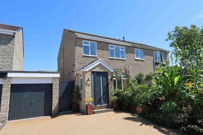
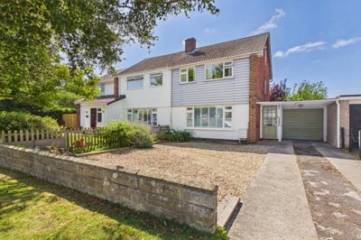
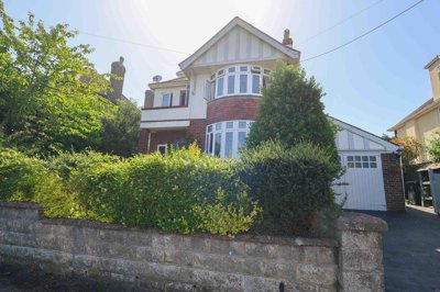
£397,500
Semi-Detached, 3 bed
Bryant Gardens, BS21 5HG
£397,500
Semi-Detached, 3 bed
Bryant Gardens, BS21 5HG

Compare local agents for a Clevedon home, using local price points and area insight from Bay Road to Old Church Road


Bay Court on 2-6 Bay Road gives Clevedon a clear pricing marker, with apartments from £350,000 to £425,000 and an exceptional duplex at £495,000. home.co.uk listings show how much buyers are being asked to pay for modern homes close to the seafront, and that matters when you choose an agent. The best sale price often comes from the best valuation, not the loudest one. In a town with Victorian streets, coastal homes and conservation area stock, the right agent needs to explain why your property sits where it does.
Clevedon is not a one-note market. The town has apartments at Bay Court, planned affordable homes at Millcross on the south side, and detached homes proposed at Jellalabad and Vimy Ridge in Ladye Bay. Older stock around Old Street, Beach and Copse Road and the Triangle Conservation Area needs a different sales approach from a newer flat or a family home near Kenn Road. That is where careful agent selection pays off. You want a valuation built on comparable homes, not a quick guess.

£350,000-£495,000
Average House Price
50
Sales in Last 12 Months
0.0%
12-Month Price Change
£495,000
Detached Average
£425,000
Semi-Detached Average
£350,000
Terraced Average
£350,000
Flat Average
Using listing data from home.co.uk and property data from homedata.co.uk
Bay Road sets the tone for the local market. At Bay Court, 2 and 3-bedroom apartments are being marketed from £350,000 to £425,000, with a duplex priced at £495,000. That gives sellers a live benchmark for modern coastal stock, and it is a useful starting point for any valuation discussion. A flat with a sea view, a good finish and strong presentation will be judged against those numbers quickly.
The wider town has a different rhythm. Clevedon grew strongly in the Victorian period, so the streets around Old Street, the Triangle and Beach and Copse Road contain homes that need careful pricing and strong presentation. A buyer looking at a period house near the Triangle Conservation Area will compare condition, layout and setting as much as headline price. An agent who knows those streets can explain why one home deserves a premium and another needs sharper pricing to keep interest moving.
Development activity adds another layer. Millcross, on the south side of Clevedon, is planned for around 50 affordable homes on a brownfield site that was once a supermarket. Jellalabad and Vimy Ridge at Ladye Bay are proposed for four detached dwellings bordering the greenbelt and a Site of Nature Conservation Interest, while Chapel Hill Homes has planning in principle for up to 4 houses at Tickenham. Those schemes matter because they shape buyer expectations, especially for detached homes and new-build apartments.
Based on 171 live listings with an average asking price of £521,892.
Source: home.co.uk
See which agents are selling fastest and at the best prices in Clevedon.
Compare Estate Agents FreeNewer homes are doing a lot of the heavy lifting in the local conversation. Bay Court, on 2-6 Bay Road, has 2 and 3-bedroom apartments in a clear price band, which helps set expectations for buyers who want something modern near the coast. That type of stock is easier for an agent to market with floorplans, strong photography and precise positioning. It also tells sellers that presentation matters from the first viewing.
Clevedon's supply is broader than one development. Millcross will bring around 50 affordable homes to the south side of town, while the Ladye Bay scheme at Jellalabad and Vimy Ridge points to four detached homes on a sensitive site close to the greenbelt. Those are very different products, and they attract very different buyers. A good agent should be able to explain where each sits in the local market, then pitch the home to the right audience.
The town's character is shaped by its seafront, its Victorian growth and its conservation stock. Clevedon Pier, Clevedon Court, the Curzon cinema, Clevedon Hall and the Church of St John all sit within a built environment that asks more from an agent than a simple upload to the portals. The Triangle Conservation Area covers about 8.9 hectares and was designated in 1981, while the Beach and Copse Road areas helped form the first Conservation Area in 1974. Homes here need careful wording, sound legal understanding and a sales pitch that respects the setting.
Local geography matters too. Clevedon's geology includes Devonian sandstones, Carboniferous marine sedimentary rocks and Upper Triassic sediments, with a major mineralised fault running east-west beside Clevedon Pier. That does not mean every property has a problem, but it does mean buyers of older homes will often ask sharper questions about movement, drainage and historic construction. The town also has a strong legacy of local stone and Victorian brickwork, which makes surveys and honest marketing important on older terraces and period houses.
Flood risk needs clear handling. Parts of the coastline between Gullhouse Point and Marine Parade sit in a coastal flood warning area, and roads behind Marshalls Field, Fosseway, Churchill Avenue, Old Church Road, Strode Road and Tweed Road Industrial Estate are also flagged. River flood warning areas run through Yeolands Drive, Southern Way, Strode Sports Centre, Kenn Road, Clevedon Moor, Tickenham Road, Yeo Moor Schools and Hither Green Industrial Estate. Buyers do ask about this, so sellers should expect the agent to address it early and sensibly.
The right agent model depends on the home. A flat at Bay Court may suit a fixed-fee or hybrid approach if the pricing is clear and the seller wants speed, while a listed house near Old Street or a coastal property near Ladye Bay may benefit from a more hands-on high-street service. Sole agency contracts in England commonly run for 8-16 weeks, and that tie-in should be checked before you sign. If the home needs extra explanation because of flood history, conservation rules or unusual construction, the agent's local knowledge becomes part of the price.
Fees also shape the decision. Traditional estate agents usually charge 1-3% + VAT, with an average around 1.5% + VAT, while online agents often use a fixed fee of about £999-£1,999. That does not mean the cheapest route is the right one. It means the seller should compare what is included, how the home will be marketed and how the agent handles negotiation once offers start arriving.

Invite at least three agents to value the home, then compare the evidence behind each figure. Ask them which nearby sales they used, how they treated condition and what they thought buyers would notice first.
A strong local agent should know the Triangle, Bay Road, Old Street, Beach and Copse Road, not just the town name. That detail matters because a flat near Bay Court is not the same product as a house close to Clevedon Court.
Look at the headline fee, the tie-in period and any extras for photography, floorplans or premium listings. A lower fee can become expensive if the contract is restrictive or the marketing is thin.
Find out how quickly the home will go live, which photos will be used and how viewings will be managed. Good marketing is especially important for older homes in conservation areas and for coastal properties with a story to tell.
Ask how they handle offers, buyer qualification and price reductions. An agent who can explain flood questions around Marine Parade or heritage points near the Pier will often protect more value at the offer stage.
Before instructing anyone, decide what matters most: price, speed or certainty. The clearest instructions usually lead to the cleanest sale.
A strong valuation should come with evidence. If one agent puts a Bay Road flat near £495,000 and another is far lower, ask which comparable homes support the figure and how they have allowed for condition, outlook and lease length. The best instruction is rarely the cheapest quote. It is the one that can be defended when a buyer starts pushing back.
Price strategy matters more in Clevedon than many sellers expect. A Victorian home near the Triangle, a coastal flat by Bay Road and a detached house near Ladye Bay all sit in different buyer brackets, so one-size-fits-all pricing can miss the mark. A good agent will explain where your home sits against Bay Court, the planned homes at Millcross and the wider stock around Old Church Road and Kenn Road. That helps you avoid overpricing at the start, which is where many sales lose momentum.
Fees deserve the same scrutiny. If a high-street agent wants 1-3% + VAT, ask what the fee covers in terms of photography, accompanied viewings and negotiation. If an online agent offers a low fixed fee, check what happens when you need extra help with offers, chain updates or re-marketing. Sellers who compare both the valuation and the service often get a clearer result than those who look at the headline fee alone.

171 properties currently listed across Clevedon. Here are the most recently added.
£397,500
Semi-Detached, 3 bed
Bryant Gardens, BS21 5HG
£397,500
Semi-Detached, 3 bed
Bryant Gardens, BS21 5HG
£350,000
End of Terrace, 4 bed
Jubilee Place, BS21 5EA
£350,000
End of Terrace, 4 bed
Jubilee Place, BS21 5EA
£180,000
Flat, 2 bed
Princes Road, BS21 7ST
£180,000
Flat, 2 bed
Princes Road, BS21 7ST
£545,000
Detached, 4 bed
BS21 6AN
£545,000
Detached, 4 bed
BS21 6AN
£399,950
Semi-Detached, 3 bed
Kennaway Road, BS21 6JL
£399,950
Semi-Detached, 3 bed
Kennaway Road, BS21 6JL
£499,950
Detached Bungalow, 3 bed
Old Park Road, BS21 7HT
£499,950
Detached Bungalow, 3 bed
Old Park Road, BS21 7HT
£499,950
Semi-Detached, 3 bed
BS21 7HS
£499,950
Semi-Detached, 3 bed
BS21 7HS

£174,950
Apartment, 1 bed
Princes Road, BS21 7ST
£174,950
Apartment, 1 bed
Princes Road, BS21 7ST
£365,000
Semi-Detached, 3 bed
Fosseway, BS21 5EB
£365,000
Semi-Detached, 3 bed
Fosseway, BS21 5EB
£950,000
Detached, 4 bed
Kings Road, BS21 7EN
£950,000
Detached, 4 bed
Kings Road, BS21 7EN
£400,000
Detached Bungalow, 3 bed
BS21 7UD
£400,000
Detached Bungalow, 3 bed
BS21 7UD
£269,950
End of Terrace, 2 bed
Cannons Gate, BS21 5HN
£269,950
End of Terrace, 2 bed
Cannons Gate, BS21 5HN
Get free, no-obligation valuations from the top-performing local agents. Compare fees, services, and track records before you decide.
Compare Agents FreeStart by getting 3 valuations, then check the evidence behind each figure. A good agent should know the difference between a Bay Road apartment, a Triangle period home and a coastal property near Marine Parade. Ask how they would market your home, how they handle offers and how long you are tied in for. The strongest choice is the one that can justify the price and support the sale all the way through.
Most high-street agents charge 1-3% + VAT, with many sellers seeing around 1.5% + VAT as a common level. Online agents often charge a fixed fee of about £999-£1,999. The right fee depends on how much help you need, how tricky the property is and whether the home sits in a conservation area or has flood history that needs careful explanation.
Current price points around Bay Court on Bay Road range from £350,000 to £495,000, so sellers should treat that as a useful local benchmark. The market here is split by property type, with modern flats, Victorian houses and detached homes all priced differently. That means the question is less about one single town-wide figure and more about how your home compares with the closest like-for-like properties.
Clevedon has a population of 21,398, a 2024 estimate of 21,183 and a strong coastal identity shaped by the Pier, the Triangle and the seafront. It also works as a commuter town for Bristol, supports around 800 tourism jobs and has supermarkets including Tesco, Asda, Lidl, Aldi and Sainsbury's. Buyers also look at the conservation areas, the old streets and the flood warning zones before they decide where to buy.
Many of them do, especially the Victorian and pre-1919 homes around the Triangle, Old Street and Beach and Copse Road. A RICS Level 2 survey in Clevedon usually costs from £400 to £1,000, with a typical £300,000 property often seeing a £600 fee. Older construction can reveal damp, roof wear, outdated electrics and plumbing issues, so a survey gives the buyer a clearer picture before they commit.
Sole agency usually runs for 8-16 weeks and often gives you a clearer relationship with one point of contact. Multi-agency can widen exposure, but the fee is usually higher and the service can feel less joined up. In Clevedon, a sole agency instruction can work well for homes that need careful positioning, such as listed buildings, coastal properties or houses with unusual layouts.
Ask which comparable sales the agent used, how they adjusted for condition and what they think a buyer will notice first. Ask the same question about Bay Road flats, Triangle terraces and detached homes near Ladye Bay, because each market behaves differently. You should also ask about fee extras, the length of the contract and how quickly they can launch the listing.
Start with the closest like-for-like homes, not with the largest headline number you can find. Bay Court gives a helpful benchmark for apartments, while older stock around Old Street and the Triangle may need a stronger story around condition, setting and finish. A good agent will price to create interest without leaving money on the table.
Flooding is the main one to raise early, especially near Marine Parade, Old Church Road, Strode Road, Southern Way and parts of Tickenham Road. Buyers of older homes should also ask about the condition of roofs, drainage, electrics and any historic stonework. If the property sits near a conservation area, the agent should explain any restrictions that affect alterations.
From £499
Best for standard homes, older terraces and many semis in Clevedon
From £650
Better for listed buildings, coastal homes and unusual construction
From £60
Helpful before marketing your home and setting the right launch plan
From £150
Useful for redemption or staircasing where a formal valuation is needed
Estate Agents In London

Estate Agents In Plymouth

Estate Agents In Liverpool

Estate Agents In Glasgow

Estate Agents In Sheffield

Estate Agents In Edinburgh

Estate Agents In Coventry

Estate Agents In Bradford

Estate Agents In Manchester

Estate Agents In Birmingham

Estate Agents In Bristol

Estate Agents In Oxford

Estate Agents In Leicester

Estate Agents In Newcastle

Estate Agents In Leeds

Estate Agents In Southampton

Estate Agents In Cardiff

Estate Agents In Nottingham

Estate Agents In Norwich

Estate Agents In Brighton

Estate Agents In Derby

Estate Agents In Portsmouth

Estate Agents In Northampton

Estate Agents In Milton Keynes

Estate Agents In Bournemouth

Estate Agents In Bolton

Estate Agents In Swansea

Estate Agents In Swindon

Estate Agents In Peterborough

Estate Agents In Wolverhampton

Compare local agents for a Clevedon home, using local price points and area insight from Bay Road to Old Church Road
Find AgentsHomemove is a trading name of HM Haus Group Ltd (Company No. 13873779, registered in England & Wales). Homemove Mortgages Ltd (Company No. 15947693) is an Appointed Representative of TMG Direct Limited, trading as TMG Mortgage Network, which is authorised and regulated by the Financial Conduct Authority (FRN 786245). Homemove Mortgages Ltd is entered on the FCA Register as an Appointed Representative (FRN 1022429). You can check registrations at NewRegister or by calling 0800 111 6768.
We use cookies to show you personalised content and improve your experience of our website. Find out more in our Privacy policy and Cookie policy.