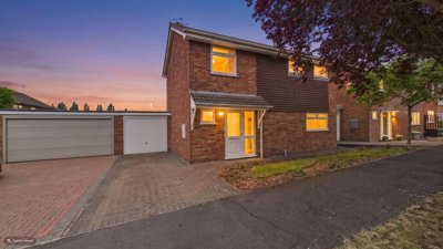
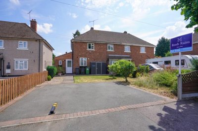
£325,000
Detached, 3 bed
Langdale Drive, CV11 6EY
£325,000
Detached, 3 bed
Langdale Drive, CV11 6EY

Compare local agents for a Bedworth move, using sold-price evidence from 255 recent sales


Bedworth's average house price sits at £217,851, and 255 homes changed hands in the last 12 months. Prices moved up 2.21% over that period, while the five-year rise reached 12.12%. That kind of market rewards sharp pricing. A small valuation error can change your final sale price by far more than the fee difference between agents.
Detached homes average £303,369, semis £222,118, and terraces £181,802, so the gap between property types is wide. CV12 8 fell -15.7% over the last year, which shows why postcode-level knowledge matters in Bedworth. We help you compare agents on evidence, fee structure, contract terms and the way they market homes like yours, not on a guess or a headline valuation.

£217,851
Average Sold Price
255
Sales in Last 12 Months
+2.21%
12-Month Price Change
£303,369
Detached Average
£222,118
Semi-Detached Average
£181,802
Terraced Average
£189,833
Flat Average
Using listing data from home.co.uk and property data from homedata.co.uk
A 255-sale year tells its own story. Bedworth changed hands far less often than the year before, down by 142 transactions and 55.69%, so each sale has to work harder. The market also sits 1% below the 2023 peak of £221,167, which makes accurate launch pricing a real factor for sellers. If an agent starts too high, the first few weeks can pass before the best buyers have even booked a viewing.
Detached homes at £303,369 sit well above the town average, while semis at £222,118 remain the main middle ground for many buyers. Terraced homes at £181,802 are the entry point for a large part of the market, so buyers often compare condition, parking and garden space as much as headline price. A good agent should treat each property type differently. One town-wide figure is not enough in Bedworth.
The postcode picture is uneven too. CV12 8 fell -15.7% over the last year, which is a reminder that one street can perform very differently from the next. Homes near the Town Centre Conservation Area need a different sales story from newer stock off Hospital Lane or on the edge of Astley Fields. Presentation, local comparables and street-level pricing all matter if you want a clean sale at the right level.
Based on 1,189 live listings with an average asking price of £292,062.
Source: home.co.uk
See which agents are selling fastest and at the best prices in Bedworth.
Compare Estate Agents FreeNew-build activity has changed the edge of Bedworth. Astley Fields by Bellway Homes is offering 2, 3 and 4-bedroom homes, with prices from £225,000 for a 2-bedroom mid-terrace, £256,495 for a 3-bedroom end-terrace, £283,500 for a 3-bedroom semi-detached, £345,000 for a 3-bedroom detached, and £399,995 for 4-bedroom detached homes. Bedworth Rugby Club off Smarts Road also brings shared ownership 2 and 3 bedroom semi-detached houses into the market.
Smaller schemes matter too. McArthur Gardens by Cartwright Homes is a bespoke nine-home development, while the Hospital Lane scheme has outline permission for 455 homes, including 55 later living units and a district centre with 25% affordable provision. Work also started in late April 2025 on 23 council homes across Armson Road and Cheveral Road, and a 150-home proposal on Woodland Lane has already reached outline approval. These schemes shape buyer expectations, especially for 2-bed and 3-bed homes.

Bedworth had a population of 31,090 in the 2021 census, rising to an estimated 31,809 in 2024. The town grew by 3.9% between 2011 and 2022, while the wider Nuneaton and Bedworth area increased by 7.1% between 2011 and 2021, from about 125,300 to 134,200. That growth sits alongside older employment patterns. Hat making, ribbon weaving and coal mining shaped the town, while many residents now commute to Coventry and surrounding towns.
Geology matters here. Bedworth sits on the eastern edge of the North Warwickshire coalfield where coal outcrops at the surface, so former mining history can raise subsidence questions for older homes. The River Sowe at Bedworth, including Heather Drive, Brooklea, Croft Pool and Delamere Road, is a designated flood warning area. As of May 24, 2026, there were no flood warnings or alerts there, and the next 5 days were classed as very low risk from rivers, the sea and groundwater.
Heritage still shapes the housing stock. Bedworth Town Centre has a designated Conservation Area, and Chamberlaine's Almshouses, rebuilt in 1840, sits among the town's listed buildings. Exhall Hall is Grade II listed, and any changes to protected buildings need the right consent. Common building materials in the area include timber, bricks, aggregates, cement, plasterboard and roofing supplies, while historic brick and tile works in nearby Nuneaton underline the construction style seen across the wider district.
Sole agency contracts in England usually run for 8-16 weeks, and many high-street agents charge 1-1.8% + VAT. Online or fixed-fee models often cost £999-£1,999, paid upfront or on completion. Hybrid agents sit between the two. In Bedworth, a small valuation miss on a terrace near the town centre can swallow the savings from a cheaper fee, so the contract is only part of the decision.
A high-street agent can suit a home with flood history, mining questions or conservation-area constraints because buyers often need more explanation. Online models can work well for a straightforward sale in Astley Fields or a well-kept semi where presentation is strong and the seller is comfortable managing more of the process. Hybrid models suit sellers who want local input but do not want a full commission bill. The right fit depends on your home, your timeline and how much help you want.

Ask 2-3 agents for a free valuation and compare how each one justifies the figure. Use sold comparables from Bedworth, CV12 8, Hospital Lane and streets close to the Town Centre Conservation Area.
Ask which homes they have sold near Smarts Road, Heather Drive, Delamere Road and Astley Fields. A credible agent should explain how those sales compare with your property type, not just give you a round number.
Typical estate agent fees are 1-3% + VAT, with many high-street firms around 1-1.8% + VAT. Read the sole agency length, notice period and any sole-selling rights before you sign.
Ask about photography, floorplans, listing order, launch timing and how quickly they start viewings. Bedworth's lower sales volume means the first burst of interest matters.
Ask how often you will get feedback after viewings, who answers weekend calls and how chain updates are handled. Poor communication can slow a sale even when the price is right.
Check withdrawal terms, extra marketing charges and any fee that becomes due if you find your own buyer. A short, clear contract is easier to manage than a long one with vague clauses.
Ask each agent to justify the price with sold comparables, not guesswork. If one valuation comes in much higher than the others, ask which Bedworth sale supports it and how the agent would handle a slower CV12 8 postcode sector.
Bedroom count drives a lot of value in Bedworth. On Astley Fields, 2-bedroom mid-terrace homes start from £225,000, 3-bedroom end-terraces start from £256,495, and 3-bedroom semi-detached homes start from £283,500. Higher up the scale, 3-bedroom detached homes start from £345,000 and 4-bedroom detached homes from £399,995. That gives a useful marker for how buyers think about size and price across the town.
A good agent should explain how presentation changes the result. Terraced homes average £181,802, while semis average £222,118, so clean photos, tidy rooms and a sensible launch price can make a real difference to the final figure. Ask what they would do before day one: minor repairs, energy performance, photography, and the order in which they would launch the home. The best Bedworth agents will have a plan before the first viewing is booked.

1,189 properties currently listed across Bedworth. Here are the most recently added.
£325,000
Detached, 3 bed
Langdale Drive, CV11 6EY
£325,000
Detached, 3 bed
Langdale Drive, CV11 6EY
£200,000
Terraced, 3 bed
Birkdale Close, CV11 6NA
£200,000
Terraced, 3 bed
Birkdale Close, CV11 6NA
£429,995
Detached, 4 bed
CV6 6QY
£429,995
Detached, 4 bed
CV6 6QY
£374,995
Detached, 4 bed
Sephton Drive, CV6 6QY
£374,995
Detached, 4 bed
Sephton Drive, CV6 6QY
£429,995
Detached, 4 bed
Sephton Drive, CV6 6QY
£429,995
Detached, 4 bed
Sephton Drive, CV6 6QY
 New Build
£305,950
House, 3 bed
CV11 6WZ
New Build
£305,950
House, 3 bed
CV11 6WZ
£475,000
Detached, 4 bed
Windrower Close, CV11 7AB
£475,000
Detached, 4 bed
Windrower Close, CV11 7AB
£329,950
Semi-Detached, 4 bed
Sherbourne Avenue, CV10 9JH
£329,950
Semi-Detached, 4 bed
Sherbourne Avenue, CV10 9JH

£155,000
Terraced, 3 bed
Graham Street, CV11 5AL
£155,000
Terraced, 3 bed
Graham Street, CV11 5AL

£230,000
Semi-Detached, 3 bed
Tulliver Close, CV12 8HQ
£230,000
Semi-Detached, 3 bed
Tulliver Close, CV12 8HQ
£260,000
Semi-Detached, 3 bed
Marston Lane, CV12 9AE
£260,000
Semi-Detached, 3 bed
Marston Lane, CV12 9AE
£160,000
Terraced, 2 bed
Church Road, CV10 8LQ
£160,000
Terraced, 2 bed
Church Road, CV10 8LQ
Get free, no-obligation valuations from the top-performing local agents. Compare fees, services, and track records before you decide.
Compare Agents FreeStart with 2-3 valuations and compare the evidence behind each one. Ask for recent sold comparables from Bedworth, not just a broad town average, and check the fee, contract length and notice period. A strong agent should explain how they would price a terrace in the town centre differently from a detached home near Hospital Lane.
Yes, Bedworth property prices increased by 2.21% in the last 12 months and 12.12% over 5 years. The picture is mixed, though, because historical sold prices over the last year were also 4% down on the previous year and 1% below the 2023 peak of £221,167. That makes valuation accuracy more important than ever.
Bedworth has a population of 31,090 in the 2021 census and an estimated 31,809 in 2024. Its history includes hat making, ribbon weaving and coal mining, and many residents commute to Coventry and surrounding towns. The Town Centre Conservation Area, Chamberlaine's Almshouses and the local flood and mining history give the town a distinct housing backdrop.
Typical estate agent fees in England are 1-3% + VAT, with many high-street agents around 1-1.8% + VAT. Online fixed-fee models often sit at £999-£1,999, while multi-agency usually costs more because the agent takes on more marketing risk. Ask exactly what is included so you can compare like for like.
High-street agents suit homes that need more explanation, such as properties with conservation-area issues, flood questions or mining history. Online agents can work well for simple sales where you are confident managing the process and the home is easy to present. Hybrid can sit between the two if you want a lower upfront cost with some local support.
Sole agency agreements often run for 8-16 weeks, though terms can vary. Read the notice period, renewal clause and any sole-selling rights before you sign. A shorter, clearer contract is usually easier to manage if your plans change.
Ask which sold homes the agent is using, how recent those sales are and why your street compares with them. In Bedworth, it is worth asking about CV12 8, the Town Centre Conservation Area, Hospital Lane and Astley Fields because those places can point to different pricing. Also ask how they would market the property during the first two weeks.
A RICS Level 2 Survey suits many standard brick or tile homes in reasonable condition, especially homes built after 1900. Older, altered or listed properties often need a RICS Level 3 Survey, particularly in the Town Centre Conservation Area. Former mining and flood factors make a fuller inspection sensible for some homes.
The River Sowe area at Heather Drive, Brooklea, Croft Pool and Delamere Road is a designated flood warning area. There were no warnings or alerts there on May 24, 2026, and the next 5 days were very low risk from rivers, the sea and groundwater. Surface water flooding can still matter, so a local check is sensible.
Mention the exact street or scheme where it helps, such as Smarts Road, Heather Drive, Delamere Road, Hospital Lane, Astley Fields or Woodland Lane. That gives an agent a clearer view of buyer type, age of stock and possible risks. A valuation should reflect the street, not just the town name.
From £397
Check a standard Bedworth house before you commit
From £599
Better for older, altered or listed homes
From £85
Get the energy rating ready before marketing
From £150
Useful where a formal valuation is needed
Estate Agents In London

Estate Agents In Plymouth

Estate Agents In Liverpool

Estate Agents In Glasgow

Estate Agents In Sheffield

Estate Agents In Edinburgh

Estate Agents In Coventry

Estate Agents In Bradford

Estate Agents In Manchester

Estate Agents In Birmingham

Estate Agents In Bristol

Estate Agents In Oxford

Estate Agents In Leicester

Estate Agents In Newcastle

Estate Agents In Leeds

Estate Agents In Southampton

Estate Agents In Cardiff

Estate Agents In Nottingham

Estate Agents In Norwich

Estate Agents In Brighton

Estate Agents In Derby

Estate Agents In Portsmouth

Estate Agents In Northampton

Estate Agents In Milton Keynes

Estate Agents In Bournemouth

Estate Agents In Bolton

Estate Agents In Swansea

Estate Agents In Swindon

Estate Agents In Peterborough

Estate Agents In Wolverhampton

Compare local agents for a Bedworth move, using sold-price evidence from 255 recent sales
Find AgentsHomemove is a trading name of HM Haus Group Ltd (Company No. 13873779, registered in England & Wales). Homemove Mortgages Ltd (Company No. 15947693) is an Appointed Representative of TMG Direct Limited, trading as TMG Mortgage Network, which is authorised and regulated by the Financial Conduct Authority (FRN 786245). Homemove Mortgages Ltd is entered on the FCA Register as an Appointed Representative (FRN 1022429). You can check registrations at NewRegister or by calling 0800 111 6768.
We use cookies to show you personalised content and improve your experience of our website. Find out more in our Privacy policy and Cookie policy.