
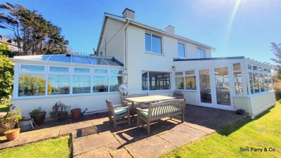
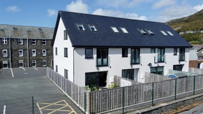
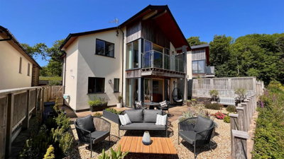
£895,000
Detached, 3 bed
LL42 1TB
£895,000
Detached, 3 bed
LL42 1TB

Compare 10 local agents, data from 69 active listings


We track 10 estate agents actively marketing properties in Barmouth, and we have ranked them all based on live listing data, market share, and average asking prices. Whether you are selling a Victorian terrace along Marine Parade or a modern flat near the harbour, our comparison tool helps you find the right agent for your property type and price point.
Barmouth property market offers a unique mix of coastal living and traditional Welsh character. With an average asking price of £376,130 across 69 current listings, the town attracts both permanent residents and those seeking holiday lets in this stunning corner of Gwynedd. Our rankings are updated daily so you can see which agents are winning listings in your area.
The coastal town sits where the River Mawddach meets the Irish Sea, creating a dramatic landscape that has attracted visitors since the Victorian era. Our data shows which local agents are successfully converting listings into sales, helping you make an informed choice when selecting representation for your property.

10
Active Estate Agents
£376,130
Average Asking Price
69
Properties For Sale
The Barmouth housing market has shown steady growth over the past 12 months, with overall house prices increasing by approximately 5% according to home.co.uk listings data and homedata.co.uk data. Our live listing data shows an average asking price of £378,803, though Land Registry sold price data indicates the actual average sale price sits closer to £250,000. This difference reflects the typical gap between asking and achieved prices, particularly in markets where negotiation plays a significant role. The detached property sector has led growth at 6% year-on-year, while flats have seen more modest increases of around 2%. ---NEXT---
Transaction volumes in the LL42 postcode area total approximately 120 sales over the last 12 months, demonstrating consistent activity in this coastal market. The town popularity as both a residential location and a holiday destination creates dual demand streams. Properties in the £200,000 to £300,000 price band represent the strongest segment with 23 current listings, while higher-end properties over £500,000 account for 11 listings, reflecting Barmouth appeal to buyers seeking premium coastal homes. ---NEXT---
The Barmouth property market benefits from its position on the Mawddach Estuary and proximity to Snowdonia National Park, which continues to drive interest from buyers seeking the Welsh coast and mountains. However, the high proportion of second homes and holiday lets in the area, estimated at over 20% of the housing stock, can limit availability for primary residence buyers and contributes to competitive pricing in certain segments. This dual market dynamic means agents must understand both residential buyer needs and holiday let investment requirements.
Based on 47 live listings with an average asking price of £416,733.
Source: home.co.uk
See which agents are selling fastest and at the best prices in Barmouth.
Compare Estate Agents FreeThree-bedroom properties represent the most active segment in Barmouth with 20 current listings, followed closely by two-bedroom homes at 18 listings. This distribution reflects the town predominantly Victorian and Edwardian housing stock, much of which dates from the pre-1919 period when Barmouth flourished as a seaside resort. The typical Victorian and Edwardian terraced houses along Marine Parade and in the older town centre remain highly sought after, offering period features and sea views.
New build activity in Barmouth remains limited, with no significant active developments identified in the LL42 postcode area. The majority of properties available are period homes requiring varying degrees of modernisation. This creates opportunities for buyers willing to undertake renovation work, while also generating demand for properties in good condition. The lack of new supply means existing stock is heavily recycled, with properties often selling to incoming residents or holiday let investors.
The flat market in Barmouth comprises 19 current listings averaging £210,047, making this the most affordable entry point to the local market. Flats are particularly popular with first-time buyers and holiday let investors, though properties in the conservation area may require adherence to specific planning constraints. Detached properties command the highest average prices at £755,831, reflecting the premium nature of larger coastal homes with views across the estuary or towards the mountains. ---NEXT---
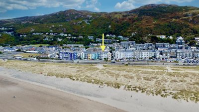
Barmouth sits on the Cambrian coast where the River Mawddach meets the Irish Sea, creating a dramatic landscape of mountain and sea that has attracted visitors since the Victorian era. The town forms part of the historic county of Gwynedd in North Wales, with a population of approximately 2,500 permanent residents across roughly 1,200 households. The local economy centres on tourism, retail, hospitality, and public services, with agriculture and fishing playing smaller but continuing roles in the surrounding area.
The geology of Barmouth consists primarily of Cambrian and Ordovician sedimentary rocks including slates, grits, and sandstones, which have historically provided the building materials for local properties. Traditional Welsh slate roofs and local stone walls characterise much of the older housing stock, while rendered finishes over stone or brick are also common. The underlying geology generally presents low shrink-swell clay risk, though localised pockets of superficial deposits can vary. Properties are predominantly constructed using traditional solid wall methods, with cavity wall construction becoming more common in properties built after the mid-20th century.
Flood risk is a significant consideration for property buyers in Barmouth due to its coastal location and position on the Mawddach Estuary. Coastal flooding poses risks along the seafront and low-lying areas, while fluvial flooding affects properties close to the river. Surface water flooding can occur in urbanised sections during heavy rainfall, and prospective buyers should consult the Welsh Water flood risk maps. The town has a designated Conservation Area covering the historic centre, harbour, and seafront, with numerous Grade II listed buildings requiring specialist consideration during any purchase or renovation.
Walter Lloyd Jones and Co dominates the Barmouth market with 42% market share and 29 active listings at an average asking price of £294,310. Based in nearby Dolgellau, this established local agent has built a strong presence in the mid-market segment and handles a significant proportion of transactions in the area. Their pricing strategy targets properties at the more accessible end of the Barmouth market, making them a common choice for standard two and three-bedroom homes. ---NEXT---
Monopoly Buy Sell Rent operates from Llanbedr and commands 30.4% of the market with 21 listings at an average asking price of £482,055, positioning themselves in the premium segment. This agent focuses on higher-value properties, including larger detached homes and properties with scenic views. Tom Parry and Co, based in Harlech, holds 7.2% market share with five listings averaging £407,490, offering another option for sellers targeting the mid-to-upper price brackets. ---NEXT---
When selecting an estate agent in Barmouth, consider whether you need a local specialist with established local knowledge or a larger operation with broader marketing reach. Traditional high-street agents like Walter Lloyd Jones and Co offer the advantage of physical presence and face-to-face client service, while online agents such as Purplebricks may offer lower fixed fees. Given Barmouth tourism-driven market, agents with experience in holiday let properties and second homes can provide valuable insights into buyer demographics. Most agents in the area work on a percentage fee basis, typically ranging from 1% to 3% plus VAT, though you should always negotiate and obtain quotes from multiple agents before instructing.
Start by comparing agents active in Barmouth, looking at their market share, listing volumes, and the types of properties they typically sell. Our comparison tool shows you exactly which agents are winning listings in your area.
Look for agents with proven experience in your specific price range and property type. In Barmouth, some agents focus on premium coastal homes while others specialise in more affordable terraces and flats.
Request free valuations from at least three agents before making your decision. Be wary of agents who overvalue your property to win your business, as an unrealistic asking price can lead to months on the market.
Ask about how your property will be marketed. In a tourist-focused area like Barmouth, consider whether the agent has experience marketing to second-home buyers and holiday let investors.
Clarify whether fees are fixed or percentage-based, whether they include VAT, and what services are included. Some agents offer sole agency agreements while others recommend multi-agency for broader coverage.
Look for feedback from previous clients in Barmouth specifically, as local experience matters. Check how quickly properties sell and whether the agent communicates effectively throughout the process.
Estate agent fees are negotiable in Barmouth, just as they are anywhere else in the UK. Do not automatically accept the first quote you receive. If an agent is keen to win your business, they may be willing to reduce their percentage or include additional marketing services at no extra cost. Getting quotes from at least three agents gives you leverage in negotiations.
The bedroom distribution across Barmouth listings reveals clear pricing tiers that reflect buyer preferences and property types in this coastal town. Three-bedroom properties dominate the market with 23 listings averaging £302,713, representing the traditional family home segment that appeals to both permanent residents and those purchasing holiday lets. Two-bedroom properties follow closely with 14 listings at an average of £254,281, popular with first-time buyers and smaller holiday investments. ---NEXT---
Four-bedroom properties account for ten listings with an average price of £581,395, positioning them in the premium segment alongside larger detached homes. The five-bedroom category shows seven listings at £661,429, while six-bedroom properties average £700,000 across two listings. At the upper end, seven-bedroom properties average £415,000 across three listings, representing the pinnacle of Barmouth luxury market. One-bedroom properties, with six listings averaging £112,292, offer the most affordable entry point and are particularly attractive to buy-to-let investors targeting the holiday let market. ---NEXT---
The data suggests that properties with three bedrooms represent the sweet spot for the Barmouth market, combining strong demand with reasonable pricing. However, the limited supply of one and two-bedroom properties means these smaller homes often sell quickly when priced competitively. The gap between three-bedroom and four-bedroom pricing indicates a significant premium for additional space and larger property types, which buyers in Barmouth appear willing to pay given the area appeal as a lifestyle destination.
47 properties currently listed across Barmouth. Here are the most recently added.
£895,000
Detached, 3 bed
LL42 1TB
£895,000
Detached, 3 bed
LL42 1TB
£625,000
House, 4 bed
LL42 1AJ
£625,000
House, 4 bed
LL42 1AJ
£300,000
Detached, 5 bed
LL42 1YP
£300,000
Detached, 5 bed
LL42 1YP
£300,000
House, 5 bed
Marine Parade, LL42 1NA
£300,000
House, 5 bed
Marine Parade, LL42 1NA
£125,000
Studio
LL42 1AD
£125,000
Studio
LL42 1AD
£350,000
House, 3 bed
Barmouth Promenade, LL42 1BF
£350,000
House, 3 bed
Barmouth Promenade, LL42 1BF
£265,000
Apartment, 3 bed
LL42 1RE
£265,000
Apartment, 3 bed
LL42 1RE
£175,000
Terraced, 3 bed
Water Street, LL42 1AT
£175,000
Terraced, 3 bed
Water Street, LL42 1AT
£285,000
Terraced, 4 bed
Marine Gardens, LL42 1HL
£285,000
Terraced, 4 bed
Marine Gardens, LL42 1HL
£665,000
Detached, 3 bed
LL42 1DT
£665,000
Detached, 3 bed
LL42 1DT

£249,500
End of Terrace, 3 bed
Gellfechan Road, LL42 1DE
£249,500
End of Terrace, 3 bed
Gellfechan Road, LL42 1DE
£249,000
End of Terrace, 3 bed
Heol Y Llan, LL42 1LD
£249,000
End of Terrace, 3 bed
Heol Y Llan, LL42 1LD
Get free, no-obligation valuations from the top-performing local agents. Compare fees, services, and track records before you decide.
Compare Agents FreeBased on our live market data, Walter Lloyd Jones and Co is the leading agent with 42% market share and 29 active listings. Monopoly Buy Sell Rent holds second position with 30.4% market share, followed by Tom Parry and Co at 7.2%. The top three agents together control nearly 80% of the market, making them the most established choices for sellers in Barmouth. These agents have demonstrated consistent success in the local market and understand the unique dynamics of selling properties in this coastal town.
Estate agent fees in Barmouth typically range from 1% to 3% plus VAT (1.2% to 3.6% including VAT), which is consistent with national averages. However, you should always negotiate and obtain quotes from multiple agents. Some online agents offer fixed fees starting around £999 plus VAT, though these may not include the same level of service as traditional high-street agents. Given the local market characteristics, traditional agents often provide more hands-on service including viewings, negotiation, and progress updates throughout the sale process. ---NEXT---
Yes, house prices in Barmouth have increased by approximately 5% over the past 12 months according to home.co.uk listings data and homedata.co.uk data. Detached properties have shown the strongest growth at 6%, while flats have seen more modest increases of around 2%. This growth reflects continued demand for the area unique combination of coastal living and mountain access, particularly from buyers seeking holiday homes or relocation from more urban areas. The limited supply of new-build properties in LL42 continues to support price growth in the secondary market.
Barmouth is a charming coastal town with approximately 2,500 permanent residents, set against the backdrop of Snowdonia National Park and overlooking the Mawddach Estuary. The town offers a good range of local amenities, schools, and services, though many residents travel to larger towns for specialist shopping and healthcare. The high proportion of holiday lets and second homes creates a seasonal atmosphere, with the population swelling significantly during summer months. Local residents benefit from stunning natural surroundings, walking opportunities, and a strong sense of community, though the seasonal tourism can affect parking and amenity availability during peak periods.
Key considerations include flood risk from both coastal and fluvial sources, particularly for properties near the seafront or river. The town conservation area and numerous listed buildings may restrict renovation options. Properties in Barmouth commonly suffer from damp and timber defects due to the coastal environment, so a thorough survey is essential. The prevalence of holiday lets in certain areas may also affect mortgage availability for buy-to-let purposes. We recommend obtaining a RICS Level 2 Survey for any property purchase in Barmouth given the age of the housing stock and coastal exposure.
Sale times in Barmouth vary depending on pricing, property type, and market conditions. Properties priced realistically for the current market typically sell within 8 to 16 weeks, though this can be longer for premium properties or those requiring significant modernisation. Working with a local agent who understands the market dynamics can help ensure your property is priced correctly from the outset. Properties in the most sought-after price bands, particularly £200,000 to £300,000, tend to attract stronger interest and sell more quickly than those at the upper end of the market. ---NEXT---
Local agents like Walter Lloyd Jones and Co and Tom Parry and Co have established relationships with local buyers and knowledge of the Barmouth market that online agents may lack. However, online agents like Purplebricks can offer lower fixed fees, which may suit sellers on tighter budgets. Consider what level of service you need and whether local expertise is important for your property type. For period properties, holiday lets, or premium coastal homes, local expertise often proves valuable in reaching the right buyers and achieving optimal sale prices.
Given Barmouth predominantly older housing stock, with over 70% of properties estimated to be over 50 years old, a RICS Level 2 Survey is strongly recommended. Common issues in the area include damp, timber defects, roofing problems, and salt contamination from the coastal environment. For listed buildings or properties in the conservation area, a more comprehensive RICS Level 3 Building Survey may be advisable. Survey costs for a typical 3-bedroom property in Barmouth range from £450 to £700, depending on property size and condition.
Estate Agents In London

Estate Agents In Plymouth

Estate Agents In Liverpool

Estate Agents In Glasgow

Estate Agents In Sheffield

Estate Agents In Edinburgh

Estate Agents In Coventry

Estate Agents In Bradford

Estate Agents In Manchester

Estate Agents In Birmingham

Estate Agents In Bristol

Estate Agents In Oxford

Estate Agents In Leicester

Estate Agents In Newcastle

Estate Agents In Leeds

Estate Agents In Southampton

Estate Agents In Cardiff

Estate Agents In Nottingham

Estate Agents In Norwich

Estate Agents In Brighton

Estate Agents In Derby

Estate Agents In Portsmouth

Estate Agents In Northampton

Estate Agents In Milton Keynes

Estate Agents In Bournemouth

Estate Agents In Bolton

Estate Agents In Swansea

Estate Agents In Swindon

Estate Agents In Peterborough

Estate Agents In Wolverhampton

Compare 10 local agents, data from 69 active listings
Find AgentsHomemove is a trading name of HM Haus Group Ltd (Company No. 13873779, registered in England & Wales). Homemove Mortgages Ltd (Company No. 15947693) is an Appointed Representative of TMG Direct Limited, trading as TMG Mortgage Network, which is authorised and regulated by the Financial Conduct Authority (FRN 786245). Homemove Mortgages Ltd is entered on the FCA Register as an Appointed Representative (FRN 1022429). You can check registrations at NewRegister or by calling 0800 111 6768.
We use cookies to show you personalised content and improve your experience of our website. Find out more in our Privacy policy and Cookie policy.