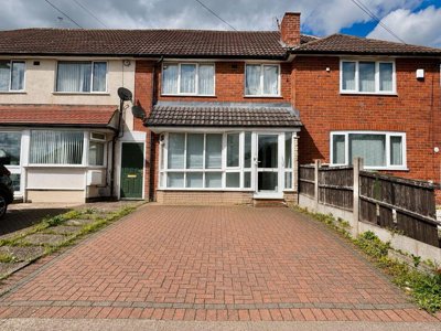
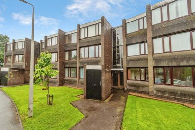
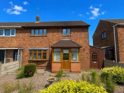
£225,000
Detached, 3 bed
Collingwood Drive, B43 7NS
£225,000
Detached, 3 bed
Collingwood Drive, B43 7NS

Compare local agents using sold-price evidence from 2,750 recent sales


Walsall homes average £219,650, with 2,750 sales in the last 12 months and a 12-month price rise of 0.7%. That gives sellers a market where pricing, launch timing and presentation can change the final result. Our analysis of homedata.co.uk records shows enough movement to reward sharp valuations and enough price spread to punish guesswork. A good estate agent should explain the local evidence, not just point to a headline figure.
Semi-detached homes average £222,000, terraced houses £175,000, detached homes £345,500 and flats £115,000. That gap matters because a house in Aldridge, a terrace in Palfrey and a flat near Walsall town centre do not sell on the same terms. Walsall's housing stock is heavily shaped by semi-detached and terraced homes, so an agent needs to understand how buyers compare those homes against newer stock at The Pavilions, Lockside and The Croft. The best agent for your sale is the one who prices that difference properly, then markets it with discipline.

£219,650
Average Sold Price
2750
Sales in Last 12 Months
+0.7%
12-Month Price Change
£345,500
Detached Average
£222,000
Semi-Detached Average
£175,000
Terraced Average
£115,000
Flat Average
Using listing data from home.co.uk and property data from homedata.co.uk
Walsall's average sold price of £219,650 sits in a market that is still dominated by family housing rather than large detached stock. Detached homes average £345,500, which shows how far the top end can pull away from the rest of the market. Semi-detached homes at £222,000 sit very close to the overall average, which is exactly what you would expect in a borough where semis make up about 38% of the housing stock. That makes valuation skill critical, because a small error on a semi in WS3 or WS9 can shift interest quickly.
Terraced homes average £175,000 and flats £115,000, so entry-level and downsizer demand remain important across the borough. The local market is not one single price band. It is a ladder, and each rung needs different marketing language, photography and buyer targeting. A one-bedroom flat near Walsall town centre does not compete with a three-bed terrace in Bloxwich or a four-bed detached home near Aldridge Road.
Walsall's 0.7% annual price rise points to a steady rather than fast-moving market. Flats have moved a little faster at 0.9%, while detached, semi-detached and terraced homes are all up 0.6% to 0.8%. That kind of spread usually rewards agents who know where buyers are stretching and where they are holding back. It also means the launch price needs care, especially if your home sits near flood-sensitive parts of Palfrey or Bloxwich, or within one of the borough's conservation areas.
Based on 1,324 live listings with an average asking price of £312,242.
Source: home.co.uk
See which agents are selling fastest and at the best prices in Walsall.
Compare Estate Agents FreeWalsall recorded about 2,750 sales in the last 12 months, so the market has plenty of recent evidence for an accurate valuation. Much of that activity still sits in semi-detached and terraced homes, which fits the borough's housing mix and the way buyers move through the area. The Croft on Walsall Road in Aldridge, WS9 0GG, adds 3 and 4 bedroom detached and semi-detached homes from £320,000 to £470,000, which gives the upper end of the market a clear new-build reference point.
The Pavilions on Broadway North, Walsall, WS1 2QB, brings 2, 3 and 4 bedroom homes from £210,000 to £350,000, while Lockside in WS2 8LD starts from £190,000 to £300,000. Those developments matter because they reset buyer expectations, especially for homes that are modernised but not brand new. The Walsall Housing Regeneration Programme also keeps smaller phases moving across the borough, which adds more variety to the resale landscape. An agent who knows where those schemes sit can pitch your home against the right competition.
Sales in Walsall do not all behave the same way. A brick terrace with a tired roof on an older street will attract a different audience from a 3-bed new-build near Broadway North or a detached house in Aldridge with a broader garden plot. That is why stock type matters as much as the postcode. The strongest instructions usually come from agents who can explain how your home compares with the best available alternatives, not just the nearest one.
Walsall had a population of 287,900 and 115,700 households at the last census, so this is a sizeable borough rather than a single compact town. Its economy has long been tied to manufacturing, especially leather goods and engineering, and that legacy still shapes the housing around older industrial corridors. Retail at Crown Wharf Retail Park, public-sector employment through Walsall Healthcare NHS Trust and Walsall Council, plus logistics linked to the M6 and M5, all feed the local market. That mix supports a steady flow of movers across WS1, WS2, WS3 and WS9.
Brick is the dominant building material, usually in red or brown, with pitched roofs covered in concrete or clay tiles. Many of the older homes are solid-wall or early cavity builds, which means roof condition, damp and outdated services come up often in surveys. Mercia Mudstone Group geology and glacial till bring a moderate to high shrink-swell risk, especially where clay content is heavy. That is the sort of local condition a good selling agent should understand, because buyers often ask about movement before they commit.
Flood risk also plays a part in buyer confidence. The River Tame, Ford Brook and Bentley Mill Lane Brook all contribute to fluvial risk, while surface water flooding can affect low-lying pockets across the borough. Town centre areas, Palfrey and parts of Bloxwich have all seen higher attention on flood exposure. Conservation Areas such as Walsall Town Centre, The Chuckery, parts of Aldridge and Great Wyrley add another layer, particularly where listed buildings like St Matthew's Church and Walsall Leather Museum sit close to older streets.
Walsall sellers often compare online, high-street and hybrid agents without looking at how each model fits the property. A flat near Broadway North, WS1 2QB, is not sold in the same way as a detached home near Walsall Road in Aldridge, WS9 0GG. High-street agents usually bring more face-to-face support, while online models lean on fixed fees and a seller-led process. Hybrid agents sit between the two, with a mix of local support and variable extras.
Fee structure matters as much as marketing reach. Traditional sole agency contracts often run for 8-16 weeks, while online firms usually ask for payment upfront or on completion. If your home needs a stronger launch, better photography or careful handling around flood history, a high-street or hybrid service may be worth the extra cost. If the home is a straightforward terrace in a liquid price band, a fixed-fee model can still work well if the pricing is sharp.
A good comparison starts with the valuation script, not the brochure. Ask each agent how they would price your home against The Pavilions in WS1, Lockside in WS2 or The Croft in WS9. Then ask how they would handle viewings, feedback and price reductions if the first wave of interest slows. The agent with the clearest plan is often the one that keeps your sale moving.
Start with 2-3 free valuations so you can compare price advice, marketing plans and contract terms side by side. Ask each agent to explain the evidence behind the figure they give you.
Check whether the agent can talk sensibly about Walsall Town Centre, Palfrey, Bloxwich and Aldridge, not just the broad borough. Real local knowledge shows up in price bands, buyer behaviour and the way they talk about risk.
Typical English estate agent fees sit around 1-3% + VAT, with many high-street sole agency agreements around 8-16 weeks. A lower fee can still cost more if the sale drags or the asking price is pitched badly.
Look for proper photography, floor plans, portal placement and a launch timetable. The best agents explain how they will market a terrace in WS3 differently from a detached home in WS9.
Watch the tie-in period, notice period and any withdrawal charges. If the agreement feels rigid, ask for changes before signing, because it is easier to negotiate at instruction stage than halfway through.
Decide how often you want updates and who will handle feedback after viewings. Good communication is usually what keeps a sale alive when the first offer is not the right one.
The biggest mistake is choosing the agent with the highest figure and the lowest fee without checking the evidence behind either one. In Walsall, a small overestimate on a terrace in Bloxwich or a semi in Aldridge can mean fewer viewings and a longer time on the market. Ask each valuer what recent sales they would use to justify the number, then ask how they would respond if the first two weeks are quiet. A strong agent will have an answer that covers price, presentation and follow-up.
Pricing by property type matters more than many sellers expect. Detached homes average £345,500, so a detached house in WS9 needs a different launch strategy from a terraced home near WS2 at £175,000 or a flat at £115,000. New-build schemes such as The Croft, The Pavilions and Lockside also set fresh reference points because buyers compare your home with modern finishes and new-home warranties. A good agent should show you where your home sits in that price ladder before they recommend a figure.
Bedrooms change the conversation too. The Pavilions offers 2, 3 and 4 bedroom homes, Lockside spans 2, 3 and 4 bedroom layouts, and The Croft focuses on 3 and 4 bedroom detached and semi-detached houses. That tells you how buyers in Walsall move between starter stock, family homes and upsizer homes. If your property has an extra bedroom, a larger plot or a better kitchen layout than nearby comparables, the agent should be able to explain exactly how that affects demand.
Fee negotiation should never be a guessing game. A seller who gets three valuations can spot when one agent is pitching too high to win the instruction, or too low to secure a quick deal. That matters even more in streets with clay ground risk, older brickwork or flood attention around Palfrey and Bloxwich, because the buyer questions tend to be tougher. The right agent will price honestly, market quickly and keep the contract terms fair.
1,324 properties currently listed across Walsall. Here are the most recently added.
£225,000
Detached, 3 bed
Collingwood Drive, B43 7NS
£225,000
Detached, 3 bed
Collingwood Drive, B43 7NS
£240,000
Semi-Detached, 3 bed
Lichfield Road, WS4 1PY
£240,000
Semi-Detached, 3 bed
Lichfield Road, WS4 1PY
£665,000
Detached Bungalow, 4 bed
Grosvenor Avenue, B74 3PE
£665,000
Detached Bungalow, 4 bed
Grosvenor Avenue, B74 3PE
£350,000
Detached, 3 bed
Redshank Road, WS3 1DT
£350,000
Detached, 3 bed
Redshank Road, WS3 1DT
£140,000
Ground Flat, 2 bed
Parkland Gardens, WS1 2NN
£140,000
Ground Flat, 2 bed
Parkland Gardens, WS1 2NN
£120,000
Terraced, 3 bed
Lower Forster Street, WS1 1XA
£120,000
Terraced, 3 bed
Lower Forster Street, WS1 1XA
£230,000
Semi-Detached, 3 bed
Simmonds Road, WS3 3PT
£230,000
Semi-Detached, 3 bed
Simmonds Road, WS3 3PT
£275,000
Semi-Detached, 3 bed
Coronation Road, WS4 1BA
£275,000
Semi-Detached, 3 bed
Coronation Road, WS4 1BA
£210,000
End of Terrace, 3 bed
Peake Road, WS8 7BZ
£210,000
End of Terrace, 3 bed
Peake Road, WS8 7BZ
£350,000
Detached, 3 bed
Linley Close, WS9 0ES
£350,000
Detached, 3 bed
Linley Close, WS9 0ES
£330,000
Semi-Detached, 3 bed
The Leasow, WS9 0EF
£330,000
Semi-Detached, 3 bed
The Leasow, WS9 0EF
£425,000
Detached, 4 bed
Goscote Road, WS3 4LE
£425,000
Detached, 4 bed
Goscote Road, WS3 4LE
Get free, no-obligation valuations from the top-performing local agents. Compare fees, services, and track records before you decide.
Compare Agents FreeStart with 2-3 valuations and compare the evidence behind each figure. The best agent should know Walsall Town Centre, Palfrey, Bloxwich and Aldridge well enough to explain how your home fits the local market. Fee level matters, but the quality of the launch plan, communication and contract terms matters just as much.
Yes, Walsall prices are up 0.7% over the last 12 months. Detached homes have risen 0.6%, semi-detached homes 0.8%, terraced homes 0.6% and flats 0.9%. That is a steady picture rather than a sharp upswing, so accurate pricing still matters.
Typical high-street estate agent fees in England are around 1-3% + VAT, with many sole agency deals sitting near 8-16 weeks. Online agents often charge a fixed fee of £999-£1,999. In Walsall, the right fee depends on how much help you want with viewings, negotiation and handling buyers.
Sole agency usually costs less and often gives you a clearer relationship with one branch or negotiator. Multi-agency can widen exposure, but it normally costs more and can weaken control over the sale process. For most Walsall homes, a well-chosen sole agency instruction is enough if the pricing is realistic.
Ask which recent sales were used, how your home compares with The Pavilions, Lockside or The Croft, and what evidence supports the asking price. Then ask how they will market the property in the first two weeks. A good valuer should be able to explain the plan without drifting into vague promises.
Walsall is a large borough with a population of 287,900 and 115,700 households, so it has a broad mix of housing and daily routines. Manufacturing, retail, public services and logistics all play a part in the local economy, with Crown Wharf Retail Park, Walsall Healthcare NHS Trust and Walsall Council all shaping local demand. Conservation areas, older brick housing and newer regeneration sites give the borough a varied feel from WS1 through to WS9.
They do, especially in parts of Walsall affected by the River Tame, Ford Brook, Bentley Mill Lane Brook and surface water flood risk. Mercia Mudstone Group geology and glacial till can also create shrink-swell concerns, so buyers may ask about movement or drainage. If your home sits in one of those areas, the right agent should know how to handle the questions early.
Detached homes sell for the most on average at £345,500. Semi-detached homes average £222,000, terraced homes £175,000 and flats £115,000. That spread is why valuation accuracy matters so much, especially if your home is close to a new-build reference point like The Croft or The Pavilions.
If you are moving into another property, a Level 2 survey is often the starting point for many Walsall semis and terraces, with local prices typically £400 to £700 for an average 3-bedroom semi-detached house. Older homes, altered homes or properties in conservation areas may need a Level 3 Building Survey instead. That is especially relevant where damp, roof wear or shrink-swell ground conditions could affect the result.
From £400
Good for many Walsall semis and terraces, especially older brick homes
From £700
Suits older, altered or listed homes in conservation areas
From £60
Required before you market a home for sale
From £200
Useful if you need a formal valuation for your next step
Estate Agents In London

Estate Agents In Plymouth

Estate Agents In Liverpool

Estate Agents In Glasgow

Estate Agents In Sheffield

Estate Agents In Edinburgh

Estate Agents In Coventry

Estate Agents In Bradford

Estate Agents In Manchester

Estate Agents In Birmingham

Estate Agents In Bristol

Estate Agents In Oxford

Estate Agents In Leicester

Estate Agents In Newcastle

Estate Agents In Leeds

Estate Agents In Southampton

Estate Agents In Cardiff

Estate Agents In Nottingham

Estate Agents In Norwich

Estate Agents In Brighton

Estate Agents In Derby

Estate Agents In Portsmouth

Estate Agents In Northampton

Estate Agents In Milton Keynes

Estate Agents In Bournemouth

Estate Agents In Bolton

Estate Agents In Swansea

Estate Agents In Swindon

Estate Agents In Peterborough

Estate Agents In Wolverhampton

Compare local agents using sold-price evidence from 2,750 recent sales
Find AgentsHomemove is a trading name of HM Haus Group Ltd (Company No. 13873779, registered in England & Wales). Homemove Mortgages Ltd (Company No. 15947693) is an Appointed Representative of TMG Direct Limited, trading as TMG Mortgage Network, which is authorised and regulated by the Financial Conduct Authority (FRN 786245). Homemove Mortgages Ltd is entered on the FCA Register as an Appointed Representative (FRN 1022429). You can check registrations at NewRegister or by calling 0800 111 6768.
We use cookies to show you personalised content and improve your experience of our website. Find out more in our Privacy policy and Cookie policy.