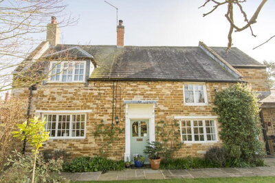
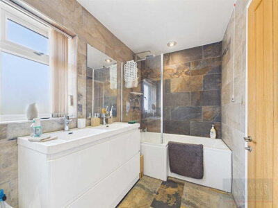
£450,000
Cottage, 3 bed
Church Street, LE16 8QG
£450,000
Cottage, 3 bed
Church Street, LE16 8QG

Compare 6 local agents, data from 12 active listings


We track 6 estate agents actively marketing properties in Wilbarston, and we've ranked them all based on live listing data, market share, and average asking prices. selling a period cottage in the village centre or a modern detached home on the outskirts, finding the right agent is the first step to a successful sale.
The Wilbarston property market reflects its identity as a desirable Northamptonshire village. With an average asking price of £521,667 across 12 current listings, the market offers strong opportunities for sellers. Our comparison tool puts you in control, letting you compare agent fees, track records, and local expertise before you commit.

6
Active Estate Agents
£521,667
Average Asking Price
12
Properties For Sale
The Wilbarston housing market presents a stable picture for sellers, with house prices increasing by 1% over the last 12 months according to Rightmove data. The average house price now sits at approximately £389,000, though this figure masks significant variation across property types. Detached properties command an average of £475,000, while semi-detached homes sell for around £320,000 and terraced properties at approximately £290,000. With 10 property sales recorded in the last 12 months, market activity remains steady despite broader national fluctuations.
Our live data shows 12 active listings across Wilbarston, with properties primarily concentrated in the £300,000 to £750,000 price bands. The village's positioning within the East Midlands property market, between Market Harborough and Kettering, creates a catchment area that attracts buyers seeking rural village life with reasonable commuting options. The limited supply relative to demand in this village location works in favour of sellers who present their properties well and price competitively.
The market demonstrates a clear preference for larger family homes, with four-bedroom detached properties dominating current stock at an average price of £599,286. This reflects the profile of buyers attracted to Wilbarston, often families and professionals seeking space in a village setting. The relative scarcity of new build developments in the area means existing stock faces less competition from newly constructed homes, preserving value for period properties and established dwellings. We find that this shortage of new housing creates sustained demand for characterful village homes, particularly those with original features and garden space.
Based on 5 live listings with an average asking price of £576,000.
Source: home.co.uk
See which agents are selling fastest and at the best prices in Wilbarston.
Compare Estate Agents FreeTransaction data reveals that Wilbarston's housing market is dominated by detached properties, which account for 7 of the 12 currently listed homes. This preference for detached living reflects the village's rural character and the type of buyer attracted to the area. Two-bedroom properties represent the most accessible entry point to the market at an average of £396,667, while three-bedroom homes average £437,500, appealing to growing families and those upsizing from smaller properties.
The notable absence of new build developments within Wilbarston itself creates a market almost entirely dependent on existing housing stock. This situation benefits sellers of period properties, as the limited supply means buyers have fewer alternatives. The property type mix shows a complete absence of flats in current listings, confirming Wilbarston's character as a village dominated by houses rather than apartments or units. This distinctive market composition influences the type of agent best suited to sell in the area, with those experienced in period homes and village properties holding an advantage.

Wilbarston is a traditional Northamptonshire village with a recorded population of 556 according to the 2011 Census, situated in the historic county of North Northamptonshire. The village is characterised by its Conservation Area, which preserves the historic architecture and village layout, and by several Listed Buildings including the Grade I listed All Saints Church. This heritage status significantly influences the character of the village and the type of properties available, with many homes constructed from local ironstone, a distinctive building material of the region. Red brick is also common, particularly for properties built in later periods, and some rendered homes add variety to the streetscape.
The underlying geology of the area presents important considerations for property owners and buyers. The Jurassic period rocks characteristic of Northamptonshire include limestone, ironstone, and clay formations, with the latter presenting particular challenges. Clay soils are susceptible to shrink-swell behaviour, posing potential risks to foundations during periods of extreme wet or dry weather. This geological factor means that subsidence and heave are considerations for property surveys, particularly for older buildings with potentially shallower foundations. Additionally, while Northamptonshire has a history of ironstone mining, Wilbarston itself is not a primary mining area, though a mining search would still be prudent for older properties to rule out any historical shallow workings that could impact ground stability.
Transport links make Wilbarston viable for commuters, with the village positioned between Market Harborough and Kettering, both offering rail connections to London and Birmingham. The local economy balances agriculture with residents commuting to larger towns for employment. Market Harborough, approximately 8 miles away, provides the nearest mainline station with regular services to London St Pancras in around an hour, making it particularly attractive for professional commuters. The village benefits from a range of local amenities including a primary school, public house, and village hall, while larger shopping and leisure facilities are accessible in the nearby market towns.
Flood risk from major rivers is minimal due to the inland location, though localised surface water flooding can occur during heavy rainfall due to the village's topography and drainage characteristics. The Environment Agency's flood risk maps should be consulted for specific property assessments, particularly for properties in lower-lying areas or those with large gardens. For buyers, understanding these local flood risks is an important part of the property assessment process, and we always recommend a thorough survey that takes account of these local factors.
Sellers in Wilbarston can choose between traditional high-street agents based in nearby Market Harborough and Kettering, and online fixed-fee alternatives. Adams & Jones Estate Agents operates from Market Harborough and currently holds 25% of the local market with 3 active listings at an average asking price of £475,000. Their strong market presence reflects established local expertise and client relationships built over years of serving the surrounding villages. James Sellicks, also based in Market Harborough, focuses on the middle market segment with listings averaging £525,000.
Traditional percentage-based agents typically charge between 1% and 3% plus VAT (1.2% to 3.6% inclusive), with the industry average sitting around 1.5% plus VAT. For a property at Wilbarston's average price of £389,000, this translates to fees of approximately £4,668 to £14,004. Online agents offer fixed-fee alternatives, typically charging between £999 and £1,999 regardless of property value, which can represent significant savings for higher-priced homes. However, traditional agents argue their in-person local knowledge, marketing expertise, and negotiation skills justify their fees, particularly for complex village properties with heritage considerations.
The choice between sole agency and multi-agency agreements also warrants consideration. Sole agency agreements typically run for 8-16 weeks and offer exclusivity, while multi-agency arrangements allow you to instruct multiple agents simultaneously, usually at a higher combined fee (typically 0.5% to 1% more than sole agency rates). Given Wilbarston's smaller market with only 6 active agents, the potential pool of buyers may be more limited, making the marketing reach and local networks of a high-street agent potentially more valuable than in larger urban markets. We often find that local agents in village markets like Wilbarston have established networks of buyers actively looking in the area, which can prove invaluable for achieving a quick sale at a competitive price.

Start by comparing all 6 agents active in Wilbarston. Look at their current listings, average asking prices, and market share to understand their positioning in the local market. Pay particular attention to whether they have experience selling properties similar to yours, whether period homes, family houses, or modern detached properties.
Get valuations from at least 3 agents. Be wary of agents who overvalue your property to win your business, as an inflated asking price can lead to properties sitting unsold. A realistic valuation based on comparable sales data and current market conditions is the foundation of a successful sale.
Ask about photography quality, floor plans, virtual tours, and online exposure across major property portals. Properties in Wilbarston's heritage-conscious market may benefit from agents who understand conservation requirements and can market period properties appropriately to attract the right buyers. Professional photography and detailed descriptions can significantly impact buyer interest.
Understand the notice period, sole versus multi-agency options, and what happens if your property doesn't sell within the agreed period. The typical sole agency period is 8-16 weeks, after which you can reassess or switch agents. Make sure you understand all terms before signing.
Do not accept the first fee quoted. Given the smaller market in Wilbarston, agents may be willing to negotiate on their rates, particularly if you have a desirable property in a sought-after price bracket. Consider what services are included in the fee, such as professional photography, floor plans, and marketing across major property portals.
Before instructing any agent, always request at least 3 free valuations. Use our comparison tool to see how each agent's pricing strategy compares to the Wilbarston average of £521,667, and choose the agent who provides the most realistic and well-evidenced valuation.
Analysis of bedroom counts reveals distinct market segments within Wilbarston. Four-bedroom properties dominate the listings with 7 homes available at an average price of £599,286, reflecting strong demand from families seeking space in the village. These larger properties represent the premium end of the market and typically attract buyers willing to pay for additional bedrooms and garden space. The prevalence of four-bedroom homes in current listings suggests that families are the primary buyer demographic in Wilbarston, with agents reporting strong interest in properties that offer home working space and good-sized gardens.
Three-bedroom homes, with just 2 current listings at an average of £437,500, represent the middle ground of the market. This segment may present opportunities for sellers, as limited supply against steady demand could work in their favour. Three-bedroom semis and terraced houses appeal to growing families upgrading from two-bedroom properties, and the relative scarcity of options in this bracket means well-presented homes can command strong interest. We note that many buyers looking for three-bedroom properties in village locations like Wilbarston are specifically seeking family homes with good school catchment appeal.
Two-bedroom properties, averaging £396,667 across 3 listings, serve as the most accessible entry point to Wilbarston ownership and appeal to first-time buyers, downsizers, and investors. This segment often generates quick interest, particularly from couples and small families looking to get a foothold in the village property market. The relative balance between supply and demand varies significantly by bedroom count, making timing and agent selection crucial for achieving the best price and a timely sale.

Pricing strategy in Wilbarston requires careful calibration to the local market. Our data shows the average asking price stands at £521,667, while sold prices (according to Rightmove data) average around £389,000. This gap between asking and achieved prices highlights the importance of realistic pricing from the outset. Properties priced correctly from the start typically achieve sale prices closer to their asking price, while those launched at optimistic levels often require subsequent reductions, which can signal to potential buyers that there may be issues with the property.
Agent fees represent another negotiation point. While the national average sits around 1.5% plus VAT, agents in smaller village markets like Wilbarston may be more flexible, particularly for higher-value properties where the percentage fee represents a substantial sum. Consider what services are included in the fee, such as professional photography, floor plans, virtual tours, and marketing across major property portals. The cheapest fee is not always the best value if it results in fewer viewings or a less effective marketing campaign for your unique property.
Presentation matters significantly in Wilbarston's market, where period properties and character homes dominate. Investing in decluttering, minor repairs, and kerb appeal can make a substantial difference to buyer interest. For period properties, maintaining original features while updating kitchens and bathrooms can attract buyers seeking character with modern convenience. Given the village's Conservation Area status, any external alterations may require planning permission, so factor this into your sale preparation timeline.

5 properties currently listed across Wilbarston. Here are the most recently added.
£450,000
Cottage, 3 bed
Church Street, LE16 8QG
£450,000
Cottage, 3 bed
Church Street, LE16 8QG
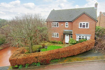
£550,000
Detached, 4 bed
Weinahr Close, LE16 8QX
£550,000
Detached, 4 bed
Weinahr Close, LE16 8QX
£650,000
Detached, 4 bed
Weinahr Close, LE16 8QX
£650,000
Detached, 4 bed
Weinahr Close, LE16 8QX
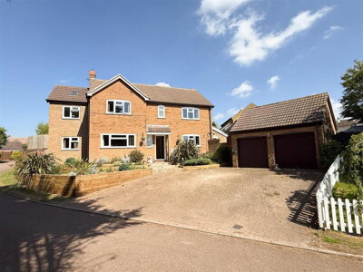
£580,000
Detached, 4 bed
Rushton Road, LE16 8QL
£580,000
Detached, 4 bed
Rushton Road, LE16 8QL
£650,000
Detached, 4 bed
Weinahr Close, LE16 8QX
£650,000
Detached, 4 bed
Weinahr Close, LE16 8QX
Get free, no-obligation valuations from the top-performing local agents. Compare fees, services, and track records before you decide.
Compare Agents FreeBased on current market share data, Adams & Jones Estate Agents leads with 25% of the market and 3 active listings averaging £475,000. James Sellicks Estate Agents and Lucas Estate Agents each hold 16.7% market share, making them significant local players. However, the "best" agent depends on your property type and price point. If you're selling a period property in the Conservation Area, an agent with heritage experience may be preferable, while for modern detached homes, agents with strong online marketing presence might serve you better. We recommend comparing multiple agents to find the right match for your specific property.
Estate agent fees in Wilbarston typically range from 1% to 3% plus VAT (1.2% to 3.6% inclusive), with the national average around 1.5% plus VAT. For a property at the village average of £389,000, this means fees between £4,668 and £14,004. Online agents offer fixed fees typically between £999 and £1,999, which can represent significant savings for higher-priced properties. However, traditional agents based in nearby Market Harborough like Adams & Jones and James Sellicks have established local networks that can be particularly valuable in a smaller village market where buyer pools are more limited.
Yes, house prices in Wilbarston have increased by 1% over the last 12 months according to Rightmove data. The average house price now sits at approximately £389,000, with detached properties averaging £475,000 and terraced properties around £290,000. This steady growth reflects the continued desirability of village locations within commuting distance of major urban centres. The limited supply of properties for sale in Wilbarston, combined with steady demand from families seeking village life, suggests prices are likely to remain stable or continue modest growth, though broader economic conditions and mortgage rates will influence overall market activity.
The Wilbarston market is stable with 12 active listings and 6 estate agents operating in the village. Four-bedroom detached properties dominate at £599,286 average, while two-bedroom homes offer more accessible entry at £396,667. The market shows limited new build activity, with buyers primarily purchasing from existing stock. This scarcity of new builds works in favour of sellers of character properties, as buyers have fewer alternatives. The market attracts primarily families and professionals seeking the village lifestyle with good commuter links to Market Harborough and Kettering, both offering rail connections to London.
Wilbarston is a historic Northamptonshire village with a population of approximately 556, featuring a Conservation Area and several Listed Buildings including the Grade I listed All Saints Church. The village offers a peaceful rural lifestyle while remaining within commuting distance of Market Harborough and Kettering, with train services to London making it practical for professionals. Local amenities include a primary school, village hall, and public house, while the nearby market towns provide additional shopping and services. The local geology includes clay soils, which may affect property foundations, and the area has low river flood risk but potential surface water flooding during heavy rainfall.
There were 10 property sales in Wilbarston in the last 12 months according to Rightmove data. This steady transaction volume reflects a functioning local market, though activity can fluctuate with broader economic conditions and mortgage interest rates. The limited number of sales highlights the importance of pricing correctly and presenting your property well to attract the relatively small pool of active buyers in this village market. Working with an experienced local agent who understands the nuances of village property sales can help maximise your chances of achieving a successful sale.
Given the age of much of Wilbarston's housing stock and local geology, common defects include damp (rising and penetrating), roof wear on slate and tile roofs, subsidence risk from clay soils (shrink-swell behaviour), timber rot and woodworm, outdated electrical systems, and structural movement. Properties in the Conservation Area or Listed Buildings may require specialist surveys due to their age and construction. The underlying clay geology means that foundation movement is a particular concern, especially for older properties with shallower foundations. We always recommend a thorough RICS Level 2 or Level 3 survey before purchasing in the village to identify any potential issues.
Local agents like Adams & Jones and James Sellicks, based in nearby Market Harborough, have established presence and local market knowledge that can be particularly valuable in a village market. They understand the character of different streets, know the history of properties, and maintain networks of local buyers actively looking in the area. Online agents offer lower fixed fees but may lack in-person local expertise and the ability to conduct physical viewings and provide immediate feedback. Given Wilbarston's village nature, the importance of heritage properties, and the relatively limited buyer pool, a traditional agent with local knowledge often provides better service and can potentially achieve a higher price for your property through their established networks.
When valuing your Wilbarston property, consider recent sale prices of similar properties in the village and surrounding area, current market conditions, and your property's specific features. Detached properties in Wilbarston average around £475,000, while terraced properties sell for approximately £290,000. The premium four-bedroom segment averages £599,286. Properties with original features, good garden size, and off-street parking typically command premiums. Be realistic about pricing, as the limited buyer pool in a village location means that overpriced properties can languish on the market while correctly priced homes attract immediate interest. An experienced local agent can provide a comparative market analysis to help you set the right asking price.
From £500
Building survey for modern homes and conventional construction
From £800
Comprehensive survey for older or complex properties
From £100
Energy performance certificate required for sale
From £300
Official valuation for government scheme
Estate Agents In London

Estate Agents In Plymouth

Estate Agents In Liverpool

Estate Agents In Glasgow

Estate Agents In Sheffield

Estate Agents In Edinburgh

Estate Agents In Coventry

Estate Agents In Bradford

Estate Agents In Manchester

Estate Agents In Birmingham

Estate Agents In Bristol

Estate Agents In Oxford

Estate Agents In Leicester

Estate Agents In Newcastle

Estate Agents In Leeds

Estate Agents In Southampton

Estate Agents In Cardiff

Estate Agents In Nottingham

Estate Agents In Norwich

Estate Agents In Brighton

Estate Agents In Derby

Estate Agents In Portsmouth

Estate Agents In Northampton

Estate Agents In Milton Keynes

Estate Agents In Bournemouth

Estate Agents In Bolton

Estate Agents In Swansea

Estate Agents In Swindon

Estate Agents In Peterborough

Estate Agents In Wolverhampton

Compare 6 local agents, data from 12 active listings
Find AgentsHomemove is a trading name of HM Haus Group Ltd (Company No. 13873779, registered in England & Wales). Homemove Mortgages Ltd (Company No. 15947693) is an Appointed Representative of TMG Direct Limited, trading as TMG Mortgage Network, which is authorised and regulated by the Financial Conduct Authority (FRN 786245). Homemove Mortgages Ltd is entered on the FCA Register as an Appointed Representative (FRN 1022429). You can check registrations at NewRegister or by calling 0800 111 6768.
We use cookies to show you personalised content and improve your experience of our website. Find out more in our Privacy policy and Cookie policy.