£210,000
Town House, 2 bed
Radley Court, WF14 9FD
£210,000
Town House, 2 bed
Radley Court, WF14 9FD

Compare 32 local agents, data from 292 active listings


We track 32 estate agents actively marketing properties in WF14 (Mirfield), and we have ranked them all based on live listing data, market share, and average asking prices. Whether you are selling a family home in the town centre or a modern apartment near the River Calder, our analysis helps you identify the agents with the strongest local presence and the expertise to secure the best price for your property.
The Mirfield property market has shown remarkable resilience with Rightmove reporting a 9% increase in house prices over the previous year, while Property Solvers confirms a 4.18% rise based on HM Land Registry data. With an average asking price of £326,560 across 292 active listings, the WF14 market offers strong opportunities for sellers. Compare agents today to find the right partner for your sale.

32
Active Estate Agents
£326,560
Average Asking Price
292
Properties For Sale
The WF14 postcode area, covering Mirfield and surrounding neighbourhoods, has established itself as a thriving residential hub in West Yorkshire. According to Zoopla, the average house price over the last 12 months stands at approximately £275,843, while Rightmove reports £274,031 and Property Solvers, using HM Land Registry data, cites £279,050. This consistency across major property portals reflects a stable and healthy market where sellers can feel confident in achieving realistic valuations for their properties. The 9% year-on-year increase reported by Rightmove demonstrates strong buyer demand and growing property values in the area.
Looking at specific property types, detached homes in WF14 command an average price of between £412,257 and £421,116, making them the premium segment of the market. Semi-detached properties, which form the backbone of Mirfield's housing stock, average around £249,803 to £251,919, offering excellent value for families seeking spacious accommodation. Terraced properties provide more affordable entry points at approximately £177,587 to £197,893, while flats remain the most accessible option at around £136,706. The market saw 263 residential property sales in the last year, indicating healthy transaction volumes despite broader economic uncertainties.
Sector-level analysis reveals nuanced price movements across different parts of WF14, with the overall 9% annual increase reflecting positive sentiment among both buyers and sellers. The combination of reasonable property prices compared to nearby Leeds and Huddersfield, excellent transport links via the M62 motorway, and strong local schools makes Mirfield an attractive proposition for commuters and families alike. Understanding these local market dynamics is essential when pricing your property, and our agent comparison data helps you work with professionals who understand these micro-market variations.
Based on 115 live listings with an average asking price of £360,445.
Source: home.co.uk
See which agents are selling fastest and at the best prices in WF14 (Mirfield).
Compare Estate Agents FreeThe WF14 housing market benefits from selective new build development that adds variety to the traditional housing stock. The Applewood development by Miller Homes on Granny Lane represents one of the most significant recent additions, offering 67 three, four, and five-bedroom homes in a semi-rural setting with prices starting from around £210,000 for a three-bedroom semi-detached. This development, which began groundworks in May 2022 and welcomed its first occupants in late 2022, has proven popular with families seeking modern energy-efficient homes on the outskirts of Mirfield. The development show home opened in early 2023, and properties continue to be available through national housebuilders.
For those seeking premium low-maintenance living, East-Thorpe Court by Darren Smith Homes offers luxury two-bedroom apartments designed exclusively for the over-55s, with prices ranging from £340,000 to £499,000. This development in the WF14 area represents the growing trend toward specialist retirement housing that caters to an aging population seeking downsizing options without compromising on quality. The nearby St. Paul Lock development at Wheatley House, also by Darren Smith Homes, sits within Mirfield conservation area alongside the Calder and Hebble Navigation canal, offering a unique waterside living experience though the development is now fully occupied. These new build options complement the area substantial stock of period properties, including the 47 listed buildings that reflect Mirfield rich architectural heritage dating back to the 13th century.
Transaction data shows that three-bedroom properties dominate the WF14 market with 105 active listings, representing the sweet spot for family buyers seeking a balance of space and affordability. Four-bedroom properties follow with 65 listings, appealing to larger families and those seeking premium accommodation, while two-bedroom homes at 76 listings serve first-time buyers and buy-to-let investors. The relatively smaller proportion of one-bedroom properties (17 listings) and larger homes with five or more bedrooms (27 listings combined) reflects the practical housing needs of the local population, with most demand centred on mid-sized family homes that offer good value compared to neighbouring urban centres.
Mirfield sits within the Kirklees district in West Yorkshire, with a population of approximately 20,171 residents according to 2024 estimates. The town enjoys a strategic position between the regional centres of Huddersfield, Dewsbury, and Wakefield, with the M62 motorway providing direct access to Leeds, Manchester, and Sheffield. The town centre offers a good selection of shops, restaurants, and amenities, while the surrounding countryside provides scenic walks along the River Calder and the Calder and Hebble Navigation canal. The blend of urban convenience and rural accessibility makes WF14 particularly appealing to families and commuters seeking a balanced lifestyle without city centre prices.
The geological characteristics of WF14 present important considerations for property owners and prospective buyers. The local clay soils, typical of much of West Yorkshire, create potential shrink-swell subsidence risks, particularly during periods of drought when soil moisture levels fluctuate significantly. Properties with mature trees or those built on medium to high plasticity clay should receive careful structural assessment. Additionally, Mirfield historical coal mining legacy means some areas may have underlying stability concerns from old mine workings, a factor that surveys and valuations should address. These geological factors underscore the importance of obtaining appropriate property surveys before committing to a purchase in certain areas of WF14.
Flood risk is a genuine consideration in parts of WF14 due to the River Calder and the Calder and Hebble Navigation traversing the area. Specific flood warning zones include "Calder View to Steanard Lane" around the Ship Inn and Granny Lane, and "Central Mirfield" covering Battyeford, East Thorpe, and Lower Hopton. Properties in areas such as Granny Lane and Hopton Bottom, situated on ancient floodplains, have experienced significant flooding events in the past. Local communities have raised concerns about drainage issues and the impact of new developments on flood risk. Prospective buyers should check flood risk assessments and consider properties with adequate flood resistance measures, particularly in the lower-lying areas near the river and canal system.
The educational profile of WF14 supports a strong family demographic, with several well-regarded primary and secondary schools serving the area. Average household incomes in Mirfield stand at approximately £32,000, below the Kirklees average, which contributes to the area reputation for affordable housing relative to surrounding towns. The local economy benefits from a diverse employment base, with the broader Kirklees area showing particular strength in manufacturing (employing 15.8% of the workforce, nearly double the national average), alongside retail, education, and healthcare sectors. This economic stability supports the housing market by providing employment opportunities that attract and retain residents in the WF14 area.
Selecting the right estate agent in WF14 requires understanding the local market landscape and each agent particular strengths. Wilcock, based in Mirfield, dominates the local market with 48 active listings representing a 16.4% market share and an average asking price of £400,650, positioning them as the go-to agent for premium properties and sellers seeking maximum exposure. Bramleys, also operating from Mirfield, offers strong competition with 44 listings and a 15.1% market share at an average asking price of £313,899, making them particularly active in the mid-market segment where most WF14 transactions occur.
Snowgate Estate Agency maintains a significant presence with 38 listings and a 13% market share at an average asking price of £326,989, while Whitegates focuses on the more affordable end of the market with 29 listings averaging £250,276. For sellers seeking online agent options, Purplebricks covers the WF14 area with 8 listings at an average of £301,249, offering potential fee savings for those comfortable with less hands-on support. Understanding these different positioning strategies helps you align your property with an agent whose client base and marketing approach match your selling objectives.
Fee structures in WF14 follow the national pattern of percentage-based charges for high-street agents, typically ranging from 1% to 3% plus VAT of the final sale price, with the industry average sitting around 1.5% plus VAT (1.8% total). Online agents like Purplebricks and Yopa offer fixed-fee alternatives that can provide savings for properties in lower price brackets, though the trade-off often comes in reduced local presence and personal service. Most agents in WF14 work on a sole agency basis with typical contract terms of 8 to 16 weeks, though multi-agency options are available for those willing to pay higher overall fees (typically an additional 0.5% to 1%) for broader market coverage. We always recommend obtaining free valuations from at least three agents before instructing, as this provides comparative market insights and negotiating leverage.
The rental market in WF14 also shows healthy activity, with 34 rental listings across 14 agents. Whitegates leads the rental sector with 7 listings at an average of £986 per month, followed by Wilcock with 4 listings averaging £949 and Bramleys with 3 listings at £908. This rental activity indicates strong investor interest in the area, with demand driven by tenants seeking affordable accommodation in a commuter-friendly location. Landlords should consider these agent specialisations when selecting representation for their rental properties.
Start by comparing agents based on their active listings, average asking prices, and market share in WF14. Our data shows the top agents handle significant volumes, giving you confidence in their local expertise and marketing reach.
Request valuations from at least three different agents to understand how your property sits in the current market. Different agents may offer varying price assessments based on their buyer databases and recent comparable sales.
Ask agents about their marketing plans for your property, including online presence, professional photography, virtual tours, and local advertising. Premium agents like Wilcock and Bramleys typically invest more extensively in marketing.
Review the fee breakdown carefully, including whether fees are fixed or percentage-based, whether VAT is included, and what services are covered. Remember that the lowest fee is not always the best value if it means reduced marketing effort.
Review the sole agency or multi-agency agreement carefully, including the contract duration and notice periods. Most WF14 agents offer 8-16 week sole agency terms, after which you can renegotiate or switch agents.
Use the information gathered from multiple valuations to negotiate fees and terms. Agents are often willing to negotiate on their commission, particularly for higher-value properties where a small percentage represents significant pound value.
Before instructing any estate agent in WF14, book free valuations with at least three different agencies. This gives you crucial market intelligence, compares their service levels, and puts you in a stronger negotiating position on fees.
Understanding how bedroom count affects property values helps you price realistically and identify the most competitive segments of the WF14 market. Three-bedroom properties dominate the market with 105 active listings at an average price of £279,909, representing the largest pool of buyer demand and the segment where competition among agents is most intense. These properties typically sell fastest as they appeal to growing families and first-time buyers stepping up the property ladder, making them a reliable choice for sellers seeking a straightforward transaction.
Four-bedroom properties, with 65 listings averaging £408,443, appeal to larger families and those seeking home office space following the shift toward remote working. This segment commands a premium over three-bedroom homes but faces less competition in terms of available stock, potentially giving sellers an advantage if buyer demand outstrips supply. Two-bedroom properties at 76 listings with an average of £216,038 serve as the primary entry point for first-time buyers, with strong demand from buy-to-let investors seeking to capitalise on tenant demand in a relatively affordable market.
At the premium end, five-bedroom properties average £706,456 across 24 listings, while six-bedroom homes reach £978,333 on average, though these represent a smaller market segment with longer typical marketing periods. One-bedroom properties at 17 listings with an average of £89,553 offer the most affordable entry to the WF14 market, though this segment sees competition from both new build apartments and rented accommodation. The majority of properties fall within the £200,000 to £300,000 price band, with 104 listings representing the heart of the market where realistic pricing and professional marketing yield the best results.
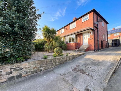
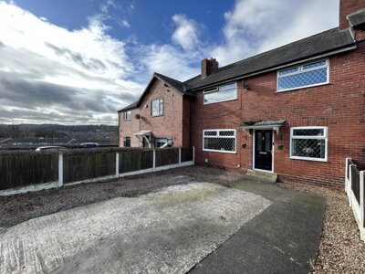
115 properties currently listed across WF14 (Mirfield). Here are the most recently added.
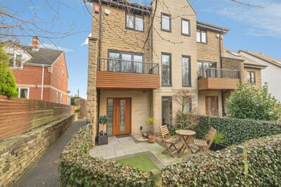
£210,000
Town House, 2 bed
Radley Court, WF14 9FD
£210,000
Town House, 2 bed
Radley Court, WF14 9FD
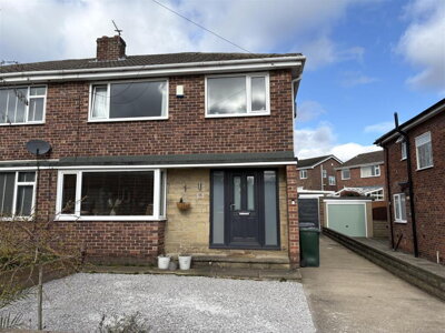
£315,000
Semi-Detached, 3 bed
Hepworth Lane, WF14 0PR
£315,000
Semi-Detached, 3 bed
Hepworth Lane, WF14 0PR
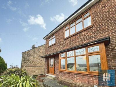
£315,000
Semi-Detached, 3 bed
Hopton Lane, WF14 8JU
£315,000
Semi-Detached, 3 bed
Hopton Lane, WF14 8JU
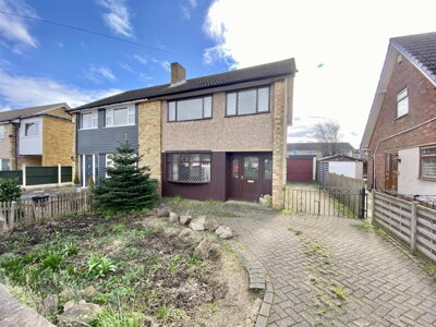
£225,000
Semi-Detached, 3 bed
Water Royd Avenue, WF14 9LT
£225,000
Semi-Detached, 3 bed
Water Royd Avenue, WF14 9LT
£200,000
Semi-Detached, 3 bed
Huddersfield Road, WF14 0EG
£200,000
Semi-Detached, 3 bed
Huddersfield Road, WF14 0EG
£425,000
Detached, 4 bed
Moor Croft Close, WF14 9FA
£425,000
Detached, 4 bed
Moor Croft Close, WF14 9FA
£200,000
Semi-Detached, 3 bed
Northway Crescent, WF14 0LR
£200,000
Semi-Detached, 3 bed
Northway Crescent, WF14 0LR
£325,000
Semi-Detached, 4 bed
Greenside Mount, WF14 0AY
£325,000
Semi-Detached, 4 bed
Greenside Mount, WF14 0AY
£189,000
Terraced, 2 bed
Nettleton Road, WF14 9AP
£189,000
Terraced, 2 bed
Nettleton Road, WF14 9AP
£495,000
Detached, 4 bed
Cheviot Way, WF14 8HW
£495,000
Detached, 4 bed
Cheviot Way, WF14 8HW
£120,000
Terraced, 1 bed
North Street, WF14 8PN
£120,000
Terraced, 1 bed
North Street, WF14 8PN
£295,000
Semi-Detached, 5 bed
Ebor Gardens, WF14 9BU
£295,000
Semi-Detached, 5 bed
Ebor Gardens, WF14 9BU
Get free, no-obligation valuations from the top-performing local agents. Compare fees, services, and track records before you decide.
Compare Agents FreeBased on our live market data, Wilcock leads the WF14 market with 48 active listings and a 16.4% market share, followed closely by Bramleys with 44 listings (15.1% share) and Snowgate Estate Agency with 38 listings (13% share). These three agents collectively control nearly 45% of the market, making them the most influential players in the Mirfield area. The right agent for you depends on your property type and price point, as each has different specialisations and average asking prices.
Estate agent fees in WF14 follow the national pattern, with high-street agents typically charging between 1% and 3% plus VAT of the final sale price, averaging around 1.5% plus VAT. Online agents like Purplebricks and Yopa offer fixed-fee alternatives that can range from £999 to £1,999, potentially saving money on lower-value properties. Remember that the advertised percentage fee excludes VAT, so the actual cost is 20% higher than stated.
Yes, WF14 has experienced consistent price growth, with Rightmove reporting a 9% increase over the previous year and Property Solvers confirming a 4.18% rise based on Land Registry data. The average asking price currently sits at £326,560, with detached properties commanding around £568,596 and semi-detached homes averaging £266,223. This growth reflects strong buyer demand and the area relative affordability compared to neighbouring Leeds and Huddersfield.
Mirfield offers a balanced lifestyle with a population of around 20,000 residents, good local schools, and convenient transport links via the M62 motorway connecting to Leeds and Manchester. The town centre provides shopping and amenities, while the River Calder and surrounding countryside offer recreational opportunities. Average household incomes of approximately £32,000 reflect a working-class heritage, though the area benefits from diverse employment in manufacturing, retail, and services. The presence of 47 listed buildings and a conservation area reflects the town historical character.
WF14 has notable flood risk due to the River Calder and Calder and Hebble Navigation canal running through the area. Specific flood warning zones include Central Mirfield, Calder View to Steanard Lane, and areas around Granny Lane and Lower Hopton. Properties on ancient floodplains have experienced significant flooding events in the past. Prospective buyers should check specific flood risk assessments for individual properties and consider flood resistance measures when purchasing in lower-lying areas.
Online agents like Purplebricks and Yopa operate in WF14 and can offer cost savings through fixed fees, but they typically provide less personal service and local market expertise than established high-street agents. With premium agents like Wilcock and Bramleys dominating 31.5% of the market between them, you benefit from their established buyer databases and local knowledge. Online agents may suit experienced sellers comfortable with self-service marketing, though the potential savings diminish for higher-value properties where the percentage fee difference becomes negligible.
Three-bedroom semi-detached properties represent the sweet spot of the WF14 market, with 105 active listings and strong demand from families and first-time buyers. These properties typically sell fastest due to their appeal to the broadest buyer demographic. Two-bedroom homes also perform well, particularly for first-time buyers and buy-to-let investors, with 76 listings at an average of £216,038. Premium four and five-bedroom properties face longer marketing periods but can achieve strong prices in the right market conditions.
Given WF14 substantial stock of older properties, including many pre-1919 stone-built homes and 47 listed buildings, obtaining a professional survey is strongly recommended. A RICS Level 2 Survey costs between £400 and £800 depending on property size and age, while a full RICS Level 3 Building Survey is advisable for older, larger, or listed properties. Common issues in local properties include damp, roofing problems, structural movement from clay shrinkage, and potential mining-related subsidence. The investment in a survey can reveal issues that affect value or require expensive remediation.
Estate Agents In London

Estate Agents In Plymouth

Estate Agents In Liverpool

Estate Agents In Glasgow

Estate Agents In Sheffield

Estate Agents In Edinburgh

Estate Agents In Coventry

Estate Agents In Bradford

Estate Agents In Manchester

Estate Agents In Birmingham

Estate Agents In Bristol

Estate Agents In Oxford

Estate Agents In Leicester

Estate Agents In Newcastle

Estate Agents In Leeds

Estate Agents In Southampton

Estate Agents In Cardiff

Estate Agents In Nottingham

Estate Agents In Norwich

Estate Agents In Brighton

Estate Agents In Derby

Estate Agents In Portsmouth

Estate Agents In Northampton

Estate Agents In Milton Keynes

Estate Agents In Bournemouth

Estate Agents In Bolton

Estate Agents In Swansea

Estate Agents In Swindon

Estate Agents In Peterborough

Estate Agents In Wolverhampton

Compare 32 local agents, data from 292 active listings
Find AgentsHomemove is a trading name of HM Haus Group Ltd (Company No. 13873779, registered in England & Wales). Homemove Mortgages Ltd (Company No. 15947693) is an Appointed Representative of TMG Direct Limited, trading as TMG Mortgage Network, which is authorised and regulated by the Financial Conduct Authority (FRN 786245). Homemove Mortgages Ltd is entered on the FCA Register as an Appointed Representative (FRN 1022429). You can check registrations at NewRegister or by calling 0800 111 6768.
We use cookies to show you personalised content and improve your experience of our website. Find out more in our Privacy policy and Cookie policy.