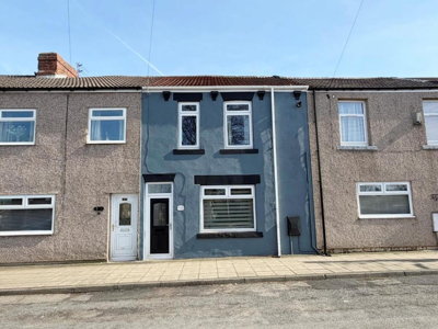
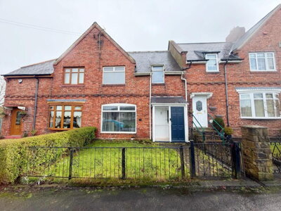
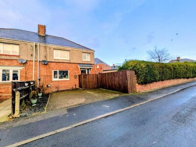
£115,000
Terraced, 3 bed
Commercial Street, TS29 6AD
£115,000
Terraced, 3 bed
Commercial Street, TS29 6AD

Compare 7 local agents, data from 49 active listings


We track 7 estate agents actively marketing properties in Trimdon, and we've ranked them all based on live listing data, market share, and average asking prices. selling your family home in Trimdon Village or a terraced house near the village centre, finding the right agent can make a significant difference to your sale price and timeline.
The Trimdon property market offers affordable entry points compared to national averages, with the average house price sitting around £132,000. Our comprehensive analysis covers every active agent in the area, giving you the data you need to make an informed decision and secure the best possible outcome for your property sale.
We update our agent rankings weekly using live listing data, ensuring you have the most current picture of who is actually selling properties in Trimdon right now. This means you can trust our market share figures and listing numbers to reflect real-time activity, not outdated information.

7
Active Estate Agents
£129,715
Average Asking Price
49
Properties For Sale
The Trimdon property market reflects the character of this County Durham village, offering buyers more affordable options than many parts of the North East. According to Land Registry data sourced through Plumplot, the average house price in Trimdon currently stands at £132,042, with house prices having increased by 0.38% over the last 12 months. This modest growth indicates a stable market rather than the dramatic swings seen in larger urban centres, making it an attractive option for first-time buyers and families seeking value for money.
Transaction volumes in the area show healthy activity, with 52 property sales recorded in Trimdon over the past 12 months. This figure demonstrates active market participation despite Trimdon's relatively small population. The balance between supply and demand has remained reasonable, with 49 properties currently listed for sale through local agents. The market serves a diverse range of buyers, from those seeking affordable terraced properties to families looking for larger detached homes in the village and surrounding countryside.
Property types in Trimdon align with its mining heritage and village character. Semi-detached properties represent the largest segment at 39% of housing stock, followed by terraced houses at 33.6%, while detached properties make up around 18% of homes. This mix provides options across various price points, from more affordable terraced houses to premium detached homes in sought-after positions within the village conservation area.
The price distribution across Trimdon shows that 28 properties are listed under £100,000, making this village particularly accessible for first-time buyers entering the property market. A further 12 properties fall in the £100,000 to £200,000 range, typically comprising three-bedroom semi-detached homes, while 8 properties are marketed between £200,000 and £300,000, predominantly detached family homes. This tiered structure gives sellers clear positioning opportunities based on their property type and target buyer demographic.
Based on 22 live listings with an average asking price of £152,712.
Source: home.co.uk
See which agents are selling fastest and at the best prices in Trimdon.
Compare Estate Agents FreeAnalysis of current listings in Trimdon reveals what types of properties are available to buyers. Three-bedroom semi-detached houses dominate the market with 24 listings, representing the most popular choice for families and offering an average price of around £117,980. These properties provide the ideal balance of space and affordability that attracts both first-time buyers moving up the property ladder and growing families seeking more room.
Two-bedroom properties, predominantly terraced houses, make up the second-largest segment with 17 listings averaging £83,800. These more affordable options continue to attract first-time buyers and investors seeking to enter the Trimdon property market. Meanwhile, four-bedroom detached properties account for 7 listings at an average of £269,275, catering to buyers seeking larger family homes with gardens and parking in this desirable County Durham village.
New build activity in the Trimdon area remains limited, with The Sycamores development by Miller Homes in Trimdon Village representing one of the few recent developments. This scheme offers three and four-bedroom homes priced from £199,950 to £299,950. The scarcity of new build options means the majority of transactions involve older properties, primarily those built before 1945 and during the post-war period, reflecting the village's established character.
Our analysis of bedroom distribution shows that three-bedroom homes represent nearly half of all current listings, indicating strong demand from families who need extra space without stretching to premium prices. For sellers with three-bedroom properties, this means entering a competitive market where presentation and accurate pricing become crucial differentiators. Two-bedroom properties, while more affordable, face less competition but also attract a different buyer segment focused on entry-level purchasing.
Trimdon comprises several distinct settlements within its parish boundary, including Trimdon Village, Trimdon Colliery, and Trimdon Grange, each with its own character. The population of the broader Trimdon and Thornley ward stands at approximately 6,076 residents across 2,634 households according to the 2021 Census. The area maintains a strong community identity with local amenities including shops, pubs, and primary schools serving daily needs. The historic heart around Trimdon Village features a designated Conservation Area, protecting several listed buildings including the Church of St Mary Magdalene, The Old Rectory, and various farmhouses that reflect the area's agricultural and mining heritage.
Transport connections from Trimdon are convenient for commuters, with the village positioned near the A19 and A1(M) providing straightforward access to Durham, Newcastle, and Teesside. This accessibility makes Trimdon particularly attractive for workers who want village living with easy reach of urban employment centres. The reliable road links mean that buyers considering Trimdon often include commuters who work in larger towns but prefer the quieter lifestyle the village offers.
The area's geology reflects its County Durham location, characterised by Carboniferous rocks including coal measures, with overlaying Permian limestones and Quaternary glacial deposits. Clay content in the glacial till creates potential for shrink-swell ground movement, particularly during extreme weather conditions, though this is generally manageable with modern construction standards. Properties in certain parts of Trimdon may benefit from ground condition surveys, particularly those with large trees nearby or those built on clay-rich soils where foundation movement can occur over time.
Flood risk in Trimdon remains relatively low compared to coastal or riverside locations. The village sits away from major river systems, reducing fluvial flood concerns, and being inland means tidal flooding is not a factor. However, localized surface water flooding can occur during heavy rainfall, particularly in low-lying areas where drainage systems may be overwhelmed. The Environment Agency provides detailed flood risk mapping for those considering properties in specific locations within the village. The legacy of coal mining in the area also warrants consideration, as potential ground stability issues from historical workings may affect some properties, and a mining report is often recommended as part of the purchase process.
Selecting the right estate agent in Trimdon requires understanding the local market dynamics and the specific strengths of each agency. Robinsons, based in nearby Sedgefield, dominates the local market with 57.1% market share and 28 active listings at an average asking price of £147,816, making them the clear market leader for sellers seeking maximum exposure. Their strong presence in the Sedgefield area translates to established local knowledge of Trimdon's property market, and their high listing volume suggests proven marketing capabilities for properties across all price points.
Dowen, also operating from Sedgefield, holds 18.4% market share with 9 listings averaging £111,722, positioning them as a competitive alternative for properties at various price levels. Their average asking price being notably lower than Robinsons suggests they may handle a different segment of the market, potentially attracting buyers seeking more affordable properties. The price gap between Robinsons and Dowen listings often reflects the type and condition of properties each agent markets, with Robinsons tending toward larger family homes and Dowen capturing more starter properties.
Pattinson Estate Agents, operating from Peterlee, represents another option with 2 listings at an average price of £162,500, indicating they focus on the higher end of the Trimdon market. For sellers, comparing valuations from multiple agents is essential, as different agencies may offer varying perspectives on your property's market value based on their buyer databases and recent sales success in specific streets or developments.
When choosing between agents, consider whether you prefer a high-street presence like Robinsons or an online agent option. High-street agents typically charge percentage-based fees of around 1-1.5% plus VAT and provide face-to-face valuation and marketing services, while online agents offer fixed fees typically between £999 and £1,999. Given Trimdon's village market, local knowledge is particularly valuable, making agents with established presence in the surrounding area worth considering. Always request a free valuation from at least three agents before making your decision, and ensure you understand whether you are entering a sole agency or multi-agency agreement, as the latter typically involves higher total fees but may achieve a faster sale.
Estate agent fees in Trimdon typically follow the national pattern, with high-street agents charging percentage-based commissions while online alternatives offer fixed-price packages. The average property value in Trimdon sits around £130,000, meaning percentage fees of 1% plus VAT would equate to approximately £1,560 for a standard sale. This is notably lower than fees in higher-value southern markets, making agent representation more accessible for Trimdon sellers.
Fixed-fee online agents have gained popularity across the UK, and Trimdon sellers can access these services nationwide. However, the trade-off often includes reduced local presence and potentially less personalized service. For a village market like Trimdon, where local knowledge and buyer relationships matter significantly, this can impact how quickly your property sells and at what price. Agents with physical offices in nearby towns like Sedgefield or Peterlee typically have stronger local networks and can facilitate viewings more flexibly than remote-only services.

Start by identifying all estate agents actively marketing properties in Trimdon. Look at their current listings, average asking prices, and how long properties have been on the market. Pay attention to which agents appear most frequently in your search results and check their individual websites for complete inventory.
Request free valuations from at least three agents. Be wary of agents who overvalue your property to win your business, as an overpriced home will simply sit on the market. Ask each agent to explain their valuation methodology and provide comparable recent sales evidence from Trimdon specifically.
Understanding an agent's market share in Trimdon gives insight into their local influence. Agents with higher shares like Robinsons at 57.1% typically have more buyers registered and may achieve better results. Market share data helps you identify who is actually succeeding in selling properties locally, not just listing them.
Ask about marketing strategies, including online presence, property portals, and local advertising. Quality photography and floor plans are essential market. Enquire about video tours, virtual viewings, and social media promotion, as these increasingly influence buyer interest.
Clarify whether fees are fixed or percentage-based, and what services are included. Remember that the cheapest option is not always the best value. Consider what support you will receive throughout the selling process, including negotiation assistance and progression coordination.
Look for reviews from previous clients in Trimdon or surrounding villages to gauge agent performance and customer service quality. Platforms like Trustpilot and Google Reviews provide independent feedback, while asking agents for references directly can give more detailed insight into their service delivery.
Don't accept the first valuation you receive. In a village market like Trimdon, different agents may offer varying perspectives on your property's value. Getting 3-4 valuations gives you leverage when negotiating fees and helps ensure you price your home correctly from the start.
Understanding how bedroom count affects property prices in Trimdon helps sellers position their homes competitively and helps buyers understand what their budget will secure. Three-bedroom properties represent the most prevalent option in the current market with 24 listings averaging £117,980, making them the backbone of the Trimdon housing market. These properties typically include two reception rooms and a bathroom, suiting growing families who need extra space without stretching to premium prices.
Two-bedroom properties offer the most accessible entry point to the Trimdon market with 17 listings averaging £83,800. These properties, predominantly terraced houses, attract first-time buyers and investors alike. The relatively low average price compared to three-bedroom properties makes homeownership achievable for those with smaller deposits, and rental yields can be attractive given the affordable purchase prices. The strong supply of two-bedroom properties means buyers have plenty of choice, so sellers need to ensure their property stands out through presentation and competitive pricing.
Four-bedroom detached homes represent the premium segment with 7 listings averaging £269,275, offering substantial living space, gardens, and off-street parking that appeals to larger families and those seeking village life with modern conveniences. A single five-bedroom property is also listed at £215,000, representing the rarest segment of the Trimdon market. Properties at this price point typically attract serious buyers with specific requirements, and marketing to the right audience becomes crucial for achieving a timely sale.
The distribution of listings shows strong demand for family-sized homes, with three-bedroom properties dominating supply. For sellers, this means competition is highest in the three-bedroom segment, making accurate pricing and quality marketing particularly important to stand out. Properties priced correctly for their condition and location tend to sell within reasonable timeframes, while overpriced homes can stagnate in what remains a sensible but price-conscious market. Our data shows that correctly priced three-bedroom semi-detached homes in Trimdon typically attract viewings within the first two weeks of listing.
22 properties currently listed across Trimdon. Here are the most recently added.
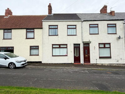
£115,000
Terraced, 3 bed
Commercial Street, TS29 6AD
£115,000
Terraced, 3 bed
Commercial Street, TS29 6AD
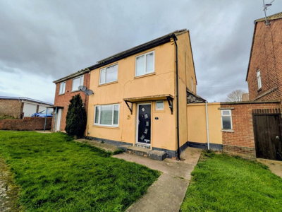
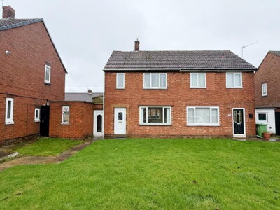
£70,000
Semi-Detached, 3 bed
Carrside Road, TS29 6JT
£70,000
Semi-Detached, 3 bed
Carrside Road, TS29 6JT
£184,950
Semi-Detached, 4 bed
Cleveland Avenue, TS29 6PP
£184,950
Semi-Detached, 4 bed
Cleveland Avenue, TS29 6PP
£54,950
Terraced, 3 bed
St Albans Terrace, TS29 6HB
£54,950
Terraced, 3 bed
St Albans Terrace, TS29 6HB
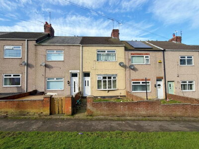
£99,950
Terraced, 3 bed
Northside Buildings, TS29 6HW
£99,950
Terraced, 3 bed
Northside Buildings, TS29 6HW
£69,950
Semi-Detached, 2 bed
St Pauls Road, TS29 6AL
£69,950
Semi-Detached, 2 bed
St Pauls Road, TS29 6AL
£85,000
Terraced, 3 bed
Langdale Oval, TS29 6LG
£85,000
Terraced, 3 bed
Langdale Oval, TS29 6LG
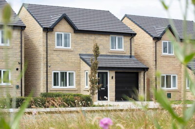
£229,995
Detached, 3 bed
TS29 6FF
£229,995
Detached, 3 bed
TS29 6FF
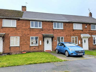
£120,000
Semi-Detached, 3 bed
West Grove, TS29 6QQ
£120,000
Semi-Detached, 3 bed
West Grove, TS29 6QQ
£259,995
Detached, 4 bed
Broadway Avenue, TS29 6PU
£259,995
Detached, 4 bed
Broadway Avenue, TS29 6PU
£289,995
Detached, 4 bed
TS29 6FF
£289,995
Detached, 4 bed
TS29 6FF
£94,950
Terraced, 3 bed
Front Street North, TS29 6PF
£94,950
Terraced, 3 bed
Front Street North, TS29 6PF
Get free, no-obligation valuations from the top-performing local agents. Compare fees, services, and track records before you decide.
Compare Agents FreeBased on current market data, Robinsons is the leading estate agent in Trimdon with 57.1% market share and 28 active listings. They are followed by Dowen with 18.4% market share and Pattinson Estate Agents with 4.1%. These three agents collectively handle nearly 80% of all property listings in the area, making them the most established options for sellers in Trimdon. Robinsons operates from Sedgefield and has strong local knowledge of the village, while Dowen also serves the area from their Sedgefield office.
Estate agent fees in Trimdon typically range from 1% to 1.5% plus VAT (1.2% to 1.8% total) for high-street percentage-based agents, which aligns with national averages. Online agents offer fixed-fee alternatives typically ranging from £999 to £1,999. In Trimdon's market, where average property values are around £130,000, percentage fees would typically equate to around £1,300 to £2,000 for a standard sale. Some agents may offer tiered packages with additional services such as professional photography, floor plans, or accompanied viewings included.
Yes, house prices in Trimdon have increased by 0.38% over the last 12 months according to Land Registry data. While this represents modest growth rather than dramatic increases, it indicates a stable market. The average property price sits at approximately £132,042, making Trimdon an affordable option within the North East property market. This stability makes it an attractive location for buyers seeking reasonable property values with predictable market conditions.
Trimdon is a welcoming County Durham village with a population of around 6,000 residents across the wider ward. The area offers a strong sense of community, local amenities including shops and pubs, and convenient access to larger towns via the A19 and A1(M). Trimdon Village features a Conservation Area with historic buildings, while the surrounding countryside provides attractive rural walks. The area appeals to families and commuters seeking affordable village life within reach of urban employment centres in Durham, Newcastle, and Teesside.
The housing stock in Trimdon consists predominantly of semi-detached properties (39%) and terraced houses (33.6%), reflecting its mining village heritage. Detached properties account for approximately 18% of homes, with flats and maisonettes comprising around 9.4%. This mix provides options across various price points, from affordable terraced houses starting around £70,000 to larger family detached homes reaching £250,000 or more in premium positions.
While exact figures for Trimdon specifically are not available, the average time to sell in the North East typically ranges from 3 to 6 months, depending on property type, price, and market conditions. In Trimdon's relatively stable market, properties priced correctly tend to attract interest within the first few weeks of marketing. Overpriced properties can remain on the market significantly longer, which is why obtaining accurate valuations from local agents is essential. The current supply of 49 properties for sale indicates balanced market conditions where realistic pricing leads to reasonable sale timescales.
Using an agent with established presence in the Trimdon area offers significant advantages. Local agents possess specific knowledge of the village's different neighbourhoods, property values, and buyer preferences. Robinsons and Dowen both operate from nearby Sedgefield, giving them strong regional coverage while understanding local market dynamics. Their established presence means they likely have active buyers registered who are specifically looking in Trimdon, and their familiarity with the area helps them market properties effectively to the right audience.
Many properties in Trimdon date from the mining era and pre-war periods, meaning older homes may have issues common to their age. These can include damp, outdated electrics, roof wear, and potential ground stability concerns related to historical mining activity. A RICS Level 2 Survey is recommended for properties over 50 years old, with a more detailed Level 3 Survey advised for listed buildings or those in the Conservation Area. Given the clay geology in parts of County Durham, foundation movement and shrink-swell soil behaviour may also be concerns worth investigating. Buyers should also consider obtaining a mining report given the area's coal mining heritage.
Properties within the Trimdon Village Conservation Area may be subject to additional planning constraints if you wish to make alterations or extensions. Selling a conservation area property requires awareness of any Article 4 Directions that might restrict permitted development rights. Potential buyers may request a more detailed survey given the age and character of properties in these protected areas. Your estate agent should be familiar with the conservation area boundaries and any restrictions that might affect marketing or future modifications to the property.
Estate Agents In London

Estate Agents In Plymouth

Estate Agents In Liverpool

Estate Agents In Glasgow

Estate Agents In Sheffield

Estate Agents In Edinburgh

Estate Agents In Coventry

Estate Agents In Bradford

Estate Agents In Manchester

Estate Agents In Birmingham

Estate Agents In Bristol

Estate Agents In Oxford

Estate Agents In Leicester

Estate Agents In Newcastle

Estate Agents In Leeds

Estate Agents In Southampton

Estate Agents In Cardiff

Estate Agents In Nottingham

Estate Agents In Norwich

Estate Agents In Brighton

Estate Agents In Derby

Estate Agents In Portsmouth

Estate Agents In Northampton

Estate Agents In Milton Keynes

Estate Agents In Bournemouth

Estate Agents In Bolton

Estate Agents In Swansea

Estate Agents In Swindon

Estate Agents In Peterborough

Estate Agents In Wolverhampton

Compare 7 local agents, data from 49 active listings
Find AgentsHomemove is a trading name of HM Haus Group Ltd (Company No. 13873779, registered in England & Wales). Homemove Mortgages Ltd (Company No. 15947693) is an Appointed Representative of TMG Direct Limited, trading as TMG Mortgage Network, which is authorised and regulated by the Financial Conduct Authority (FRN 786245). Homemove Mortgages Ltd is entered on the FCA Register as an Appointed Representative (FRN 1022429). You can check registrations at NewRegister or by calling 0800 111 6768.
We use cookies to show you personalised content and improve your experience of our website. Find out more in our Privacy policy and Cookie policy.