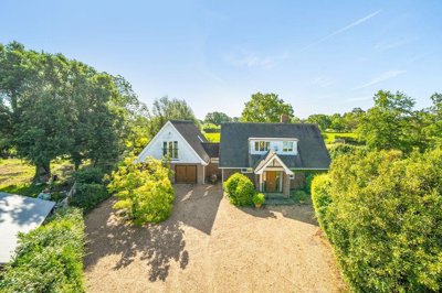
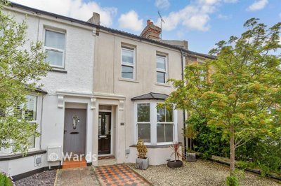
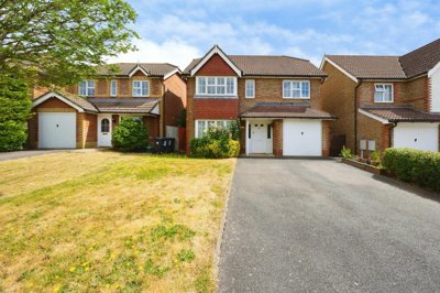
£945,000
Detached, 4 bed
Tenterden Road, TN27 8BB
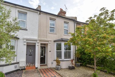
£945,000
Detached, 4 bed
Tenterden Road, TN27 8BB

Compare local agents for an Ashford home, using sold-price evidence from 1,323 recent sales


Ashford homes averaged £339,077 in May 2024, with 1,323 sales over the last 12 months and a -1.7% move across the market. That is the backdrop for every sale here. A good estate agent matters because even a small shift in price can change your final figure by a meaningful amount. We help you compare local agents on the parts that shape the result, from pricing and marketing to negotiation and contract terms.
Detached homes averaged £508,495, while flats sat at £192,238, so the gap between property types is wide. Semi-detached homes averaged £345,984 and terraces averaged £280,486, which tells us Ashford has a broad buyer base and a wide spread of stock. That spread matters when you instruct an agent, because a flat in a newer scheme needs a different sales plan from a detached home near one of the town's conservation areas. The right agent should know where your home sits in that mix and explain it clearly to buyers.

£339,077
Average Sold Price
1,323
Sales in Last 12 Months
-1.7%
12-Month Price Change
£508,495
Detached Average
£345,984
Semi-Detached Average
£280,486
Terraced Average
£192,238
Flat Average
Using listing data from home.co.uk and property data from homedata.co.uk
Our sold-price records put Ashford at £339,077 on average, with detached homes commanding £508,495 and flats at £192,238. That spread is useful because it shows where the value sits and where buyers are more price-sensitive. Detached homes held up best over the last year at -0.1%, which is close to flat, while flats moved the furthest at -3.0%. In a market like this, an agent needs to price with care, not guesswork.
Semi-detached homes averaged £345,984 and fell -2.7% over 12 months, while terraced homes averaged £280,486 and slipped -2.3%. Those two bands matter for much of Ashford's housing stock, since semi-detached and terraced homes make up a large share of the town. If your home sits in the 1945-1980 or post-1980 stock, the valuation should be anchored to similar sales rather than broad town averages. That keeps the asking price realistic and gives buyers less room to push back.
The market is shaped by a large number of sales, with 1,323 completed over the last 12 months. That level of activity gives agents plenty of comparables, but only if they know which streets, schemes and house types match your home. A strong local valuation should explain the difference between a house in the town centre conservation area, a family home in Finberry, and a newer property at Chilmington Green. It should also show how long similar homes took to sell and where price reductions appeared.
Based on 1,183 live listings with an average asking price of £540,449.
Source: home.co.uk
See which agents are selling fastest and at the best prices in Ashford.
Compare Estate Agents FreeAshford recorded 1,323 sales in the last 12 months, so this is a busy local market rather than a thin one. That matters because agents can build a stronger price case when they have enough nearby sales to compare against. Semi-detached and terraced homes will usually generate the widest pool of buyers, while detached homes depend more on presentation, plot and position. A good agent should use that transaction volume to back up the valuation, not pad it.
New-build activity adds a different layer. Chilmington Green in TN23 3DN offers 2, 3, 4 and 5-bedroom homes from Barratt Homes, David Wilson Homes and Redrow. Bridgefield in TN25 4AB has 2, 3 and 4-bedroom homes from Barratt Homes and David Wilson Homes, while Conningbrook Lakes in TN24 9QX and Finberry in TN25 7GS widen the choice again. Those schemes matter because sellers are competing with brand-new homes as well as older resale stock.
A well-prepared valuation should explain where your home sits against those newer phases. A post-1980 house may be judged beside a Finberry property with a modern layout, while an older brick home can stand out if it has more space or a better plot. The best agents talk about buyer comparisons, not just square footage. They should also know when a house needs sharper pricing because the market has moved -1.7% over the past year.
Ashford had 132,729 residents and 53,883 households in the 2021 Census, so this is a substantial town rather than a small market settlement. Housing stock is split across terraced houses at 28.1%, semi-detached homes at 31.9%, detached homes at 22.0% and flats, maisonettes or apartments at 17.6%. That mix helps explain the strong sales count and the different valuation bands across the town. It also gives a careful agent plenty of comparable homes if they know the area properly.
Age matters here. Only 13.9% of homes were built before 1919, 11.2% between 1919 and 1945, 30.6% between 1945 and 1980 and 44.3% after 1980. That means 55.7% of properties were built before 1980, which is exactly the kind of stock where a careful survey and a precise valuation both matter. Older homes often need more explanation at market stage, especially where damp, roofing or wiring history affects buyer confidence.
Local construction is often brick, including red or yellow stock brick, with rendered finishes on some newer homes and older properties. Clay or concrete tile roofs are common too. Beneath that sits Gault Clay and Lower Greensand, and the clay brings a moderate to high shrink-swell risk, so subsidence and heave deserve attention in older homes. Flood risk is also part of the picture, especially near the River Stour flood plain and in places affected by surface water after heavy rain. Conservation areas in the town centre, Newtown and around Victoria Park add another layer, because listed buildings and protected streets need a more careful sales pitch.
Ashford International and the HS1 rail line shape buying decisions, along with Eurostar services that add a wider travel option. Major employers in retail, logistics, healthcare and public services support the local economy, and William Harvey Hospital remains an important anchor for many households. Buyers often weigh those factors alongside local schools and the newer housing on the edge of town. That means an agent should understand not just the house, but the part of Ashford that surrounds it.
Fees are one of the first questions sellers ask, but they are only part of the decision. High-street sole agency usually sits around 1-1.8% + VAT, with an 8-16 week contract term, while online or fixed-fee models often start at £999-£1,999. Hybrid agents sit between the two. The right choice depends on how much support you want, how much control you want to keep, and how much negotiation you are comfortable handling.
In Ashford, the type of property should shape the instruction. A detached home near a conservation area or an older property with clay-soil concerns may suit a hands-on agent who can explain the story of the house properly. A newer flat or a standard terrace in a busy resale pocket might suit a leaner fee model if the marketing is strong. The key is not the brand on the signboard, it is the agent's ability to price, present and pursue buyers.
Ask each agent how they will photograph the home, where they will advertise it, how they handle viewings and what happens if the first price is too high. You should also check whether the fee covers accompanied viewings, floor plans and negotiation. If the contract includes a tie-in period, ask how long it lasts and what happens if you want to leave. Clear answers usually tell you more than a glossy pitch.

Ask 2-3 local agents to visit the property, then compare the sale prices they expect and the reasoning behind them. The best valuers mention nearby sales in Ashford, not just broad averages.
Ask which homes they have sold in places such as Chilmington Green, Finberry, Newtown or around Victoria Park, and how long those homes took to sell.
Look at the percentage or fixed fee, VAT, tie-in length and any extra costs for photos, floor plans or premium listings. A lower fee is not a saving if the marketing is weak.
Good agents explain where your home sits against detached, semi-detached, terraced or flat comparables. They should say why the asking price is chosen and what happens if viewings do not convert.
Check whether the agent will use strong photos, clear floor plans, decent write-ups and regular feedback after viewings. If your home needs extra explanation because of age, clay soil or conservation area restrictions, they should say so early.
Sole agency is usually 8-16 weeks, while multi-agency costs more. Make sure you know the exit clause, any notice required and what happens if a buyer is introduced after you leave.
Do not accept the highest price by default. Ask each agent to show you three recent Ashford sales they would use as comparables, then compare the fee, contract length and marketing plan side by side. If two valuations cluster together and one sits far above the rest, ask for the evidence behind it. A grounded valuation often saves time and cuts the risk of a stale listing.
Detached homes averaged £508,495, so a premium presentation can pay off if your property sits in that band. Flats, at £192,238 on average, need a tighter price strategy because buyers compare them directly with other flats and with newer apartment stock. Semi-detached and terraced homes sit in the middle, which is where much of Ashford's resale activity happens. The best agent will explain the differences in plot size, parking, finish and layout, not just the headline average.
Across Chilmington Green, Bridgefield, Conningbrook Lakes and Finberry, buyers can compare 2 to 5-bedroom new-build options with older resale homes. That puts pressure on properties with awkward room shapes, dated kitchens or poor energy performance. It also rewards homes that present cleanly, photograph well and give viewers a clear reason to choose resale over new build. If your house has period features, a bigger garden or a better location within the town, the agent should make that point early.
A skilled agent should also know how to handle offers once they arrive. Some buyers start low and work up, especially when they know the market has moved -1.7% over the last year. Your agent needs to judge when to counter, when to wait and when to push for best and final offers. In a market with 1,323 annual sales, speed matters, but the wrong price can still leave a home hanging around too long.
Sellers sometimes focus on fee alone. That can be a mistake. A slightly higher commission can be worth it if the agent brings better photos, better buyer follow-up and firmer negotiation. If two agents see your home in a similar way, the one with the stronger process may deliver the better net result.
1,183 properties currently listed across Ashford. Here are the most recently added.
£945,000
Detached, 4 bed
Tenterden Road, TN27 8BB
£945,000
Detached, 4 bed
Tenterden Road, TN27 8BB
£350,000
Semi-Detached, 3 bed
Shepherd Drive, TN24 0UJ
£350,000
Semi-Detached, 3 bed
Shepherd Drive, TN24 0UJ

£1,350,000
Detached, 5 bed
The Hill, TN27 0LU
£1,350,000
Detached, 5 bed
The Hill, TN27 0LU
 New Build
£799,995
Detached, 4 bed
Appledore Road, TN30 7BE
New Build
£799,995
Detached, 4 bed
Appledore Road, TN30 7BE

£1,485,000
Detached, 5 bed
Church Hill, TN26 3JB
£1,485,000
Detached, 5 bed
Church Hill, TN26 3JB
£599,950
Cottage, 3 bed
Court Lodge Road, TN26 2DD
£599,950
Cottage, 3 bed
Court Lodge Road, TN26 2DD
£198,500
Terraced, 3 bed
Linden Road, TN24 8BS
£198,500
Terraced, 3 bed
Linden Road, TN24 8BS
£300,000
Terraced, 3 bed
Linden Road, TN24 8BS
£300,000
Terraced, 3 bed
Linden Road, TN24 8BS
£285,000
Terraced, 3 bed
Arcon Road, TN23 5BZ
£285,000
Terraced, 3 bed
Arcon Road, TN23 5BZ
£750,000
Semi-Detached, 4 bed
Withersdane Lane, CT4 8HU
£750,000
Semi-Detached, 4 bed
Withersdane Lane, CT4 8HU
£475,000
Detached, 4 bed
John Dutton Way, TN24 9PW
£475,000
Detached, 4 bed
John Dutton Way, TN24 9PW
£425,000
Bungalow, 3 bed
Magpie Hall Road, TN26 1HF
£425,000
Bungalow, 3 bed
Magpie Hall Road, TN26 1HF
Get free, no-obligation valuations from the top-performing local agents. Compare fees, services, and track records before you decide.
Compare Agents FreeStart by getting 2-3 free valuations and ask each agent to explain the comparables they used. The best choice is usually the agent who knows Ashford's housing mix, from Chilmington Green to the town centre conservation areas, and can justify the asking price with recent sales. Look closely at fees, contract length and the marketing plan, not just the headline valuation. A clear answer on negotiation is a good sign too.
High-street agents usually charge around 1-1.8% + VAT on a sole-agency basis, while online or fixed-fee agents often start at £999-£1,999. Hybrid models sit between those two. The cheapest quote is not always the best deal if the marketing is weak or the contract is restrictive. Always check what is included before you instruct anyone.
No, not over the last 12 months. Ashford's average sold price is £339,077, which is down -1.7% year on year to May 2024. Detached homes were almost flat at -0.1%, while flats fell -3.0%. That mix tells us some parts of the market are steadier than others.
Ashford is a sizeable town with 132,729 residents and 53,883 households, so there is plenty of housing choice. The town has a mix of older brick homes, post-war stock and newer developments such as Finberry and Chilmington Green. Ashford International, HS1, Eurostar services, William Harvey Hospital and the local retail and logistics economy all shape daily life here. Conservation areas in the town centre, Newtown and around Victoria Park add to the variety.
We recommend 2-3 valuations. That gives you enough perspective to spot an over-optimistic figure without spending all week on appointments. It also helps you compare how different agents value the same home in Ashford, which can be revealing if your property sits near clay soil, flood risk or a conservation area. Matching the valuation to the evidence matters more than chasing the highest number.
It depends on the home and how much help you want. A high-street agent can be a better fit for detached homes, older houses or anything that needs extra explanation, while an online model can suit a simpler sale if you are comfortable doing more yourself. Hybrid agents sit in the middle and can work well for many sellers. Compare the fee, the contract and the marketing, then decide.
Sole-agency contracts are usually 8-16 weeks. That gives the agent time to launch the marketing, arrange viewings and negotiate offers. Ask about the notice period, any exit clause and whether fees are payable if a buyer is introduced after the contract ends. A short contract sounds flexible, but the wording still matters.
Ask how they arrived at the price, which recent Ashford sales they used, and how they would market your home. You should also ask how many viewings they expect, how they handle buyer feedback and what they would do if the first month is quiet. If your home is in a conservation area or has issues linked to Gault Clay, ask how they would explain that to buyers. Good agents answer plainly.
Yes, because buyers and surveyors will think about them. Gault Clay can bring shrink-swell risk, so older homes may raise questions about subsidence or heave, while areas near the River Stour flood plain or exposed to surface water can trigger extra checks. A good agent does not hide those points, they frame them sensibly and show how the home has been maintained. That can keep the sale moving.
Sole agency is usually cheaper and gives one agent a clear incentive to work the listing well. Multi-agency can speed up exposure, but the fee is often higher and the process can feel less coordinated. In Ashford, where there are 1,323 sales over 12 months, a strong sole agent often has enough local evidence to make the case for your asking price. If you go multi-agency, make sure the fee and terms still make sense.
From £400
A practical survey for conventional homes and many older Ashford properties
From £600
A deeper check for older, altered or higher-risk homes
From £80
Needed before marketing your home for sale
From £150
For owners who need an official valuation figure
Estate Agents In London

Estate Agents In Plymouth

Estate Agents In Liverpool

Estate Agents In Glasgow

Estate Agents In Sheffield

Estate Agents In Edinburgh

Estate Agents In Coventry

Estate Agents In Bradford

Estate Agents In Manchester

Estate Agents In Birmingham

Estate Agents In Bristol

Estate Agents In Oxford

Estate Agents In Leicester

Estate Agents In Newcastle

Estate Agents In Leeds

Estate Agents In Southampton

Estate Agents In Cardiff

Estate Agents In Nottingham

Estate Agents In Norwich

Estate Agents In Brighton

Estate Agents In Derby

Estate Agents In Portsmouth

Estate Agents In Northampton

Estate Agents In Milton Keynes

Estate Agents In Bournemouth

Estate Agents In Bolton

Estate Agents In Swansea

Estate Agents In Swindon

Estate Agents In Peterborough

Estate Agents In Wolverhampton

Compare local agents for an Ashford home, using sold-price evidence from 1,323 recent sales
Find AgentsHomemove is a trading name of HM Haus Group Ltd (Company No. 13873779, registered in England & Wales). Homemove Mortgages Ltd (Company No. 15947693) is an Appointed Representative of TMG Direct Limited, trading as TMG Mortgage Network, which is authorised and regulated by the Financial Conduct Authority (FRN 786245). Homemove Mortgages Ltd is entered on the FCA Register as an Appointed Representative (FRN 1022429). You can check registrations at NewRegister or by calling 0800 111 6768.
We use cookies to show you personalised content and improve your experience of our website. Find out more in our Privacy policy and Cookie policy.