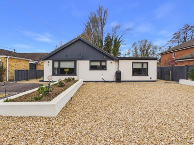
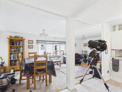
£375,000
Detached Bungalow, 3 bed
Ryes Close, PE33 0BS
£375,000
Detached Bungalow, 3 bed
Ryes Close, PE33 0BS

Compare 9 local agents, data from 12 active listings


We track 9 estate agents actively marketing properties in Shouldham, and we've ranked them all based on live listing data. selling a family home near The Green or a period property in this historic Norfolk village, finding the right agent makes all the difference to your sale. Our comprehensive comparison draws on real-time market data to help you make an informed decision.
Shouldham's property market offers a distinctive mix of traditional cottages, Victorian terraces, and modern developments set within a conservation area. With an average asking price of £416,917 across 12 current listings, the village presents opportunities across multiple price brackets from starter homes to premium properties. The village sits on the western escarpment of a chalk ridge rising above the Fens, creating a landscape that attracts buyers seeking authentic Norfolk village life with scenic views across the low-lying countryside.

9
Active Estate Agents
£416,917
Average Asking Price
12
Properties For Sale
The Shouldham housing market has experienced significant price adjustments over the past year, with Rightmove data indicating sold prices down 42% compared to the previous year and 32% below the 2023 peak of £392,167. Zoopla records an average sold price of £298,875 over the last twelve months, while OnTheMarket reports a 36.6% fall in the same period. These figures reflect broader market corrections rather than local economic factors, as the village maintains its appeal as a desirable rural community in West Norfolk. The current market presents opportunities for buyers who missed the 2022-2023 peak, with improved affordability across most property segments.
Land Registry data for the broader King's Lynn and West Norfolk area shows varied performance across different postcode sectors, with some areas demonstrating resilience while others adjust to post-pandemic price expectations. The current average asking price of £416,917 sits above the achieved sold prices, suggesting sellers are testing market conditions while buyers benefit from improved affordability. Properties in the PE33 postcode area, which covers Shouldham and surrounding villages, continue to attract interest from families drawn to the area's schools, amenities, and transport connections to Cambridge and Norwich.
Property types in Shouldham range from traditional terraced cottages valued around £197,500 to detached homes averaging £306,125, according to Rightmove data. The village's position on the western escarpment of a chalk ridge, combined with its conservation area status, ensures properties here retain character elements that appeal to buyers seeking authentic Norfolk village life. Transaction volumes remain steady despite the price corrections, indicating continued demand from families and retirees attracted to the village's schools, amenities, and transport connections. The rental market shows limited but active interest, with two rental listings currently available through The Norfolk Agents and Ashton Roberts.
Based on 6 live listings with an average asking price of £330,333.
Source: home.co.uk
See which agents are selling fastest and at the best prices in Shouldham.
Compare Estate Agents FreeThe Shouldham property market is characterised by a strong bias towards three-bedroom homes, which dominate current listings with seven properties averaging £388,429. Two-bedroom properties represent another significant segment with three listings at an average of £169,667, offering accessible entry points for first-time buyers and downsizers alike. The limited supply of four and five-bedroom properties, with just one each currently available, indicates demand for family homes consistently outstrips availability.
New build activity in Shouldham remains modest but meaningful. The Borough Council of King's Lynn and West Norfolk's local development plan allocates 10 new homes for the village, with five already completed and construction set to begin on five more. Planning permission was granted in February 2025 for five new homes on the former Matthews Coach Depot site on Westgate Street, representing the most significant recent development in the village. A proposal for four self-build plots off Westgate Street was withdrawn in April 2025 following village objections to the loss of green space, highlighting community engagement in local development decisions. The broader King's Lynn area offers larger new build developments including Castle Reach by Barratt Homes and David Wilson Homes, and The Willows by Persimmon Homes in Downham Market.
Shouldham sits on the western escarpment of a chalk ridge rising above the Fens, creating a distinctive landscape of narrow greensands and gault clay belts running north-south through the village. The geology presents important considerations for property owners, as clay-rich soils are susceptible to shrink-swell behaviour that can cause ground movement. Properties with shallow foundations near trees require particular attention, and prospective buyers should factor this into their survey requirements. The British Geological Survey GeoSure data indicates potential for ground stability issues in areas with older housing stock and clay substrata. Shouldham Warren to the north has been identified as potentially containing silica sand deposits, though no extraction plans are currently proposed.
The village centre focuses around The Green, a designated Conservation Area since 1979 that encompasses the Church of All Saints, period properties, and surrounding open spaces. Eight listed buildings grace the conservation area, including the 14th-century Church of All Saints built from characteristic carstone and flint, the early 19th-century Colts Hall with its refined gault brick facade, and The King's Arms public house. Buildings around The Green showcase the traditional building materials local to this part of Norfolk, including chalk (often galletted with carstone), carstone sandstone, red and gault bricks, flint, and clunch, with roofs of red clay pantiles or Welsh slates. Shouldham Thorpe, the neighbouring settlement, also has its own Conservation Area designated in 1980, featuring the early 12th-century Grade II* listed Parish Church of St Mary.
Flood risk awareness is important for Shouldham property owners. The village sits in low-lying land east of the Great Ouse river and south of the River Nar, with a small rivulet flowing through the village into Sandy Drain on the Mere Plot Fen. The broader West Norfolk area faces increasing coastal flood risk projections for 2050, while clay geology combined with high water tables can create surface water flood challenges. Properties in lower-lying areas of the village warrant particular attention during surveys and insurance assessments. The King's Lynn and West Norfolk Local Plan includes specific policies addressing flood risk for development in vulnerable areas.
The village has a population of approximately 653 according to the 2021 Census, with around 246 households. Shouldham provides adequate local services including a primary school, village shop, Post Office, and The King's Arms public house. The nearby RAF Marham, which extends into the southeastern corner of Shouldham parish, provides employment opportunities for local residents. Regular bus services connect the village to Downham Market and King's Lynn, maintaining transport links for commuters.
Selecting the right estate agent in a small village like Shouldham requires understanding local market dynamics and agent specialisms. Morris Armitage operates from Downham Market with three active listings averaging £329,000, giving them the strongest market presence in the village. Their focus on the mid-market segment makes them particularly relevant for three-bedroom family homes, which represent the largest portion of Shouldham's property stock. The agency's Downham Market base positions them well to serve the village's primary commuter catchment area, with strong connections to the railway station offering services to Cambridge and London.
For sellers targeting the premium end of the Shouldham market, The Norfolk Agents and Russen & Turner both operate from King's Lynn with average asking prices of £575,000 and £525,000 respectively. These agencies bring experience with higher-value period properties and the specialist knowledge required for conservation area listings, where Listed Building requirements and planning constraints add complexity to sales. Sowerbys, also King's Lynn-based with a £400,000 average, offers another established option for properties in the village's mid-to-upper price brackets. The Norfolk Agents also maintain a rental presence in the village with one active rental listing.
William H. Brown and King & Partners, both based in Downham Market, provide coverage at the more accessible price points with averages of £315,000 and £369,000 respectively. Abbotts offers the lowest average price point at £270,000, potentially suitable for terraced cottages and starter homes. The presence of Haart covering the Grantham area with a £200,000 average listing indicates broader geographic coverage reaching into Shouldham's market. Online agents offer fixed-fee alternatives, typically ranging from £999 to £1,999, though the personal service and local knowledge provided by established high-street agencies often prove valuable in rural village markets where relationships matter.
When selecting an agent, consider their track record in the specific PE33 postcode area and familiarity with the Shouldham conservation area requirements. Agents who understand the local geology and its implications for property surveys, or who have experience selling properties with traditional materials like carstone and flint, can provide valuable insights for sellers. The current market favours sellers who price realistically given the 30-40% price corrections seen over the past year, and agents who can demonstrate local comparable data are best positioned to achieve successful sales.
Look at each agent's current listings in Shouldham, their average asking prices, and how long properties have been on market. Agents with relevant local experience and appropriate market positioning for your property type will deliver better results. Pay particular attention to how many active listings they have in the village and whether their price points align with your property.
Ask for free valuations from at least three agents. Compare their suggested asking prices against current market data and each other's estimates. Be wary of inflated valuations designed to win your instruction, particularly given the recent price corrections in the Shouldham area. A realistic valuation based on sold price data from Zoopla and Rightmove will generate more genuine interest.
Verify memberships of professional bodies such as Propertymark or NAEA Propertymark. Ask about their experience with conservation area properties if selling a listed building or home within Shouldham's designated zone. Agents familiar with the planning constraints affecting properties around The Green can better advise on buyer requirements.
Estate agent fees in England typically range from 1% to 3% plus VAT (1.2% to 3.6% total). Discuss whether fees are fixed or percentage-based, and clarify what's included in the service. Negotiate where possible, particularly if using sole agency. For a property at the Shouldham average of £416,917, fees would typically range from £4,169 to £12,507.
Understand the terms of instruction, including the duration (typically 8-16 weeks for sole agency) and notice periods. Multi-agency agreements offer broader coverage but come with higher total fees, usually an additional 0.5% to 1%. Given the current market conditions in Shouldham, ensure your contract allows flexibility if price adjustments become necessary.
Ensure the agent's marketing approach includes professional photography, floorplans, and prominent listings on Rightmove, Zoopla, and OnTheMarket. For Shouldham's market, strong online presence matters given buyer search patterns. Ask about virtual tours, social media marketing, and whether they utilse the property's traditional features and conservation area setting in their marketing materials.
Estate agent fees in Shouldham typically range from 1% to 3% plus VAT. For a property at the village average of £416,917, this translates to £4,169-£12,507 in fees. Always request a detailed breakdown of what's included and negotiate where possible. Many agents offer bundle packages that include photography, floorplans, and accompanied viewings. Online agents can offer savings for straightforward sales, but may lack the local market knowledge important in rural village markets.
Bedroom count significantly influences property values in Shouldham, with three-bedroom homes forming the backbone of the local market at an average of £388,429 across seven listings. This property size appeals to growing families and represents the sweet spot between space requirements and affordability in the village. The concentration of three-bedroom stock reflects both the existing housing stock composition and current market demand patterns. Properties in this bracket typically include traditional semis and modern family homes suitable for the village's school catchment.
Two-bedroom properties offer the most accessible entry point to Shouldham's property market, with three listings averaging £169,667. These properties attract first-time buyers, couples, and downsizers seeking village life without the commitment of a larger family home. The price differential between two and three-bedroom properties, approximately £218,000, highlights the premium commanded by additional bedroom space in this market. The village's older cottage stock, built with traditional materials like chalk and carstone, frequently appears in this price bracket.
Premium properties in Shouldham include a single four-bedroom home listed at £525,000 and an executive five-bedroom property at £1,250,000, demonstrating the market's upper range. These properties typically feature larger plots, period features, and views across the surrounding countryside. The limited supply at this level indicates consistent demand from buyers seeking spacious family homes in a village setting, though price sensitivity remains a factor given the broader market corrections experienced over the past year. The premium segment is where conservation area properties and homes with character features command the highest prices.
The price distribution across Shouldham shows two listings in the £100k-£200k range, two in the £200k-£300k bracket, five in the £300k-£500k segment, two in the £500k-£750k range, and one property exceeding £1 million. This distribution indicates a relatively healthy spread across price points, though the concentration in the mid-market suggests opportunities for both first-time buyers and families upgrading within the village.
6 properties currently listed across Shouldham. Here are the most recently added.
£375,000
Detached Bungalow, 3 bed
Ryes Close, PE33 0BS
£375,000
Detached Bungalow, 3 bed
Ryes Close, PE33 0BS
£365,000
Detached Bungalow, 3 bed
Warren Road, PE33 0DG
£365,000
Detached Bungalow, 3 bed
Warren Road, PE33 0DG
£270,000
Detached Bungalow, 2 bed
Woodward Close, PE33 0DE
£270,000
Detached Bungalow, 2 bed
Woodward Close, PE33 0DE
£575,000
Detached Bungalow, 3 bed
Westgate Street, PE33 0BJ
£575,000
Detached Bungalow, 3 bed
Westgate Street, PE33 0BJ

£270,000
Bungalow, 2 bed
Woodward Close, PE33 0DE
£270,000
Bungalow, 2 bed
Woodward Close, PE33 0DE
£127,000
Park Home, 2 bed
The Green, PE33 0BZ
£127,000
Park Home, 2 bed
The Green, PE33 0BZ
Get free, no-obligation valuations from the top-performing local agents. Compare fees, services, and track records before you decide.
Compare Agents FreeBased on current market share data, Morris Armitage leads with 25% of the Shouldham market and three active listings from their Downham Market office. Russen & Turner, Sowerbys, and The Norfolk Agents each hold 8.3% market share with premium-positioned listings averaging between £400,000 and £575,000. The best agent for your property depends on your price point and property type, with different agents specialising in different segments of the village market. Consider whether your property falls within the conservation area, as some agents have more experience with period properties and listed building requirements.
Estate agent fees in Shouldham follow national patterns ranging from 1% to 3% plus VAT (1.2% to 3.6% total). For a property at the village average of £416,917, fees typically fall between £4,169 and £12,507. Online agents offer fixed-fee alternatives between £999 and £1,999, though high-street agents like Morris Armitage, William H. Brown, and King & Partners provide more comprehensive services including local market expertise, property valuations based on recent sold data, and guided viewings. The current market conditions may offer opportunities to negotiate lower fees given reduced transaction volumes.
No, house prices in Shouldham have experienced significant corrections over the past year. Rightmove data shows sold prices down 42% compared to the previous year and 32% below the 2023 peak of £392,167. OnTheMarket reports a 36.6% decline, while Zoopla's average sold price stands at £298,875. This reflects broader national market adjustments rather than local issues, and improved affordability may attract renewed buyer interest. The gap between asking prices (£416,917 average) and achieved sold prices suggests scope for negotiation.
The Shouldham market currently features 12 active listings across nine agents with an average asking price of £416,917. Three-bedroom homes dominate with seven listings, while two-bedroom properties offer accessible entry points around £169,667. Transaction volumes remain steady despite price corrections, indicating sustained demand from buyers attracted to the village's character, conservation area status, and local amenities including the school, shop, and The King's Arms public house. The rental market shows limited activity with two listings through The Norfolk Agents and Ashton Roberts.
Shouldham is a historic Norfolk village with a population of approximately 653, featuring a Conservation Area centred on The Green, eight listed buildings, and a range of local services including a school, shop, Post Office, and The King's Arms public house. The village sits on a chalk ridge with scenic views across the Fens, while nearby RAF Marham provides employment. Community amenities include regular bus services connecting to Downham Market and King's Lynn, with railway stations offering commuter links to Cambridge and London. The village's traditional building materials including carstone, flint, and gault brick create distinctive street scenes.
Yes, new build activity includes five homes completed under the local development plan, with five more under construction. Planning permission was granted in February 2025 for five additional homes on the former Matthews Coach Depot site on Westgate Street. A proposal for four self-build plots was withdrawn following community consultation in April 2025 due to objections about loss of green space. Shouldham Warren to the north has been identified as potentially containing silica sand deposits, though no extraction plans are currently proposed. Nearby new build developments in King's Lynn and Downham Market offer alternative options for buyers seeking modern properties.
Shouldham sits in low-lying land east of the Great Ouse river and south of the River Nar, creating potential flood susceptibility. A small rivulet flows through the village into Sandy Drain on the Mere Plot Fen, and properties in lower-lying areas should be assessed carefully. The broader West Norfolk area faces coastal flood risk projections for 2050, and clay geology combined with high water tables can create surface water issues particularly during periods of heavy rainfall. Properties in Shouldham should have appropriate insurance coverage, and buyers should request flood risk assessments as part of their conveyancing.
Properties in Shouldham, particularly older buildings in the conservation area, require thorough surveying due to common issues including damp (rising and penetrating), roof condition problems, subsidence risk from shrink-swell clay soils, and outdated electrical systems. Traditional building materials like chalk, carstone, and flint require specialist assessment. Given the age of much of the housing stock, a RICS Level 3 Building Survey is often recommended for period properties rather than a standard Level 2 survey. For properties in the village averaging around £416,917, survey costs typically range from £400-£800 for a Level 2 and £600-£1,000 for a Level 3, with premium properties potentially costing more.
Current market conditions in Shouldham suggest properties may take longer to sell than during the 2022-2023 peak, given the price corrections and reduced buyer activity. The time on market varies significantly by price segment, with well-priced three-bedroom family homes typically attracting more interest given their dominance in local demand. Properties priced realistically against recent sold data from Rightmove and Zoopla tend to achieve faster sales. Working with an agent who understands the local market and can advise on appropriate pricing is essential in current conditions.
Properties around The Green within the conservation area are highly desirable, particularly those with period features and views of the Church of All Saints. The Westgate Street area has seen recent development interest with the former Matthews Coach Depot site. Properties with larger plots on the village periphery offer countryside views, while those close to the primary school appeal to families. The chalk ridge location provides good drainage compared to lower-lying fenland areas, though clay soils remain a consideration throughout the village.
From £400
Detailed inspection for conventional properties in reasonable condition
From £600
Comprehensive survey for older or complex properties
From £60
Energy Performance Certificate required for all sales
From £300
Required for Help to Buy equity loan applications
Estate Agents In London

Estate Agents In Plymouth

Estate Agents In Liverpool

Estate Agents In Glasgow

Estate Agents In Sheffield

Estate Agents In Edinburgh

Estate Agents In Coventry

Estate Agents In Bradford

Estate Agents In Manchester

Estate Agents In Birmingham

Estate Agents In Bristol

Estate Agents In Oxford

Estate Agents In Leicester

Estate Agents In Newcastle

Estate Agents In Leeds

Estate Agents In Southampton

Estate Agents In Cardiff

Estate Agents In Nottingham

Estate Agents In Norwich

Estate Agents In Brighton

Estate Agents In Derby

Estate Agents In Portsmouth

Estate Agents In Northampton

Estate Agents In Milton Keynes

Estate Agents In Bournemouth

Estate Agents In Bolton

Estate Agents In Swansea

Estate Agents In Swindon

Estate Agents In Peterborough

Estate Agents In Wolverhampton

Compare 9 local agents, data from 12 active listings
Find AgentsHomemove is a trading name of HM Haus Group Ltd (Company No. 13873779, registered in England & Wales). Homemove Mortgages Ltd (Company No. 15947693) is an Appointed Representative of TMG Direct Limited, trading as TMG Mortgage Network, which is authorised and regulated by the Financial Conduct Authority (FRN 786245). Homemove Mortgages Ltd is entered on the FCA Register as an Appointed Representative (FRN 1022429). You can check registrations at NewRegister or by calling 0800 111 6768.
We use cookies to show you personalised content and improve your experience of our website. Find out more in our Privacy policy and Cookie policy.