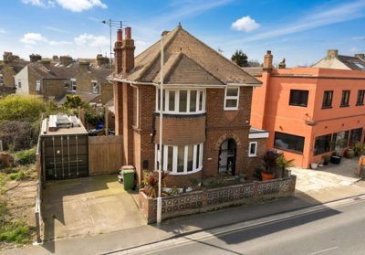
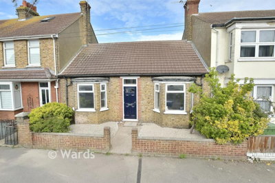
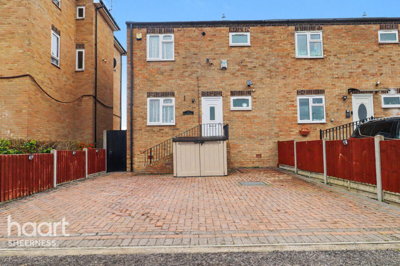
£240,000
Detached, 3 bed
Marine Parade, ME12 2BX
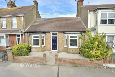
£240,000
Detached, 3 bed
Marine Parade, ME12 2BX

Compare 20 local agents, data from 148 active listings


We track 20 estate agents actively marketing properties in Sheerness, and we've ranked them all based on live listing data, market share, and average asking prices. selling a family home or a flat by the sea, finding the right agent can make a significant difference to your sale outcome.
The Sheerness property market offers diverse opportunities across property types and price points. With an average asking price of £205,706 and 148 properties currently for sale, there's strong choice for buyers and realistic pricing expectations for sellers. Our comparison tool helps you find the agent with the right local expertise for your specific property and price range.
Sheerness sits on the northern tip of the Isle of Sheppey in the Borough of Swale, Kent. With a population of 13,249 across 5,248 households, this historic port town provides affordable coastal living with excellent transport links to the mainland. The local market reflects its maritime heritage, with terraced properties dominating the housing stock and prices significantly below the national average.

20
Active Estate Agents
£205,706
Average Asking Price
148
Properties For Sale
The Sheerness housing market reflects the character of this historic port town on the Isle of Sheppey. Our data shows an average sold price of £198,500 over the last 12 months, though Land Registry figures indicate the broader ME12 area has seen prices increase by 1.82% annually to around £207,666. Property Solvers recorded 80 residential sales in Sheerness specifically, representing a 25% decrease from the previous year, while the wider ME12 postcode saw 418 sales, down 7.42% year-on-year.
The market shows notable variation between property types. Zoopla data indicates terraced properties averaged £187,614, semi-detached homes reached £250,950, and detached properties sold for around £196,750. Flats in Sheerness remain the most affordable entry point at approximately £107,500 average. These figures compare to the overall Sheerness average of £252,750 reported by Mouseprice, which sits 11.1% below the national average.
Sector-level analysis reveals interesting geographic trends within the Sheerness area. The ME12 1 sector covering Minster On Sea has seen house prices grow by 0.4% over the past year, while Sheerness-on-Sea Station saw prices surge 17% year-on-year according to Rightmove data. The Sheerness East postcode sector experienced a more modest 1% decline. These micro-market differences highlight why local expertise matters when choosing an estate agent who understands your specific neighbourhood.
Transaction data from Quealy & Co confirms houses dominate sales at 96% of transactions, with flats comprising only 4% of the market. This aligns with Sheerness's character as a working port town where terraced and semi-detached housing predominates. The limited flat stock reflects the town's historical development pattern, though for those seeking affordable entry points, one-bedroom flats at around £105,000 represent the most accessible route onto the property ladder in this coastal location.
Based on 79 live listings with an average asking price of £224,209.
Source: home.co.uk
See which agents are selling fastest and at the best prices in Sheerness.
Compare Estate Agents FreeCurrent listing data reveals the make-up of Sheerness's available stock. Terraced properties dominate the market with 72 listings, representing the largest segment, followed by 58 properties classified as "Other" which typically includes larger period homes and unconventional layouts. Three-bedroom properties are the most prevalent with 81 listings, reflecting strong demand from families and first-time buyers looking for practical accommodation at accessible price points.
The two-bedroom sector offers 39 listings at an average of £179,692, while four-bedroom homes provide more space with 13 properties averaging £249,231. One-bedroom properties, ideal for first-time buyers or investors, number just 8 listings at an average of £105,000. This distribution shows a market firmly focused on practical family housing rather than premium or luxury segments.
Price segmentation shows the majority of listings fall within the £100,000 to £300,000 range, with 67 properties in this bracket. Only 12 properties exceed £300,000, while 7 properties are priced under £100,000. This pricing structure makes Sheerness particularly attractive for first-time buyers and those seeking affordable coastal living without the premium prices found in more fashionable seaside locations.
Sheerness sits on the northern tip of the Isle of Sheppey in the Borough of Swale, Kent. With a population of 13,249 across 5,248 households according to the 2021 Census, the town offers a close-knit community feel with average household sizes of 2.5 persons. The town's maritime heritage remains central to its identity, with the Port of Sheerness continuing as a significant employer and the historic Royal Navy dockyard, though closed in 1960, leaving a lasting legacy on the local area.
The geological landscape around Sheerness presents unique considerations for property buyers. The area around Sheerness Docks is entirely underlain by London Clay Formation and alluvium, including tidal river deposits. Notably, this clay lies permanently below sea level, meaning properties in the area are not typically liable to seasonal shrink-swell movement that causes foundation problems in other clay-rich areas of the South East. This is a positive factor for structural integrity, though buyers should still obtain appropriate surveys.
Flood risk requires consideration in this coastal location. While current flood warnings show very low risk, Sheerness falls within a designated Flood Warning Area for coastal flooding, encompassing Minster, Queenborough, and surrounding areas. Historical alerts have affected areas near Scrapsgate Drain and Warden Bay Drain. Properties in lower-lying areas near the coast should be viewed with appropriate caution and prospective buyers should consider flood risk in their decision-making process.
Sheerness boasts 51 listed buildings, including one Grade I, eight Grade II*, and 42 Grade II listed properties. The Sheerness - Mile Town Conservation Area protects the historic core, covering High Street, Portland Terrace, Rose Street, Broadway, Clarence Row, Beach Terrace, Beach Street, and Wood Street. This heritage adds character to certain neighbourhoods and may affect renovation possibilities for period property owners.
The Sheerness market features a mix of national chains and established local specialists, giving sellers options across different service models and fee structures. Mann, operating as part of Countrywide UK, leads the market with 20 active listings and a 13.5% market share, focusing on properties averaging £222,000. Their national backing provides marketing reach while their Sheerness presence offers local knowledge of the town's various neighbourhoods from the harbour areas to the residential estates.
Haart, part of the Spicerhaart group, operates with 19 listings averaging £252,368, positioning them toward the upper end of the local market. Their higher average asking price suggests expertise in premium properties and larger family homes, making them suitable for sellers with semi-detached or detached properties in the £250,000-plus bracket. Your Move, operating under National Home Move, offers a different angle with 16 listings at an average of £180,844, appealing to sellers in the more affordable segment of the local market, particularly terraced properties and starter homes.
Rule & Rule Estate Agents represents the local specialist option with 12 listings averaging £184,167. Their established presence in the Sheerness area means they understand local market dynamics, including the nuances between different postcode sectors and the impact of the port town economy on buyer demand. For sellers seeking personalized service with local expertise, independent agents like Rule & Rule often provide more dedicated attention compared to larger chains managing multiple offices across wider regions.
Rental activity in Sheerness also shows healthy market participation, with 50 rental listings across 13 agents. Openrent leads the rental market with 10 listings at an average of £1,479 per month, while local specialists like Rule & Rule manage 5 rental properties averaging £1,035. This indicates strong investor interest in the area, particularly in the affordable flat sector where rental yields can be attractive.
Look at how many active listings each agent has in Sheerness. Agents with strong local presence typically have better visibility and can attract more motivated buyers from their existing applicant databases. Mann's 20 listings demonstrate significant local market penetration, while smaller operators like Quealy & Co may offer more personalized service.
Different agents use varying strategies. Consider whether you want extensive online marketing through major portals, traditional viewings, or a combination. Ask about photography quality, floor plans, and virtual tours included in their service. In Sheerness's competitive market, quality marketing can significantly impact buyer interest.
Estate agent fees in England typically range from 1% to 3% plus VAT. High-street percentage-based fees usually include more personal service and active marketing, while online fixed-fee agents may offer cost savings but require more seller involvement. In Sheerness, with properties averaging around £205,706, fees typically range from £2,469 to £7,405.
Request free valuations from at least three agents. Be wary of agents who overvalue your property to win your instruction. Realistic pricing based on local data leads to faster sales and better outcomes. Given the varying micro-market conditions across Sheerness postcode sectors, ensure valuations reflect your specific area.
Typical sole agency agreements run for 8-16 weeks. Understand the termination terms and what happens if your property doesn't sell. Multi-agency options provide broader coverage but at higher total cost. With 20 agents active in Sheerness, sellers have good options for negotiation.
The best agents in Sheerness understand micro-market differences between areas like Sheerness-on-Sea Station (up 17% year-on-year), Sheerness East (down 1%), and the conservation areas. This expertise helps price your property correctly and target appropriate buyers.
Consider negotiating agent fees, especially if your property is well-presented and priced competitively. With 20 agents competing for your business in Sheerness, you have leverage. Many agents are willing to offer reduced rates or enhanced marketing packages to secure quality instructions.
Understanding how bedroom count affects pricing helps sellers position their property correctly and helps buyers understand value within their budget. The three-bedroom sector dominates Sheerness with 81 listings averaging £218,290, representing the sweet spot for families seeking practical accommodation without premium pricing. These properties typically offer good square footage and garden space at prices significantly below the national average.
Two-bedroom properties, with 39 listings at £179,692, attract first-time buyers and investors alike. This segment includes both purpose-built flats and smaller terraced houses, offering entry points starting around £105,000 for one-bedroom properties. The one-bedroom category, though limited with only 8 listings, represents the most affordable route into Sheerness ownership at approximately £105,000 average.
The four-bedroom market, comprising 13 listings at £249,231, serves larger families requiring additional space. These properties command premium pricing over three-bedroom homes, though the premium is more modest in Sheerness compared to national averages. Five and six-bedroom properties are rare, with just 4 combined listings, reflecting the town's position as an affordable coastal location rather than a premium market.
New build activity in the immediate Sheerness area remains limited, with most recent development occurring in the neighbouring town of Minster-on-Sea. The Shurland Park development by Jones Homes offers 2, 3, and 4-bedroom houses priced from £295,000 to £445,000 in ME12 3SN. Blake Gardens by Matthew Homes provides additional new build options in the same area, while Persimmon Homes' Ovinia Chase offers further selection.
Within Sheerness itself, new build availability is sparse, meaning buyers seeking newer properties may need to consider the surrounding areas of the Isle of Sheppey or accept the character and potential maintenance requirements of the town's substantial older housing stock. The predominance of existing properties means that for most buyers and sellers, the choice lies within the terraced and semi-detached properties that define Sheerness's residential character.
Given the limited new build stock, prospective buyers should consider the age of Sheerness's housing when making purchasing decisions. Properties built before 1919 may require more detailed surveys to assess structural condition, while post-war properties generally offer more modern construction standards. A RICS Level 2 survey is suitable for conventional properties in Sheerness, though older or non-standard properties may benefit from the more comprehensive RICS Level 3 Building Survey.

79 properties currently listed across Sheerness. Here are the most recently added.
£240,000
Detached, 3 bed
Marine Parade, ME12 2BX
£240,000
Detached, 3 bed
Marine Parade, ME12 2BX
£220,000
Terraced, 3 bed
Alma Road, ME12 2PA
£220,000
Terraced, 3 bed
Alma Road, ME12 2PA
£130,000
End of Terrace, 2 bed
Invicta Road, ME12 2SU
£130,000
End of Terrace, 2 bed
Invicta Road, ME12 2SU
£185,000
Terraced, 2 bed
James Street, ME12 2QE
£185,000
Terraced, 2 bed
James Street, ME12 2QE
£300,000
Terraced Bungalow, 3 bed
ME12 2QP
£300,000
Terraced Bungalow, 3 bed
ME12 2QP
£198,500
Terraced Bungalow, 4 bed
ME12 2QP
£198,500
Terraced Bungalow, 4 bed
ME12 2QP
£135,000
Semi-Detached, 3 bed
Victoria Street, ME12 1YB
£135,000
Semi-Detached, 3 bed
Victoria Street, ME12 1YB
£140,000
Semi-Detached, 3 bed
Alder Close, ME12 1JW
£140,000
Semi-Detached, 3 bed
Alder Close, ME12 1JW
£260,000
End of Terrace, 3 bed
Davie Close, ME12 1EP
£260,000
End of Terrace, 3 bed
Davie Close, ME12 1EP
£240,000
Terraced, 3 bed
Alexandra Road, ME12 2AT
£240,000
Terraced, 3 bed
Alexandra Road, ME12 2AT
£250,000
Terraced, 3 bed
Queensway, ME12 1LD
£250,000
Terraced, 3 bed
Queensway, ME12 1LD
£240,000
Terraced, 3 bed
Granville Road, ME12 1QP
£240,000
Terraced, 3 bed
Granville Road, ME12 1QP
Get free, no-obligation valuations from the top-performing local agents. Compare fees, services, and track records before you decide.
Compare Agents FreeBased on current market share data, Mann leads with 13.5% of the market and 20 active listings, followed by Haart at 12.8% and Your Move at 10.8%. However, the best agent depends on your property type and price point. Haart focuses on higher-value properties averaging £252,368, while Your Move suits those in the £180,844 average bracket. Rule & Rule offers established local expertise for sellers preferring personalized service from an independent local agent.
Estate agent fees in England typically range from 1% to 3% plus VAT (1.2% to 3.6% total). In Sheerness, with properties averaging around £205,706, this translates to roughly £2,469 to £7,405 in fees. High-street agents like Mann and Haart generally charge percentage-based fees, while online agents such as Yopa and Homewise offer fixed-fee alternatives starting around £999-£1,999. With 20 agents competing for business, sellers often have room to negotiate.
The data shows mixed trends depending on the source and timeframe. Property Solvers reports a 2.77% annual increase in ME12, while some sources indicate a 16.8% fall in sold prices. Rightmove shows Sheerness-on-Sea Station up 17% year-on-year but Sheerness East down 1%. Overall, the market appears relatively stable with modest growth in some sectors and slight softening in others, typical of smaller coastal towns. The ME12 area saw 418 sales in the past year, down 7.42% from the previous year.
Sheerness offers affordable coastal living with a population of 13,249. The town has a maritime heritage, 51 listed buildings, and a conservation area protecting its historic core around High Street and Wood Street. The Port of Sheppey provides local employment, while residents benefit from relative affordability compared to nearby towns. The town's coastal location means flood risk should be considered, though current risk levels are generally low except during severe weather events. Amenities include shops, schools, and direct transport links to the mainland via the Sheerness-on-Sea railway station.
Terraced properties dominate the Sheerness market with 72 of 148 current listings, followed by other property types at 58 listings. Flats comprise only 9 listings, while semi-detached homes are surprisingly scarce at just 6 listings and detached properties rarest at 3. This reflects the town's working-class heritage and affordable housing stock, with three-bedroom terraced homes being the predominant property type. Houses account for 96% of all sales, with flats comprising just 4% of transactions.
GetAgent data indicates properties in Sheerness spend an average of 15 weeks on the market. This timeframe can vary significantly based on pricing, property type, and how well the property is presented. Realistically priced properties in good condition in popular areas like Sheerness-on-Sea Station tend to sell faster, while overpriced or poorly presented homes may linger. Given the 25% year-on-year decrease in sales volume reported by Property Solvers, pricing competitively is particularly important in the current market.
Online estate agents like Yopa, Homewise, and Express Estate Agency operate in Sheerness with lower fixed fees typically between £999 and £1,999. These suit sellers comfortable handling viewings and negotiations themselves. Traditional high-street agents like Mann, Haart, and Rule & Rule provide more hands-on service including viewings, negotiations, and marketing expertise, but at higher percentage-based fees. For unique or premium properties, local expertise often proves valuable, and with the varied micro-market conditions across Sheerness postcode sectors, local knowledge can significantly impact sale outcomes.
Standard surveys include RICS Level 2 (Homebuyer Report) suitable for conventional properties in Sheerness, typically costing £400-£600 depending on property size and value. For older properties, particularly those over 50 years old or with visible defects, a RICS Level 3 (Building Survey) provides more detailed structural assessment. Given Sheerness's coastal location and mix of older properties, a thorough survey is advisable to identify any specific issues related to the local geology (London Clay and alluvium), flood risk considerations, or the condition of period buildings. Properties in conservation areas may require additional specialist assessments.
From £450
Recommended for conventional properties in Sheerness. Identifies common defects in terraced and semi-detached homes.
From £600
Comprehensive survey for older properties, period homes, or properties showing signs of structural movement.
From £60
Required by law before selling. Energy performance certificate for your Sheerness property.
From £150
Official valuation for Help to Buy, shared ownership, or mortgage purposes.
Estate Agents In London

Estate Agents In Plymouth

Estate Agents In Liverpool

Estate Agents In Glasgow

Estate Agents In Sheffield

Estate Agents In Edinburgh

Estate Agents In Coventry

Estate Agents In Bradford

Estate Agents In Manchester

Estate Agents In Birmingham

Estate Agents In Bristol

Estate Agents In Oxford

Estate Agents In Leicester

Estate Agents In Newcastle

Estate Agents In Leeds

Estate Agents In Southampton

Estate Agents In Cardiff

Estate Agents In Nottingham

Estate Agents In Norwich

Estate Agents In Brighton

Estate Agents In Derby

Estate Agents In Portsmouth

Estate Agents In Northampton

Estate Agents In Milton Keynes

Estate Agents In Bournemouth

Estate Agents In Bolton

Estate Agents In Swansea

Estate Agents In Swindon

Estate Agents In Peterborough

Estate Agents In Wolverhampton

Compare 20 local agents, data from 148 active listings
Find AgentsHomemove is a trading name of HM Haus Group Ltd (Company No. 13873779, registered in England & Wales). Homemove Mortgages Ltd (Company No. 15947693) is an Appointed Representative of TMG Direct Limited, trading as TMG Mortgage Network, which is authorised and regulated by the Financial Conduct Authority (FRN 786245). Homemove Mortgages Ltd is entered on the FCA Register as an Appointed Representative (FRN 1022429). You can check registrations at NewRegister or by calling 0800 111 6768.
We use cookies to show you personalised content and improve your experience of our website. Find out more in our Privacy policy and Cookie policy.