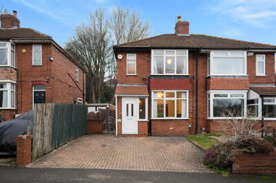
£250,000
Semi-Detached, 3 bed
Loxley Road, S6 4TJ
£250,000
Semi-Detached, 3 bed
Loxley Road, S6 4TJ

Compare 65 local agents, data from 768 active listings


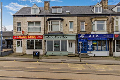
We track 65 estate agents actively marketing properties in the S6 postcode area of Sheffield, and we have ranked them all based on live listing data, market share, and average asking prices. Whether you are selling a family home in Hillsborough, a terraced house in Crookes, or a flat in Walkley, our comparison tool helps you find the agent with the right local expertise for your specific property type and neighbourhood.
The S6 housing market has shown remarkable resilience with a 2.3% annual rise in average house prices and an impressive 25.2% increase over the past five years. With properties taking an average of just 64 days to sell, now is an active time to instruct an agent. The area covers diverse neighbourhoods including Hillsborough, Crookes, Walkley, Stannington, Malin Bridge, and the Loxley Valley, each with distinct property types and buyer demographics. Compare quotes from multiple agents to ensure you get the best service and fee for your specific situation.

65
Active Estate Agents
£253,287
Average Asking Price
768
Properties For Sale
The S6 postcode area in Sheffield has established itself as one of the city's most sought-after residential districts, with the overall average house price standing at £219,774 according to recent Land Registry data. Houses in S6 command an average of £234,226, while flats and apartments average £145,324, reflecting the variety of property types available from Victorian terraced homes in traditional neighbourhoods to modern developments. The area has experienced consistent growth, with Rightmove data showing sold prices 2% up on the previous year and 1% above the 2023 peak of £240,703.
Over the last year, there were 676 residential property sales in S6 with a total transaction value of £177.8 million. The market saw a 3.11% increase in average property prices over the 12 months to March 2024, demonstrating strong buyer demand despite a 26.92% decrease in transaction volumes compared to the previous year. This reduction in sales volume reflects broader national trends rather than weakening demand, as properties continue to achieve competitive prices with sellers receiving an average of 95-97% of their asking price. The total value of property sales in S6 stands at £177.8 million, indicating significant activity in this sub-market.
The S6 postcode covers diverse sub-markets including Hillsborough, Crookes, Walkley, Malin Bridge, Stannington, and the Loxley Valley. Each neighbourhood offers distinct characteristics, from the family-friendly streets of Hillsborough with its excellent schools and transport connections to the artistic community in Walkley. Properties in the area are taking approximately 64 days to sell on average, indicating a healthy market where well-priced homes attract serious buyers quickly. The market breakdown shows 264 properties in the £100k-£200k range and 307 in the £200k-£300k bracket, representing the core buyer activity in this sector.
Based on 194 live listings with an average asking price of £246,473.
Source: home.co.uk
See which agents are selling fastest and at the best prices in S6 Sheffield.
Compare Estate Agents FreeTerraced properties dominate the S6 housing market, accounting for 230 of the 768 current listings, with an average asking price of £199,918. These Victorian and Edwardian terraced homes are particularly popular with first-time buyers and young families, representing excellent value compared to semi-detached properties which average £255,258. The strong terraced property sector reflects Sheffield's industrial heritage, with many homes dating back to the 1800s featuring traditional brick construction and period features that appeal to buyers seeking character. In Hillsborough specifically, as many as 45% of properties are terraced, reflecting the residential nature of this established suburb.
Semi-detached properties make up 145 of the current listings, while detached homes represent 76 properties with an average asking price of £509,131. The detached market in S6 tends to focus on family homes in quieter residential areas like Stannington and Loxley, where larger gardens and off-street parking add significant value. Flats account for 99 listings, with an average price of £134,242, providing accessible entry points to the S6 market for first-time buyers and investors alike. The bedroom distribution shows three-bedroom properties dominate with 435 listings, confirming S6 as a family-focused market where three-bed homes average £242,258.
The S6 postcode encompasses a rich of Sheffield neighbourhoods, each with its own distinct character and appeal. Hillsborough, perhaps the most well-known area within S6, offers excellent transport links via the Supertram and regular train services to Leeds and Manchester, making it ideal for commuters. The area boasts a vibrant independent shopping scene, popular pubs and restaurants, and is home to the famous Hillsborough Stadium. According to local data, as many as 45% of properties in Hillsborough are terraced, reflecting the residential nature of this established suburb. The average asking price in Hillsborough reaches £294,118 for properties marketed by premium agents like Hunters.
The district contains 180 listed buildings recorded in the National Heritage List for England, including one Grade I listed building and four Grade II listed properties. These heritage assets are concentrated in areas like Bradfield, Dungworth, and Stannington, where traditional stone cottages and Georgian farmhouses contribute to the area's architectural diversity. Sheffield City Council's Urban Design Compendium emphasises the preservation of places with architectural or historical value, and any new developments within these conservation areas must respect their historic context, protecting the character that makes S6 distinctive. Properties in these heritage areas may require specialist surveys due to their unique construction and historical significance.
The geography of S6 creates both opportunities and considerations for property owners. The area sits within the eastern foothills of the Pennines, with the River Don and its tributaries including the Loxley, Porter Brook, Rivelin, and Sheaf flowing through various parts of the postcode. While flood risk is very low for most S6 postcodes, properties in the Loxley Valley and areas near watercourses should consider flood risk assessments. Sheffield's mining heritage, particularly in the eastern parts of the city, means some areas may have historical ground stability considerations that a RICS survey can identify. The exposed coalfield ends in the east of Sheffield, where a band of Magnesian Limestone stretches, and the dip of coal seams from west to east meant shallow mining was common in certain areas.
The S6 market features a diverse mix of estate agents ranging from established high-street brands to modern online-only operators. Morfittsmith leads the market with 79 active listings and a 10.3% market share, focusing on properties averaging £234,550. This local independent has established strong presence across Sheffield's western suburbs and offers comprehensive marketing services including professional photography, virtual tours, and extensive local knowledge that comes from operating specifically within the S6 and surrounding areas. Their average rental price of £878 across 8 listings also shows strength in the lettings market.
For sellers targeting the premium end of the market, Hunters operates in both Hillsborough and Crookes with 34 and 20 listings respectively, commanding the highest average asking price among major agents at £294,118 in their Hillsborough office. Their Crookes office targets the student and young professional market with properties averaging £213,500. Hughes Family Estate Agents holds a 5.5% market share with properties averaging £276,427, positioning themselves in the middle-to-upper market segment where they benefit from strong local recommendations and community presence. Their average rental price of £994 is the highest among rental agents, indicating focus on premium lettings.
When choosing between agents, consider their specific track record in your neighbourhood rather than overall brand reputation. Saxton Mee operates from both Hillsborough and Crookes with a combined 78 listings across both offices, while Blundells focuses on the Hillsborough market with 43 listings averaging £220,814. Online agents like Yopa with 19 listings averaging £220,895 and Purplebricks with 13 listings averaging £187,077 also operate in S6, offering lower fixed fees that may suit sellers in lower price brackets, though they typically provide less hands-on support than traditional high-street agents. For rental properties, Henry Spencer (part of Saxton Mee) offers 6 listings averaging £865, while Nicholas Humphreys provides 5 listings at £980 average.
Look for agents with strong market share in your specific S6 neighbourhood, whether Hillsborough, Crookes, Walkley, or Stannington. Check their current listings and recent sales to ensure they have experience with your property type. Agents like Morfittsmith dominate the overall market, while specialists like Hunters command premium pricing in specific areas.
Request free valuations from at least three agents. Be wary of agents who overpromise on asking price to win your business. A realistic valuation leads to faster sales and often higher final prices. In the S6 market, we typically see asking prices ranging from £175,208 to £294,118 depending on the agent's specialism and target market segment.
Ask about their marketing approach including photography quality, virtual tours, floor plans, and online presence. In a competitive market like S6, premium marketing helps your property stand out. Properties with professional photography and virtual tours typically attract more viewings and sell faster than those with basic listings.
Estate agent fees in England typically range from 1% to 3% plus VAT. High-street agents like Morfittsmith and Saxton Mee generally charge percentage-based fees, while online agents like Yopa and Purplebricks offer fixed-fee packages typically between £999 and £1,999. The average fee is around 1.5% plus VAT, but this varies based on the level of service and whether you choose sole agency or multi-agency representation.
Sole agency agreements typically run for 8-16 weeks. Understand the notice period and what happens if you need to switch agents. Multi-agency agreements allow you to instruct multiple agents but typically charge higher fees. Ensure you understand exactly what services are included and what happens if your property does not sell within the agreed period.
Do not accept the first fee quoted. Agents are often willing to negotiate, particularly if you have multiple quotes from competing agencies in the S6 area. Some will match competitors' fees or offer bundled services including survey referrals, mortgage advice, or enhanced marketing packages at no additional cost.
Before instructing any estate agent, request a free valuation from at least three companies. In the S6 market, we typically see asking prices ranging from £175,208 to £294,118 depending on the agent's specialism. Getting multiple valuations ensures you understand your property's true market value and gives you leverage when negotiating fees.
Understanding the bedroom distribution in S6 helps sellers position their property correctly and buyers identify value opportunities. Three-bedroom properties dominate the market with 435 active listings averaging £242,258, representing the core family home segment where competition is strongest. These three-bed terraced and semi-detached homes in areas like Hillsborough and Crookes attract strong demand from young families seeking room to grow without stretching to detached property prices. Properties in this bracket typically sell within the 64-day average timeframe when priced correctly.
Two-bedroom properties offer the best entry point to the S6 market with 190 listings averaging £171,228. These properties appeal to first-time buyers, couples, and investors, with many terraced houses and flats available at accessible price points. The one-bedroom market is smaller with 42 listings averaging £99,333, primarily consisting of flats and starter homes ideal for buy-to-let investors or those downsizing. This segment has seen increased activity from investors seeking to capitalise on Sheffield's growing rental demand, with agents like Hunters and Nicholas Humphreys reporting strong tenant interest.
At the premium end, four-bedroom properties command significant premiums with 63 listings averaging £435,714, while five-bedroom homes average £532,059 across 17 listings. The S6 market also includes a small number of larger properties with six bedrooms averaging £950,395, typically located in sought-after areas like Stannington or Loxley where buyers can access larger plots and rural views. For sellers, the data suggests three-bedroom properties sell fastest in current market conditions, while larger homes may require more patient marketing. The £300k-£500k price bracket contains 126 listings, showing strong activity in the mid-to-upper market despite broader economic uncertainty.
194 properties currently listed across S6 Sheffield. Here are the most recently added.
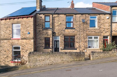
£250,000
Semi-Detached, 3 bed
Loxley Road, S6 4TJ
£250,000
Semi-Detached, 3 bed
Loxley Road, S6 4TJ
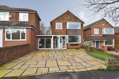
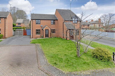
£375,000
Detached, 3 bed
Marchwood Road, S6 5LE
£375,000
Detached, 3 bed
Marchwood Road, S6 5LE
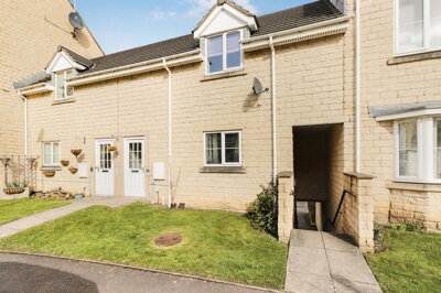
£190,000
Terraced, 2 bed
Queenswood Road, S6 1RU
£190,000
Terraced, 2 bed
Queenswood Road, S6 1RU
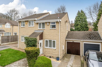
£185,000
Semi-Detached, 2 bed
Edge Close, S6 1ER
£185,000
Semi-Detached, 2 bed
Edge Close, S6 1ER
£230,000
Terraced, 2 bed
Rivelin Street, S6 5DL
£230,000
Terraced, 2 bed
Rivelin Street, S6 5DL
£200,000
Semi-Detached, 2 bed
Midvale Close, S6 3HL
£200,000
Semi-Detached, 2 bed
Midvale Close, S6 3HL
£250,000
Terraced, 3 bed
Parkside Road, S6 2AA
£250,000
Terraced, 3 bed
Parkside Road, S6 2AA
£300,000
Semi-Detached, 3 bed
Hollins Lane, S6 5GQ
£300,000
Semi-Detached, 3 bed
Hollins Lane, S6 5GQ
£240,000
Flat, 5 bed
Langsett Road, S6 2LL
£240,000
Flat, 5 bed
Langsett Road, S6 2LL
£290,000
Town House, 3 bed
Stannington Road, S6 5FP
£290,000
Town House, 3 bed
Stannington Road, S6 5FP
£75,000
Flat, 1 bed
Infirmary Road, S6 3DH
£75,000
Flat, 1 bed
Infirmary Road, S6 3DH
£170,000
House, 3 bed
Industry Street, S6 2WU
£170,000
House, 3 bed
Industry Street, S6 2WU
Get free, no-obligation valuations from the top-performing local agents. Compare fees, services, and track records before you decide.
Compare Agents FreeBased on current market share data, Morfittsmith leads the S6 market with 10.3% market share and 79 active listings, followed by Saxton Mee with 6.8% and Blundells with 5.6%. However, the best agent depends on your property type and location - Hunters commands the highest average asking prices at £294,118 in Hillsborough while Reeds Rains focuses on more affordable properties averaging £189,167. We recommend getting valuations from multiple agents to find the best match for your specific property and neighbourhood, as different agents specialise in different segments of the S6 market.
Estate agent fees in England typically range from 1% to 3% plus VAT (1.2% to 3.6% total). In the S6 market, high-street agents like Morfittsmith and Saxton Mee generally charge percentage-based fees, while online agents like Yopa and Purplebricks offer fixed-fee packages typically between £999 and £1,999. The average fee is around 1.5% plus VAT, but this varies based on the level of service, your property value, and whether you choose sole agency or multi-agency representation. For a £250,000 property, this would equate to approximately £3,750 in fees at the average rate.
Yes, the S6 housing market has shown steady growth with a 2.3% annual increase in average house prices as of late 2024. Over the past five years, prices have risen by an impressive 25.2%, significantly outpacing inflation. Rightmove data shows sold prices are 2% up on the previous year and 1% above the 2023 peak of £240,703. The market remains competitive with properties taking an average of just 64 days to sell, indicating strong buyer demand. Despite transaction volumes decreasing by 26.92% compared to the previous year, prices have remained resilient due to continued demand outstripping supply in most segments.
S6 offers excellent quality of life with diverse neighbourhoods to suit different lifestyles. Hillsborough provides outstanding transport links via Supertram and train services to Leeds and Manchester, along with independent shops, cafes, and the famous Hillsborough Stadium. Crookes and Walkley have vibrant artistic communities with period housing stock, attracting young professionals and creative families. The area benefits from proximity to the Peak District, excellent schools including King Edward VII and Silverdale, and the cultural amenities of central Sheffield while maintaining a more residential, community-focused atmosphere. The 180 listed buildings in the area, including one Grade I and four Grade II properties, reflect the historical character that residents value.
Three-bedroom terraced and semi-detached properties dominate the S6 market, representing 435 of 768 current listings. These family homes sell fastest, typically taking around 64 days to find buyers. Terraced properties average £199,918 while three-bed semi-detached properties command higher prices averaging £255,258. Flats provide accessible entry points at £134,242 average, while detached homes in areas like Stannington and Loxley appeal to buyers seeking larger gardens and premium specifications. The 230 terraced listings represent the strongest segment by volume, consistent with Hillsborough where 45% of properties are terraced houses.
Properties in S6 are taking an average of 64 days to sell from listing to completion, according to recent market data. This represents a healthy market where well-priced properties attract serious buyers relatively quickly. The actual time can vary significantly depending on property type, asking price, and marketing quality. Three-bedroom properties in popular areas like Hillsborough and Crookes typically sell fastest, while larger detached homes in premium locations may require more patient marketing. Properties priced realistically from the outset tend to sell within the average timeframe, while those requiring price reductions can take considerably longer.
The S6 area has several considerations worth noting. Parts of S6, particularly near the Loxley Valley and other watercourses, have some flood risk from the River Don and its tributaries, so flood risk assessments are recommended for properties in these areas. Sheffield's historical coal mining activity means some areas may have ground stability considerations - a RICS Level 2 survey can identify potential subsidence risks. The area also contains 180 listed buildings, with one Grade I and four Grade II properties, some in conservation areas which may have restrictions on modifications. Properties in the eastern parts of S6 near former coal mining areas should be subject to specific surveys checking for ground stability.
Given S6's mix of older properties, many dating from the Victorian and Edwardian periods, we strongly recommend a RICS Level 2 Survey for most buyers. These surveys typically cost between £416 and £639 depending on property size and value. Older properties in S6 may have issues including damp, roof condition concerns, outdated electrics, and potential ground stability issues from historical mining activity. A survey provides and can identify issues that affect value or require expensive remediation. Properties in conservation areas or listed buildings may require more detailed RICS Level 3 surveys due to their unique construction and historical significance.
The S6 rental market shows active demand with 139 current listings across 41 rental agents. Morfittsmith leads with 8 rental listings averaging £878 per month, followed by Henry Spencer and Reeds Rains with 6 listings each. Premium rental properties commanded by Hunters average £994 per month, reflecting higher-end lettings. The average rental price across S6 sits around £865-£994 depending on property type and location, with two-bedroom properties being the most popular rental segment. Investors should note that the S6 area's strong transport links and proximity to universities make it attractive to tenants, with properties near Supertram routes commanding premium rental values.
Estate Agents In London

Estate Agents In Plymouth

Estate Agents In Liverpool

Estate Agents In Glasgow

Estate Agents In Sheffield

Estate Agents In Edinburgh

Estate Agents In Coventry

Estate Agents In Bradford

Estate Agents In Manchester

Estate Agents In Birmingham

Estate Agents In Bristol

Estate Agents In Oxford

Estate Agents In Leicester

Estate Agents In Newcastle

Estate Agents In Leeds

Estate Agents In Southampton

Estate Agents In Cardiff

Estate Agents In Nottingham

Estate Agents In Norwich

Estate Agents In Brighton

Estate Agents In Derby

Estate Agents In Portsmouth

Estate Agents In Northampton

Estate Agents In Milton Keynes

Estate Agents In Bournemouth

Estate Agents In Bolton

Estate Agents In Swansea

Estate Agents In Swindon

Estate Agents In Peterborough

Estate Agents In Wolverhampton

Compare 65 local agents, data from 768 active listings
Find AgentsHomemove is a trading name of HM Haus Group Ltd (Company No. 13873779, registered in England & Wales). Homemove Mortgages Ltd (Company No. 15947693) is an Appointed Representative of TMG Direct Limited, trading as TMG Mortgage Network, which is authorised and regulated by the Financial Conduct Authority (FRN 786245). Homemove Mortgages Ltd is entered on the FCA Register as an Appointed Representative (FRN 1022429). You can check registrations at NewRegister or by calling 0800 111 6768.
We use cookies to show you personalised content and improve your experience of our website. Find out more in our Privacy policy and Cookie policy.