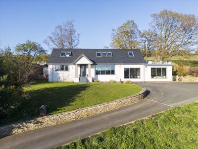
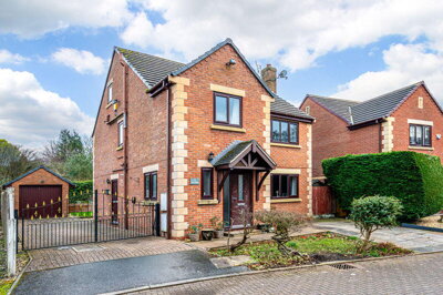
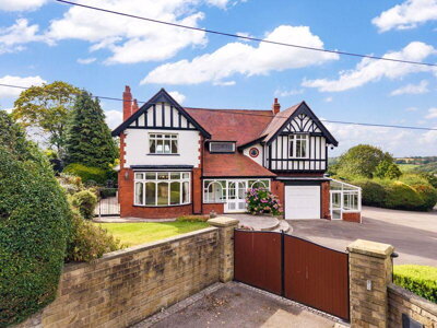
£890,000
Detached, 3 bed
Wood Lane, WN8 7TH
£890,000
Detached, 3 bed
Wood Lane, WN8 7TH

Compare 8 local agents, data from 33 active listings


We track 8 estate agents actively marketing properties in Parbold, and we've ranked them all based on live listing data, average asking prices, and market share. selling a period cottage near the Leeds and Liverpool Canal or a modern family home in this sought-after West Lancashire village, finding the right agent makes all the difference to your sale.
Parbold's property market has shown remarkable resilience, with sold prices climbing 10% year-on-year according to Land Registry data. The village offers a unique blend of Victorian and Edwardian character homes alongside prestigious new developments like The Retreat, making it an attractive location for buyers across multiple price brackets. Our comparison tool helps you connect with the agents who know this market best.
With an average asking price of £686,509 across 33 current listings, Parbold caters to everyone from first-time buyers seeking terraced homes around £220,000 to downsizers looking for substantial detached properties approaching £1 million. The agents we feature have proven track records in this specific market, and we provide free access to their contact details so you can request valuations directly.

8
Active Estate Agents
£686,509
Average Asking Price
33
Properties For Sale
The Parbold property market operates within the WN8 7 postcode sector and has demonstrated strong growth characteristics over the past year. Our data shows that the current average asking price stands at £686,509 across 33 active listings, while sold price data from the Land Registry indicates an overall average of £389,714 over the last year. This difference between asking and achieved prices reflects the typical premium that sellers hope to secure in this desirable village location, where properties regularly exceed guide prices in competitive bidding situations.
Year-on-year price trends reveal a 10% increase in sold prices compared to the previous period, though prices remain approximately 8% below the 2022 peak of £421,454. The WN8 7 sector specifically recorded a -3.0% change in the last year, with a -6.6% adjustment after accounting for inflation. These figures suggest a market that has stabilised following the post-pandemic boom, offering realistic pricing opportunities for both sellers and buyers. Over 101 sales have completed in the last 24 months, demonstrating consistent transaction volumes that underline Parbold's appeal as a residential destination.
Property type analysis reveals significant price differentiation across the housing stock. Detached properties command the highest average prices at £974,056, reflecting the premium nature of larger family homes in the area. Semi-detached homes average £326,238, while terraced properties offer more accessible entry points at £220,000. Flats represent the most affordable sector at £145,000 average, though these form a smaller proportion of the local housing stock. This spread across property types ensures that Parbold caters to diverse buyer segments, from first-time purchasers to downsizers seeking period charm.
The bedroom breakdown provides further insight for sellers pricing their properties competitively. Three and four-bedroom homes dominate the current market with 10 listings each, representing the sweet spot for families. Three-bedroom properties average £357,490, while four-bedrooms command £948,495. Five-bedroom homes form a significant premium segment with 6 listings averaging £1,062,492, while one and two-bedroom properties provide accessible entry points at £211,667 and £278,333 respectively.
Based on 13 live listings with an average asking price of £724,227.
Source: home.co.uk
See which agents are selling fastest and at the best prices in Parbold.
Compare Estate Agents FreeTransaction volumes in Parbold remain healthy, with 101 properties changing hands over the past 24 months in the WN8 7 postcode. Over the last decade, approximately 486 properties have sold in the village, indicating sustained demand that attracts both national and local estate agents to the area. The housing mix skews heavily towards detached properties at 38% of the stock, followed by semi-detached homes at 31%, terraced properties at 22%, and smaller proportions of flats and other accommodation types.
New build activity has been particularly notable with The Retreat development by P J Livesey Group on Lancaster Lane. This flagship scheme transforms the former Convent of Notre Dame into a collection of converted heritage homes and newly constructed properties. The development offers everything from three-bedroom semi-detached houses like The Rufford at £549,950 to substantial six-bedroom detached homes like The Wyfold at £1,750,000. The conversion of Lancaster House, a Victorian villa built in 1845, demonstrates the premium that buyers place on period character combined with modern specifications.
Beyond The Retreat, the wider West Lancashire area continues to see new housing development, though Parbold itself maintains its village character through strict planning controls and the presence of 15 listed buildings within the civil parish. These include notable structures such as Manor Cottage, a 17th-century sandstone farmhouse, and Parbold Hall, an early-to-mid 18th-century residence with earlier remains. The conservation of such heritage assets ensures that new developments integrate sensitively with the established streetscape, preserving the architectural integrity that makes Parbold distinctive.
Parbold sits in the West Lancashire district, approximately 4 miles from Ormskirk and within easy reach of Wigan and Southport. The village owes much of its character to the local red sandstone, known as Parbold stone, which features prominently in historical buildings including Parbold railway station and St. Anne's Church. This distinctive geological heritage creates a warm, earthy palette throughout the conservation areas and around the village centre, where independent shops, cafes, and traditional pubs serve the local community. The Leeds and Liverpool Canal passes through the village, adding to its scenic appeal and providing popular walking and cycling routes.
Demographically, Parbold supports a population of around 2,412 residents according to Census 2021 data, with estimates suggesting a slight decline to approximately 2,369 by 2024. The village functions primarily as a commuter settlement, with brilliant transport links connecting residents to major employment centres in Wigan, Ormskirk, and beyond. The railway station on the Manchester to Southport line provides regular services, while road connections via the A5209 and proximity to the M6 motorway make car travel straightforward. This accessibility explains why Parbold remains popular with professionals seeking village living without sacrificing city access.
Local schools in Parbold and the surrounding area perform well, with primary schools serving the village and secondary options in nearby Ormskirk attracting families to the area. The community hosts various events throughout the year, and the village benefits from active local groups catering to diverse interests. For buyers with school-age children, the presence of good educational options significantly influences property demand in this area, with catchment areas playing an important role in purchase decisions.
Prospective buyers should be aware of specific local considerations when purchasing in Parbold. The village sits within a flood risk zone associated with the River Douglas, particularly affecting low-lying properties on the right bank downstream of Canal Bridge, including areas known as Burnside, Bankside, and Northdene. The British Geological Survey indicates that while shrink-swell soils are less problematic here than in south-east England, the underlying sandstone geology means foundations should be checked during surveys. Additionally, Parbold lies on the western edge of the South Lancashire coalfield, meaning a specialist mining search is advisable for older properties to assess any potential subsidence risks.
Selecting the right estate agent in Parbold requires understanding the local market dynamics and each agent's area of expertise. Arnold & Phillips, based in Ormskirk, leads the market with 10 active listings representing a 30.3% market share and an average asking price of £431,000. Their pricing strategy targets the more accessible end of the Parbold market, particularly three-bedroom semi-detached homes and terraced properties that appeal to first-time buyers and families upgrading within the village. The firm's Ormskirk base provides strong knowledge of the surrounding area and established relationships with local solicitors and mortgage advisors.
Regan & Hallworth operates from Wigan with 8 active listings and a 24.2% market share, averaging £433,744 per property. The firm competes directly with Arnold & Phillips in the mid-market sector and has built a reputation for thorough marketing and attentive customer service. Meanwhile, Maria B Evans Estate Agents focuses on the premium end of the market, with 6 listings averaging £985,833 and a market share of 18.2%. This Croston-based firm excels at selling higher-value properties, including detached homes and period houses that characterise Parbold's more exclusive neighbourhoods.
House & Heritage, part of the Arnold & Phillips group, targets the ultra-premium sector with 2 listings averaging £1,174,975. Their expertise in period properties and heritage homes makes them particularly suitable for sellers of converted heritage properties like those at The Retreat or older sandstone cottages in the village conservation areas. Armitstead Barnett from Burscough and Ben Rose from Chorley each have single premium listings, while Tracy Phillips Estates in Standish offers a unique £1,500,000 listing representing the very top end of Parbold's market.
The choice between high-street and online agents depends on your property type and personal preferences. High-street agents like those dominating the Parbold market offer face-to-face valuations, dedicated account management, and established local networks that can be invaluable for achieving the best price. Online agents typically charge fixed fees between £999 and £1,999, which can represent significant savings for properties at lower price points. However, given Parbold's average price of £686,509 and the premium nature of many homes, the personalized service and market expertise of established local agents often delivers superior results. We recommend obtaining at least three free valuations before instructing an agent to ensure you secure the best possible price and terms.
Understanding the differences between online and high-street estate agents helps you make the right choice for your Parbold property sale. Online agents operate through digital platforms, offering reduced fees typically ranging from £999 to £1,999 regardless of your property's value. This model appeals to sellers looking to minimize upfront costs, particularly for properties in the lower price brackets such as the two-bedroom homes around £278,333 or one-bedroom flats at £211,667 currently listed in the village.
High-street agents in Parbold provide comprehensive services that justify their higher fees, typically 1-3% plus VAT of the sale price. Our research shows that the leading agents in this area combine local market knowledge with established networks, handling everything from professional photography and virtual tours to negotiating with buyers and coordinating with solicitors. For a village like Parbold where period properties and premium homes dominate, this hands-on approach often results in better outcomes.
The decision depends on your circumstances. If you own a straightforward modern property in good condition and have time to manage viewings yourself, an online agent might save you money. However, for Victorian sandstone cottages, listed buildings, or premium detached homes averaging over £974,000, the expertise and marketing resources of a high-street agent with proven local success typically deliver higher final sale prices. Many sellers in Parbold find that the additional cost is an investment that pays for itself through stronger buyer interest and better negotiation outcomes.

Start by identifying agents with proven track records in Parbold. Look at their current listings, average asking prices, and how long properties typically stay on the market. Our comparison tool provides all this data in one place. Pay particular attention to agents who list properties similar to yours in style, size, and price range.
Request free valuations from at least three agents. Be wary of agents who overvalue your property to win your business, as inflated asking prices often lead to extended marketing periods and reduced final sale prices. The best agents will provide comparable sold prices and explain their pricing rationale based on current market conditions in Parbold.
Ask about each agent's marketing approach. Professional photography, virtual tours, Rightmove and Zoopla listings, and social media exposure all contribute to achieving the best price. The best agents invest in showcasing your property effectively, including staging advice and targeted online advertising that reaches the specific buyer demographic for your property type.
Examine the agency agreement carefully before signing. Most sole agency contracts run for 8-16 weeks, and you should understand the notice period, fees, and what happens if you change agents. Multi-agency options are available but typically cost 0.5-1% more in total fees. Ensure you understand exactly what's included in their service package.
Estate agent fees are negotiable, especially for higher-value properties. While the national average hovers around 1.5% plus VAT, many agents will reduce their commission for properties expected to sell quickly or for clients willing to commit to longer contracts. In Parbold's market where properties average £686,509, even a small percentage reduction represents significant savings.
Don't automatically choose the agent with the lowest fee. In Parbold's market, where properties average £686,509, a 0.5% difference in commission amounts to just £3,432. However, the right agent who understands local buyers and markets effectively could secure £10,000 or more above your asking price.
Before completing your sale, you'll need to consider what surveys potential buyers might require. In Parbold's mix of Victorian, Edwardian, and modern properties, common defects include dampness issues in period sandstone construction, roofing problems on older properties, and potential structural movement related to the local geology. The presence of 15 listed buildings in the civil parish means some properties require specialist surveys that assess heritage considerations.
For most properties in Parbold, a RICS Level 2 Home Survey (formerly HomeBuyer Report) is recommended, costing between £400 and £800 depending on property size and value. This survey identifies common defects including dampness, roofing issues, structural movement, and outdated electrical systems that affect properties across all price brackets in the village.
For listed buildings or properties over 100 years old, a more comprehensive RICS Level 3 Building Survey is advisable. Given that Parbold's older properties feature traditional construction methods including sandstone walls, lime mortar, and timber frames, a specialist survey ensures buyers understand the maintenance requirements and historical character of these homes. The mining history of the area also means older properties should be checked for any subsidence risks related to former coal workings.
13 properties currently listed across Parbold. Here are the most recently added.
£890,000
Detached, 3 bed
Wood Lane, WN8 7TH
£890,000
Detached, 3 bed
Wood Lane, WN8 7TH
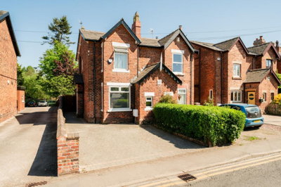
£450,000
Semi-Detached, 2 bed
Station Road, WN8 7NU
£450,000
Semi-Detached, 2 bed
Station Road, WN8 7NU
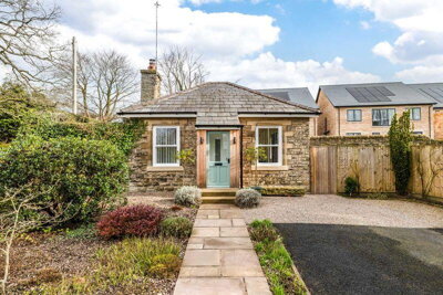
£400,000
Detached Bungalow, 1 bed
Tan House Lane, WN8 7HG
£400,000
Detached Bungalow, 1 bed
Tan House Lane, WN8 7HG
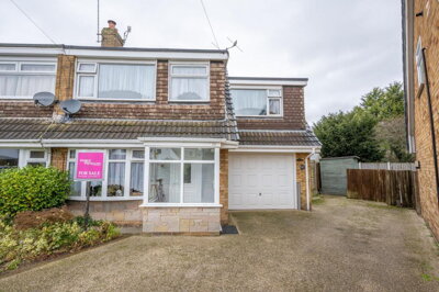
£325,000
Semi-Detached, 3 bed
Broadmead, WN8 7PB
£325,000
Semi-Detached, 3 bed
Broadmead, WN8 7PB
£625,000
Detached, 5 bed
The Heys, WN8 7DU
£625,000
Detached, 5 bed
The Heys, WN8 7DU
£779,995
Detached, 4 bed
The Common, WN8 7DA
£779,995
Detached, 4 bed
The Common, WN8 7DA
£950,000
Detached, 5 bed
Broadhey Lane
£950,000
Detached, 5 bed
Broadhey Lane
£125,000
Flat, 1 bed
Beacon Crossing, WN8 7DR
£125,000
Flat, 1 bed
Beacon Crossing, WN8 7DR
£1,350,000
Character Property, 4 bed
Parbold Hill, WN8 7TQ
£1,350,000
Character Property, 4 bed
Parbold Hill, WN8 7TQ
£695,000
House, 3 bed
Miry Lane, WN8 7TA
£695,000
House, 3 bed
Miry Lane, WN8 7TA
£999,950
Detached, 5 bed
Tan House Lane, WN8 7HG
£999,950
Detached, 5 bed
Tan House Lane, WN8 7HG

£1,100,000
Detached, 4 bed
Bradshaw Lane, WN8 7NQ
£1,100,000
Detached, 4 bed
Bradshaw Lane, WN8 7NQ
Get free, no-obligation valuations from the top-performing local agents. Compare fees, services, and track records before you decide.
Compare Agents FreeBased on our live market data, Arnold & Phillips leads with 10 active listings and 30.3% market share, followed by Regan & Hallworth with 8 listings and 24.2% market share. Maria B Evans Estate Agents holds 18.2% of the market with 6 listings focused on premium properties averaging £985,833. The top three agents collectively control over 72% of the market, meaning these firms handle the majority of transactions in the village. House & Heritage targets the ultra-premium sector for period and heritage properties.
Estate agent fees in Parbold typically range from 1% to 3% plus VAT (1.2% to 3.6% including VAT), with the national average sitting around 1.5% plus VAT. For a property at the current average asking price of £686,509, this translates to fees between £8,238 and £24,714. Many agents offer negotiable rates, particularly for higher-value properties, and some may reduce fees in exchange for longer contract terms or sole agency agreements. Online agents offer an alternative with fixed fees typically between £999 and £1,999.
Yes, sold prices in Parbold have risen 10% year-on-year according to Land Registry data, though they remain approximately 8% below the 2022 peak of £421,454. The WN8 7 postcode sector recorded a -3.0% change in the last year, suggesting the market has stabilised after the post-pandemic boom. This overall positive trend indicates strong underlying demand for Parbold properties, though buyers should expect competitive situations in the most desirable locations, particularly for period homes near the canal and modern family houses in developments like The Retreat.
Parbold offers an attractive village lifestyle with excellent commuter links to Wigan, Ormskirk, and Southport. The village features independent shops, traditional pubs, and scenic walks along the Leeds and Liverpool Canal. Local schools perform well, and the community hosts various events throughout the year. The presence of 15 listed buildings and conservation considerations help maintain the village's architectural character, while transport links make city centres accessible for work and leisure. The local red sandstone gives the village a distinctive appearance that residents particularly appreciate.
Parbold's housing stock comprises approximately 38% detached properties, 31% semi-detached, 22% terraced, and 8% flats and other types. The village features a mix of Victorian and Edwardian period homes alongside new developments like The Retreat by P J Livesey Group. Red sandstone construction is characteristic of older properties, reflecting the local geological heritage that gives Parbold its distinctive appearance. Properties range from one-bedroom flats around £145,000 to substantial six-bedroom homes exceeding £1,750,000 at The Retreat development.
Parbold has a known flood risk from the River Douglas, particularly affecting low-lying properties on the right bank downstream of Canal Bridge in areas like Burnside, Bankside, and Northdene. Surface water flooding is also a potential concern, and the local council maintains a Strategic Flood Risk Assessment. Additionally, Parbold sits on the western edge of the South Lancashire coalfield, meaning mining subsidence should be investigated for older properties. A RICS Level 2 survey will identify these risks and any other structural concerns related to the local geology and history.
For most properties in Parbold, a RICS Level 2 Home Survey (formerly HomeBuyer Report) is recommended, costing between £400 and £800 depending on property size and value. Given the village's mix of Victorian, Edwardian, and modern properties, this survey identifies common defects including dampness, roofing issues, structural movement, and outdated electrical systems. For listed buildings or properties over 100 years old, a more comprehensive RICS Level 3 Building Survey is advisable that properly assesses traditional construction methods and heritage considerations.
The time to sell varies based on pricing, property type, and market conditions. Well-priced properties in Parbold typically find buyers within 4-8 weeks, while those requiring price adjustments may take longer. Current market activity shows healthy transaction volumes with 101 sales in the last 24 months, indicating active buyer demand. Working with an experienced local agent who understands buyer preferences in the area can significantly reduce marketing times. Properties in the most popular price brackets (three and four-bedroom homes) tend to attract the strongest interest.
For Parbold's average property value of £686,509 and the premium nature of many homes, high-street agents typically deliver better results through their local expertise and personalized service. Online agents suit straightforward properties where you can manage viewings yourself. However, the difference in commission (typically 1.5% vs a fixed £999-£1,999 fee) is often justified by superior marketing, better negotiation, and stronger buyer networks that established local agents provide. We recommend getting quotes from both models before deciding.
From £400
Identify defects in Victorian, Edwardian, and modern properties common in Parbold
From £600
Comprehensive survey for older properties and listed buildings
From £60
Required by law before selling your property
From £200
If you're using government schemes to sell
Estate Agents In London

Estate Agents In Plymouth

Estate Agents In Liverpool

Estate Agents In Glasgow

Estate Agents In Sheffield

Estate Agents In Edinburgh

Estate Agents In Coventry

Estate Agents In Bradford

Estate Agents In Manchester

Estate Agents In Birmingham

Estate Agents In Bristol

Estate Agents In Oxford

Estate Agents In Leicester

Estate Agents In Newcastle

Estate Agents In Leeds

Estate Agents In Southampton

Estate Agents In Cardiff

Estate Agents In Nottingham

Estate Agents In Norwich

Estate Agents In Brighton

Estate Agents In Derby

Estate Agents In Portsmouth

Estate Agents In Northampton

Estate Agents In Milton Keynes

Estate Agents In Bournemouth

Estate Agents In Bolton

Estate Agents In Swansea

Estate Agents In Swindon

Estate Agents In Peterborough

Estate Agents In Wolverhampton

Compare 8 local agents, data from 33 active listings
Find AgentsHomemove is a trading name of HM Haus Group Ltd (Company No. 13873779, registered in England & Wales). Homemove Mortgages Ltd (Company No. 15947693) is an Appointed Representative of TMG Direct Limited, trading as TMG Mortgage Network, which is authorised and regulated by the Financial Conduct Authority (FRN 786245). Homemove Mortgages Ltd is entered on the FCA Register as an Appointed Representative (FRN 1022429). You can check registrations at NewRegister or by calling 0800 111 6768.
We use cookies to show you personalised content and improve your experience of our website. Find out more in our Privacy policy and Cookie policy.