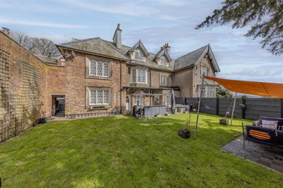
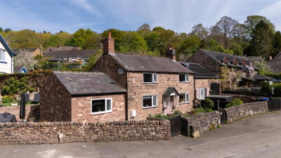
£575,000
House, 3 bed
Cheadle Road, ST10 3AN
£575,000
House, 3 bed
Cheadle Road, ST10 3AN

Compare 5 local agents, data from 11 active listings


We track 5 estate agents actively marketing properties in Oakamoor, and we've ranked them all based on live listing data. Selling a Victorian terrace along the Churnet Valley or a detached family home near the village centre, finding the right agent can make a significant difference to your sale outcome and final price. Our comparison tool puts you in touch with agents who know the local market intimately, from the conservation area around St Mary's Church to the newer developments near Oakamoor Primary School.
The Oakamoor property market presents unique opportunities and challenges. With an average asking price of £363,177 across 11 current listings, the village offers a mix of period properties and modern homes. The village sits within the Staffordshire Moorlands district, attracting buyers seeking rural life within commutable distance of Stoke-on-Trent and Stafford. Our research shows that understanding which agents dominate the local market, and what they charge, helps sellers make informed decisions about instrucing representation for their property.
selling a period cottage with original features or a modern family home, our comparison service connects you with Oakamoor's most active estate agents. We provide free access to agent contact details, allowing you to request market appraisals and compare their strategies for your specific property type. This approach ensures you find an agent whose expertise aligns with your selling goals and property characteristics.

5
Active Estate Agents
£363,177
Average Asking Price
11
Properties For Sale
The Oakamoor housing market reflects the character of this distinctive Staffordshire Moorlands village. Based on Land Registry data, house prices in Oakamoor have experienced a 6.4% adjustment over the past twelve months, which places the village within broader regional trends affecting rural communities in the Peak District fringe. The median price point recorded by Land Registry stands at £153,250, though this figure encompasses smaller properties and older stock, while larger family homes command significantly higher figures. This discrepancy between median and average prices highlights the diverse nature of Oakamoor's property stock, from modest starter homes to substantial period residences.
Property type analysis reveals clear price stratification in Oakamoor. Detached properties achieve median prices around £525,000, representing the premium segment of the market, while semi-detached homes trade at approximately £360,000. Terraced properties, which comprise the majority of sales activity according to PropertyResearch.uk data accounting for 50% of transactions, sell at a median of £245,000. These figures demonstrate the value premium that detached homes command in this desirable village setting, where buyers pay substantially for additional space and privacy. The relative strength of the terraced sector suggests strong demand from first-time buyers and investors attracted to the village's character and affordability compared to surrounding areas.
Transaction volumes in Oakamoor remain modest, as is typical for a village of its size, with approximately 306 sales reported across the broader catchment area in the past year. The limited supply of properties for sale creates conditions where well-presented homes can achieve strong prices, particularly those with character features or views over the Churnet Valley. The village's proximity to Alton Towers and its position along the B5417 tourist route also influences the market, with some buyers seeking holiday let opportunities. This seasonal tourism interest adds another dimension to the local market, potentially creating opportunities for sellers of properties suitable for holiday accommodation or investment purposes.
The Oakamoor market demonstrates resilience despite broader national fluctuations. Rightmove data suggests sold prices have remained similar to previous years, while OnTheMarket reports significant rises, indicating divergence between data sources that buyers and sellers should consider carefully. Our research indicates properties priced correctly for current market conditions continue to sell, though the modest inventory levels mean buyers have limited choice, particularly at the premium end of the market. This supply constraint favours sellers who can present their property well and price competitively within the current market context.
Based on 8 live listings with an average asking price of £448,744.
Source: home.co.uk
See which agents are selling fastest and at the best prices in Oakamoor.
Compare Estate Agents FreeAnalysis of current listings in Oakamoor shows a market weighted toward family homes. Two-bedroom properties dominate the available stock with 5 listings averaging £346,000, while three-bedroom homes account for 4 listings at an average of £328,750. Four-bedroom detached properties represent the premium end with 2 listings averaging £474,975. This distribution suggests strong demand from families seeking village life within commutable distance of Stoke-on-Trent and Stafford, with the village offering a balance of rural charm and practical connectivity to larger employment centres.
The new build market in Oakamoor itself remains extremely limited. Our research indicates no verified new build developments within the ST10 3xx postcode area, with the nearest activity occurring in surrounding villages such as Tean (Mill Place by Keepmoat Homes), Uttoxeter (Bramshall Meadows by St Modwen Homes), and Ashbourne (Ashbourne Airfield by Barratt Homes). This scarcity of newbuild stock makes existing period properties more desirable for buyers seeking character homes in a village setting, as the opportunities to purchase brand new construction in Oakamoor itself are effectively non-existent. The lack of new build development also means that the existing housing stock, much of which comprises period properties dating from the 18th and 19th centuries, carries premium value due to its relative scarcity.
Price range analysis shows Oakamoor offers properties across several market segments. The majority of listings fall within the £300,000-£500,000 range, accounting for 5 properties, while premium properties priced between £500,000-£750,000 represent 2 listings. More affordable options under £300,000 account for 4 listings, providing entry points for first-time buyers and investors. This distribution indicates a reasonably balanced market across price points, though the limited overall inventory means buyers seeking properties in specific price brackets may face constraints. Sellers in popular price brackets should note that competition from similar properties may require competitive pricing and strong marketing to attract buyer attention.
Oakamoor sits nestled in the Churnet Valley, a scenic area of Staffordshire Moorlands that attracts visitors throughout the year. The village's character is defined by its relationship with the River Churnet, which flows through the centre and has historically shaped both the local economy and the built environment. The B5417 road carries substantial tourist traffic heading to Alton Towers, particularly during peak seasons, which brings both opportunity and occasional congestion to the village. The tourism dimension influences the local economy and creates year-round activity that distinguishes Oakamoor from more isolated rural villages, with the Churnet Valley cycleway also drawing recreational visitors to the area.
The geological context of Oakamoor influences both its landscape and property characteristics. Drift geology of alluvium, comprising sand, silt, and clay, covers the area south of the River Churnet, including Mill Road and Church Bank. The northern portion of the settlement sits atop Millstone Grit, with western and southern sections resting on Lower Coal Measures Formation. Properties in areas with clay-rich soils, particularly those south of the river, may face shrink-swell risks common to clay substrates, and prospective buyers should consider this when assessing older properties. The solid geology underlying the village includes sandstone formations that have historically been quarried locally, with sandstone quarry workings located to the north-west of the settlement.
Flood risk represents a practical consideration for Oakamoor property owners. The River Churnet has a designated flood warning area encompassing The Square, Mill Road, Stoney Dale, and Red Road. A flood alert was in place as recently as February 2026, indicating ongoing flood risk awareness in the area. Anyone considering a property in these areas should review flood risk assessments and consider appropriate insurance coverage. The long-term flood risk from rivers, surface water, and groundwater warrants investigation before purchase, particularly for properties in low-lying positions near the river channel. Properties in the designated flood warning areas should factor in potential insurance implications and flood resilience measures.
Oakamoor's built environment reflects its historical significance through 16 Grade II listed buildings and a designated conservation area. Properties within the conservation area, particularly around St Mary's Church and the village centre, are subject to specific planning constraints that protect their character. These heritage designations can influence property values positively, as buyers often seek period features and historical character, but they also impose obligations regarding maintenance and alteration. The predominant building materials include stone, brick, and render, with blue clay tiles dominating the roofing, reflecting the Staffordshire pottery industry heritage. Some older properties feature roughcast brick with slate roofs or stone construction with shaped gables, adding to the architectural variety that defines the village character.
Selecting the right estate agent in Oakamoor requires understanding the local market dynamics and your specific property type. Kevin Ford and Co LTD, based in nearby Cheadle, currently leads the market with 2 active listings and an average asking price of £332,475, giving them strong presence in the mid-market segment. Their local knowledge of the Cheadle and Oakamoor areas proves valuable for properties targeting families and commuters seeking village amenities. The agent's positioning in the mid-market range makes them particularly suitable for sellers of terraced and semi-detached properties, which represent the majority of the village's housing stock and transaction activity.
John German, operating from Uttoxeter, maintains 2 listings with an average asking price of £400,000, positioning them in the premium segment of the Oakamoor market. This agent focuses on higher-value detached properties and character homes, which aligns with the village's conservation area properties and period features. Their presence in the premium segment demonstrates the village's appeal to buyers seeking higher-end rural properties, and their Derbyshire and Staffordshire coverage provides broader marketing reach for suitable properties. Sellers of character cottages and period homes may find John German's expertise particularly relevant for achieving premium prices.
Abode, covering Staffordshire and Derbyshire, also operates in Oakamoor with 2 listings averaging £370,000, offering another option for sellers targeting the upper end of the market. Their regional coverage provides access to buyers across county boundaries, potentially expanding the pool of interested parties for Oakamoor properties. The combination of local presence and broader regional marketing could benefit sellers seeking maximum exposure for their property. Their positioning at £370,000 average suggests focus on quality family homes and well-presented period properties.
For sellers seeking competitive pricing strategies, Denise White Estate Agents based in Leek offers a listing at £250,000, representing the more accessible entry point to the Oakamoor market. Their presence demonstrates the market's breadth, from entry-level properties through to premium residences. Findahome Online LTD provides another option with a £350,000 listing, demonstrating the range of agents serving this village. When choosing an agent, consider their track record with properties similar to yours, their marketing reach, and whether their fee structure suits your circumstances, whether percentage-based or fixed fee arrangements. The diversity of agents serving Oakamoor means sellers can select representation that matches their specific property type and selling priorities.
Look at which agents are actively listing properties in Oakamoor and check their average asking prices to ensure they match your property type and price expectations. Review their websites and recent activity to understand their market focus and performance.
Contact at least three agents for free valuations. Compare their suggested asking prices and marketing strategies before making your decision. Ask each agent to explain their pricing rationale and provide comparable properties that support their valuation.
Verify that any agent you consider is a member of a redress scheme (Property Redress Scheme or The Property Ombudsman) and has appropriate client money protection. These memberships protect you if things go wrong and demonstrate professional standards.
Estate agent fees in England typically range from 1% to 3% plus VAT (1.2% to 3.6% total). In the Oakamoor market, agents handling properties at higher price points may charge toward the lower end of this range due to the higher absolute commission, while some online agents offer fixed fees between £999 and £1,999. Always request a full breakdown of what's included in the fee, such as marketing, photography, and floorplans.
Ask about online marketing, Rightmove/Zoopla presence, local advertising, and whether professional photography and floorplans are included. Enquire about their social media strategy and whether they proactively target registered buyers looking for properties in Oakamoor.
Don't accept the first offer. Negotiate both the fee and the contract terms, including the sole agency period (typically 8-16 weeks for sole agency). Consider asking for a flexible contract that allows you to exit if you're dissatisfied with the service.
The top three estate agents in Oakamoor (Kevin Ford and Co, Abode, and John German) together control 54.6% of the market. This concentration means these agents have significant local reach. However, don't rule out smaller agents like Denise White or Findahome Online, as they may offer competitive fees and dedicated personal service that larger chains cannot match. The best choice depends on your specific property and selling circumstances, so obtaining multiple appraisals remains advisable.
Understanding how bedroom count affects asking prices helps sellers position their property correctly and buyers assess value. In Oakamoor's current market, two-bedroom properties represent the most common listing type with 5 properties available at an average price of £346,000. This segment attracts first-time buyers, young couples, and investors seeking rental opportunities in the village. The relatively strong representation of two-bedroom properties in the listings suggests healthy demand from buyers seeking smaller, more affordable properties in the village, though this also indicates competitive conditions for sellers in this segment.
Three-bedroom homes form another substantial segment with 4 listings averaging £328,750. These properties typically appeal to growing families and often represent good value per bedroom compared to two-bedroom properties. The slight discount per bedroom in three-bedroom homes compared to two-bedroom properties reflects the broader market dynamics in rural villages where smaller properties sometimes command premium prices relative to their size. This anomaly often occurs when first-time buyer demand is strong and supply of smaller properties is limited, driving up prices per square foot for the most affordable entry points to the market.
Four-bedroom properties in Oakamoor command the highest prices at an average of £474,975 based on 2 current listings. These premium homes typically feature larger plots, period features, and views over the Churnet Valley. The limited supply of four-bedroom properties means demand often exceeds available stock, creating opportunities for sellers of quality family homes to achieve strong prices. The premium commanded by four-bedroom properties reflects both their relative scarcity and the target market of buyers seeking substantial family homes in a village setting, often relocating from urban areas seeking improved quality of life.
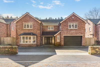
8 properties currently listed across Oakamoor. Here are the most recently added.
£575,000
House, 3 bed
Cheadle Road, ST10 3AN
£575,000
House, 3 bed
Cheadle Road, ST10 3AN
£750,000
Detached, 4 bed
Woodside View, ST10 3AU
£750,000
Detached, 4 bed
Woodside View, ST10 3AU
£265,000
Semi-Detached, 3 bed
Carr Bank, ST10 3DG
£265,000
Semi-Detached, 3 bed
Carr Bank, ST10 3DG
£250,000
End of Terrace, 2 bed
Carr Bank, ST10 3AB
£250,000
End of Terrace, 2 bed
Carr Bank, ST10 3AB
£399,950
Detached, 4 bed
Churnet View Road, ST10 3AE
£399,950
Detached, 4 bed
Churnet View Road, ST10 3AE
£350,000
Detached, 3 bed
Carr Bank, ST10 3DG
£350,000
Detached, 3 bed
Carr Bank, ST10 3DG
£650,000
Detached, 2 bed
Farley Road, ST10 3BD
£650,000
Detached, 2 bed
Farley Road, ST10 3BD
£350,000
Detached, 3 bed
Carr Bank, ST10 3DG
£350,000
Detached, 3 bed
Carr Bank, ST10 3DG
Get free, no-obligation valuations from the top-performing local agents. Compare fees, services, and track records before you decide.
Compare Agents FreeBased on current market data, Kevin Ford and Co LTD, Abode, and John German are the leading agents in Oakamoor, each holding 18.2% market share with 2 active listings. Kevin Ford and Co operates from Cheadle and focuses on properties averaging £332,475, while John German targets the premium segment at £400,000 average. The best agent for you depends on your property type and price expectations, so we recommend getting appraisals from multiple agents before instructing one. Consider your specific circumstances, whether you seek a quick sale or maximum price, and choose an agent whose experience matches your property characteristics.
Estate agent fees in England typically range from 1% to 3% plus VAT (1.2% to 3.6% total). In the Oakamoor market, agents handling properties at higher price points may charge toward the lower end of this range due to the higher absolute commission, while some online agents offer fixed fees between £999 and £1,999. Always request a full breakdown of what's included in the fee, such as marketing, photography, and floorplans. Some agents include premium services like virtual tours or targeted social media marketing within their fee, while others charge extra, so understanding precisely what you're paying for enables proper comparison between agents.
House prices in Oakamoor have experienced a 6.4% adjustment over the past twelve months according to Land Registry data. This follows broader regional trends affecting rural Staffordshire communities. However, PropertyResearch.uk data shows certain property types performing differently, with detached homes showing 34.2% year-on-year growth in 2025, while semi-detached properties increased by just 0.6%. The mixed picture suggests the market is stabilising after previous growth periods, with property type and specific location influencing individual price outcomes significantly. Buyers and sellers should examine their specific property segment rather than relying on overall averages when assessing market conditions.
Oakamoor is a charming Staffordshire Moorlands village set in the Churnet Valley, offering scenic countryside and access to outdoor activities including the Churnet Valley cycleway. The village has a primary school, local amenities, and proximity to Alton Towers, making it popular with families and tourism-related businesses. The B5417 road provides connections to Cheadle, Stoke-on-Trent, and Staffordshire beyond. The presence of 16 Grade II listed buildings and a conservation area reflect the village's architectural heritage, creating an attractive environment for buyers seeking period properties and character. The community feel, combined with access to rural pursuits and reasonable commuting options, makes Oakamoor appealing to various buyer segments from families to retirees.
Oakamoor has a flood warning area for the River Churnet, covering The Square, Mill Road, Stoney Dale, and Red Road. Properties in these areas face potential flooding during heavy rainfall and snowmelt periods. The geological conditions, particularly the alluvium (clay-rich soil) south of the river, also suggest potential for subsidence in some areas. Prospective buyers should obtain flood risk assessments and factor in appropriate insurance costs. The flood warning system provides advance notice of potential flooding, giving residents time to take preventive action, but insurance considerations should be factored into purchasing decisions in affected areas.
Currently there are 11 properties for sale in Oakamoor across all estate agents. The market consists primarily of two-bedroom and three-bedroom properties, with fewer detached family homes and very limited availability of premium four-bedroom properties. This relatively low supply creates opportunities for sellers but means buyers have limited choice, particularly at the upper end of the market. The constrained inventory levels mean well-presented properties in popular price brackets can attract multiple viewings and competitive offers, while buyers may need to act quickly when suitable properties become available.
Online estate agents can offer cost savings through fixed fees, typically between £999 and £1,999, compared to percentage-based fees from high-street agents. However, local agents like Kevin Ford and Co or John German offer valuable on-the-ground knowledge of the Oakamoor market, existing relationships with local buyers, and personal service that online agents cannot match. For premium properties or period homes in the conservation area, a local specialist often delivers better results. The decision depends on your priorities - cost savings versus local expertise and hands-on service - and the nature of your property, with complex or high-value sales often benefiting from traditional agent representation.
Terraced properties accounted for 50% of recent sales in Oakamoor, making them the most common transaction type. Detached homes command the highest prices at around £525,000 but represent a smaller portion of sales. Properties with character features, period details, and views over the Churnet Valley attract strong interest. Given the limited new build supply in the village, existing quality homes in good condition tend to sell well, particularly those priced appropriately for the current market. The strong terraced sales reflect both affordability and demand from first-time buyers entering the market, while the premium for detached properties demonstrates continued demand for spacious family homes in the village.
When selecting an estate agent in Oakamoor, prioritise local market knowledge and track record with similar properties. Verify they are members of The Property Ombudsman or Property Redress Scheme for consumer protection. Ask about their marketing strategy, including Rightmove and Zoopla presence, professional photography, and floorplan provision. Compare at least three agents in terms of their suggested asking price, marketing approach, and fee structure, including contract terms and sole agency periods. The right agent should demonstrate understanding of the Oakamoor market, including awareness of local factors like flood risk areas and conservation constraints that may affect your sale.
From £400
Identify issues before selling with our detailed RICS Level 2 Survey
From £600
Comprehensive structural survey for older or complex properties
From £60
Energy Performance Certificate required for all property sales
From £250
Official valuation for Help to Buy equity loan requirements
Estate Agents In London

Estate Agents In Plymouth

Estate Agents In Liverpool

Estate Agents In Glasgow

Estate Agents In Sheffield

Estate Agents In Edinburgh

Estate Agents In Coventry

Estate Agents In Bradford

Estate Agents In Manchester

Estate Agents In Birmingham

Estate Agents In Bristol

Estate Agents In Oxford

Estate Agents In Leicester

Estate Agents In Newcastle

Estate Agents In Leeds

Estate Agents In Southampton

Estate Agents In Cardiff

Estate Agents In Nottingham

Estate Agents In Norwich

Estate Agents In Brighton

Estate Agents In Derby

Estate Agents In Portsmouth

Estate Agents In Northampton

Estate Agents In Milton Keynes

Estate Agents In Bournemouth

Estate Agents In Bolton

Estate Agents In Swansea

Estate Agents In Swindon

Estate Agents In Peterborough

Estate Agents In Wolverhampton

Compare 5 local agents, data from 11 active listings
Find AgentsHomemove is a trading name of HM Haus Group Ltd (Company No. 13873779, registered in England & Wales). Homemove Mortgages Ltd (Company No. 15947693) is an Appointed Representative of TMG Direct Limited, trading as TMG Mortgage Network, which is authorised and regulated by the Financial Conduct Authority (FRN 786245). Homemove Mortgages Ltd is entered on the FCA Register as an Appointed Representative (FRN 1022429). You can check registrations at NewRegister or by calling 0800 111 6768.
We use cookies to show you personalised content and improve your experience of our website. Find out more in our Privacy policy and Cookie policy.