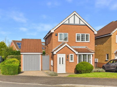
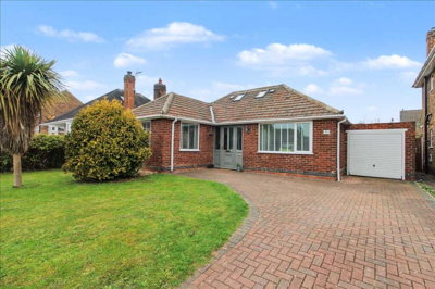
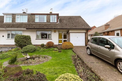
£325,000
Detached, 3 bed
Greenford Close, NG16 1RH
£325,000
Detached, 3 bed
Greenford Close, NG16 1RH

Compare 19 local agents, data from 106 active listings


We track 19 estate agents actively marketing properties in Nuthall, and we've ranked them all based on live listing data, market share, and average asking prices. selling a family home in the conservation area or a modern property on the Hempshill estate, finding the right agent can make a significant difference to your sale outcome.
Nuthall's property market offers a diverse range of housing, from period stone cottages along Nottingham Road to contemporary detached homes on the Mornington Estate. With an average asking price of £362,538 and 106 properties currently for sale, the village maintains strong demand thanks to its excellent transport links, good schools, and high rate of home ownership at 82.8 percent. Our comparison tool helps you find the agent with the right local expertise and market reach for your property.

19
Active Estate Agents
£362,538
Average Asking Price
106
Properties For Sale
19
Agents Tracked
£306,000 - £475,000
Price Range
We've ranked every estate agent in the area based on live listing data. See who comes out on top.
See Who's #1 - Compare Agents FreeOur data shows that Nuthall's property market has experienced notable activity, with sold prices averaging around £272,000 to £278,000 according to recent Land Registry and Zoopla figures. This represents a 5 percent decline compared to the previous year and sits slightly below the 2023 peak of £282,121, indicating a market that has stabilised after a period of growth. The broader Nottingham postcode area (NG) recorded approximately 14,400 property sales between January and December 2025, though transaction volumes have dropped by around 15 percent over the past twelve months, reflecting broader national trends.
When examining specific postcode sectors within and around Nuthall, the market reveals nuanced performance patterns that differ from the overall averages. Properties in the detached category command the highest prices, with our current listings showing averages around £414,817, while semi-detached properties average approximately £243,462. The village's position within the Kimberley housing sub-market, which the Nuthall Neighbourhood Plan projects will provide up to 600 new homes by 2028, suggests continued development pressure and evolving market dynamics.
For sellers, understanding the distinction between asking and sold prices is crucial for realistic pricing expectations. Our live listing data shows that Nuthall properties are currently marketing at an average of £362,538, which represents a premium over recent sold prices. This gap can be attributed to seller optimism and the typical negotiation process, where properties often sell for 95 to 98 percent of their asking price in the current market conditions.
Based on 53 live listings with an average asking price of £377,453.
Source: home.co.uk
See which agents are selling fastest and at the best prices in Nuthall.
Compare Estate Agents FreeTransaction data from the broader Nottingham area reveals that the market is dominated by properties in the £300,000 to £500,000 price bracket, which accounts for 62 of the 106 current listings in Nuthall. Four-bedroom properties represent the largest segment of available stock, with 41 homes on the market averaging £436,439, reflecting strong demand from families upgrading to larger accommodation. Three-bedroom properties follow closely with 38 listings averaging £302,237, making them the most affordable entry point for families seeking space in this desirable village location.
New build activity continues to shape the Nuthall market, with the Hempshill Croft development by Peveril Homes on Low Wood Road offering two, three, and four-bedroom homes priced from £289,995 to £474,995. This development has addressed recent concerns regarding surface water flooding, which the developer attributes to broken pipework that has now been rectified. The neighbourhood plan indicates commitments for approximately 116 new homes on land adjacent to Hempshill Hall, representing significant growth that will attract further investment to the area.
The property type mix in Nuthall skews heavily towards detached housing, with 60 such properties currently listed, followed by 32 properties classified as "other" which typically includes bungalows and smaller detached homes. Semi-detached properties number just 13 listings, indicating limited supply in this often-popular price bracket, while terraced properties are particularly scarce with only one listing available. This supply imbalance suggests strong competition among buyers for the limited semi-detached and terraced stock.
Nuthall boasts a rich historical character, with a designated conservation area centred around St. Patrick's Church and featuring distinctive stone-built cottages along Nottingham Road. The village contains 15 listed buildings, including two at Grade II* and the remainder at Grade II, with notable structures including Hempshill Hall, Home Farmhouse, and remnants from the former Nuthall Temple grounds. This heritage, combined with surrounding woodland and the distinctive lake to the south of the conservation area, creates a highly sought-after village atmosphere that appeals to buyers seeking character and history.
The demographic profile of Nuthall reveals an affluent community with 82.8 percent home ownership, significantly exceeding national averages and indicating strong economic stability. The Watnall and Nuthall West ward contains approximately 1,850 households with an average size of 2.4 persons, while the broader built-up area has a population of around 9,576 residents. Unemployment in the Broxtowe district stands at just 2.7 percent, notably below the regional average of 3.4 percent and the national figure of 3.8 percent, supporting high property values and sustained demand.
Transport connectivity significantly enhances Nuthall's appeal, with the M1 motorway, A610, and A6002 providing straightforward access to Nottingham, Derby, and the wider East Midlands. Bulwell Train Station lies approximately ten minutes' drive away, offering regular services to Nottingham city centre, while East Midlands Airport is reachable within twenty minutes for those requiring international connections. Local amenities include the Giltbrook Retail Park, traditional pubs, and charming cafes, with popular schools such as Hempshill Hall Primary and Horsendale Primary serving families with children.
From a geological perspective, Nuthall sits on clay-rich soils that present a moderate shrink-swell risk, particularly during extended dry periods or heatwaves associated with climate change. The Environment Agency classifies the area within Flood Zone 1, indicating low river flood risk, though surface water flooding can occur and has been highlighted in connection with the Hempshill Croft development. Properties in the conservation area and older stone buildings may require particular attention to drainage and foundation conditions during surveys.
The Nuthall market is served by a diverse mix of agent types, from traditional high-street firms with physical offices to modern online operators offering fixed-fee services. Watsons Estate Agents dominates the local market with 49 active listings representing a 46.2 percent market share, operating from their Nottingham office and focusing on properties averaging £373,245. William H. Brown maintains a strong presence through their Kimberley office with 11 listings at an average price of £351,818, while Holdencopley operates from Hucknall with six listings averaging £333,333.
For sellers weighing their options, traditional percentage-based agents like Watsons and William H. Brown typically charge between 1 and 3 percent plus VAT, with the average across England sitting around 1.5 percent plus VAT. Online alternatives such as Yopa and Ewemove offer fixed-fee packages typically ranging from £999 to £1,999, which can prove cost-effective for properties at the lower end of the market but may limit the level of marketing support and negotiation expertise. The choice between these models often depends on the property value, the seller's confidence in achieving a sale independently, and the level of personal service required.
Multi-agency agreements, where sellers instruct more than one agent simultaneously, typically incur higher total fees of around 0.5 to 1 percent additional, but can maximise exposure for premium properties in competitive areas like Nuthall. Sole agency agreements remain the most common approach, usually running for 8 to 16 weeks before requiring renewal or a change of agent. Given the high average property values in Nuthall and the competitive nature of the market, obtaining valuations from multiple agents before making an instruction decision represents the most prudent approach for sellers seeking optimal outcomes.

Start by reviewing agents active in Nuthall, focusing on their market share, average asking prices, and track record in your specific price bracket. Look for agents who regularly handle properties similar to yours in type, value, and location.
Request free valuations from at least three agents to compare their suggested asking prices and marketing strategies. Be wary of agents who overpromise on price to win your business, as inflated valuations often lead to prolonged market times and price reductions.
Verify that prospective agents are members of professional bodies such as The Property Ombudsman or the Property Redress Scheme. Online reviews and testimonials from previous clients can provide valuable insight into an agent's communication style and negotiation effectiveness.
Clarify whether agents charge percentage-based fees, fixed fees, or a hybrid model, and ensure you understand what services are included. Negotiate where possible, particularly if you're using a multi-agency approach or have a property in a price range where agents compete heavily for business.
Ask about each agent's marketing approach, including their use of Rightmove, Zoopla, social media, and local advertising. Properties with professional photography and well-written descriptions typically attract more viewings and stronger buyer interest.
Ensure you understand the contract terms, including the duration of the sole agency agreement, notice periods, and any tie-in clauses. Don't hesitate to negotiate more flexible terms if the standard contract doesn't suit your circumstances.
Don't accept the first valuation you receive. Our data shows that properties priced correctly from the outset achieve sale prices 10 to 15 percent higher than those requiring subsequent reductions. Ask each agent to justify their valuation with comparable local evidence and choose the agent who demonstrates the strongest local market understanding.
Bedroom count significantly influences both the available stock and pricing in Nuthall, with four-bedroom properties dominating the market at 41 listings with an average price of £436,439. This reflects strong demand from families seeking larger accommodation in a village that offers good schools and safe neighborhoods, with properties ranging from family homes on established estates to premium residences with generous gardens.
Three-bedroom properties represent the next most common option at 38 listings, averaging £302,237 and providing the most accessible entry point for families looking to purchase in Nuthall's competitive market. Two-bedroom properties number 18 listings with an average price of £257,222, appealing to first-time buyers, downsizers, and investors seeking rental opportunities in an area with strong commuting credentials. The limited one-bedroom stock at just one listing, plus six-bedroom properties at four listings, indicates a market focused predominantly on family-sized homes.
Five-bedroom properties command premium prices averaging £491,667, while six-bedroom homes average £561,250, representing the upper end of the Nuthall market. These larger properties typically attract buyers seeking space for home offices, extended families, or those valuing the village's character and convenient location. The average property size across all listings demonstrates that Nuthall predominantly serves the mid-to-upper market segment, with limited availability for entry-level buyers.

Achieving the best possible price for your Nuthall property starts with accurate pricing based on current market conditions and recent sold data from comparable properties in the area. Our live market data shows properties currently listed between £180,000 for terraced homes to over £500,000 for premium detached residences, with the majority of activity in the £300,000 to £400,000 bracket where buyer competition remains healthy.
Agent selection plays a crucial role in price optimisation, as experienced local agents like Watsons Estate Agents with their dominant 46.2 percent market share understand exactly what buyers in Nuthall are willing to pay. Agents with established reputations often attract more qualified viewings and can negotiate more effectively due to their relationships with local buyers and understanding of the village's unique selling points, from the conservation area to the excellent transport links.
Negotiating agent fees is standard practice, particularly for properties valued above £300,000 where the percentage-based fees translate to significant sums. Consider the total cost of sale, including marketing expenses and any additional fees for photography, floorplans, or premium listing features, when comparing agent quotes. Remember that the cheapest agent is rarely the best value if they achieve a lower sale price or take longer to secure a buyer, given that extended market times often result in final sale prices below valuation.

53 properties currently listed across Nuthall. Here are the most recently added.
£325,000
Detached, 3 bed
Greenford Close, NG16 1RH
£325,000
Detached, 3 bed
Greenford Close, NG16 1RH
£550,000
Detached, 4 bed
Mornington Crescent, NG16 1QQ
£550,000
Detached, 4 bed
Mornington Crescent, NG16 1QQ
£450,000
Detached, 4 bed
Kenton Avenue, NG16 1PX
£450,000
Detached, 4 bed
Kenton Avenue, NG16 1PX
£450,000
Detached, 4 bed
Nottingham Road, NG16 1DN
£450,000
Detached, 4 bed
Nottingham Road, NG16 1DN
£375,000
Bungalow, 3 bed
Queens Drive, NG16 1EG
£375,000
Bungalow, 3 bed
Queens Drive, NG16 1EG
£450,000
Detached, 5 bed
Drummond Drive, NG16 1BJ
£450,000
Detached, 5 bed
Drummond Drive, NG16 1BJ
£300,000
Detached, 3 bed
Harcourt Crescent, NG16 1AT
£300,000
Detached, 3 bed
Harcourt Crescent, NG16 1AT
£325,000
Detached, 4 bed
Atkinson Gardens, NG16 1LN
£325,000
Detached, 4 bed
Atkinson Gardens, NG16 1LN
£240,000
Semi-Detached, 3 bed
Nightingale Close, NG16 1DW
£240,000
Semi-Detached, 3 bed
Nightingale Close, NG16 1DW
£425,000
Detached, 4 bed
Ayscough Avenue, NG16 1BY
£425,000
Detached, 4 bed
Ayscough Avenue, NG16 1BY
£475,000
Detached, 4 bed
Highbury Close, NG16 1QU
£475,000
Detached, 4 bed
Highbury Close, NG16 1QU
£550,000
Detached, 4 bed
Holborn Close, NG16 1QZ
£550,000
Detached, 4 bed
Holborn Close, NG16 1QZ
Get free, no-obligation valuations from the top-performing local agents. Compare fees, services, and track records before you decide.
Compare Agents FreeBased on current market data, Watsons Estate Agents leads the Nuthall market with 49 active listings and 46.2 percent market share, making them the most visible and active agent in the area. William H. Brown follows with 11 listings and 10.4 percent market share from their Kimberley office, while Holdencopley, Freckleton Brown, and Ewemove round out the top five agents. The best agent for your property depends on your specific circumstances, property type, and asking price, which is why comparing multiple agents is essential.
Estate agent fees in Nuthall typically range from 1 to 3 percent plus VAT (1.2 to 3.6 percent total), with the national average sitting around 1.5 percent plus VAT. For a property at the Nuthall average asking price of £362,538, this translates to fees between £4,350 and £13,050. Online fixed-fee agents offer an alternative at £999 to £1,999, which can be cost-effective for lower-value properties but may not provide the same level of service or local market expertise.
Recent data indicates that Nuthall house prices have experienced a 5 percent decline over the past year, sitting slightly below the 2023 peak of £282,121. Current sold prices average around £272,000 to £278,000 depending on the data source, reflecting broader market adjustments across the East Midlands and nationally. However, the strong fundamentals of Nuthall, including high home ownership rates, low unemployment, and excellent transport links, suggest the market should stabilise and potentially recover as buyer confidence returns.
Nuthall offers an exceptional quality of life, combining village character with convenient access to larger cities. The area features a conservation area with historic stone cottages, 15 listed buildings, and attractive woodland surroundings. Residents benefit from excellent schools, local amenities including Giltbrook Retail Park, and straightforward transport connections via the M1, A610, and Bulwell Train Station. The high home ownership rate of 82.8 percent reflects the area's prosperity and desirability as a place to live.
Detached properties dominate the Nuthall market, accounting for 60 of the 106 current listings, with an average asking price of £414,817. The housing mix includes family homes on estates like Hempshill and Mornington, period properties in the conservation area, and new builds at developments such as Hempshill Croft. Four-bedroom properties represent the most common size, followed by three-bedroom homes, making Nuthall particularly suitable for families seeking space and quality.
Yes, new build activity in Nuthall includes the Hempshill Croft development by Peveril Homes on Low Wood Road, offering two, three, and four-bedroom homes priced from £289,995 to £474,995. Additional development is planned on land adjacent to Hempshill Hall, which will provide approximately 116 new homes. The Nuthall Neighbourhood Plan projects up to 600 new homes in the broader Kimberley housing sub-market by 2028, indicating continued growth in the area.
When selecting an estate agent in Nuthall, prioritise local market knowledge, particularly experience with properties similar to yours in type and price range. Review their current listings and sales history to assess their activity levels and success rates. Consider their marketing approach, including quality of photography and use of major property portals. Communication style and responsiveness are crucial, as is their understanding of Nuthall's unique selling points, from the conservation area to schools and transport links.
The time to sell in Nuthall varies depending on pricing, property type, and market conditions, but properties priced correctly for the current market typically achieve sales within 8 to 16 weeks. Properties requiring price reductions often take longer, and the average time on market has increased nationally as buyer demand has softened. Working with an experienced local agent who prices realistically from the outset offers the best chance of achieving a timely sale at your target price.
From £420
A detailed survey ideal for conventional properties in reasonable condition, highlighting structural issues, damp, and other defects.
From £600
Comprehensive building survey for older, larger, or altered properties, providing detailed analysis of condition and recommendations.
From £80
Energy Performance Certificate required by law before selling, rating your property's energy efficiency.
Free
Professional market valuation to set the right asking price and attract serious buyers.
Estate Agents In London

Estate Agents In Plymouth

Estate Agents In Liverpool

Estate Agents In Glasgow

Estate Agents In Sheffield

Estate Agents In Edinburgh

Estate Agents In Coventry

Estate Agents In Bradford

Estate Agents In Manchester

Estate Agents In Birmingham

Estate Agents In Bristol

Estate Agents In Oxford

Estate Agents In Leicester

Estate Agents In Newcastle

Estate Agents In Leeds

Estate Agents In Southampton

Estate Agents In Cardiff

Estate Agents In Nottingham

Estate Agents In Norwich

Estate Agents In Brighton

Estate Agents In Derby

Estate Agents In Portsmouth

Estate Agents In Northampton

Estate Agents In Milton Keynes

Estate Agents In Bournemouth

Estate Agents In Bolton

Estate Agents In Swansea

Estate Agents In Swindon

Estate Agents In Peterborough

Estate Agents In Wolverhampton

Compare 19 local agents, data from 106 active listings
Find AgentsHomemove is a trading name of HM Haus Group Ltd (Company No. 13873779, registered in England & Wales). Homemove Mortgages Ltd (Company No. 15947693) is an Appointed Representative of TMG Direct Limited, trading as TMG Mortgage Network, which is authorised and regulated by the Financial Conduct Authority (FRN 786245). Homemove Mortgages Ltd is entered on the FCA Register as an Appointed Representative (FRN 1022429). You can check registrations at NewRegister or by calling 0800 111 6768.
We use cookies to show you personalised content and improve your experience of our website. Find out more in our Privacy policy and Cookie policy.