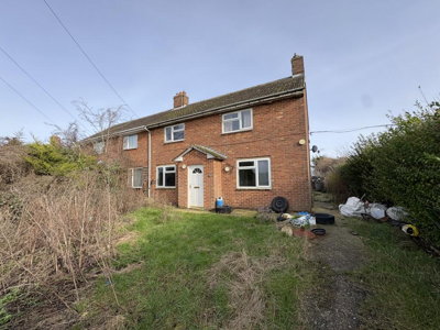
£90,000
Semi-Detached, 3 bed
Birchfield Road, PE38 0BT
£90,000
Semi-Detached, 3 bed
Birchfield Road, PE38 0BT

Compare 7 local agents, data from 8 active listings


We track 7 estate agents actively marketing properties in Nordelph, and we have ranked them all based on live listing data, market share, and average asking prices. Whether you are selling a detached family home or a smaller terraced property, finding the right agent can make a significant difference to your final sale price and how quickly your property moves.
The Nordelph property market sits within the broader King's Lynn and West Norfolk district, offering a mix of period properties and modern homes. With an average asking price of £290,625 and properties ranging from £90,000 to over £420,000, the local market serves diverse buyer segments. Our comprehensive comparison helps you identify which agents have the expertise, market reach, and proven track record to sell your home effectively.

7
Active Estate Agents
£290,625
Average Asking Price
8
Properties For Sale
+5%
Avg. Price Change (12m)
The Nordelph housing market has demonstrated steady growth, with property prices increasing by approximately 5% over the last 12 months according to recent market data. Our research shows the current average property price sits at £295,000, closely aligned with the live listing average of £290,625 that we track through our platform. This modest upward trajectory reflects broader trends in the King's Lynn and West Norfolk district, where demand remains consistent driven by both local buyers and those seeking more affordable options compared to larger urban centres. The PE38 postcode area continues to attract buyers from Cambridgeshire and broader Norfolk, benefiting from relatively lower property costs while maintaining good transport links to Cambridge and Peterborough.
Analysis of sold price data reveals clear stratification across property types in Nordelph. Detached properties command the highest prices at around £350,000 on average, reflecting the predominance of larger family homes in the area. Semi-detached properties sell at approximately £250,000, while terraced homes typically achieve around £200,000. This pricing hierarchy mirrors the national pattern but at more accessible entry points than neighbouring counties, making Nordelph attractive for first-time buyers and families alike. The relatively tight spread between asking and selling prices indicates a healthy market with realistic seller expectations.
Transaction volumes in Nordelph show approximately 25 property sales in the last 12 months, representing reasonable activity for a village of this size. The market benefits from its position within the PE38 postcode area, which straddles the border between Norfolk and Cambridgeshire, creating a broad pool of potential buyers. Properties in the £300,000 to £500,000 price band dominate current listings, accounting for 5 of the 8 active sale properties, while more affordable options under £100,000 remain scarce, representing just one listing. This supply-demand dynamic favours sellers in the mid-to-upper price brackets.
Based on 5 live listings with an average asking price of £262,000.
Source: home.co.uk
See which agents are selling fastest and at the best prices in Nordelph.
Compare Estate Agents FreeThe current listing mix in Nordelph reveals interesting patterns about what types of properties are coming to market. Detached properties dominate the inventory with 4 homes actively marketed, representing 50% of all listings and carrying an average asking price of £360,000. These larger homes appeal to families and buyers seeking space, with many properties offering multiple bedrooms and generous plot sizes typical of the Fens region. Four-bedroom properties represent the most common listing type, with 4 properties on the market at an average price of £347,500.
Three-bedroom homes follow with 3 active listings at an average of £211,667, while two-bedroom properties account for 1 listing at £300,000. This bedroom distribution suggests strong demand from family buyers, though the limited supply of smaller properties may be constraining first-time buyer activity in the area. The scarcity of two-bedroom homes, combined with an average price of £300,000 for what few are available, indicates potential value opportunities for developers or buyers willing to renovate properties in the terraced and semi-detached categories.
Nordelph occupies a distinctive position in the Fens landscape, sitting approximately 8 miles east of Downham Market and within easy reach of King's Lynn to the north. The village forms part of the King's Lynn and West Norfolk district, characterised by its low-lying terrain and agricultural heritage. The local economy remains predominantly agricultural, with farming and related industries serving as key employers, though proximity to larger towns provides residents with access to broader employment opportunities in retail, services, and light industry. The population of approximately 1,200 residents across 500 households creates a close-knit community atmosphere that appeals to families and retirees seeking a quieter lifestyle while remaining connected to urban amenities.
The geological setting of Nordelph presents specific considerations for property buyers. The village sits on superficial deposits of alluvium (comprising clay, silt, sand, and gravel) overlying bedrock of Gault Formation clay or Lower Greensand Group sandstone. This clay-dominated geology creates a moderate to high shrink-swell risk, meaning properties with shallow foundations may experience movement during periods of drought or excessive rainfall. Prospective buyers, particularly those considering older properties, should factor this into their surveys and property assessments. The presence of alluvial deposits also indicates the historical flooding that shaped the Fens landscape, with properties in lower-lying areas potentially requiring specialist insurance considerations.
Flood risk represents a significant environmental consideration for the Nordelph area. As part of the low-lying Fens, the village experiences areas with notable flood vulnerability from the River Great Ouse and its tributaries, as well as surface water flooding. Properties in certain locations may require flood resilience measures, and buyers should consult the Environment Agency flood maps when considering specific properties. This environmental factor makes the expertise of a local estate agent who understands the nuances of different neighbourhoods particularly valuable. Agents familiar with the Nordelph area can advise on which properties have historically performed well during flood events and which locations may present higher risk.
The housing stock in Nordelph reflects its evolution over several decades. According to ONS Census 2021 data, detached properties comprise approximately 45% of the housing stock, semi-detached homes account for 30%, terraced properties 20%, and flats just 5%. This profile indicates a predominantly family-oriented housing landscape with limited apartment options. Property age distribution shows 20% of homes were built pre-1919, 15% between 1919-1945, 35% during the post-war boom years of 1945-1980, and 30% since 1980. With approximately 70% of properties built before 1980, the local housing stock includes many homes that would benefit from a RICS Level 2 Survey to identify potential structural or maintenance issues.
Selecting the right estate agent in Nordelph requires understanding the local market dynamics and matching them to your property type and selling objectives. Our data shows Morris Armitage currently leads the market with a 25% market share and 2 active listings at an average asking price of £235,000, making them a strong choice for properties in the mid-market range. Their presence in Downham Market provides valuable local knowledge of the surrounding villages and commuter catchments. The agent has established relationships with local buyers seeking properties in the Nordelph area and understands the specific appeal of different neighbourhoods within the village.
For higher-value properties, Brown and Co and Sowerbys both operate from King's Lynn and maintain strong presences in the premium segment, with average asking prices of £420,000 and £325,000 respectively. These agents bring established reputations and buyer databases that can attract offers for character homes and larger family properties. Brown and Co particularly excels with period properties and rural homes, having operated in the Norfolk market for decades. King and Partners, also based in Downham Market, offers another option with an average listing price of £345,000, positioning them firmly in the upper-mid market and serving buyers looking for quality family homes.
The choice between high-street and online estate agents also warrants consideration in Nordelph. Traditional high-street agents like Morris Armitage, Brown and Co, and Sowerbys offer face-to-face valuations, local market expertise, and personal service throughout the sales process. These agents maintain physical offices in nearby towns, allowing sellers to meet their agent regularly and receive updates in person. Online agents may offer lower fixed fees but typically provide less local presence and may not have the same established relationships with local buyers and conveyancers. For a village market like Nordelph, where local knowledge and personal connections often drive successful sales, the additional service provided by traditional agents frequently proves worthwhile. Auction House represents an alternative for properties that may struggle in traditional sales, particularly those in the lower price brackets, while The Agency UK (Tauk) offers a modern hybrid approach covering the nationwide market.
Request free valuations from at least 3 different agents operating in Nordelph. This gives you a realistic asking price range and allows you to compare each agent's approach and market knowledge. Ask each agent to explain how they arrived at their valuation and what comparable properties they considered.
Look at how many listings each agent has, their average asking prices, and how long properties typically stay on their books. Agents with strong local presence like Morris Armitage often have proven sales histories in the PE38 postcode area. Request data on properties they have sold in Nordelph specifically, not just their broader market activity.
Estate agent fees in England typically range from 1% to 3% plus VAT (1.2% to 3.6% total). Some agents in the Nordelph area may offer fixed-fee alternatives, particularly for lower-value properties. Ensure you understand exactly what services are included in the fee and whether there are any additional costs for marketing or photography.
Ask about each agent's marketing strategy, including their presence on major property portals (Rightmove, Zoopla, OnTheMarket), social media marketing, and whether they offer professional photography and virtual tours. In a village market like Nordelph, local advertising and word-of-mouth remain important, so ask how agents plan to reach buyers specifically looking in this area.
Understand the duration of sole-agency agreements (typically 8-16 weeks) and what happens if you need to switch agents. Multi-agency agreements carry higher fees but provide broader market coverage. Ensure you understand termination clauses and any notice periods required to end the agreement.
Once you have selected your preferred agent, remember that fees are often negotiable, particularly if you are selling a property in a competitive price range where multiple agents would welcome your business. Do not be afraid to discuss fee flexibility while ensuring you receive the level of service you require.
Before instructing an estate agent, consider obtaining a RICS Level 2 Survey on your property. With 70% of Nordelph homes built before 1980, identifying any structural issues early can prevent delays during the conveyancing process. Local surveyors typically charge between £400-£700 depending on property size. This is particularly important given the clay geology in the area, which can cause foundation movement and subsidence issues in older properties.
Understanding how bedroom count affects property values helps sellers price accurately and buyers identify value opportunities. Our current listing data reveals that four-bedroom properties dominate the Nordelph market with 4 active listings averaging £347,500. These homes attract family buyers seeking space for home offices, growing children, or guest accommodation, and the premium pricing reflects the additional square footage and flexibility they offer. Many four-bedroom homes in Nordelph feature generous gardens and off-street parking, appealing to buyers who work from home or need space for multiple vehicles.
Three-bedroom homes represent the next most common category with 3 listings at an average of £211,667. This segment typically appeals to first-time buyers, young couples, and smaller families, offering a balance between space and affordability. The gap between three and four-bedroom prices (approximately £136,000) highlights the premium that buyers pay for that extra bedroom in this market. Three-bedroom properties in Nordelph often include semi-detached and terraced homes, representing good value compared to detached four-bedroom alternatives.
Two-bedroom properties are scarce in Nordelph, with just one listing currently available at £300,000. This relatively high average for a two-bed property may reflect the specific characteristics of available stock rather than market-wide pricing. The limited supply of smaller properties suggests potential demand from first-time buyers who may struggle to find suitable options in the village, potentially driving prices upward when properties do become available. This shortage presents an opportunity for developers or investors to consider properties that could be extended or converted to add bedroom capacity.
5 properties currently listed across Nordelph. Here are the most recently added.
£90,000
Semi-Detached, 3 bed
Birchfield Road, PE38 0BT
£90,000
Semi-Detached, 3 bed
Birchfield Road, PE38 0BT
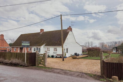
£325,000
Not Specified, 3 bed
Barroway Drove Road, PE38 0BJ
£325,000
Not Specified, 3 bed
Barroway Drove Road, PE38 0BJ
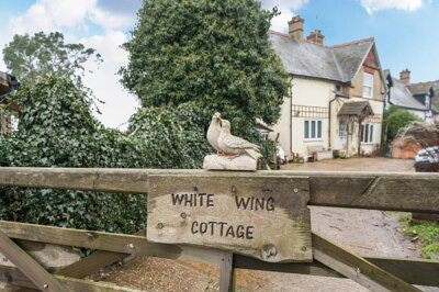
£300,000
Detached, 2 bed
Silt Road, PE38 0BW
£300,000
Detached, 2 bed
Silt Road, PE38 0BW
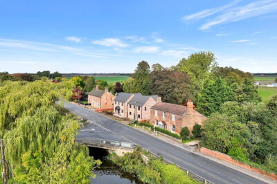
£375,000
Detached, 4 bed
Downham Road, PE38 0BQ
£375,000
Detached, 4 bed
Downham Road, PE38 0BQ
£220,000
Terraced, 3 bed
High Street, PE38 0BL
£220,000
Terraced, 3 bed
High Street, PE38 0BL
Get free, no-obligation valuations from the top-performing local agents. Compare fees, services, and track records before you decide.
Compare Agents FreeBased on our live market data, Morris Armitage currently leads the Nordelph market with a 25% market share and 2 active listings at an average price of £235,000. Their strong local presence in Downham Market makes them particularly well-connected to the village market. Other prominent agents include Brown and Co and Sowerbys, both based in King's Lynn and handling premium properties, as well as King and Partners operating from Downham Market. The best agent for your property depends on your price range and property type, with larger agencies handling character homes and premium properties while smaller agents serve the mid-market effectively. Consider your specific needs when selecting an agent.
Estate agent fees in England typically range from 1% to 3% plus VAT (1.2% to 3.6% total), with the national average around 1.5% plus VAT. In the Nordelph market, fees may vary based on the agent's reputation, the services included, and whether you opt for sole-agency or multi-agency representation. Morris Armitage, as the market leader, may command fees at the higher end of this range given their proven track record, while smaller agents or online alternatives may offer more competitive rates. Fixed-fee online alternatives exist but typically offer less local presence and service. Always request a full breakdown of what is included in the fee before signing any agreement.
Yes, property prices in Nordelph have increased by approximately 5% over the last 12 months, according to market data from Rightmove and Zoopla. This growth aligns with broader trends in the King's Lynn and West Norfolk district and reflects continued demand for properties in the Fens region. The average property price now sits around £295,000, compared to the live listing average of £290,625. This steady growth makes Nordelph an attractive option for both buyers seeking to enter the market and sellers looking to achieve reasonable returns on their investment. The relatively affordable nature of the area compared to Cambridge and Peterborough continues to attract buyers from those higher-priced markets.
Nordelph is a small village community of approximately 1,200 residents, offering a peaceful rural setting while remaining within commuting distance of larger towns like Downham Market (8 miles away) and King's Lynn to the north. The area is characterised by its low-lying Fens landscape, agricultural heritage, and mix of period and modern properties. Local amenities include village shops and pubs, with broader services available in nearby towns. The community feel and affordability compared to larger Norfolk towns make it attractive for families and retirees. The village benefits from good transport links via the A10 and the Fen Line railway, with regular services to London King's Cross from nearby stations.
The housing stock in Nordelph comprises approximately 45% detached properties, 30% semi-detached, 20% terraced, and 5% flats according to ONS Census 2021 data. This distribution reflects a predominantly family-oriented housing market with limited apartment options. Current listings show detached properties dominating at 4 homes, with semi-detached and terraced each represented by 1 listing. The limited flat availability means that apartment seekers may need to look in nearby towns like King's Lynn or Downham Market. The property age profile shows a mix of period homes (20% pre-1919) and more modern construction (30% post-1980).
When choosing an estate agent in Nordelph, prioritised local market knowledge is essential, particularly understanding of the area's flood risks, geological considerations, and neighbourhood character. Look for agents with proven track records in the PE38 postcode area and the King's Lynn and West Norfolk district. Consider whether you want a high-street agent with physical presence in nearby towns like Downham Market or King's Lynn, or an online alternative with lower fees. Ask potential agents about their experience selling properties in Nordelph specifically, and request details of recent sales in the village. A good local agent should be able to explain how the village's position in the Fens affects property values and buyer interest.
While specific data for Nordelph is limited, the broader East Anglia region typically sees average selling times of several months depending on pricing and property type. Properties priced correctly according to current market conditions (average asking price £290,625) tend to attract stronger buyer interest and sell more quickly than overpriced properties. Working with an experienced local agent who understands the market dynamics can significantly influence your selling timeline. Properties in the popular four-bedroom category may see faster interest given the limited supply, while unique properties or those in higher price brackets may require more patient marketing.
Given that approximately 70% of properties in Nordelph were built before 1980, a RICS Level 2 Survey is highly recommended for most sales. These surveys typically cost between £400-£700 depending on property size and can identify structural issues common in older properties, including dampness, timber defects, and potential subsidence related to the local clay geology. The moderate to high shrink-swell risk in the area means foundations may move during drought or wet periods, making professional surveys particularly valuable. For listed buildings or properties with significant character, a more comprehensive RICS Level 3 Survey may be appropriate. The Environment Agency flood maps should also be consulted for properties in lower-lying areas.
From £400
Identify structural issues in older Nordelph properties
From £700
Comprehensive survey for period or unique properties
From £60
Energy Performance Certificate required for sale
From £150
Required for Help to Buy equity loan properties
Estate Agents In London

Estate Agents In Plymouth

Estate Agents In Liverpool

Estate Agents In Glasgow

Estate Agents In Sheffield

Estate Agents In Edinburgh

Estate Agents In Coventry

Estate Agents In Bradford

Estate Agents In Manchester

Estate Agents In Birmingham

Estate Agents In Bristol

Estate Agents In Oxford

Estate Agents In Leicester

Estate Agents In Newcastle

Estate Agents In Leeds

Estate Agents In Southampton

Estate Agents In Cardiff

Estate Agents In Nottingham

Estate Agents In Norwich

Estate Agents In Brighton

Estate Agents In Derby

Estate Agents In Portsmouth

Estate Agents In Northampton

Estate Agents In Milton Keynes

Estate Agents In Bournemouth

Estate Agents In Bolton

Estate Agents In Swansea

Estate Agents In Swindon

Estate Agents In Peterborough

Estate Agents In Wolverhampton

Compare 7 local agents, data from 8 active listings
Find AgentsHomemove is a trading name of HM Haus Group Ltd (Company No. 13873779, registered in England & Wales). Homemove Mortgages Ltd (Company No. 15947693) is an Appointed Representative of TMG Direct Limited, trading as TMG Mortgage Network, which is authorised and regulated by the Financial Conduct Authority (FRN 786245). Homemove Mortgages Ltd is entered on the FCA Register as an Appointed Representative (FRN 1022429). You can check registrations at NewRegister or by calling 0800 111 6768.
We use cookies to show you personalised content and improve your experience of our website. Find out more in our Privacy policy and Cookie policy.