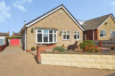
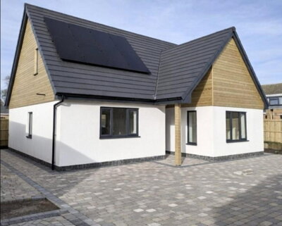
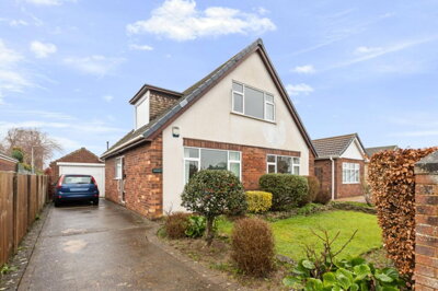
£260,000
Detached Bungalow, 3 bed
Butterwick Road, DN17 3NY
£260,000
Detached Bungalow, 3 bed
Butterwick Road, DN17 3NY

Compare 13 local agents, data from 57 active listings


We track 13 estate agents actively marketing properties in Messingham, and we have ranked them all based on live listing data, market share, and average asking prices. Whether you are selling a family home in the village centre or a countryside property on the outskirts, our comparison tool helps you find the right agent for your specific situation.
The Messingham property market presents a nuanced picture for sellers. With an average asking price of £287,372 across 57 current listings, the market offers opportunities across various price points. Our data shows the market is well-served by agents operating from nearby Scunthorpe, providing local expertise with access to the broader North Lincolnshire buyer pool. Read on to discover which agents dominate the local market and how their specialisms could benefit your sale.

13
Active Estate Agents
£287,372
Average Asking Price
57
Properties For Sale
The Messingham housing market has experienced notable shifts over the past year, with our analysis revealing price adjustments that reflect broader regional trends. According to Rightmove, the average house price in Messingham over the last year stood at £221,556, while Zoopla reports a slightly lower figure of £211,867. OnTheMarket indicates an average price paid of £216,000 as of early 2026. These figures suggest asking prices currently sit around £287,372, indicating vendor optimism despite softening sold prices.
Year-on-year price trends show Messingham experienced a decline of approximately 9% compared to the previous year, with prices sitting 12% below the 2023 peak of £251,718. However, postcode-level data reveals nuanced variations: the broader DN17 3 postcode area saw 1.1% growth in the last year, while the more specific DN17 3PS sector recorded 1.8% price growth. This suggests certain pockets of Messingham are performing better than others, potentially driven by property type and location within the village.
Transaction volumes provide additional context, with Housemetric data for DN17 3 indicating 175 sales over the past 24 months, and Home.co.uk reporting 20 properties sold in Messingham within the last six months. The market shows resilience despite broader economic headwinds, with detached properties continuing to dominate sales in the DN17 3PS postcode area, accounting for approximately 67% of all transactions. This strong demand for detached homes presents opportunities for vendors with larger properties to achieve competitive prices.
Based on 26 live listings with an average asking price of £315,313.
Source: home.co.uk
See which agents are selling fastest and at the best prices in Messingham.
Compare Estate Agents FreeThe Messingham property market reveals clear preferences among buyers, with detached properties commanding the largest share of both listings and sales activity. Our current data shows 20 detached properties on the market with an average asking price of £361,788, representing the premium segment of the local market. These properties typically attract families and buyers seeking space in this village location, with prices ranging from around £280,000 for older examples to well over £500,000 for modern executive homes.
Semi-detached properties form a significant portion of the market with six listings averaging £194,133, while terraced homes represent the more affordable entry point at an average of £134,975 across just two listings. The "Other" category, which includes bungalows and unusual property types, shows 29 listings averaging £265,852, indicating strong demand for single-story living in this village setting. New build activity in the area includes the Wesley Gardens development by Cyden Homes on Brigg Road, offering 2, 3, and 4-bedroom homes starting from £169,950, while planning applications for over 90 additional homes on Brigg Road demonstrate continued development interest in the village.
Bedroom analysis reveals four-bedroom properties dominate current listings at 18 units, with an average asking price of £361,292, reflecting the family-oriented nature of the Messingham market. Three-bedroom and two-bedroom properties each show 16 listings, averaging £236,859 and £207,331 respectively. The limited supply of one-bedroom properties (just one listing at £99,950) and five-bedroom properties (five listings averaging £494,990) indicates a market focused primarily on family homes rather than starter apartments or large country estates.
Messingham is a village and civil parish in North Lincolnshire, situated approximately four miles northeast of Scunthorpe. The village has a rich history, being mentioned in the Domesday Book of 1086, and experienced significant growth following World War II when housing development tripled the village size. Today, the estimated population stands at approximately 3,547 to 4,000 residents according to various sources, making it a sizable village community within the region.
The village offers a range of local amenities including shops, pubs, restaurants, a medical centre, and leisure facilities, providing residents with daily necessities without requiring travel to larger towns. Transport links connect Messingham to nearby Scunthorpe and the broader Lincolnshire road network, while the area benefits from the economic influence of Scunthorpe's industrial heritage, historically centred on steelmaking. Agriculture and sand extraction remain important local industries, contributing to the rural character that attracts buyers seeking village life within reach of larger urban centres.
Several listed buildings dot the Messingham landscape, including the Church of the Holy Trinity (Grade II*), The Old Vicarage, and properties along Brigg Road and West View such as 1 Brigg Road and 10 West View, reflecting the historical architecture that adds character to the area. The village also features a war memorial that holds listed building status. While specific conservation area designation for the village centre remains unclear from available records, the presence of these heritage properties suggests planning considerations for owners undertaking renovations or extensions. The mix of period properties alongside post-war housing creates varied stock that appeals to different buyer preferences, from those seeking character cottages to families wanting modern family homes.
Flood risk awareness is important for potential buyers, with the Environment Agency monitoring river levels for the River Eau, River Trent, and River Ancholme. As of late 2025, river levels were reported as normal, though surface water flooding can occur during periods of heavy rainfall. North Lincolnshire Council's updated flood mapping provides detailed risk assessments for the area, offering valuable information for property purchasers.
Sellers in Messingham can choose between traditional high-street agents based in nearby Scunthorpe and online fixed-fee alternatives, each offering distinct advantages depending on vendor requirements. Our data shows Paul Fox and Cade Estate Agency lead the local market with 10 active listings each, both operating from Scunthorpe and commanding 17.5% market share apiece. These established high-street agencies offer the benefit of physical offices where buyers can visit, experienced local valuers who understand the Messingham market nuances, and comprehensive marketing including window displays and local newspaper presence.
Starkey & Brown, also based in Scunthorpe, maintains six active listings with 10.5% market share at an average asking price of £262,900, positioning them competitively in the mid-market segment. For sellers with higher-value properties, Biltons covers Lincolnshire with five listings averaging £321,990, while Bella Properties and William H. Brown both target premium segments with average asking prices exceeding £340,000. Hunters, another established Scunthorpe agency, offers three listings averaging £296,667, providing coverage across different price points.
The online agent segment in Messingham includes Purplebricks with one listing at £150,000 and Ewemove covering national markets with a single listing at £675,000. These fixed-fee alternatives typically charge between £999 and £1,999 regardless of property price, which can prove cost-effective for higher-value sales but may offer reduced local market presence compared to established Scunthorpe agencies. Additional agents serving the Messingham market include Ddm Residential with four listings, Bell Watson & Co from nearby Brigg, and Fine & Country Northern Lincolnshire targeting the premium sector with a listing at £595,000.
When choosing between online and high-street options, sellers should consider whether they value in-person valuations and negotiations or prefer the convenience and fixed pricing of digital platforms, remembering that the average traditional agent fee in England runs at approximately 1.5% plus VAT. The decision often comes down to personal preference, property type, and how much hands-on support vendors need throughout the selling process.

Start by comparing agents actively selling properties in Messingham. Look at their current listings, average asking prices, and how long properties have been on market. Agents like Paul Fox and Cade Estate Agency dominate locally, but smaller agencies may offer more personalized service. Pay attention to which agents have listings similar to your property type and price point.
Request free valuations from at least three agents. Be wary of agents who overvalue your property to win your business, as an inflated asking price can lead to properties sitting unsold for months. The average asking price in Messingham is £287,372, use this as a benchmark. Ask each agent to explain their valuation methodology and provide comparable evidence from recent local sales.
Ask about each agent's marketing approach. Professional photography, floorplans, virtual tours, and listing on major portals like Rightmove and Zoopla are essential. Inquire about their social media presence, local advertising reach, and whether they offer video tours or enhanced listing packages. For new build properties, ask about marketing to developers and investors.
Estate agent fees in England typically range from 1% to 3% + VAT. Do not be afraid to negotiate, particularly if your property is in a higher price bracket. Consider whether you want sole or multi-agency agreements, noting that multi-agency typically costs 0.5% to 1% more but provides broader market coverage. For a property at the Messingham average of £287,372, fees could range from £3,448 to £10,345 at standard rates.
Verify the agent is a member of a redress scheme (Property Redress Scheme or The Property Ombudsman) and has client money protection insurance. Online reviews and testimonials from previous sellers in the Messingham area can provide valuable insight into their service quality. Look for feedback on communication, negotiation skills, and completed sales.
Carefully examine the contract terms before signing, particularly the sole agency period (typically 8 to 16 weeks), notice periods, and what happens if you find a buyer yourself during the contract term. Ensure you understand all terms including termination conditions and any hidden fees. Ask specifically about exit fees if you need to change agents before the contract expires.
Before instructing any estate agent in Messingham, always get at least three free valuations. The average asking price in the village is £287,372, but your property's worth depends on its specific location, condition, and property type. A good agent will explain exactly how they arrived at their valuation figure and provide comparable evidence from recent sales in your street or neighbourhood.
Understanding how asking prices vary by bedroom count helps sellers position their Messingham property competitively within the market. Four-bedroom properties represent the largest segment of current listings at 18 units, with an average asking price of £361,292, indicating strong demand for family-sized homes in the village. These properties typically attract buyers seeking space for growing families or those working from home who need dedicated office rooms.
Three-bedroom properties, traditionally the most popular family home configuration, show 16 listings averaging £236,859, representing the middle ground of the Messingham market. Two-bedroom properties also number 16 listings but at a lower average of £207,331, appealing to first-time buyers, downsizers, or investors seeking rental opportunities. The premium end of the market features five-bedroom properties with five listings averaging £494,990, typically executive homes with larger plots or modern rural residences.
One-bedroom properties are scarce in Messingham with just one listing at £99,950, reflecting the village's family-oriented housing stock rather than apartment or starter home provision. This limited supply suggests potential opportunities for investors in the one-bedroom segment, though the overall rental market in Messingham shows no current listings according to our data, indicating either strong owner-occupier demand or limited rental investment activity in the village.

Pricing your Messingham property correctly from the outset is crucial for achieving a timely sale in the current market conditions. With prices having declined approximately 9% year-on-year and sitting 12% below the 2023 peak, realistic pricing aligned with recent sold prices (averaging around £216,000 according to OnTheMarket) is essential. Properties priced accurately for their condition and location tend to attract more viewings and generate competitive interest, while overpriced homes risk stagnation.
Negotiating agent fees can yield significant savings, particularly for higher-value properties where percentage-based fees translate to substantial amounts. With typical fees ranging from 1% to 3% + VAT, a property priced at the Messingham average of £287,372 could incur fees between £3,448 and £10,345 at the standard rate. Negotiating down to 1% + VAT could save over £4,000 on an average-priced property, though ensure the agreed fee reflects the level of service you expect to receive. Some agents may offer reduced fees in exchange for longer contract terms or bundled services.
A professional RICS Level 2 survey can add value to your sale by identifying any issues that might derail negotiations later in the process. With Messingham's mix of older post-war properties and period buildings, a survey can highlight potential concerns before buyers commission their own reports. Survey costs typically range from £384 for properties under £200,000 to £586 for homes over £500,000. Common issues identified in older properties include damp, roof condition problems, outdated electrical systems, and structural movement. This proactive approach demonstrates transparency to prospective buyers and can actually strengthen your negotiating position by allowing you to address issues or adjust your asking price accordingly.
Consider timing your sale strategically, as the spring months typically see increased buyer activity in the UK property market. TheDN17 3PS postcode area has shown recent growth at 1.8%, suggesting certain pockets of Messingham remain attractive to buyers. Working with an agent who understands these local variations can help you price and market your property effectively for the best possible outcome.

26 properties currently listed across Messingham. Here are the most recently added.
£260,000
Detached Bungalow, 3 bed
Butterwick Road, DN17 3NY
£260,000
Detached Bungalow, 3 bed
Butterwick Road, DN17 3NY
£340,000
Detached, 4 bed
Kealholme Road, DN17 3SX
£340,000
Detached, 4 bed
Kealholme Road, DN17 3SX
£275,000
Detached Bungalow, 2 bed
Leaburn Road, DN17 3SR
£275,000
Detached Bungalow, 2 bed
Leaburn Road, DN17 3SR
£360,000
Detached Bungalow, 4 bed
Ash Grove, DN17 3QY
£360,000
Detached Bungalow, 4 bed
Ash Grove, DN17 3QY
£400,000
Detached, 4 bed
West View, DN17 3PF
£400,000
Detached, 4 bed
West View, DN17 3PF
£425,000
Detached, 4 bed
New Row, DN17 3RY
£425,000
Detached, 4 bed
New Row, DN17 3RY
£245,000
Detached Bungalow, 3 bed
Ingleby Road, DN17 3SS
£245,000
Detached Bungalow, 3 bed
Ingleby Road, DN17 3SS
£150,000
Terraced, 3 bed
High Street, DN17 3RX
£150,000
Terraced, 3 bed
High Street, DN17 3RX
£250,000
Detached, 2 bed
West Green, DN17 3QT
£250,000
Detached, 2 bed
West Green, DN17 3QT
£325,000
Detached, 4 bed
Elm Way, DN17 3UR
£325,000
Detached, 4 bed
Elm Way, DN17 3UR
£249,950
Detached Bungalow, 3 bed
Wood View, DN17 3UG
£249,950
Detached Bungalow, 3 bed
Wood View, DN17 3UG
 New Build
£184,950
Semi-Detached, 2 bed
Ash Grove, DN17 3QY
New Build
£184,950
Semi-Detached, 2 bed
Ash Grove, DN17 3QY
Get free, no-obligation valuations from the top-performing local agents. Compare fees, services, and track records before you decide.
Compare Agents FreeBased on our live listing data, Paul Fox and Cade Estate Agency are the leading agents in Messingham, each commanding 17.5% market share with 10 active listings apiece. Paul Fox operates from Scunthorpe with an average asking price of £288,490, while Cade Estate Agency shows similar metrics at £289,230. Starkey & Brown ranks third with 10.5% market share, followed by Biltons covering Lincolnshire with higher-value properties averaging £321,990. These agencies have demonstrated consistent activity in the local market and have established relationships with buyers searching in the DN17 area.
Estate agent fees in England typically range from 1% to 3% + VAT (1.2% to 3.6% including VAT), with the national average around 1.5% + VAT. For a property at the Messingham average asking price of £287,372, this would translate to fees between £3,448 and £10,345. Online fixed-fee agents typically charge between £999 and £1,999 regardless of property price, which can be more cost-effective for higher-value homes but may offer less local presence and personalized service. Many high-street agents in nearby Scunthorpe are open to negotiation, particularly for properties at the higher end of the market.
The picture is mixed. Overall, Messingham house prices were approximately 9% down on the previous year and 12% down from the 2023 peak of £251,718, according to Rightmove. OnTheMarket reports an 11.6% fall over the last 12 months for sold prices. However, postcode-level data shows the broader DN17 3 area grew 1.1% in the last year, while the specific DN17 3PS sector recorded 1.8% growth. This suggests certain pockets of the village are performing better than others, likely depending on property type and exact location within Messingham.
Messingham is a village community in North Lincolnshire with a population of approximately 3,500 to 4,000 residents, situated about four miles northeast of Scunthorpe. The village offers local amenities including shops, pubs, restaurants, a medical centre, and leisure facilities, with good transport links to larger towns. Its history dates back to the Domesday Book, with several listed buildings including the Church of the Holy Trinity (Grade II*). The village tripled in size after World War II, creating a mix of period and post-war housing. Agriculture and sand extraction remain important local industries, contributing to the rural character that attracts buyers seeking village life within reach of larger urban centres like Scunthorpe.
Detached properties dominate the Messingham market, comprising approximately 67% of transactions in the DN17 3PS postcode area. Four-bedroom family homes represent the largest listing segment at 18 properties, with strong demand from buyers seeking space. Three and two-bedroom properties each show 16 listings, appealing to families and first-time buyers respectively. The limited supply of one-bedroom properties (just one listing) suggests demand outstrips supply in this segment. New build options at developments like Wesley Gardens by Cyden Homes offer modern alternatives, with 2, 3, and 4-bedroom homes starting from £169,950.
There are currently 57 properties for sale in Messingham according to our live listing data. The market shows good variety across property types, with 20 detached homes, 29 "other" properties (including bungalows), 6 semi-detached properties, and 2 terraced homes. Four-bedroom properties dominate at 18 listings, followed by two and three-bedroom properties with 16 each. Price ranges span from under £100,000 to over £500,000, with the majority of listings (21 properties) falling in the £200,000 to £300,000 bracket.
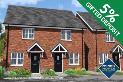
Yes, new build activity is ongoing in Messingham. The Wesley Gardens development by Cyden Homes offers 2, 3, and 4-bedroom homes starting from £169,950, located off Brigg Road. Additional developments include barn conversions at West View, which received planning consent in March 2024 for converting agricultural barns into three residential buildings plus four new dwellings. Planning applications for over 90 homes on Brigg Road demonstrate continued development interest in the village, with further proposals for 20 homes on Scotter Road. These new build options provide alternatives to the village's existing housing stock and may attract buyers seeking modern energy-efficient homes.
While not legally required, commissioning a RICS Level 2 survey before selling can benefit your sale. With Messingham's mix of post-war properties and period buildings (including several listed buildings like the Church of the Holy Trinity and The Old Vicarage), a survey identifies potential issues that might concern buyers. Common problems in older local properties include damp, roof condition issues, outdated electrics, and structural movement. Survey costs typically range from £384 for properties under £200,000 to £586 for homes over £500,000, representing a worthwhile investment to avoid complications during conveyancing. For listed buildings, a more comprehensive RICS Level 3 survey may be recommended due to their historical and architectural significance.
Several factors influence property values in Messingham, including location within the village (properties in DN17 3PS have shown 1.8% growth), property type (detached homes command premium prices averaging £361,788), and proximity to local amenities like schools and the village centre. The condition of the property, its EPC rating, and whether it has parking or garden space all impact value. Recent market data shows properties priced realistically for their condition achieve faster sales, while those priced above market rates tend to stagnate. The ongoing new developments in the area may also influence values, both positively (increased buyer interest) and potentially (increased supply).
Selling times in Messingham vary depending on pricing, property type, and market conditions. Properties priced correctly according to recent sold prices (averaging around £216,000) tend to attract more interest and sell more quickly. Overpriced properties can sit on the market for months, particularly in the current market where prices are approximately 9% down on last year. Working with an experienced local agent who understands the Messingham market can help you price realistically and market effectively to achieve a timely sale.
Estate Agents In London

Estate Agents In Plymouth

Estate Agents In Liverpool

Estate Agents In Glasgow

Estate Agents In Sheffield

Estate Agents In Edinburgh

Estate Agents In Coventry

Estate Agents In Bradford

Estate Agents In Manchester

Estate Agents In Birmingham

Estate Agents In Bristol

Estate Agents In Oxford

Estate Agents In Leicester

Estate Agents In Newcastle

Estate Agents In Leeds

Estate Agents In Southampton

Estate Agents In Cardiff

Estate Agents In Nottingham

Estate Agents In Norwich

Estate Agents In Brighton

Estate Agents In Derby

Estate Agents In Portsmouth

Estate Agents In Northampton

Estate Agents In Milton Keynes

Estate Agents In Bournemouth

Estate Agents In Bolton

Estate Agents In Swansea

Estate Agents In Swindon

Estate Agents In Peterborough

Estate Agents In Wolverhampton

Compare 13 local agents, data from 57 active listings
Find AgentsHomemove is a trading name of HM Haus Group Ltd (Company No. 13873779, registered in England & Wales). Homemove Mortgages Ltd (Company No. 15947693) is an Appointed Representative of TMG Direct Limited, trading as TMG Mortgage Network, which is authorised and regulated by the Financial Conduct Authority (FRN 786245). Homemove Mortgages Ltd is entered on the FCA Register as an Appointed Representative (FRN 1022429). You can check registrations at NewRegister or by calling 0800 111 6768.
We use cookies to show you personalised content and improve your experience of our website. Find out more in our Privacy policy and Cookie policy.