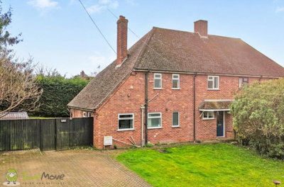
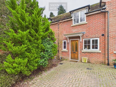
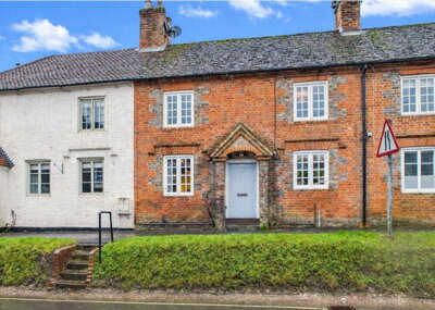
£475,000
Semi-Detached, 3 bed
Coppice Road, RG20 5RR
£475,000
Semi-Detached, 3 bed
Coppice Road, RG20 5RR

Compare 15 local agents, data from 31 active listings


We track 15 estate agents actively marketing properties in Kingsclere, and we've ranked them all based on live listing data, market share, and average asking prices. selling a period cottage in the village centre or a modern family home near The Chase development, finding the right agent makes all the difference to your sale.
Kingsclere sits in the heart of North Hampshire, within the Basingstoke and Deane district. With an average asking price of £676,932 across 31 current listings, this is a market where expertise matters. Our comparison tool puts you in control, letting you compare agent fees, track records, and local knowledge before making your decision.

15
Active Estate Agents
£676,932
Average Asking Price
31
Properties For Sale
The Kingsclere property market reflects its position as a desirable Hampshire village with strong commuter links. Our data shows an average asking price of £676,932 across 31 active listings, though Rightmove figures indicate the broader RG20 postcode area has seen a modest 12-month price adjustment of -1.0% to February 2026, with the overall average sitting at £588,500. This slight softening presents opportunities for buyers while maintaining strong seller values in this scenic location.
Breaking down by property type reveals the premium nature of Kingsclere housing. Detached properties average £1,739,158 according to current listings data, while semi-detached homes fetch around £698,333. Terraced properties, which form a significant portion of the village's characterful housing stock, average £372,143. Flats remain scarce in this village setting, with just 2 listings averaging £155,000, reflecting the predominantly house-based nature of local housing.
Transaction volumes in the area show 33 properties sold in the last 12 months, indicating steady but measured market activity. The RG20 postcode sector covering Kingsclere has maintained relative stability despite wider market fluctuations, largely thanks to the village's sought-after location within the North Wessex Downs, strong transport connections via the A339 and proximity to both the A34 and M3/M4 corridors, and excellent local schooling.
Based on 15 live listings with an average asking price of £539,963.
Source: home.co.uk
See which agents are selling fastest and at the best prices in Kingsclere.
Compare Estate Agents FreeUnderstanding what sells in Kingsclere helps you price strategically and choose the right agent for your property type. Our listing data shows 3-bedroom properties dominate the market with 14 current listings, averaging £413,568. These family homes attract strong demand from commuters seeking village life within reach of Basingstoke, Newbury, and Reading. The 2-bedroom segment follows with 8 listings averaging £319,375, appealing to first-time buyers and downsizers alike.
New build activity in Kingsclere continues to shape the market, with The Chase and The Pastures developments by David Wilson Homes and Barratt Homes offering 2, 3, 4, and 5-bedroom homes in the RG20 5PL area. These developments bring modern energy efficiency and warranty protection to buyers, creating competition for period properties while expanding the village's housing stock. Transaction data suggests new builds account for a meaningful proportion of recent sales, particularly among families seeking turnkey solutions.
The village's position within Basingstoke and Deane, which has a housing stock profile of 35.8% detached, 30.5% semi-detached, 20.3% terraced, and 13.0% flats according to ONS Census 2021, influences what's available. Kingsclere itself likely skews more heavily toward detached and semi-detached properties given its village character, with flats remaining rare. This supply profile means detached family homes face competitive demand, while terraced properties offer more accessible entry points to the market.
Kingsclere nestles in the North Wessex Downs, a landscape of chalk downland, wooded valleys, and agricultural land that defines much of North Hampshire's character. The village has a population of approximately 3,639 residents across 1,559 households according to the 2021 Census, creating a close-knit community feel while offering easy access to larger towns. The geology here is predominantly chalk, which while generally stable, can lead to shrink-swell risks where clay deposits overlay the bedrock, particularly in areas with mature trees or historic ground movement.
The village centre features a designated Conservation Area encompassing much of the historic core, including the parish church and period cottages built from traditional red brick with tile roofs. Many older properties feature flint or local stone elements, adding to the architectural richness that makes Kingsclere visually distinctive. Newer developments around the periphery, including The Chase and The Pastures, use modern construction methods while respecting the village scale.
Flood risk in Kingsclere is primarily surface water flooding, affecting low-lying areas and properties near the small streams and tributaries that flow through the village. Unlike riverside locations, Kingsclere faces no significant coastal flood risk. For buyers, this means considering drainage and ground conditions, particularly for older properties where historic foundations may be shallower. The proximity to major transport links, including the A339, A34, M3, and M4, makes Kingsclere particularly attractive to commuters, with Basingstoke, Newbury, and Reading all within reasonable driving distance.
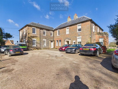
Choosing between online and traditional high-street agents in Kingsclere requires understanding how each model performs in a village market. Our data shows traditional agents dominate the area, with Sansome & George from Basingstoke leading with 29% market share and 9 active listings at an average price of £303,889. Their local presence and established reputation make them a go-to choice for sellers seeking hands-on guidance through the process.
Premium agents including Carter Jonas from Newbury and Jones Robinson from Lambourn focus on higher-value properties, with Carter Jonas averaging £1,172,500 across their listings and Jones Robinson at £912,500. These agents bring specialist knowledge of the upper end of the Kingsclere market, including estate properties and conversions within the conservation area. For sellers with unique or high-value homes, their expertise in marketing distinctive properties can justify higher fee structures.
Online agents including Yopa and Purplebricks maintain presence in Kingsclere, with Yopa holding 6.5% market share at an average price of £380,000 and Purplebricks listing one property at £350,000. These fixed-fee options can work for straightforward sales, though the village's character properties and conservation constraints may benefit from an agent's in-person guidance. Traditional percentage-based fees typically range from 1-3% plus VAT, while online agents offer fixed fees typically between £999 and £1,999, though the right choice depends on your property and priorities.

Start by comparing the 15 agents actively marketing in Kingsclere. Look at their current listings, average asking prices, and market share to understand which ones handle properties similar to yours. Our comparison tool does this work for you, showing you exactly how each agent performs in your specific market.
Request free valuations from at least three agents before instructing anyone. This gives you a realistic asking price based on current market conditions in Kingsclere and prevents you from overpricing and stalling your sale. Watch for agents who over-inflate valuations to win your business.
Ask agents how they plan to market your property. In a village like Kingsclere, local knowledge matters significantly. Agents who understand the conservation area constraints, know the schools catchment areas, and can highlight the village's transport links to London will market your home more effectively than those without local insight.
Understand the sole agency versus multi-agency options. Sole agency agreements typically run for 8-16 weeks and commit you to one agent, while multi-agency allows multiple agents to market your property but usually at a higher total fee. Consider how quickly you need to sell and comfortable with an exclusive relationship.
Estate agent fees are negotiable, especially in competitive markets. Once you've received valuations and built relationships with agents, discuss their fees openly. Many agents will reduce their commission to win your business, particularly if you can demonstrate you've received comparable offers from competitors.
With 15 agents competing for listings in a village with just 31 current properties, you have strong negotiating power. Get at least three valuations and use them to negotiate the best fee. Agents with lower market share are often more motivated to secure your business.
Bedroom count significantly influences both pricing and buyer demand in Kingsclere. Our listing data shows 3-bedroom properties are most prevalent with 14 current listings averaging £413,568, representing the core of the market activity. These properties appeal to families and couples seeking space without the premium attached to larger homes, making them the sweet spot for price and demand.
Four-bedroom properties command substantial premiums, with 4 listings averaging £730,000. These larger family homes attract buyers seeking room for home offices, growing families, or those wanting flexible living space. The 5-bedroom segment shows 3 listings at an average of £1,053,317, representing the upper end of the traditional family home market in Kingsclere.
Two-bedroom properties offer the most accessible entry point to the Kingsclere market at £319,375 average, though only 8 listings exist. These properties face strong demand from first-time buyers and downsizers, creating competitive conditions. At the extreme end, one 6-bedroom property listed at £6,450,000 by Savills represents an exceptional outlier, likely an estate property or significant country home.

Pricing your Kingsclere property correctly from the outset is crucial for achieving the best sale price within your timeframe. Our current data shows an average asking price of £676,932, but this varies dramatically by property type and location within the village. Properties in the conservation area or with listed building status may command premiums, while those requiring renovation may need more competitive pricing to attract buyers.
Working with an experienced local agent provides invaluable pricing insight. Agents like Sansome & George, who understand the Basingstoke commuter catchment, or Carter Jonas, with their premium market expertise, can advise on realistic pricing based on recent comparable sales in the area. The Rightmove data showing a -1.0% adjustment in the RG20 postcode suggests a balanced market where well-priced properties continue to sell.
Beyond pricing, presentation matters significantly in a village market where buyers are spoilt for choice across new builds and period properties. Consider what makes your property distinctive, whether it's village centre location, proximity to the highly regarded local primary school, or period features that cannot be replicated in newer developments. Your agent should market these unique selling points effectively to differentiate your home from the competition.

15 properties currently listed across Kingsclere. Here are the most recently added.
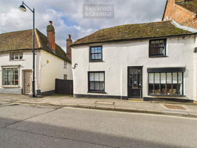
£475,000
Semi-Detached, 3 bed
Coppice Road, RG20 5RR
£475,000
Semi-Detached, 3 bed
Coppice Road, RG20 5RR
£325,000
Semi-Detached, 2 bed
George Street, RG20 5NQ
£325,000
Semi-Detached, 2 bed
George Street, RG20 5NQ
£735,000
Detached, 4 bed
George Street, RG20 5NH
£735,000
Detached, 4 bed
George Street, RG20 5NH
£235,000
Maisonette, 1 bed
Elm Grove, RG20 5RD
£235,000
Maisonette, 1 bed
Elm Grove, RG20 5RD
£700,000
Link Detached House, 4 bed
Garrett Close, RG20 5SD
£700,000
Link Detached House, 4 bed
Garrett Close, RG20 5SD
£325,000
Terraced, 2 bed
The Pellows, RG20 5AB
£325,000
Terraced, 2 bed
The Pellows, RG20 5AB
£350,000
End of Terrace, 2 bed
Swan Street, RG20 5PJ
£350,000
End of Terrace, 2 bed
Swan Street, RG20 5PJ
£1,250,000
Semi-Detached, 4 bed
Union Lane, RG19 8LR
£1,250,000
Semi-Detached, 4 bed
Union Lane, RG19 8LR
£410,000
Terraced, 2 bed
Swan Street, RG20 5PR
£410,000
Terraced, 2 bed
Swan Street, RG20 5PR
£484,950
Detached, 5 bed
Cedar Drive, RG20 5TD
£484,950
Detached, 5 bed
Cedar Drive, RG20 5TD
£1,750,000
Detached, 5 bed
Foxs Lane, RG20 5QB
£1,750,000
Detached, 5 bed
Foxs Lane, RG20 5QB
£99,500
Apartment
Phoenix Court, RG20 5PH
£99,500
Apartment
Phoenix Court, RG20 5PH
Get free, no-obligation valuations from the top-performing local agents. Compare fees, services, and track records before you decide.
Compare Agents FreeBased on our market data, Sansome & George leads Kingsclere with 29% market share and 9 active listings, making them the most active agent in the area. Carter Jonas and Jones Robinson focus on the premium market segment, while Yopa and Ewemove offer options at different price points. The best agent for you depends on your property type and price range, so comparing multiple agents using our free tool ensures you find the right match for your specific sale.
Estate agent fees in Kingsclere typically range from 1% to 3% plus VAT (1.2% to 3.6% including VAT), matching national averages. Traditional high-street agents like Sansome & George generally charge percentage-based fees, while online agents like Purplebricks and Yopa offer fixed fees typically between £999 and £1,999. For a property at the average price of £676,932, this means fees could range from approximately £6,800 to £24,400 depending on the agent and fee structure you choose.
Rightmove data for the RG20 postcode area (including Kingsclere) shows a modest -1.0% adjustment over the 12 months to February 2026, with the overall average price at £588,500. This represents stability rather than significant growth or decline, reflecting the broader national picture while maintaining the area's desirability as a commuter village with strong local connections.
Kingsclere offers village life with excellent commuter links, Nestled in the North Wessex Downs with a population of around 3,639, it provides a close-knit community feel while maintaining access to Basingstoke, Newbury, and Reading via the A339, A34, M3, and M4. The village has a conservation area, good local primary school, and range of village amenities including shops and pubs. The chalk geology creates attractive countryside walks, though buyers should note potential shrink-swell risks in some areas.
Three-bedroom properties dominate the Kingsclere market with 14 current listings, representing the core demand from families and couples. Four-bedroom detached homes also sell well, commanding premiums around £730,000 average. The limited supply of flats (just 2 listings) means demand outstrips availability for this property type, while terraced properties at £372,143 average offer accessible entry points to the market.
Yes, Kingsclere has active new build developments including The Chase and The Pastures, both offering homes through David Wilson Homes and Barratt Homes. These developments in the RG20 5PL area offer 2, 3, 4, and 5-bedroom homes, providing modern alternatives to the village's period housing stock. New builds typically start from around £350,000 for smaller properties, rising significantly for larger detached homes.
In a village market like Kingsclere, local knowledge significantly impacts sale outcomes. Traditional agents like Sansome & George (Basingstoke-based) and Carter Jonas (Newbury-based) understand the local conservation constraints, school catchment areas, and village character that national online agents may miss. However, online agents like Yopa and Purplebricks can offer cost savings for straightforward sales. The right choice depends on your property complexity and how much local guidance you need.
The time to sell varies based on pricing, property type, and market conditions. With 33 properties sold in the last 12 months in the RG20 area and 31 current listings, Kingsclere has reasonable market liquidity. Well-priced properties in the popular 3-bedroom segment typically sell faster, while premium properties or those requiring renovation may take longer. Your agent should provide realistic timeframe expectations based on current market activity and comparable sales.
While not legally required, a RICS Level 2 Survey is highly recommended for any property purchase in Kingsclere, particularly given the village's mix of older properties. Surveys in the RG20 area typically cost between £400 and £900 depending on property size and complexity. For older properties in the conservation area or listed buildings, a more detailed RICS Level 3 Building Survey may be advisable given potential issues with damp, timber defects, and historic construction methods common in period properties.
Kingsclere benefits from excellent transport connections for commuters. The village is accessible via the A339 linking to Basingstoke and Newbury, while the A34 provides direct access to the M3 and M4 motorways. Train services from Basingstoke offer connections to London Waterloo, making the village popular with commuters who work in the capital or surrounding towns. This connectivity significantly supports property values in the area.
Estate Agents In London

Estate Agents In Plymouth

Estate Agents In Liverpool

Estate Agents In Glasgow

Estate Agents In Sheffield

Estate Agents In Edinburgh

Estate Agents In Coventry

Estate Agents In Bradford

Estate Agents In Manchester

Estate Agents In Birmingham

Estate Agents In Bristol

Estate Agents In Oxford

Estate Agents In Leicester

Estate Agents In Newcastle

Estate Agents In Leeds

Estate Agents In Southampton

Estate Agents In Cardiff

Estate Agents In Nottingham

Estate Agents In Norwich

Estate Agents In Brighton

Estate Agents In Derby

Estate Agents In Portsmouth

Estate Agents In Northampton

Estate Agents In Milton Keynes

Estate Agents In Bournemouth

Estate Agents In Bolton

Estate Agents In Swansea

Estate Agents In Swindon

Estate Agents In Peterborough

Estate Agents In Wolverhampton

Compare 15 local agents, data from 31 active listings
Find AgentsHomemove is a trading name of HM Haus Group Ltd (Company No. 13873779, registered in England & Wales). Homemove Mortgages Ltd (Company No. 15947693) is an Appointed Representative of TMG Direct Limited, trading as TMG Mortgage Network, which is authorised and regulated by the Financial Conduct Authority (FRN 786245). Homemove Mortgages Ltd is entered on the FCA Register as an Appointed Representative (FRN 1022429). You can check registrations at NewRegister or by calling 0800 111 6768.
We use cookies to show you personalised content and improve your experience of our website. Find out more in our Privacy policy and Cookie policy.