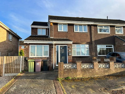
£260,000
Semi-Detached, 4 bed
Acacia Crescent, S21 1HZ
£260,000
Semi-Detached, 4 bed
Acacia Crescent, S21 1HZ

Compare 22 local agents, data from 119 active listings


We track 22 estate agents actively marketing properties in Killamarsh, and we have ranked them all based on live listing data from our platform. Selling a family home in the village centre or a modern property on one of the new developments, finding the right agent can make a significant difference to your sale price and how quickly your property moves. Our comprehensive comparison helps you find the agent with the right local expertise for your specific property type and price range.
Killamarsh's property market has shown considerable resilience, with house prices in the S21 2 postcode area growing by 13.5% over the last year according to recent market data. With an average asking price of £275,928 across 119 active listings, the village offers a diverse range of properties from terraced houses to substantial detached homes. Whether you are selling a Victorian terrace on Sheffield Road or a new build on the Forge Green development, comparing agents below helps you find the best representation for your property.

22
Active Estate Agents
£275,928
Average Asking Price
119
Properties For Sale
The Killamarsh housing market presents a mixed picture of growth and changing buyer activity. Our data shows that the average asking price sits at £275,928, though sold price data from sources like Zoopla indicates properties have achieved around £261,480 on average over the past 12 months. Rightmove reports a more conservative average of £230,852, while OnTheMarket shows £263,000 for properties sold in the area. These variations reflect the diversity of property types and locations within this former coal mining village, from traditional terraced homes near the village centre to modern developments on the outskirts.
Year-on-year price trends reveal encouraging growth, with Property Solvers reporting a 3.77% increase in property prices over the last 12 months, and OnTheMarket showing a more dramatic 21.3% rise. The S21 2 postcode sector specifically saw 13.5% growth according to Housemetric data. However, transaction volumes have decreased, with Property Solvers recording 74 residential sales in Killamarsh over the past year, representing a decline of 21 transactions compared to the previous year. This reduction in sales volume suggests buyers are being more selective in the current market conditions, making the choice of estate agent more critical than ever for sellers looking to achieve a timely sale.
When examining price trends by property type, the data shows significant variation. Detached properties on Rightmove achieved an average of £300,809, while semi-detached homes sold for around £176,798 and terraced properties fetched approximately £205,406. The premium for detached homes reflects the desirability of larger properties in this area, particularly those on the newer developments where buyers can acquire modern homes with contemporary fixtures and fittings. Our live listing data shows detached properties averaging £373,718 across 48 current listings, demonstrating strong supply in this sector.
Based on 65 live listings with an average asking price of £310,202.
Source: home.co.uk
See which agents are selling fastest and at the best prices in Killamarsh.
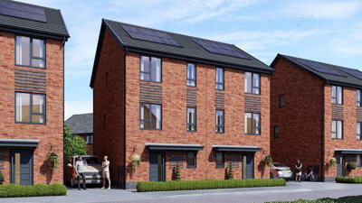
Compare Estate Agents FreeThe Killamarsh property market benefits from significant new build activity, with several major developments bringing modern housing to the area. The Gongoozlers Walk development by Redmile Homes offers 3, 4, and 5-bedroom houses with prices ranging from £399,950 for a 4-bedroom detached home up to £599,950 for a 5-bedroom property. These homes feature triple-glazed windows, high-level insulation, solar PV panels, water waste heat recovery systems, and EV charging points as standard, appealing to buyers seeking energy-efficient homes with low running costs.
The Forge Green development by Harron Homes, located next to Green Lane and Upperthorpe Road on the former Westthorpe Colliery site, offers 3, 4, and 5-bedroom homes priced from £370,000 to £422,000. This development is part of a larger expansion plan, with outline permission for up to 397 dwellings and a reserved matters application for 322 new homes currently being prepared. The Aurelle development by Honey off Upperthorpe Road has planning permission for 174 homes, with 2-bedroom semi-detached houses starting from £239,995 and 3-bedroom properties at £314,995. Sky-House Rother Valley on Station Road offers unique 3-bedroom bungalows, a rare find in the area that appeals to downsizers and retirement buyers.
Transaction data from the S21 postcode district shows approximately 475 sales in the last 24 months, indicating a reasonably active market despite the year-on-year decline. The mix of property types available includes detached homes dominating the upper price brackets, semi-detached properties forming the backbone of family housing, and terraced homes offering more affordable entry points into the market. The bedroom distribution shows 3-bedroom properties are most common with 55 listings, followed by 4-bedroom homes at 25 listings and 2-bedroom properties at 27 listings.
Killamarsh is a former coal mining village in North East Derbyshire with a population of 9,082 residents according to the 2021 Census, residing in approximately 3,894 households. The village experienced significant growth during the height of the coal mining era, with the Sheffield iron industry driving much of its early development. Today, the last collieries at Westthorpe and High Moor have long ceased operation, and the area has transformed into a local service centre with independent shops and a business park. The Norwood industrial estate and light industrial units provide local employment, while the business innovation centre on the former Westthorpe Colliery site represents efforts to attract new industries to the area.
The geological conditions in Killamarsh present specific considerations for property buyers. The village sits on a gently undulating landform rising to a magnesian limestone plateau, with clay subsoil dominating the area. This clay substrate creates potential for shrink-swell risk, where the ground expands and contracts with moisture changes, potentially causing subsidence issues particularly for properties near large trees. Additionally, Killamarsh's mining legacy means some areas may have untreated mine shafts and workings beneath them, posing risks of land instability. Properties in areas like those near the former Westthorpe Colliery may require a Coal Mining Risk Assessment as part of the conveyancing process.
Transport connectivity is a strong selling point for Killamarsh, with excellent links to the M1 motorway making it a desirable commuter base for Sheffield, Chesterfield, and Rotherham. The village has local amenities including shops, schools, and recreational facilities. The River Rother flows through the area, and flood warnings are in place for specific zones including Forge Lane, Sheffield Road, Netherthorpe Close, George Lane, and Quarry Road, as well as areas around Meadowgate Park and the local sports grounds. Green Lane is also noted as being prone to flooding during periods of heavy rainfall. Surface water flooding affects additional properties throughout the village, particularly in low-lying areas.
Killamarsh contains five listed buildings within its civil parish, all concentrated around St Giles' Church and Westhorpe Farm. St Giles' Church dates from the 12th century and is Grade II* listed, while other listed buildings include Westhorpe Farmhouse and associated barns. The village does not have any designated conservation areas, giving relative freedom for property alterations and development. Properties near St Giles' Church and Westhorpe Farm may have additional restrictions due to their proximity to listed buildings, and buyers should factor this into any renovation plans.
When selling property in Killamarsh, homeowners must choose between traditional high-street estate agents and modern online alternatives. Blundells, based at Crystal Peaks, dominates the local market with 17 active listings representing a 14.3% market share and an average asking price of £218,235. Their strong presence in the Crystal Peaks area makes them a go-to choice for many sellers looking for established local expertise. William H. Brown also operates from Crystal Peaks with 10 listings at an average price of £217,100, offering the backing of a nationwide brand with local knowledge.
For sellers targeting higher-value properties, Butlers Estate Agents based in Sheffield commands an average asking price of £414,604 across their 14 listings, holding an 11.8% market share. This positions them strongly in the premium sector of the Killamarsh market, particularly for larger detached homes and properties on the new developments. Haybrook, also at Crystal Peaks, offers 12 listings with an average price of £281,250, while Redbrik operates from two locations covering both Crystal Peaks and the broader Yorkshire and Derbyshire region, with 9 primary listings at £289,444 average and an additional 2 listings from their wider operation.
Online agents like Yopa offer an alternative model with 3 listings in the area at an average price of £413,333, targeting sellers who prefer a lower fixed fee over the traditional percentage-based commission. Yopa operates nationwide, which can mean less local knowledge compared to Crystal Peaks-based agents like Blundells or Key2Go, who have 13 listings at £237,308 average and understand the specific nuances of the Killamarsh market. Given the complexity of Killamarsh's market, including mining legacy issues and flood risk areas, local expertise from established agents like Blundells or Butlers may prove valuable. The typical fee structure for traditional agents in England ranges from 1% to 3% plus VAT, while online fixed-fee agents typically charge between £999 and £1,999.

Start by comparing estate agents actively selling properties in Killamarsh. Look at their current listings, average asking prices, and market share to understand which agents handle properties similar to yours. Pay attention to whether they have experience with properties in your specific price range and property type.
Request free valuations from at least three agents. This gives you a realistic asking price and allows you to compare their marketing strategies and proposed fees. Be wary of agents who overvalue your property to win your business, as an unrealistic asking price can lead to your property sitting on the market.
Ask agents about their recent sales in Killamarsh specifically, not just their overall performance. Understanding how quickly they sell properties in the local market matters. Request data on sold prices achieved versus asking prices to gauge their negotiation effectiveness.
Traditional agents charge percentage-based fees typically ranging from 1% to 3% plus VAT, while online agents offer fixed fees. Consider what services are included and whether you will need to pay extra for photography, floorplans, or marketing materials. Remember that the cheapest option is not always the best value.
Ask about how they plan to market your property, including which portals they advertise on, whether they offer virtual tours, and how they conduct viewings. Given Killamarsh's mining history, ensure they know how to market properties effectively to buyers who may have concerns about ground stability or flood risk.
A sole agency agreement typically runs for 8-16 weeks, while multi-agency allows you to instruct multiple agents but usually at a higher total fee. Evaluate which approach suits your timeline and budget. If you choose sole agency, ensure the contract terms are clear including what happens if the property does not sell within the agreed period.
Before instructing an estate agent, always get at least three free valuations. Agents may value your property differently based on their target buyers and current workload. A realistic valuation from multiple agents gives you the best chance of achieving a quick sale at the right price.
Understanding how asking prices vary by bedroom count helps sellers position their property correctly in the Killamarsh market. Our data reveals that 3-bedroom properties dominate the listings with 55 homes available at an average price of £236,309, representing strong demand from families seeking mid-sized homes. Four-bedroom properties are the next most common with 25 listings averaging £375,944, appealing to buyers needing additional space for home offices or growing families. The £200,000-£300,000 price bracket contains 59 listings, showing strong activity in this mid-range sector.
The premium for larger homes is substantial, with 5-bedroom properties averaging £517,985 across 10 listings. These executive homes attract buyers seeking spacious accommodation, often on the newer developments where modern design and energy efficiency add value. Two-bedroom properties offer more affordable entry points at an average of £184,443 across 27 listings, popular with first-time buyers and those looking to downsize. Single-bedroom properties are scarce with just one listing at £100,000, reflecting limited demand for this configuration in the area.

Pricing your property correctly from the outset is crucial in the current Killamarsh market. With transaction volumes having decreased by 28.38% year-on-year, competition among sellers has intensified, making accurate pricing essential to attract buyers. Properties priced realistically based on current market conditions and recent comparable sales are more likely to achieve strong offers and sell quickly, while overpriced homes risk languishing on the market. Our data shows properties in the £200,000-£300,000 range face the most competition with 59 active listings.
Negotiating agent fees is standard practice, and many high-street agents are willing to offer reduced commission rates, particularly for properties valued over £250,000. The typical estate agent fee in England ranges from 1% to 3% plus VAT, with the national average around 1.5% plus VAT. For a property at the Killamarsh average of £275,928, this would equate to between £3,311 and £9,933 plus VAT in fees. Some agents may also offer tiered pricing structures or bundled services that provide better value depending on your specific requirements.
Consider the value of professional photography, virtual tours, and comprehensive floorplans when evaluating agent packages. Properties with high-quality marketing materials typically attract more viewings and stronger buyer interest. Given Killamarsh's mining history and flood risk, ensure your agent highlights positive features like modern construction on new builds and any flood mitigation measures in place for properties in affected areas. An experienced local agent will know how to position properties to overcome buyer concerns about mining legacy issues or proximity to flood zones.
The rental market in Killamarsh is relatively small with only 4 active rental listings across 3 agents. Jmc manages 2 rentals at an average of £823 per month, while Redbrik and Ewemove each have one listing. This limited rental supply suggests opportunities for investors, though the smaller market may mean longer void periods between tenants.

65 properties currently listed across Killamarsh. Here are the most recently added.
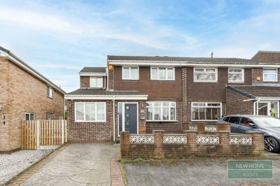
£260,000
Semi-Detached, 4 bed
Acacia Crescent, S21 1HZ
£260,000
Semi-Detached, 4 bed
Acacia Crescent, S21 1HZ
£100,000
Flat, 1 bed
Foxcroft Chase, S21 1JL
£100,000
Flat, 1 bed
Foxcroft Chase, S21 1JL

£260,000
Semi-Detached, 4 bed
Acacia Crescent, S21 1HZ
£260,000
Semi-Detached, 4 bed
Acacia Crescent, S21 1HZ
£260,000
Semi-Detached, 4 bed
Acacia Crescent, S21 1HZ
£260,000
Semi-Detached, 4 bed
Acacia Crescent, S21 1HZ
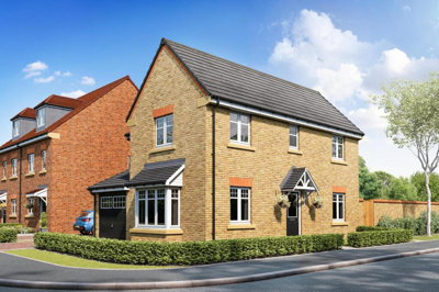
£270,000
Link Detached House, 3 bed
Nethergreen Avenue, S21 1FF
£270,000
Link Detached House, 3 bed
Nethergreen Avenue, S21 1FF
 New Build
£309,995
Semi-Detached, 3 bed
High Street, S21 1BX
New Build
£309,995
Semi-Detached, 3 bed
High Street, S21 1BX
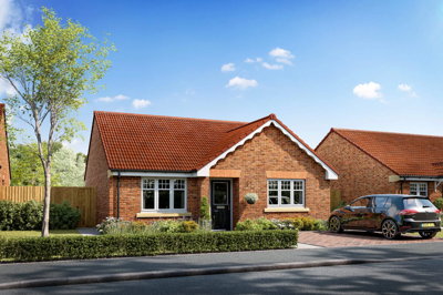
£325,000
Bungalow, 3 bed
Nethergreen Avenue, S21 1FF
£325,000
Bungalow, 3 bed
Nethergreen Avenue, S21 1FF
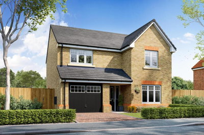
£400,000
Detached, 4 bed
Mallard Drive, S21 1ES
£400,000
Detached, 4 bed
Mallard Drive, S21 1ES
£192,500
Terraced, 4 bed
High Street, S21 1BB
£192,500
Terraced, 4 bed
High Street, S21 1BB
 New Build
£299,000
Detached Bungalow, 3 bed
Green Lane, S21 1BD
New Build
£299,000
Detached Bungalow, 3 bed
Green Lane, S21 1BD
 New Build
£400,000
Detached, 4 bed
Green Lane, S21 1BD
New Build
£400,000
Detached, 4 bed
Green Lane, S21 1BD
 New Build
£420,000
Detached, 4 bed
Green Lane, S21 1BD
New Build
£420,000
Detached, 4 bed
Green Lane, S21 1BD
Get free, no-obligation valuations from the top-performing local agents. Compare fees, services, and track records before you decide.
Compare Agents FreeBased on our market data, Blundells leads with 17 active listings and 14.3% market share, followed by Butlers Estate Agents with 14 listings commanding an 11.8% share. Key2Go, Haybrook, and William H. Brown also have significant presences in the area. The best agent for you depends on your property type and price range, with Blundells and William H. Brown averaging around £217,000-£218,000 and handling many properties in the lower-to-mid price brackets. Butlers focuses on premium properties averaging over £414,000 and is ideal for sellers of larger detached homes, particularly on the new build developments like Gongoozlers Walk or Forge Green.
Estate agent fees in Killamarsh follow national trends, typically ranging from 1% to 3% plus VAT. For a property at the average asking price of £275,928, this translates to fees between £3,311 and £9,933 plus VAT. Online fixed-fee agents typically charge between £999 and £1,999 but offer less hands-on service and may lack local market knowledge. Many traditional agents are negotiable on their fees, especially for higher-value properties, and some may offer bundled services that include professional photography, floorplans, and virtual tours as part of their commission.
Yes, house prices in Killamarsh have shown growth across multiple data sources. The S21 2 postcode area saw a 13.5% increase over the last year according to Housemetric data. Property Solvers reports a 3.77% rise, while OnTheMarket indicates a 21.3% increase. However, transaction volumes have decreased by 28.38%, indicating a more selective market where correctly priced properties are essential. Properties priced realistically tend to achieve sale agreed status within weeks, while overpriced homes may remain on the market for months. The mix of price growth but falling transaction volumes suggests buyers are being more discerning about what they purchase.
Killamarsh is a former coal mining village with a population of around 9,082 residents offering a balance of rural charm and urban convenience. It provides good transport links to Sheffield, Chesterfield, and Rotherham via the M1 motorway, making it popular with commuters working in these larger cities. The village has local shops, schools, and recreational facilities including Meadowgate Park. Considerations for buyers include flood risk from the River Rother in certain areas including Forge Lane, Sheffield Road, and George Lane, plus the geological considerations of clay soil and former mining activity that may affect some properties.
Detached properties are most prevalent among current listings at 48 homes averaging £373,718, followed by semi-detached with 33 listings at £214,758 average. Terraced homes number 7 listings at £141,429, with just 2 flats available reflecting limited apartment options in the village. Three-bedroom properties dominate the market with 55 listings, reflecting strong family buyer demand, while 4-bedroom homes at 25 listings appeal to larger families and those seeking home office space. The price range distribution shows most properties fall in the £200,000-£300,000 bracket with 59 listings.
Yes, Killamarsh has several active new build developments that are attracting significant buyer interest. Gongoozlers Walk by Redmile Homes offers 3-5 bedroom houses from £399,950 to £599,950 with high-spec eco-features including triple glazing and EV charging points. Forge Green by Harron Homes has properties from £370,000 to £422,000 on the former Westthorpe Colliery site. Aurelle by Honey offers more affordable options starting from £239,995 for a 2-bedroom semi-detached house. Sky-House Rother Valley provides rare 3-bedroom bungalows on Station Road, appealing to downsizers. These developments represent significant expansion of the village and are changing its character.
Look for agents with strong local market knowledge of Killamarsh specifically, not just national brands with limited local presence. Check their current listings and recent sales in the S21 area, ask about their marketing strategy including which portals they use, and compare at least three valuations to get a realistic asking price. Consider whether you want a high-street agent with local office presence like Blundells or Key2Go at Crystal Peaks, or an online agent with lower fees. The right agent should have experience with properties similar to yours and understand local issues like flood risk zones and mining legacy concerns that may affect buyer interest.
Selling times vary depending on property type, price, and market conditions, but properties in Killamarsh generally sell within 8-16 weeks when priced correctly. With transaction volumes having decreased recently, properties priced realistically tend to sell faster than those seeking premium prices in a softer market. Getting a realistic valuation from the start, combined with professional marketing from your estate agent, helps achieve a quicker sale. Properties in the popular £200,000-£300,000 price bracket with 3 bedrooms typically see the strongest buyer demand and fastest sales, while premium properties over £500,000 may take longer due to more limited buyer pools.
Estate Agents In London

Estate Agents In Plymouth

Estate Agents In Liverpool

Estate Agents In Glasgow

Estate Agents In Sheffield

Estate Agents In Edinburgh

Estate Agents In Coventry

Estate Agents In Bradford

Estate Agents In Manchester

Estate Agents In Birmingham

Estate Agents In Bristol

Estate Agents In Oxford

Estate Agents In Leicester

Estate Agents In Newcastle

Estate Agents In Leeds

Estate Agents In Southampton

Estate Agents In Cardiff

Estate Agents In Nottingham

Estate Agents In Norwich

Estate Agents In Brighton

Estate Agents In Derby

Estate Agents In Portsmouth

Estate Agents In Northampton

Estate Agents In Milton Keynes

Estate Agents In Bournemouth

Estate Agents In Bolton

Estate Agents In Swansea

Estate Agents In Swindon

Estate Agents In Peterborough

Estate Agents In Wolverhampton

Compare 22 local agents, data from 119 active listings
Find AgentsHomemove is a trading name of HM Haus Group Ltd (Company No. 13873779, registered in England & Wales). Homemove Mortgages Ltd (Company No. 15947693) is an Appointed Representative of TMG Direct Limited, trading as TMG Mortgage Network, which is authorised and regulated by the Financial Conduct Authority (FRN 786245). Homemove Mortgages Ltd is entered on the FCA Register as an Appointed Representative (FRN 1022429). You can check registrations at NewRegister or by calling 0800 111 6768.
We use cookies to show you personalised content and improve your experience of our website. Find out more in our Privacy policy and Cookie policy.