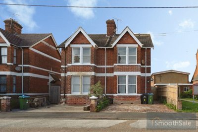
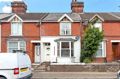
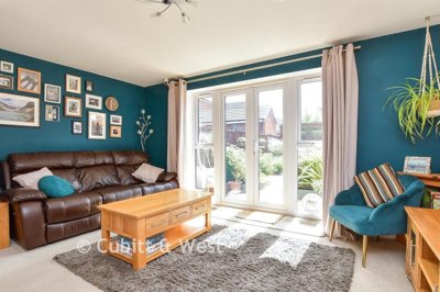
£320,000
Semi-Detached, 3 bed
East Ham Road, BN17 7AN
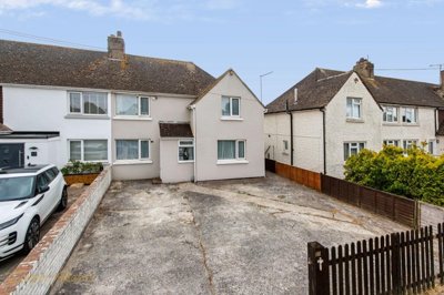
£320,000
Semi-Detached, 3 bed
East Ham Road, BN17 7AN

Compare local agents for a Littlehampton home, using sold-price evidence from 373 recent sales


Littlehampton’s property market has a clear coastal pattern, with an average sold price of £328,217 and 373 completed sales in the last 12 months. Prices are 4% lower over the year, so pricing discipline matters more than it did in a rising market. A good estate agent in Littlehampton should understand the difference between a flat near Beach Road, a terraced house around Fitzalan Road, and a larger detached home towards Wick. We help you compare agents on evidence, not sales patter.
Our sold-price data shows a wide spread by property type across Littlehampton. Detached homes average £480,211, while flats average £195,500, which creates very different buyer pools and marketing decisions. Semi-detached homes sit close to the overall market at £327,143, and terraced homes average £284,834. That range means a single town-wide valuation can be too blunt, especially around the River Arun, South Terrace, Hampton Park, and the East Street conservation area.

£328,217
Average Sold Price
373
Sales in Last 12 Months
-4%
12-Month Price Change
£480,211
Detached Average
£327,143
Semi-Detached Average
£284,834
Terraced Average
£195,500
Flat Average
Using listing data from home.co.uk and property data from homedata.co.uk
Littlehampton sits in the Arun district, and its market is shaped by the coast, the River Arun, and the town’s spread from seafront roads to Wick. The average sold price is £328,217, which places the town below many higher-priced coastal spots further east in West Sussex. Recent completed sales show a 4% fall over 12 months, so sellers need careful positioning from the start. Overpricing a flat near Beach Road or a terraced house off Fitzalan Road can weaken early buyer interest.
Detached homes form the premium end of the Littlehampton market, averaging £480,211. These properties need an agent who can evidence pricing through recent comparable sales, especially where plot size, parking, or proximity to Court Wick Park affects demand. Semi-detached homes average £327,143, almost in line with the town-wide figure. That makes them a useful barometer for the wider BN17 market, particularly around Wick and the Anderson Way area.
Terraced homes average £284,834, and they often sit in the middle of the Littlehampton market. Buyers in this price band tend to compare older brick and flint stock with newer homes at Hampton Park. Flats average £195,500, which puts valuation accuracy under pressure because service charges, lease length, sea views, and riverside flood considerations can change value sharply. A strong local agent should separate these factors before recommending a launch price.
Recent sales volume also matters. With 373 sales in the last 12 months, Littlehampton has enough movement for agents to build a proper evidence base, but it is not a market where every home sells regardless of presentation. The 4% annual fall means buyers have more reason to negotiate. Homes around conservation streets such as East Street, South Terrace, and Granville Road need marketing that explains condition, restrictions, and setting clearly.
Based on 351 live listings with an average asking price of £290,236.
Source: home.co.uk
See which agents are selling fastest and at the best prices in Littlehampton, Arun, West Sussex.
Compare Estate Agents FreeSales in Littlehampton are spread across several distinct settings, from older roads near East Street to newer housing at Hampton Park on Anderson Way in Wick. The 373 completed sales show a town with regular turnover, not a static coastal market. Buyers can choose between flats, terraces, semi-detached homes, and larger detached properties, so the best agent for one home may not be the best fit for another. That is why we focus on how agents price, market, and negotiate within your part of BN17.
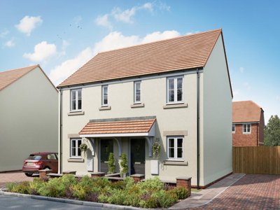
New-build activity adds another layer. Hampton Park by Persimmon Homes includes 2 to 5-bedroom homes from £260,000, while Rosemead Garden off Fitzalan Road, BN17 6FE, is set around 2 and 3-bedroom houses with construction due to complete in Autumn 2025. Those schemes affect buyer expectations on energy efficiency, layout, parking, and finish. A resale home near Wick or Fitzalan Road needs to be compared against both completed sales and current new-build alternatives.
Flats are a large part of the conversation because the average flat price is £195,500. Seafront, riverside, and town-centre flats do not all behave the same way. A buyer looking near Beach Road may judge a property differently from one looking around Caffyn’s Field or the Riverside Industrial Estate side of the Arun. Good marketing should highlight lease details, building condition, outside space, and flood context without burying buyers in paperwork.
Terraced homes at £284,834 often compete with smaller semi-detached homes and newer 2 or 3-bedroom houses. That makes launch price sensitive. Around Fitzalan Road, Selborne Road, Irvine Road, and nearby conservation streets, buyers may also think about maintenance, brickwork, roofing, and restrictions on alterations. An agent should know how to present those points as part of the property story, not as afterthoughts.

Littlehampton is a coastal town within Arun, with the River Arun running into the Channel and shaping both its setting and its risk profile. The town includes seafront areas, riverside streets, the older East Street area, and residential pockets stretching towards Wick. That variety affects buyer behaviour. A detached house near Court Wick Park is not judged against the same comparables as a flat close to South Terrace.
Local building materials are part of the valuation picture. Brick, flint, and Purbeck stone appear across older stock, with plain clay tiles and slate on many roofs. Pebble-dash is also seen in parts of the town. Buyers may like the look of older Littlehampton homes, but survey findings around damp, roof covering, pointing, and movement can influence offers after a sale is agreed.
Conservation status needs careful handling in Littlehampton. East Street is a conservation area, and parts of Fitzalan Road, Selborne Road, Irvine Road, Caffyn’s Field, St. Catherine’s Road, Beach Road, Granville Road, Lobb’s Wood, Norfolk Road, and South Terrace are also covered. The town has around 83 listed buildings, with Court Wick Park among the listed sites. Homes in these settings may need stronger photography, measured wording, and early advice on alterations or historic features.
Flood risk is another local factor. Tidal areas of Littlehampton Rope Walk, including Ferry Road and Bridge Road on the west banks of the lower tidal River Arun, are flood alert areas. Littlehampton East Bank, including Caffyn’s Field and Riverside Industrial Estate, includes flood warning areas. An agent selling close to the Arun should be ready for buyer questions about insurance, past events, searches, and lender appetite.
A 4% fall in sold prices over 12 months changes how Littlehampton sellers should think about valuation. In a softer market, the first 2 weeks of marketing can set the tone, especially for homes around BN17 where buyers compare several similar listings. A valuation that is too high may sit online while newer listings undercut it. Agents should show clear sold evidence, not just tell you what you want to hear.
Detached homes at £480,211 still carry the highest average in Littlehampton, but larger homes can take longer to secure the right buyer if pricing is stretched. Presentation matters here. Floorplans, garden photography, room measurements, and parking detail all affect enquiry quality. Around Wick and Hampton Park, buyers may compare detached resales with new-build homes that promote lower running costs.
Semi-detached homes averaging £327,143 sit close to the town average and often reveal the real temperature of the market. A good agent should be able to explain how condition, extension potential, school catchments, and road position affect this figure. The same applies to terraces at £284,834, where buyers may be price-sensitive and survey results can trigger renegotiation. Littlehampton sellers should ask agents how many similar homes they have valued recently in streets such as Fitzalan Road, Granville Road, or Norfolk Road.
Flats need an even sharper approach. The £195,500 average hides wide differences between purpose-built blocks, converted buildings, and seafront or riverside homes. Lease length, ground rent, service charges, lift condition, and outside space all feed into buyer confidence. An agent who glosses over those details may attract viewings, then lose momentum during conveyancing.
Littlehampton sellers can choose between high-street, online, and hybrid estate agency models. High-street agents usually charge a percentage fee, often around 1-3% + VAT, with many sellers seeing quotes near 1.5% + VAT. Online agents often charge a fixed fee of around £999-£1,999, with payment terms varying. The right route depends on your property, your time, and how much local negotiation support you want.
A flat near Beach Road may suit a different service model from a listed or conservation-area home near East Street. If your sale involves flood questions around Rope Walk, Ferry Road, Bridge Road, or Caffyn’s Field, local handling can be valuable. Buyers may ask detailed questions before booking a viewing. A strong agent should answer them quickly and keep the sale moving once solicitors raise enquiries.
Sole agency contracts in England often run for 8-16 weeks. Littlehampton sellers should check the tie-in period, notice requirements, withdrawal charges, and any extra fees for photography or premium advertising. Multi-agency can increase exposure, but it normally costs more. Use it with care, particularly if your home already has a clear buyer pool.
We recommend getting free valuations from 2-3 agents before making a decision. Ask each agent to explain the £328,217 town average, the 4% annual fall, and the property-type averages that apply to your home. A confident answer is useful. A vague answer is not.

Invite 2-3 agents to value your Littlehampton home and ask each one to support the figure with recent comparable sales. A flat near South Terrace, a terrace around Fitzalan Road, and a detached home near Wick need different evidence.
Ask how the agent would handle River Arun flood questions, conservation areas such as East Street, and listed building concerns around Court Wick Park. Their answer should be specific to Littlehampton, not a generic sales script.
Percentage fees are often 1-3% + VAT, while fixed-fee online agents are often around £999-£1,999. Check what is included, who conducts viewings, and whether photography or enhanced marketing costs extra.
Read the sole agency period, notice clause, withdrawal charges, and multi-agency restrictions before signing. An 8-16 week tie-in is common, but the detail can affect your options if the property does not sell.
Ask how the agent will launch your home in a market where sold prices are 4% lower over 12 months. The plan should include an opening price, review points, and how they will respond to low offers.
Look at photography, floorplans, written descriptions, and viewing feedback. Littlehampton homes near Beach Road, Ferry Road, Hampton Park, and East Street all need different selling points brought forward.
Ask every agent to explain your price against the Littlehampton averages of £480,211 for detached homes, £327,143 for semi-detached homes, £284,834 for terraced homes, and £195,500 for flats. If their valuation ignores the 4% annual fall or the specific setting of streets such as Beach Road, East Street, Fitzalan Road, or Bridge Road, ask for stronger evidence before you sign.
The best result usually starts before the listing goes live. In Littlehampton, buyer expectations differ sharply between newer homes at Hampton Park, older stock near East Street, and properties close to the lower tidal River Arun. Small details can alter the viewing response. A home with clear parking, good roof condition, and a tidy garden may outperform a similar property that looks harder to maintain.
Pricing should be built from the property type first. Detached homes average £480,211, but that figure can move significantly with plot, extension work, and road setting. Semi-detached homes at £327,143 need comparison against similar layouts, not detached houses or flats. Terraced homes at £284,834 should be pitched carefully if they compete with 2 or 3-bedroom new-build houses.
Flats need direct and honest marketing. The £195,500 average is useful, but buyers will look closely at lease length, service charge, ground rent, building management, and flood context near the Arun. If a block is close to Caffyn’s Field, Beach Road, or South Terrace, paperwork should be gathered early. Delays after offer can undo a good launch.
Negotiation is where agent choice often shows. A buyer may use the 4% annual fall to push for a discount, especially after a survey. Your agent should be able to defend the asking price with comparable sales, explain any survey points, and keep the chain focused. That matters in a town with 373 recent sales and a wide gap between flats and detached homes.
Hampton Park on Anderson Way in Wick is one of the key new-build reference points in Littlehampton. Persimmon Homes is delivering 2 to 5-bedroom homes there, with prices from £260,000. That matters for resale sellers because buyers often compare energy ratings, layouts, parking, and incentives. A resale near Wick must be priced and presented against that choice.
Rosemead Garden off Fitzalan Road, BN17 6FE, adds another local benchmark. Wise Living is bringing forward 2 and 3-bedroom houses, with completion set for Autumn 2025. Rental figures linked to the scheme include £1,525 pcm for 3-bedroom terraced houses and £1,700 pcm for 2-bedroom terraced houses. Those figures influence how some buyers think about affordability and rental alternatives.
Older Littlehampton homes can still compete well with new builds, but the agent must frame the comparison correctly. Brick, flint, Purbeck stone, clay tiles, and slate give many homes a distinct local appearance. Buyers may accept more maintenance if the rooms are larger, the garden is better, or the road feels established. Evidence and presentation both count.
Nearby Angmering also plays into buyer decision-making. Langmead Place on Water Lane, BN16 4EJ, includes 2, 3, and 4-bedroom homes from £325,000 to £725,000. Although it sits outside Littlehampton, some buyers compare it with BN17 homes before choosing a location. Your agent should understand that wider Arun and coastal West Sussex context.
Littlehampton railway station is an important factor for buyers who need rail travel across the Sussex coast and towards larger employment centres. Homes within practical reach of the station may attract different interest from properties further into Wick or along the seafront. Road position still matters. Buyers will often weigh station use against parking, garden size, and noise.
The town’s coastal position shapes daily life more than in many inland Arun locations. Beach Road, South Terrace, and the seafront areas give some homes a distinct selling angle, while properties near the River Arun need clearer flood information. Around Ferry Road and Bridge Road, buyers may ask about insurance and searches before they offer. An agent who anticipates those questions can reduce friction.
Schools and family routines also affect viewings, especially for semi-detached and terraced houses around BN17. Agents should know which parts of Littlehampton buyers ask about most, including Wick, Fitzalan Road, and streets near the town centre. They do not need to overpromise. They do need to handle questions about travel, parking, local facilities, and road layout with confidence.
Local restrictions can influence plans after completion. Conservation-area streets such as East Street, Granville Road, Norfolk Road, and St. Catherine’s Road may prompt buyers to check windows, roofing, extensions, and external finishes. That does not stop a sale. It means the marketing and follow-up need to be clear from day one.
351 properties currently listed across Littlehampton, Arun, West Sussex. Here are the most recently added.
£320,000
Semi-Detached, 3 bed
East Ham Road, BN17 7AN
£320,000
Semi-Detached, 3 bed
East Ham Road, BN17 7AN
£90,000
Apartment, 2 bed
BN17 5LE
£90,000
Apartment, 2 bed
BN17 5LE
£220,000
Terraced, 1 bed
Eagles Chase, BN17 7RF
£220,000
Terraced, 1 bed
Eagles Chase, BN17 7RF
£230,000
Terraced, 3 bed
Manning Road, BN17 7HU
£230,000
Terraced, 3 bed
Manning Road, BN17 7HU
£239,950
Terraced, 2 bed
Linden Road, BN17 7AH
£239,950
Terraced, 2 bed
Linden Road, BN17 7AH
£350,000
Semi-Detached Bungalow, 2 bed
Thatchway Close, BN17 7HQ
£350,000
Semi-Detached Bungalow, 2 bed
Thatchway Close, BN17 7HQ
 New Build
£280,000
Semi-Detached, 2 bed
Anderson Way, BN17 7TD
New Build
£280,000
Semi-Detached, 2 bed
Anderson Way, BN17 7TD
£164,000
Flat, 1 bed
Norfolk Road, BN17 5HB
£164,000
Flat, 1 bed
Norfolk Road, BN17 5HB
£231,500
Semi-Detached, 3 bed
BN17 7FA
£231,500
Semi-Detached, 3 bed
BN17 7FA
£275,000
Semi-Detached, 3 bed
Falkland Avenue, BN17 6AB
£275,000
Semi-Detached, 3 bed
Falkland Avenue, BN17 6AB
£330,000
Terraced, 3 bed
North Street, BN17 6JH
£330,000
Terraced, 3 bed
North Street, BN17 6JH
£260,000
End of Terrace, 2 bed
Timberleys, BN17 6QD
£260,000
End of Terrace, 2 bed
Timberleys, BN17 6QD
Get free, no-obligation valuations from the top-performing local agents. Compare fees, services, and track records before you decide.
Compare Agents FreeStart with 2-3 free valuations and ask each agent to explain their figure using Littlehampton sales evidence. The answer should reflect the average sold price of £328,217, the 4% annual fall, and the property-type average that matches your home. Test local knowledge too, especially around East Street conservation rules, River Arun flood areas, and new-build competition at Hampton Park.
Many high-street agents charge around 1-3% + VAT, with plenty of sellers seeing quotes near 1.5% + VAT. Online agents often charge a fixed fee of around £999-£1,999, although payment terms and service levels vary. Check whether viewings, photography, floorplans, and sales progression are included before comparing quotes.
Littlehampton sold prices are 4% down over the last 12 months. The town’s average sold price is £328,217, with 373 completed sales in the same period. That means sellers should avoid relying on older valuations, especially for flats near Beach Road or terraces around Fitzalan Road.
Littlehampton is a coastal Arun town with the River Arun, seafront streets, older conservation areas, and newer housing around Wick. East Street, South Terrace, Beach Road, and Caffyn’s Field all have different property considerations. Buyers often weigh coastal setting against flood checks, parking, rail use, and maintenance on older brick, flint, or slate-roofed homes.
Online agents may suit sellers who are comfortable managing more of the sale and want a fixed fee. A high-street agent can be helpful if your home needs local explanation, such as a conservation-area property near East Street or a riverside home near Ferry Road. Hybrid agents sit between the two, so compare the actual service rather than the label.
Sole agency contracts often run for 8-16 weeks. Before signing, check the notice period, withdrawal charges, and whether you owe a fee if you later sell to a buyer introduced elsewhere. In a Littlehampton market where prices are 4% lower over 12 months, flexibility can matter if the first launch does not work.
A good agent should ask about lease length, service charges, ground rent, building condition, and management arrangements before launch. Flats average £195,500 in Littlehampton, but values can vary around Beach Road, South Terrace, and riverside areas. Flood context, outside space, parking, and sea views can all change buyer response.
They can, particularly near the lower tidal River Arun. Rope Walk, Ferry Road, and Bridge Road sit within tidal flood alert areas, while Caffyn’s Field and Riverside Industrial Estate include flood warning areas. A strong agent will prepare answers on insurance, searches, and property history so buyers are not surprised late in the process.
New builds give buyers another benchmark for layout, energy performance, and finish. Hampton Park on Anderson Way includes 2 to 5-bedroom homes from £260,000, and Rosemead Garden off Fitzalan Road is due to complete in Autumn 2025. Resale homes can compete well, but the agent must price them against realistic alternatives.
Ask the agent which recent Littlehampton sales they used, how your property compares, and what they would do if viewings are slow after 2 weeks. Request a clear fee quote, contract terms, and marketing plan. If your home is in East Street, Granville Road, Norfolk Road, or near the Arun, ask how they will handle conservation or flood-related buyer questions.
From £350
A mid-level survey for conventional homes, useful where buyers may raise condition points after offer
From £500
A detailed survey for older, altered, listed, or higher-risk homes, including many brick, flint, and slate-roofed properties
From £65
An Energy Performance Certificate is needed before marketing most homes for sale or rent
From £250
A formal valuation for owners repaying a Help to Buy equity loan
Estate Agents In London

Estate Agents In Plymouth

Estate Agents In Liverpool

Estate Agents In Glasgow

Estate Agents In Sheffield

Estate Agents In Edinburgh

Estate Agents In Coventry

Estate Agents In Bradford

Estate Agents In Manchester

Estate Agents In Birmingham

Estate Agents In Bristol

Estate Agents In Oxford

Estate Agents In Leicester

Estate Agents In Newcastle

Estate Agents In Leeds

Estate Agents In Southampton

Estate Agents In Cardiff

Estate Agents In Nottingham

Estate Agents In Norwich

Estate Agents In Brighton

Estate Agents In Derby

Estate Agents In Portsmouth

Estate Agents In Northampton

Estate Agents In Milton Keynes

Estate Agents In Bournemouth

Estate Agents In Bolton

Estate Agents In Swansea

Estate Agents In Swindon

Estate Agents In Peterborough

Estate Agents In Wolverhampton

Compare local agents for a Littlehampton home, using sold-price evidence from 373 recent sales
Find AgentsHomemove is a trading name of HM Haus Group Ltd (Company No. 13873779, registered in England & Wales). Homemove Mortgages Ltd (Company No. 15947693) is an Appointed Representative of TMG Direct Limited, trading as TMG Mortgage Network, which is authorised and regulated by the Financial Conduct Authority (FRN 786245). Homemove Mortgages Ltd is entered on the FCA Register as an Appointed Representative (FRN 1022429). You can check registrations at NewRegister or by calling 0800 111 6768.
We use cookies to show you personalised content and improve your experience of our website. Find out more in our Privacy policy and Cookie policy.