£250,000
Semi-Detached, 3 bed
Meadow Road, SP4 9DN
£250,000
Semi-Detached, 3 bed
Meadow Road, SP4 9DN

Compare 8 local agents, data from 18 active listings


We track 8 estate agents actively marketing properties in Bulford, Wiltshire, and we've ranked them all based on live listing data. selling a family home near Bulford Camp or a period property in the village centre, finding the right agent is the first step to a successful sale.
Bulford sits on the edge of Salisbury Plain in Wiltshire, a village with a population of around 5,400 residents according to 2021 Census data. The local housing market is shaped significantly by Bulford Camp military base, which brings a steady flow of service personnel and their families to the area. With an average asking price of £363,464 across 18 current listings, the market offers opportunities across various property types and price points.
Our comparison tool puts you in control of finding the right partner for your sale. We track agent performance, market share, and pricing strategies so you can make an informed decision based on real data from the Bulford market.

8
Active Estate Agents
£363,464
Average Asking Price
18
Properties For Sale
Based on our data and Land Registry information, the Bulford property market has experienced some correction over the past year. Properties on Bulford Road achieved an average sold price of £266,667 over the last year, representing a 2% decline compared to the previous year and sitting 36% below the 2022 peak of £414,438. This adjustment reflects broader market conditions across Wiltshire, though the village's connection to Bulford Camp provides ongoing demand from military personnel and their families seeking accommodation in the area.
The rental market in Bulford operates through 2 active agents managing 7 listings, with average rental prices around £1,148 per month through Northwood. The presence of the military base creates a steady demand for both rented and purchased properties, supporting market stability even during broader economic fluctuations. Properties near the Salisbury Avon and Nine Mile River confluence can command rental premiums given the scenic waterway locations, though flood risk awareness remains important for tenants and buyers alike.
Looking at property type performance, semi-detached homes dominate the current listings with 10 properties available at an average price of £281,750. Terraced properties average £239,975 across 2 listings, while detached homes command a premium at £657,488 average across 4 listings. This mix reflects the village's character as a family-friendly location with good connectivity to Amesbury and Salisbury, where many residents commute for work.
Based on 6 live listings with an average asking price of £502,492.
Source: home.co.uk
See which agents are selling fastest and at the best prices in Bulford.
Compare Estate Agents FreeThe Bulford housing market shows strong demand for three-bedroom properties, which dominate current listings with 13 homes available at an average asking price of £293,642. This reflects the village's appeal to families and service personnel stationed at Bulford Camp, who typically seek three-bedroom homes for family accommodation. The popularity of this bedroom configuration aligns with Ministry of Defence housing specifications, which often favour three-bedroom layouts for service families.
Transaction data from Rightmove shows approximately 215 property sales in Bulford proper and 50 sales in Bulford Barracks over recent months, with transactions recorded as recently as October 2024. New build activity remains limited, though a planning application has been submitted for eight new homes on Sling Road designed to meet MoD specifications, indicating continued investment in military-family housing in the area. This new development would add to the limited new-build stock currently available in Bulford, which consists mainly of individual listings rather than larger estate developments.

Bulford is a village and civil parish in Wiltshire, England, situated on the western edge of Salisbury Plain approximately 6 miles north of Salisbury. The village has a population of around 5,400 residents and is notably home to Bulford Camp, a major army barracks established from 1897 that continues to serve as a significant local employer and influence on the housing market. The presence of the military base creates consistent demand for housing, with many properties designed to meet MoD specifications, particularly in the Hamilton Park and Sling Road areas where MoD housing is concentrated.
The local geography is defined by the Salisbury Avon, which forms the western boundary of the parish, and the Nine Mile River which meets the Avon near the village. This watercourse positioning means certain areas of Bulford carry potential river flood risk, particularly properties near Bulford Road and along watercourse boundaries. The underlying geology is predominantly chalk, typical of Salisbury Plain, which generally provides stable ground conditions though potential buyers should consider this in any survey, particularly for older properties which may have foundations affected by ground movement.
The village offers practical amenities including local shops on the High Street, primary education at Bulford St Mary's Primary School, and public houses such as The Malin Arms and The Radnor Arms. The nearby towns of Amesbury and Salisbury provide broader retail, educational, and healthcare facilities, with Salisbury District Hospital offering comprehensive medical services. The A303 trunk road passes nearby, connecting Bulford to the wider road network and making it a practical location for commuters working in Salisbury, Andover, or beyond. Historical references trace Bulford back to the Domesday Book, indicating long-standing settlement with probable concentrations of older, potentially listed properties in the village centre around the parish church of St Leonard.
Sellers in Bulford can choose between traditional high-street estate agents with local presence and online agents offering fixed-fee services. Connells, based in nearby Amesbury on Salisbury Street, maintains the strongest market presence with 27.8% market share and 5 active listings at an average asking price of £285,000. Their established local presence makes them a go-to choice for many vendors seeking hands-on guidance through the sales process, with their Amesbury office serving the broader Amesbury and Bulford corridor effectively.
Carter & May operates from Salisbury with 2 listings averaging £299,950, focusing on the mid-market segment. Woolley & Wallis, also Salisbury-based, handles properties at the higher end with an average asking price of £362,500 across their 2 listings. For those seeking premium property representation in Bulford, Strutt & Parker maintains a presence with a £1.5 million listing, demonstrating the market's capacity for high-value transactions, likely representing a substantial period property or executive home with land.
Traditional percentage-based fees typically range from 1% to 3% plus VAT, while online agents often charge fixed fees between £999 and £1,999. For Bulford properties, the average asking price of £363,464 means traditional agent fees could range from approximately £3,600 to £10,900 plus VAT. Multi-agency agreements, which allow you to instruct more than one agent, typically charge a higher fee of around 2% to 3.5% but provide broader market coverage and increased visibility across multiple office networks.

Start by comparing agents active in the Bulford market using our comparison tool. Look at their current listings, average asking prices, and market share to understand their positioning. Pay attention to whether they have experience selling properties similar to yours, whether that's a three-bedroom family home or a premium detached property.
Request free valuations from at least three agents. This gives you a realistic asking price and allows you to compare their marketing strategies and service offerings. Ask each agent to explain their pricing methodology and provide comparable evidence from recent Bulford sales, not just generic market assessments.
Ask about recent sales in Bulford specifically, not just general experience in Wiltshire. Agents with proven success in your village will understand local buyer demographics, including the military buyer segment from Bulford Camp, and pricing dynamics unique to this market. Request names and addresses of properties sold if possible.
Confirm whether fees are sole agency or multi-agency, and clarify what's included in the price. Negotiate where possible, especially if you're planning significant marketing investment or have a premium property. Many agents will bundle professional photography, floorplans, and premium portal listings into their fee - make sure you understand exactly what's included.
Ask how they'll market your property across online portals including Rightmove and Zoopla, local advertising in the Salisbury Journal, social media exposure, and whether professional photography and floorplans are included. Given Bulford's military community, ask whether they have access to MoD housing databases or military relocation networks.
Look for feedback from previous clients in Wiltshire to gauge reliability, communication quality, and overall satisfaction with the sales process. Check independent review platforms and ask agents for references if you're making a significant investment.
When comparing estate agents in Bulford, always ask for a comparative market analysis rather than just a valuation. The best agents will show you similar properties that have sold, time-on-market data, and explain exactly how they'll price and market your specific property to attract the right buyers, including military buyers through MoD channels.
The bedroom distribution in Bulford reveals clear market preferences and pricing patterns. Three-bedroom properties dominate the market with 13 listings representing the vast majority of available stock, averaging £293,642. This aligns with the village's family-oriented character and the demand from military families seeking mid-sized accommodation meeting MoD housing criteria. The saturation of three-bedroom properties means sellers in this segment face significant competition and should price competitively to attract buyers.
Four-bedroom properties offer a premium tier at an average of £337,500 across just 2 listings, representing limited supply for larger families or those seeking extra space. This undersupply of larger family homes could present opportunities for sellers with four-bedroom properties to achieve strong prices given the limited competition. Two-bedroom properties average £275,000 across 2 listings, providing more affordable entry points into the Bulford market for first-time buyers and investors alike.
The single six-bedroom listing at £1.5 million demonstrates the market's capacity for high-value transactions, likely representing a substantial period property with land or a unique character home in the village centre. This premium segment is served by agents like Strutt & Parker and Whites, who have the networks to attract high-net-worth buyers seeking distinctive rural properties on the Salisbury Plain edge.
Achieving the best price for your Bulford property starts with accurate pricing based on current market conditions. The recent price trends showing a 2% year-on-year decline in Bulford and 4% in Bulford Barracks, combined with properties sitting 36% below the 2022 peak, mean realistic pricing is essential. Overpricing in the current market can lead to extended time-on-market periods, which often results in lower final sale prices as buyers perceive stale listings with skepticism and negotiate harder.
Your choice of estate agent significantly impacts sale outcomes. Agents with strong local presence like Connells and Carter & May bring established buyer relationships and market knowledge specific to Bulford and the surrounding military community. Their understanding of what motivates military buyers, including relocation timing tied to posting orders and service-specific requirements like secure parking or proximity to schools, can translate into faster sales and better prices through targeted marketing.
Negotiating agent fees is common practice, particularly if you have a desirable property or are planning to sell at a higher price point. Many agents are willing to reduce their percentage or offer enhanced marketing packages to secure your business, especially when competing with other agencies for your instruction. Always get fee quotes in writing and understand exactly what services are included before signing any agreement, and don't be afraid to ask for extras like virtual tours or premium portal listings as part of the package.

6 properties currently listed across Bulford. Here are the most recently added.
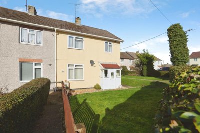
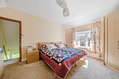
£250,000
Semi-Detached, 3 bed
Meadow Road, SP4 9DN
£250,000
Semi-Detached, 3 bed
Meadow Road, SP4 9DN
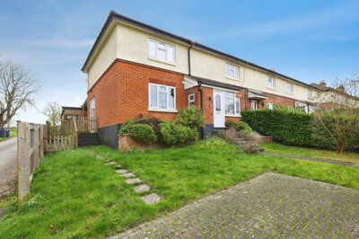
£325,000
Semi-Detached, 4 bed
Sling Road, SP4 9AP
£325,000
Semi-Detached, 4 bed
Sling Road, SP4 9AP
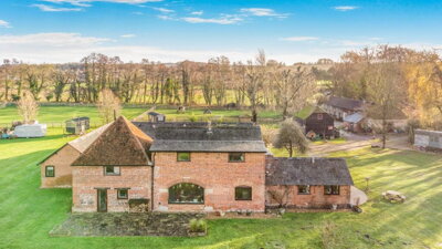
£1,500,000
Detached, 6 bed
SP4 9DY
£1,500,000
Detached, 6 bed
SP4 9DY
£270,000
Semi-Detached, 2 bed
Salisbury Road, SP4 9DG
£270,000
Semi-Detached, 2 bed
Salisbury Road, SP4 9DG
£369,950
Cottage, 3 bed
Water Street, SP4 9DZ
£369,950
Cottage, 3 bed
Water Street, SP4 9DZ
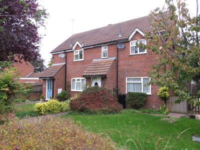
£300,000
Semi-Detached, 3 bed
Salisbury Road, SP4 9DH
£300,000
Semi-Detached, 3 bed
Salisbury Road, SP4 9DH
Get free, no-obligation valuations from the top-performing local agents. Compare fees, services, and track records before you decide.
Compare Agents FreeBased on current market share data, Connells leads the Bulford market with 27.8% share and 5 active listings from their Amesbury office. Carter & May, Woolley & Wallis, Fox & Sons, and Simon Colligan Estate Agents each hold 11.1% market share with 2 listings each. The best agent for you depends on your property type and price point - Connells covers the mainstream market well, while Woolley & Wallis and Strutt & Parker handle higher-value properties and can access premium buyer networks.
Estate agent fees in Bulford typically range from 1% to 3% plus VAT of the sale price, with the average around 1.5% plus VAT. For a property at the current average asking price of £363,464, this equates to fees between approximately £4,360 and £10,900 plus VAT. Some agents offer fixed-fee packages, particularly online operators, though these may not provide the same local market expertise or personalised service that comes from agents with established Bulford presence.
House prices in Bulford have experienced a correction, with properties on Bulford Road showing a 2% decline year-on-year and being 36% below the 2022 peak of £414,438. Bulford Barracks properties show similar trends with a 4% year-on-year decline and 18% below the 2022 peak of £265,750. The market appears to be stabilising, though buyers should expect realistic pricing rather than continued growth in the near term given broader economic conditions affecting the Wiltshire housing market.
Bulford is a village of around 5,400 residents on Salisbury Plain in Wiltshire, approximately 6 miles north of Salisbury. The presence of Bulford Camp army base significantly influences the character, providing employment and creating a community with strong military connections. The village offers local amenities including shops on the High Street, Bulford St Mary's Primary School, and public houses, with easy access to Salisbury and Amesbury for broader services. The A303 provides good road connections to the wider region, making it practical for commuters.
Three-bedroom semi-detached properties dominate the Bulford market, representing 13 of 18 current listings at an average of £293,642. These family-sized homes appeal to both military families and local buyers seeking properties meeting standard MoD specifications. Terraced and two-bedroom properties serve the first-time buyer market around £275,000, while detached homes command premium prices averaging £657,488. The limited supply of larger four-bedroom properties suggests opportunities for sellers in that segment to achieve strong prices.
Local agents like Connells, Carter & May, and Fox & Sons based in Amesbury and Salisbury offer valuable on-the-ground knowledge of the Bulford market, including insight into military buyer preferences and local property trends. These agents often have established relationships with personnel at Bulford Camp and understand the specific requirements of MoD housing. Online agents may offer lower fixed fees but typically provide less personalised service and may lack the local network connections that prove valuable in Bulford's market.
Specific time-on-market data for Bulford isn't publicly available, but the current market conditions with 18 active listings and ongoing transaction activity suggest reasonable demand. Properties priced correctly according to current market conditions, typically ranging from £280,000 to £360,000 for three-bedroom homes, typically achieve sales within reasonable timeframes. Overpriced properties risk sitting on the market, which can reduce achievable prices as buyers perceive stale listings with skepticism and negotiate harder.
When selling a property in Bulford, you'll typically need an Energy Performance Certificate (EPC) which is legally required before marketing, available from around £60 through our partner assessors. Many sellers also opt for a RICS Level 2 Survey to identify any issues before buyers' surveys reveal them, with typical costs around £455-£600 depending on property size. Given Bulford's mix of older properties dating back to the Domesday period and potential flood risk near the Salisbury Avon and Nine Mile River, a professional survey can highlight issues specific to the area and prevent complications during conveyancing.
Bulford Camp creates consistent demand for housing in Bulford from service personnel and their families, often looking for three-bedroom properties meeting MoD specifications. The military community brings particular requirements including proximity to schools, secure parking, and flexibility around relocation timing tied to posting orders. Agents with experience in the military housing market understand these dynamics and can market properties effectively to this buyer segment, potentially achieving faster sales at favourable prices through MoD channels and relocation networks.
Estate Agents In London

Estate Agents In Plymouth

Estate Agents In Liverpool

Estate Agents In Glasgow

Estate Agents In Sheffield

Estate Agents In Edinburgh

Estate Agents In Coventry

Estate Agents In Bradford

Estate Agents In Manchester

Estate Agents In Birmingham

Estate Agents In Bristol

Estate Agents In Oxford

Estate Agents In Leicester

Estate Agents In Newcastle

Estate Agents In Leeds

Estate Agents In Southampton

Estate Agents In Cardiff

Estate Agents In Nottingham

Estate Agents In Norwich

Estate Agents In Brighton

Estate Agents In Derby

Estate Agents In Portsmouth

Estate Agents In Northampton

Estate Agents In Milton Keynes

Estate Agents In Bournemouth

Estate Agents In Bolton

Estate Agents In Swansea

Estate Agents In Swindon

Estate Agents In Peterborough

Estate Agents In Wolverhampton

Compare 8 local agents, data from 18 active listings
Find AgentsHomemove is a trading name of HM Haus Group Ltd (Company No. 13873779, registered in England & Wales). Homemove Mortgages Ltd (Company No. 15947693) is an Appointed Representative of TMG Direct Limited, trading as TMG Mortgage Network, which is authorised and regulated by the Financial Conduct Authority (FRN 786245). Homemove Mortgages Ltd is entered on the FCA Register as an Appointed Representative (FRN 1022429). You can check registrations at NewRegister or by calling 0800 111 6768.
We use cookies to show you personalised content and improve your experience of our website. Find out more in our Privacy policy and Cookie policy.